Google Earth fuelling ‘armchair archaeology’
TRADITIONALLY, ARCHAEOLOGY HAS involved a lot of digging through both archives and dirt, as well as being in the right place at the right time. But the last decade has seen the development of a completely new tool, says Dr David Thomas, a pioneer of the field of satellite archaeology.
“The detail in many of the images is astonishing and allows archaeologists to investigate sites without leaving the safety of their offices,” says David, who is from Melbourne’s La Trobe University and gave a talk today on ‘armchair archaeology’ at the Melbourne Museum.
“While this has obvious advantages, it also presents archaeologists with new problems and challenges,” he says.
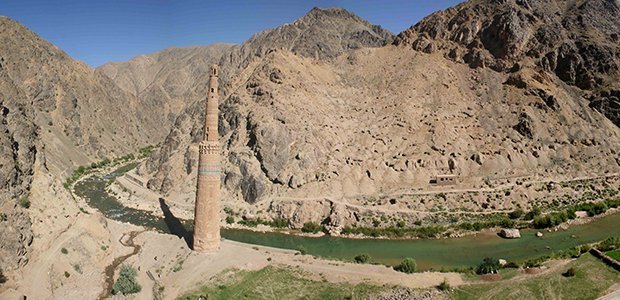
David is one of few experts who have been able to carry out work in Afghanistan over the last few decades, and he says that some of the countries with the most important archaeological remains are also the most dangerous to work in.
Uncovering a desert fortress
With the help of students, David has used Google Earth to identify more than 670 sites of archaeological interest across 2600sq.km of Afghanistan’s Registan Desert. One such site is Qal‘a-i Hauz, or the ‘Fortress of the Reservoir’.
“The site had not really been seen by any westerners since the early 1970s, when it was discovered by a French explorer. It was a real ‘wow’ moment because the fortress is so spectacular and the imagery is so clear,” David told Australian Geographic. “We think it dates back 800–900 years, so the preservation is fantastic as well.”
David is not the only researcher to be using Google Earth to search for interesting features from space. In 2007 geologist Arthur Hickman with the Geological Survey of Western Australia used the tool to discover a major meteorite crater near Newman, WA.
Scientists at NASA have used satellite archaeology to uncover Mayan treasures buried by the South American jungle, while others still have used it to map the ancient city of Angkor Wat in Cambodia.
Benefits of satellite archaeology
Using satellite imagery has a number of benefits, David says. It allows the study of locations that are too dangerous to visit and where archaeological work might otherwise have entirely ceased, and it’s also very useful for monitoring sites for looting.
Though David is keen to stress it is really just a starting point for archaeological research, scanning Google Earth images is also significantly cheaper than real expeditions and allows reconnaissance for later field work.

Qal‘a-i Hauz, or the ‘Fortress of the Reservoir’ in Afghanistan was found with Google Earth. (Credit: Google Earth)
Dr Sarah Parcak, of the University of Alabama, USA, describes herself as a space archaeologist. She works with satellites that detect images using infrared light to reveal features underground.
The density and type of material that structures are made of influences how they reflect infrared light. This method can see through thick vegetation that is impenetrable using Google Earth, says Sarah. “We use it to evaluate landscapes prior to purchasing higher resolution imagery.”
Sarah used such techniques to rediscover and map out the ancient Egyptian city of Tanis, which was buried under a delta and had been lost for 3000 years.
Dr Bjoern Menze and Dr Jason Ur, at Harvard University in Cambridge, USA, go further. They skip people out altogether and have sped up the process by using computers to scan through satellite images to study ancient human settlement sites in Mesopotamia.
The computer programs “go through satellite imagery systematically… to recognise the colours and shapes that are associated with [archaeological] sites,” Jason says.
Google Earth democratising archaeology
Multiple satellite images of an area, taken at different times, are best. “Google often put up cloud-free imagery from very dry times of the year – the worst conditions for recognising [buried] archaeological remains,” Jason says, meaning they need to search many images of the same site.
Nevertheless Google Earth is democratising archaeology, Jason says. “It doesn’t require advanced degrees in computer science… literally anyone can be an armchair archaeologist.”
In 2005 an Italian computer worker and member of the public alerted archaeologists to curious marks on Google Earth images that turned out to be a buried Roman villa.
“It’s important for academics to engage with these people,” to help make the best use of resources, says David. He monitors forums within Google Earth where enthusiastic amateurs discuss potentially interesting features they have found.
For David the thrill of armchair discovery is different to the thrill of digging in the real dirt. “But you do get a buzz when you see something no-one else has seen before,” he says.
RELATED STORIES

