
In retrospect, it was perhaps surprising how surprised we were to discover the amount of rain that actually falls in a rainforest, even such a small pocket as the 300 square-kilometre Main Range National Park in SE Queensland. The nearest rainfall station, about 20km south of our position on the Scenic Rim Trail, received 180mm the week we visited, with 52mm alone measured on our final day. As if aware of our ignorance, the Gondwana Rainforests of Australia World Heritage Area, of which the Main Range NP was part, was doing its level best to educate us!
You could be forgiven for not being familiar with the Scenic Rim Trail since it only opened in 2020. A joint ecotourism initiative between the Queensland government and Spicer’s Retreats, a chain of luxury lodges, the four-day hike runs along the spine of the northern half of the park. Beginning on the private Thornton View Nature Refuge, about 90 minutes’ drive southwest of Brisbane, it ends at the thundering A15 highway which slices the park in two at Cunningham’s Gap.
Thus, the track has a split personality: it’s used on the one hand by Spicer’s clients, who stay in a string of purpose-built huts hidden away behind cliffs and trees, and then there are people like us, the Jekyll to their Hyde, the humble bushwalkers with full packs and an arduous car shuffle at either end. We encountered exactly neither of these subgroups during our own journey. Our four bemused and dripping faces were the only ones to grace the trail that wet week.
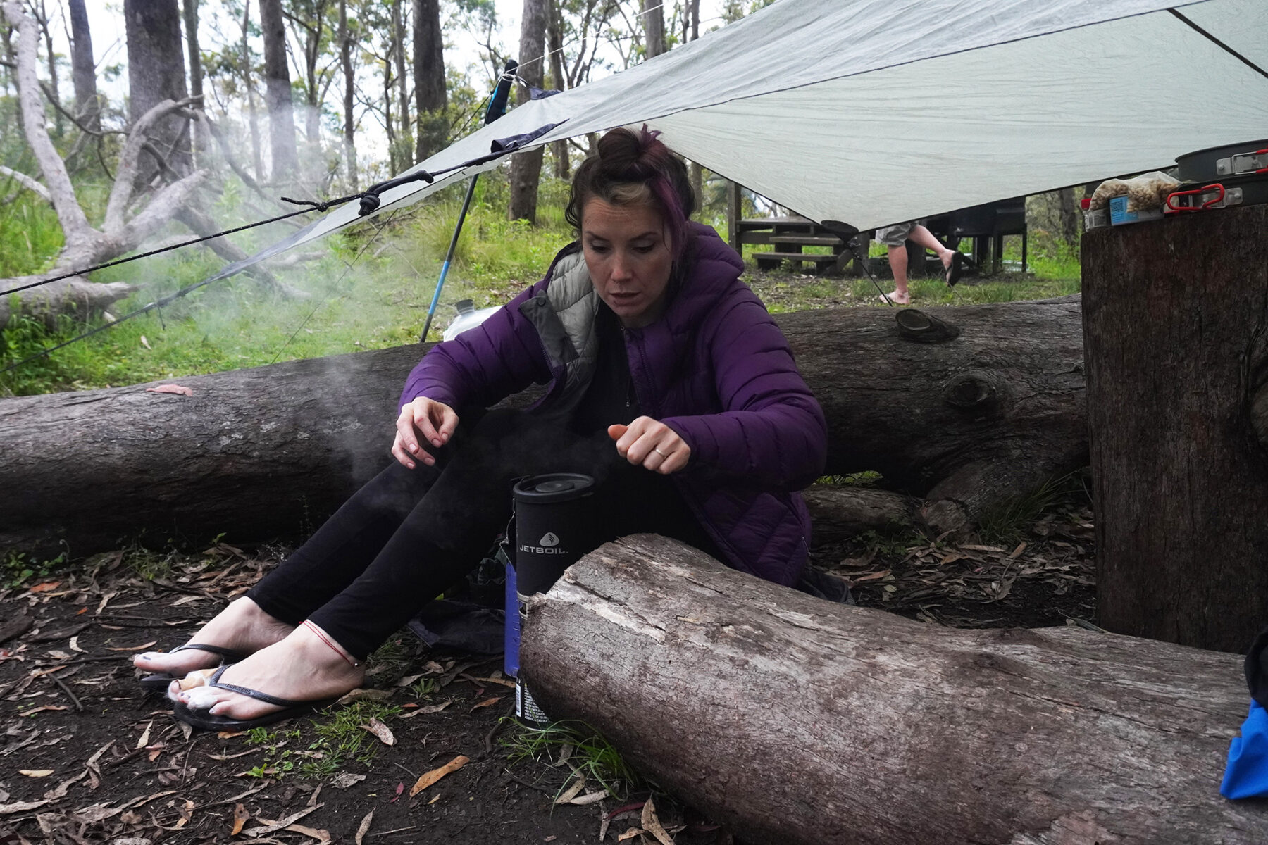
If there’s a hero to this story, it’s the Wilderness Equipment Overhang Tarp, or more accurately, it’s my wife Gerda for suggesting we take it with us. We hardly ever bother carrying it, but with the daunting forecast ahead of us this time, sense thankfully prevailed. Without that thin sheet of fabric, most of every evening would have seen all four of us huddled in the admittedly spacious long drop toilet blocks with which each campsite is furnished. And that’s no-one’s idea of a good time.
Looks can be deceiving
Truth be told, the first day was suspiciously dry. From the trailhead shelter, we scuffed through the phytophthora station and immediately into a long, slow ascent. In between deep breaths, Gerda took pains to assure us we had nothing to worry about with regards to the weather, and that we should stop being a bunch of pansies (or words to that effect). But then she is packed with more positivity than a uranium atom. Half her gear was already wet from the drive out thanks to a leaky reservoir, including her pillow. “I’ll sleep it dry!” she announced, displaying world class optimism.
Even from this far below (and keeping one eye on the ground for the eastern browns and red-bellied blacks that inhabit the park) we could make out The Ladder, a rock hugging, hooped construction clamped onto the cliff face below the escarpment like a tick (of which more later). Prominent in much of the track’s marketing, I was highly anticipating watching the vertigo-prone members of the group squirm as I coaxed them up its rungs. Disappointingly, the ladder turned out to be for the exclusive use of Spicer’s Lodge guests, and my sadism remained unsated.
Snakes and ladders notwithstanding, the track proved quite achievable, despite being graded 5 on the Australian Walking Track Grading System, the most severe grade possible. I was initially baffled as to the reason; sure, the first day features roughly 600m of ascent, but it’s so long and winding that it seems almost level except for the hairpin bends. There’s the occasional rock step where you might have to use your hands, but I wouldn’t go so far as to call it scrambling. It was only when I read that the grade is based on the most difficult of the five criteria rather than an average that it clicked, for one of them is ‘track signage’.
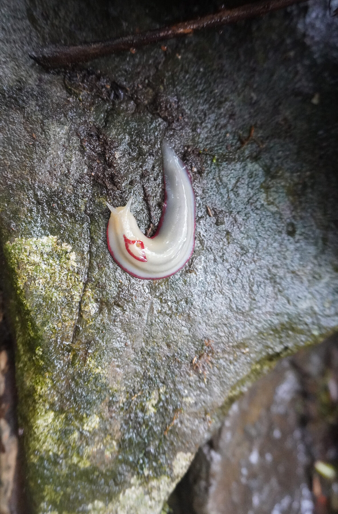
For such a new project, and one aimed at the flashpacker crowd, trail markers sure were few and far between. We went hours without a glimpse of signage, the only exceptions being the odd orange arrow splashed on a tree trunk, like a shaft of sunlight filtering through the canopy. Even trail junctions didn’t guarantee a way marker, unless a red triangle slug balancing helpfully on a low cairn of rocks counted. With its glistening white body decorated with what looked like a child’s attempt at applying lipstick, Australia’s largest native land slug was by far the queerest fauna we encountered.

And the only fauna, pretty much. The incessant rain discouraged all forms of animal life save ticks and leeches, the former keeping our professional nurse Natalie on a busman’s holiday. A whiz with the tick tweezers, it seemed like she always had her face in someone or others’ crotch, for that’s where the vampiric arachnids like to snuggle, warm and dark like a human sleeping bag. At least that was her excuse.
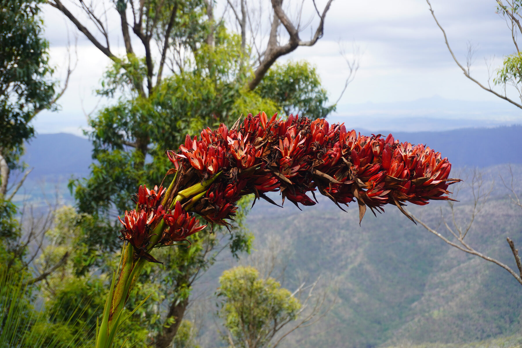
More impressive was the flora, particularly the giant spear lilies (Doryanthes palmeri) that greeted us as we crossed from private land to national park in stile (pun intended). With stalks growing up to 5m tall, and sword-shaped leaves half as long, ‘giant’ is right, although they still struggled under the weight of their enormous blooms. Rosettes comprised of hundreds of blood-coloured blossoms flowed down from each lily’s receptacle like gargantuan, headless tongues trying to lick us off the path (and at over a metre long, that’s going to be a damn good licking). It was like some crazed botanist had spliced together a Triffid with Audrey from The Little Shop of Horrors.
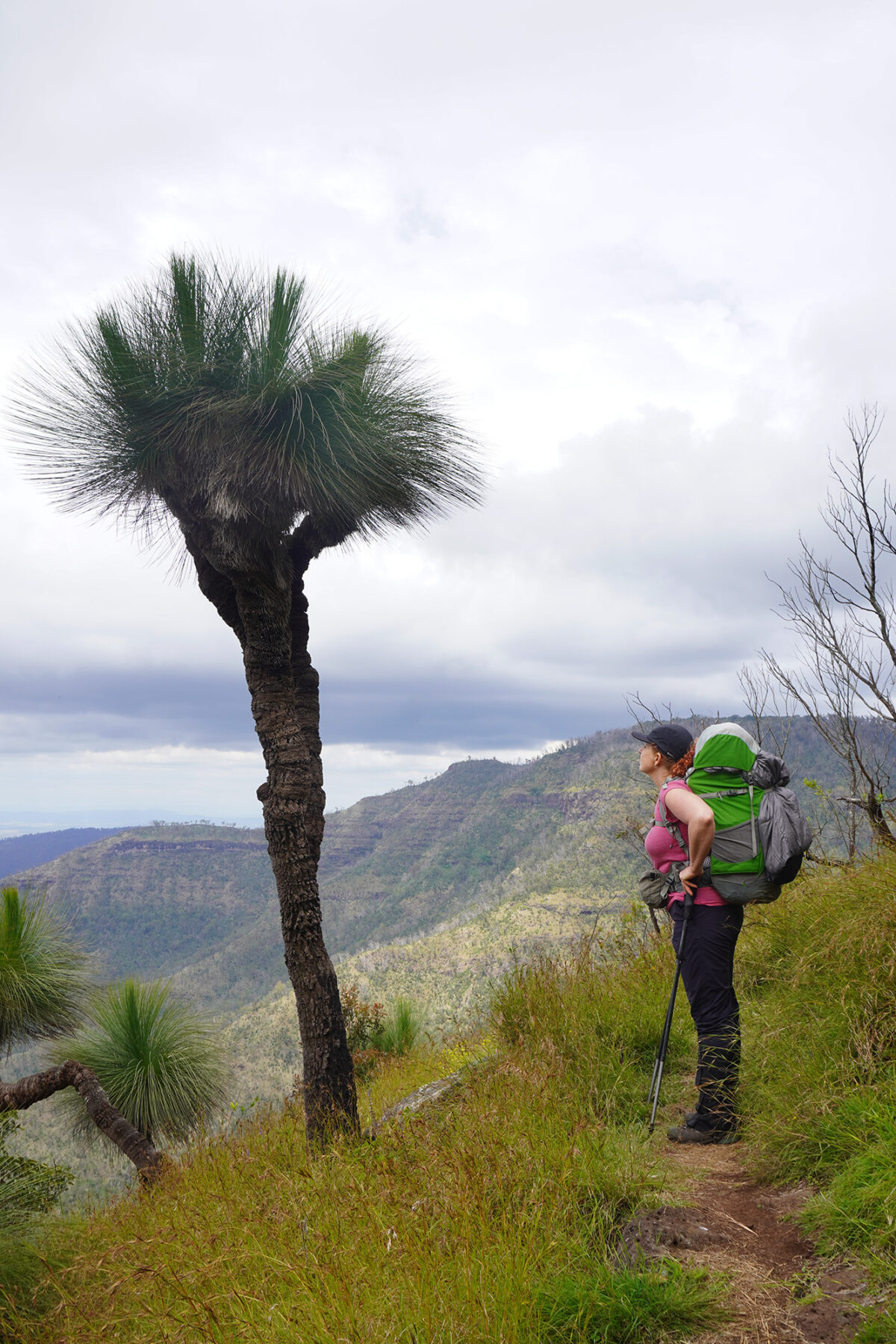
We scampered through the slobbering gauntlet and collapsed atop the escarpment; our climbing mostly done for the day. Mount Mistake loomed to our right, a rock and soil effigy of our decision to stick to our plan in the face of a weather forecast that resembled a Jackson Pollock during his blue period. We still had time to reach the first evening’s camp, a delightful clearing in the forest, during which semi-occasional drizzle lulled us into a false sense of security. It was the last time we would be dry.
Where the wild things are
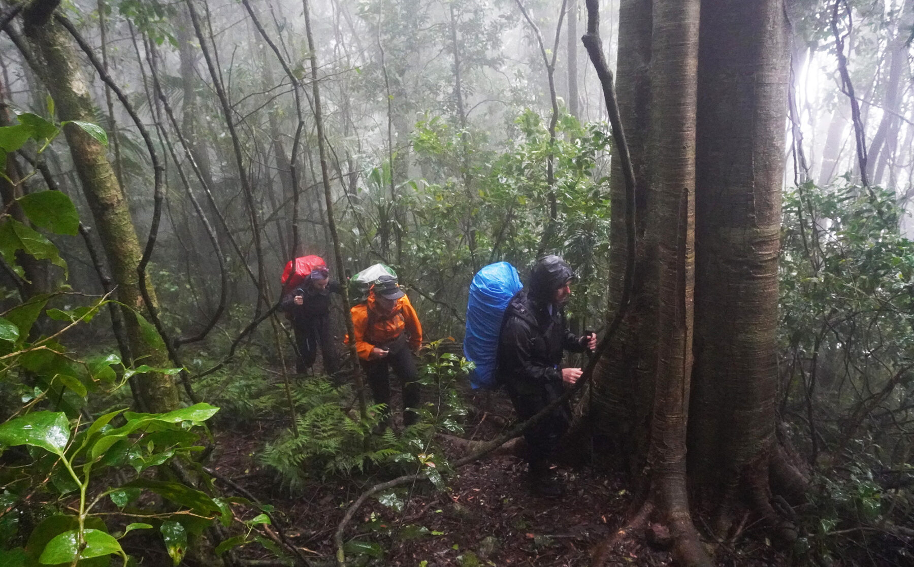
The sounds of rain pattering, and then hammering, on the flysheet during the night made our sleeping bags doubly cosy. However, our appreciation of the vast variety of nature’s precipitation gave way somewhat to gloomy-browed contemplation when we were forced to confront it without the protection of sil-nylon. Packed up and wrapped in Gore-Tex, we set off south, a little dismayed to discover we’d be following an old logging track the entire day.
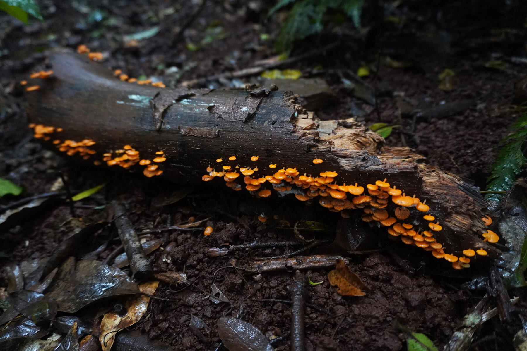
The churned mud funnelled rainwater into a slippery mire, designed to guide our boots seamlessly into its murky depths. At least we were now fully surrounded by forest. We marvelled at confusions of gothic branches dripping with moss, platelets of bright fungus spilled across the leaf litter, and muscular vines writhing hither and thither, wrestling each other for the right to strangle a stately old gentleman of the woods. And behind everything was cloud, seeping through the boughs, creeping closer and closer, yet hovering just beyond the mass of foliage – a fence holding back the abominable monsters that hid within.
Proof of said monsters came in the form of trackside feral pig traps, worryingly devoid of feral pigs. If not caught in this fragile wire cage, the wild boars, all bristling razorback and slavering tusks, must be still out here … with us. Our eyes peered into the whiteout, conjuring up menacing movement and low growls out of branches dipping and soughing in the wind. Instead, out of the mist came The Winder, a mass of lichen-spotted cogs large enough to grind an unwary hiker to pulp. With a name straight out of a bad horror movie, this perennial map waypoint was formerly a steel cable winder, logging detritus now left to rust in peace.
Castle View Camp was a lumpy bog. While the toilet and water tank were of the familiar impressive design and size, there was barely anywhere to pitch a tent. The few level sites could have doubled as water polo fields for scarlet-sided pobblebonks (Limnodynastes terraereginae – a frog), and anywhere remotely dry was only that way because all the water had run off it. In the end we threw up and tied down our three tents on a sloping grassy patch and slept in a crumpled heap.
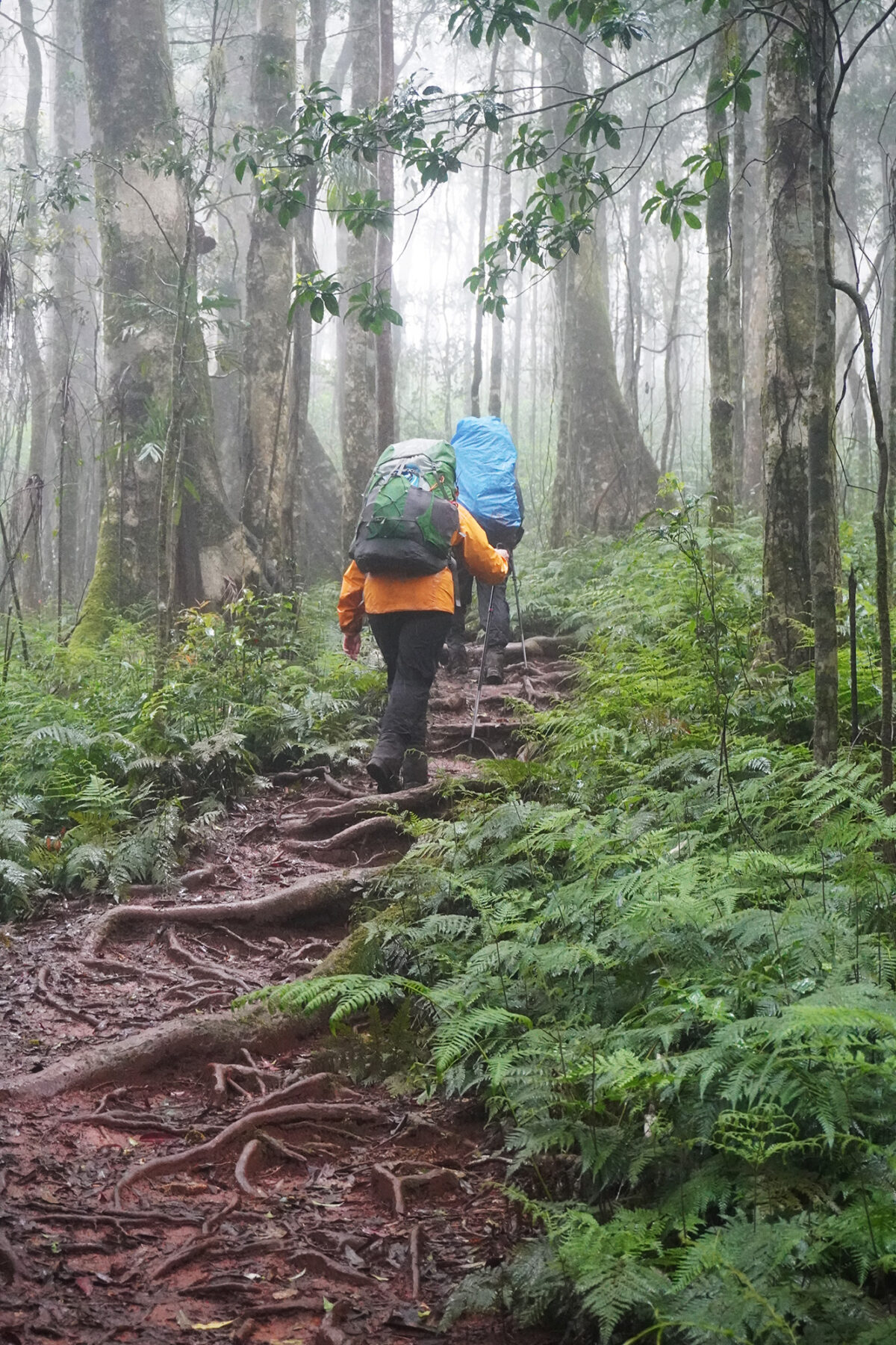
Despite the weather, the parasitic locals, and the gradient (of the campsite), we persevered, and on the third day we could finally pretend we were creeping through the primordial forests of Pangea, or possibly the Green Hell of north Vietnam, depending on the creeper. This was where we left the uniform brown logging track and plunged into a hundred shattered shades of green. Stepping into the backdrop, we followed narrow foot pads winding between behemoths. We pushed through wet curtains of leaves, trying to avoid high-fiving the large, circular palm of the Gympie-Gympie, the dreaded stinging tree. We climbed root ladders up slick slopes, arms outstretched grasping for balance. Sometimes, we lost it.
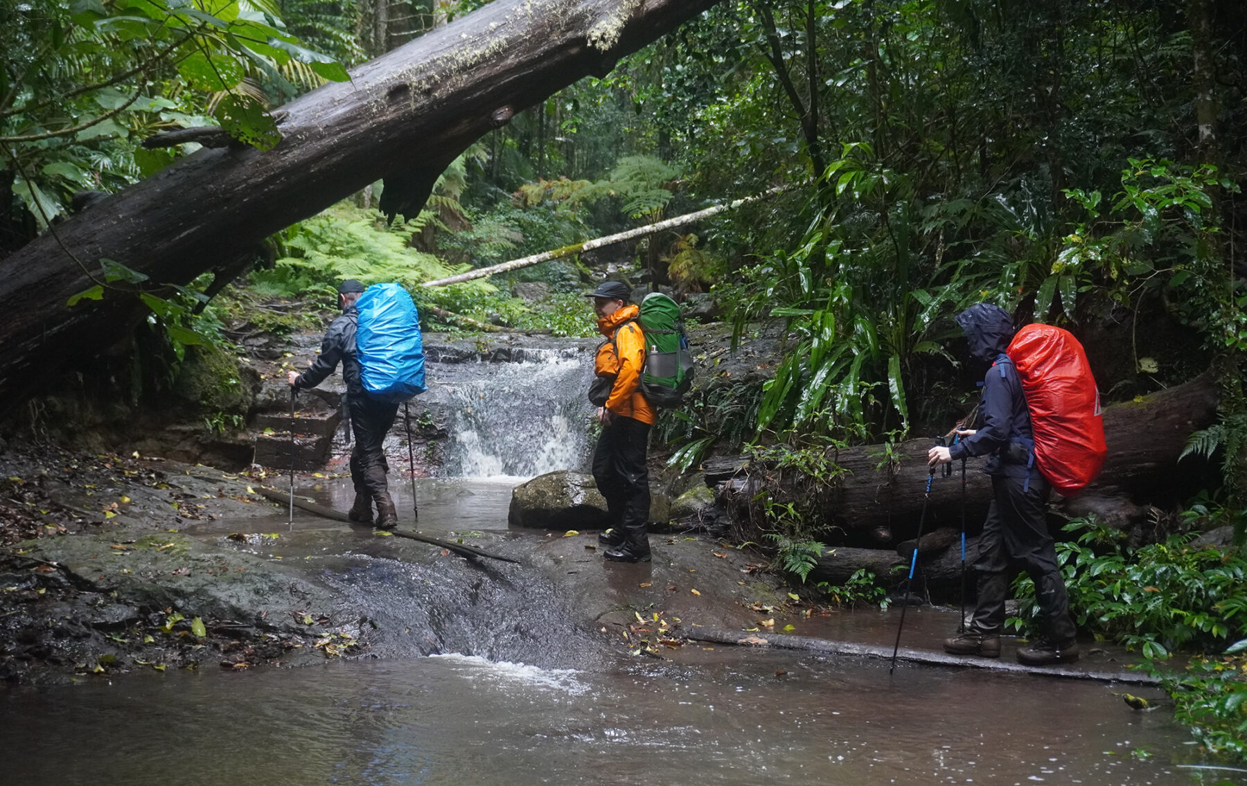
Still, at least this was real. It was a jungle out there. The main river crossing we’d been fretting over, Dalrymple Creek, turned out to be a delightful brook only one step wide. To celebrate our safe crossing the rain stopped long enough for us to enjoy lunch on the rocks while picking leeches out of our ears. The good vibes held a tad longer as we crossed side creeks and little tumbling cascades, until eventually we began the climb back up to the ridge. There was one more sweet surprise though, before the wringing wet cloud re-enveloped us – a tall waterfall in full flow, ending in a pool that would be delightful on a sunny day. The two ladies, queens of hygiene itching after a couple of wet wipe washes, performed an admirably gymnastic dunking of their nether regions. The relief was palpable.

The last camp, Banshee Junction, was a solid improvement on the previous night’s hummock patch. There were actually camp platforms, and shaded by a grove of Chinese elm trees, no less. Pretty they may be; waterproof, they were not. Now, I’m proud to say I’ve started some fires in some hopeless situations. After days of rain and armed only with a lighter and some candle wax, I’ve lovingly kindled a blaze big enough to melt my socks using only sodden twigs, half burnt logs, and fallen bark from the lee side of nearby trees. Yeah, I’m a firestarter, but even this punkin’ instigator couldn’t tease the red flower from the oyster beds of the Screaming Banshee.
Run through the jungle
The final day was another glorious riot of greenery, rushing in from all sides to cuddle us in its soggy embrace. ‘You are entering a remote area’, warned the official signage, courtesy of the Parks Queensland Scaremongering Department. ‘The formed track ends here’. That was a formed track? You could’a fooled me. But the escarpment must be retaken, so we forged ahead. Around mid-morning, we realised the moistness of the atmosphere had so far been, but a mild inconvenience compared to the deluge that duly commenced. Hood-deafening, eyelid-stinging, phone-destroying, four-dimensional rain. Our Gore-Tex broke down in tears. The puddles were flash flooding. Even Natalie’s bread-bag socks gave out.

In this environment we reached Bare Rock, the highest and most exposed point on the Scenic Rim Trail. It’s all we could do to stand still long enough for a group shot. Touted as an idyllic lunch spot, it paled beside our eventual dining room – the grubby, dilapidated toilet block at Cunningham’s Gap, a building sacrificed to the bathroom habits of long-distance families and depraved truck drivers. Yet to us it was a mansion, where we huddled, cooked, changed into dry clothes, de-ticked and generally presented a frightening vision to passing motorists, the tables turned.
But to reach that shonky paradise we had to race down from Bare Rock, along a zig-zagging descent that broke into a thousand waterfalls. We prayed for our survival, not from Pan or Demeter, but from Poseidon, for it was surely he who commanded this realm now. With the hillside below Mt. Cordeaux liquefying under our boots, and angry red lily tongues slurping on all sides, we descended as boldly as we dared through the modest Rainforest Circuit, a leg stretcher for soporific motorists, to the car park and our salvation.
The Scenic Rim? I’ll have to take your word for it.


