Kimberley close to being heritage listed
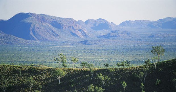
ROCKY GORGES AND DEEP ravines, jagged fossil reefs and beaches seething with bird life are some of the natural highlights of the Kimberley that have convinced the Australian Heritage Council (AHC) to identify three-quarters of the region for National Heritage Listing.
It is the largest expanse of land ever assessed by the Council, says AHC chairman Tom Harley. Nearly 20 million hectares of the west Kimberley has been identified as having “potentially high threshold values” in its natural, historic and indigenous assets, he says.
The Council identified the Kimberley’s ‘drowned river’ coastline as unique in its length and intricacy, boasting over 2500 km of headlands and island archipelagos.
Drowned river
Other natural features highlighted were the cascading waterfalls of West Kimberley gorges and migratory birds at Roebuck Bay near Broome, while Kimberley rock art, European exploration sites and pastoral activity were also named as important to the nation’s cultural history.
The National Heritage List recognises and protects Australia’s most important natural indigenous and historic places. Among the 89 sites already listed are the Sydney Opera House, Bondi Beach, Uluru and the Great Barrier Reef. Getting listed protects icons against any action that would have significantly damage their heritage values.
Heritage listing, however, does not preclude activities that are already taking place such as patoralism, pearling, mining, fishing, camping or any activities permitted under Native Title rights.
Read more about the oldest rock art on the planet and the beautiful rocky palaces of the region in our feature “Cruising the Kimberley coast“.
Big statement
The release of a map, last week on 25 March, is the first stage in an assessment requested by Peter Garrett, the federal minister for environment protection. Owners and occupiers of land will now be consulted as part of a second stage to focus on boundaries and sites for final recommendation.
“It is a big ambit statement, and it may be that the [final] area is a lot smaller or in parcels of land,” Tom told Australian Geographic. The AHC will present its final recommendation in June, with a decision by the minister likely by the end of the year.
The heritage assessment comes at a contentious time in Kimberley development, with strong local objections to plans for a liquefied natural gas processing plant on the Dampier Peninsula, near Broome. The site is excluded as an area worthy of heritage listing, but included are large bauxite deposits on the botanically-rich Mitchell Plateau, in the far north-west Kimberley.
Broad welcome
Conservation groups have welcomed the broad scope of the heritage proposal. Josh Coates, Kimberly campaigner for The Wilderness Society based in Perth, notes that the Council has, for the first time, assessed cultural and environmental aspects “at a landscape scale, rather than focussing on a particular site or local area.”
But Martin Pritchard, of the Broome-based lobby group Environs Kimberley, says he will push for the inclusion of parts of the Fitzroy River catchment and the Dampier Peninsula that are not currently on the map.
Tom agrees that the Kimberley is a particularly sensitive area, given its relatively pristine nature. “But looking at these [heritage] matters ahead of industrial development makes things easier. Let’s find out what’s around, and then make a decision.”

