Top 10 Tasmanian ghost towns

Dotted across our southernmost state are the ruins and relics of lost towns and communities. Barely noticeable today, some are victims of boom-and-bust mining days, when town fortunes rested on the mines they served, or the infrastructure they were charged with maintaining. Michael Holmes, author of Vanishing Towns: Tasmania’s Ghost Towns and Settlements, has documented the stories of many of these long-forgotten places.
Some of the towns have totally disappeared, but dozens linger on in the form of dilapidated houses, crumbling ruins, or tell-tale bursts of colour indicating where cottage gardens once grew.
Here are some of Tasmania’s long-gone places, and the tales behind their demise:
Poimena
Tasmania’s vast Blue Tier Plateau, in the state’s north-east, once held several bustling towns including Poimena. Tin miners began moving to Poimena in about the late 1870s, and by the 1880s it had a school, shops and a prominent hotel. Among the residents were Chinese tin miners, almost a thousand of whom lived and worked in the region at the time. Today, an open field lies where their houses once stood, but you can still see the foxgloves planted by Chinese miners more than a century ago, and signs point to where the town’s main landmarks were located.
Mathinna

As the 1890s gold rush to Tasmania’s north-east gained momentum, Mathinna grew to be one of the island’s largest towns. Among the prospectors was farmer William James Mullins. On 20 June 1913 Mullins left home to check possum traps and never returned. His remains were discovered in a wooden funeral pyre two weeks later, but his killer was never found and his death remains a mystery. Rocked by the murder and with the gold rush over, Mathinna began to empty. Today, only about 200 people remain.
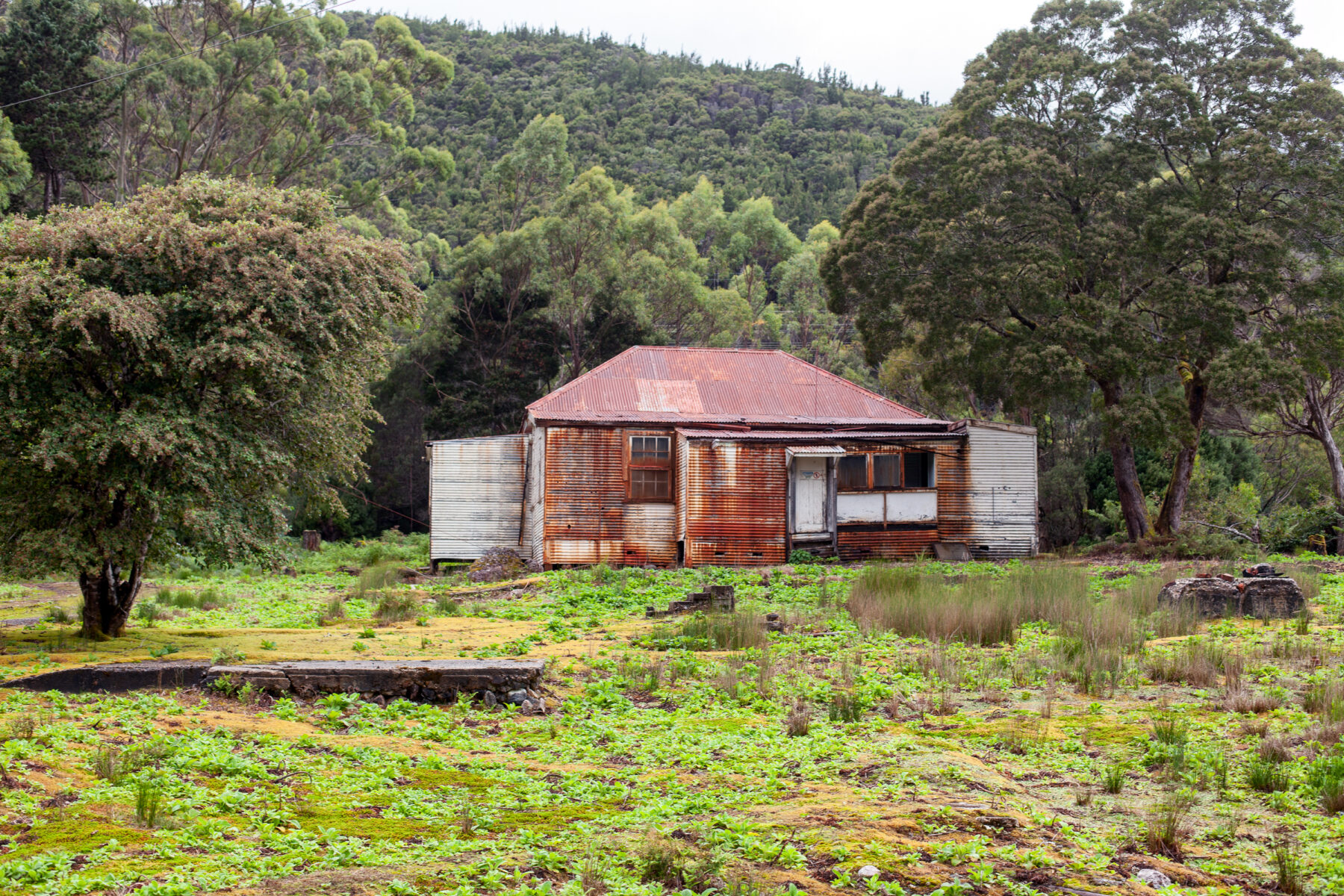
Waddamana

Waddamana is an Aboriginal word meaning ‘noisy water’, which is appropriate because it was the site of Hydro Tasmania’s first power station. In the centre of Tasmania, Waddamana was born sometime in about 1910 when workers began harnessing the waters of the Great Lake and Shannon River to provide power to Hobart. The last of the power stations was decommissioned in 1994 and they have since become museums. In Waddamana village, some of the original cottages can still be seen standing next to empty blocks of land, where daffodil-lined paths lead to long-gone front doorsteps.
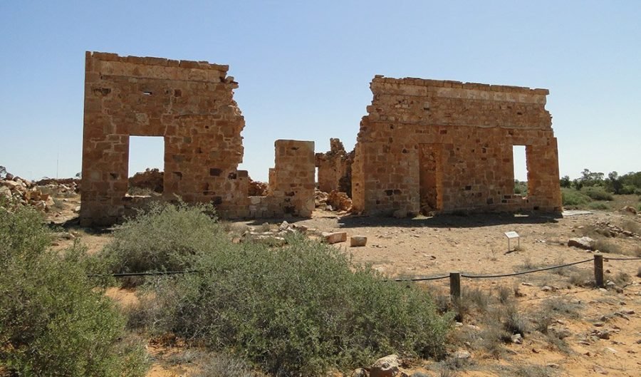
Adamsfield
This remote town owes its existence to ‘black gold’ or osmiridium, discovered in 1925. At the time, the natural alloy was seven times as valuable as gold. Hundreds of miners were drawn here, but life was tough – just reaching the town required a steep 35km trek. Most lived in tents, and lived on damper, tea, bacon and tinned meat. Today, it can be reached by a two-hour walk from Clear Hill Road in the Tasmanian Wilderness World Heritage Area or with a 4WD vehicle and a permit.
Pillinger

Within the World Heritage Area lies the deserted town of Pillinger, once a bustling port, but now reclaimed by the forest. When the North Mount Lyell Company, formed by James Crotty, constructed a railway here, the population soared. Three wharves, a saw mill, brickworks and a shipping terminus kept residents busy, but when Crotty passed away Pillinger faded from existence. Visitors can still reach ruins at East Pillinger by a four-hour return walk along the railway and river, which starts at Kelly Basin Road, south of Lynchford.
Linda
A short walk from Gormanston (see below) is the abandoned community of Linda, where the skeleton of the Royal Hotel still stands. Linda supported the North Mount Lyell Mine, now redundant, and was the terminus for the company’s railway line to Pillinger. It had a reputation as a rough-and-tumble town and was the site of a brawl between Italian immigrants and locals, known as ‘Britishers’, which saw one man fatally stabbed.
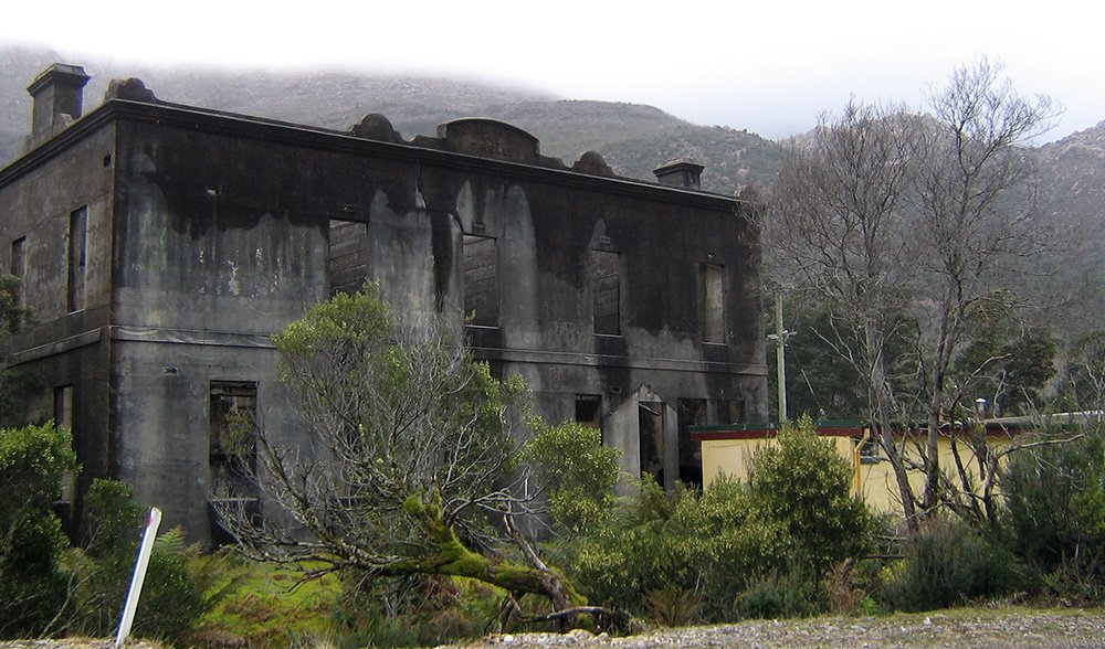
Gormanston

In October 1912 the thriving town of Gormanston in western Tasmania was struck by one of Australia’s worst mining disasters. A fire in the Mount Lyell copper mine killed 42 men and 100 more were trapped until it was extinguished. The town that was once home to 2000 people started to decline. In 1951 cyclone-force winds destroyed the school, the fire station and many homes. In 2013 Gormanston was home to just six people.
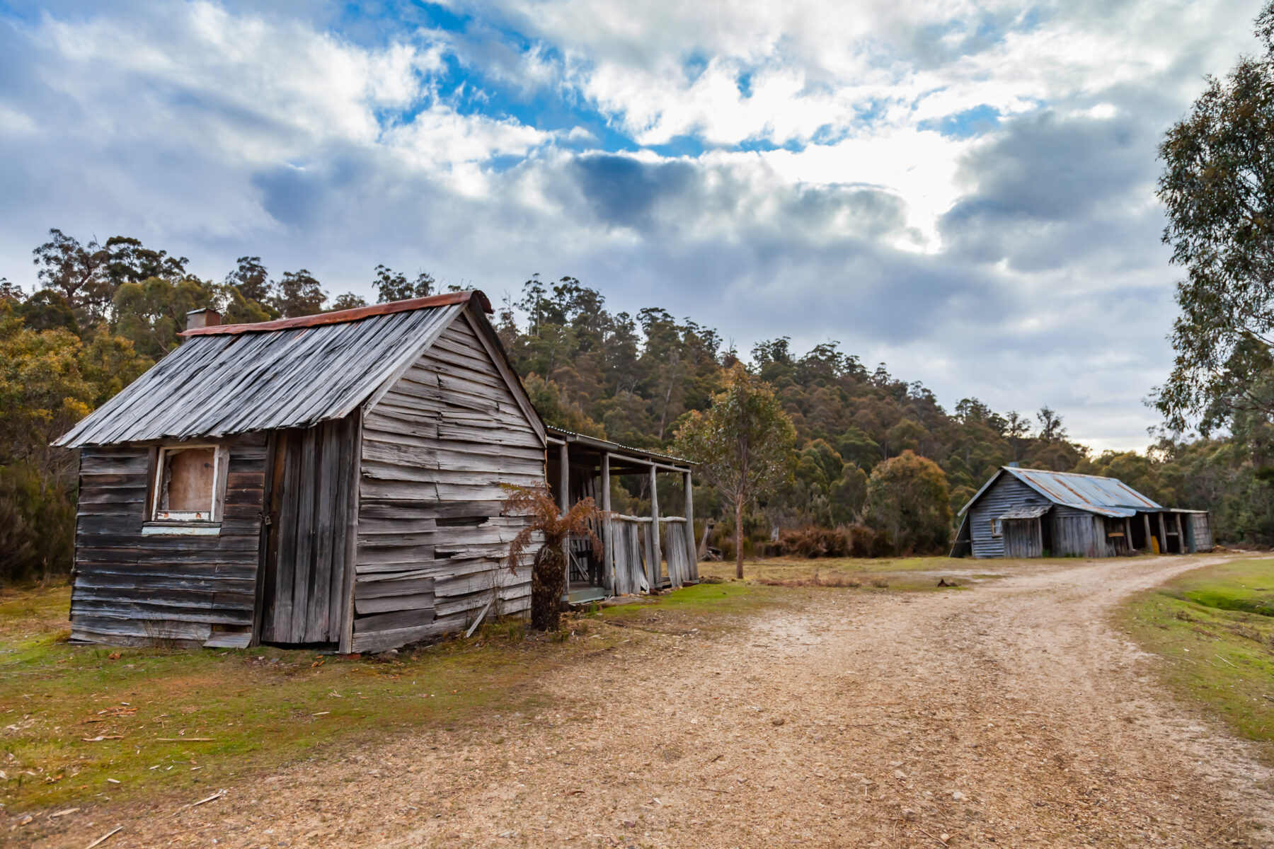
Lake Margaret
Lake Margaret’s last resident, Tim Adams, left in 2009, having lived alone for 18 years maintaining the old King Billy-pine pipeline for Hydro Tasmania. Receiving the highest annual rainfall of any Tasmanian town, Lake Margaret was established when the Mount Lyell Mining and Railway company constructed a hydro-electric scheme to power copper smelters in nearby Queenstown. The pipeline was closed in 2009, and forest now encroaches on the village lawns. You can visit the power station, which is now a museum.
Williamsford

Williamsford’s defining feature was the 500m-high Hercules haulage system that stretched more than 1.5km from the town up to the mine on the slopes of Mt Read. A town of 100, it was regarded as charming for its rugged and wild scenery, but isolated. The Hercules Mine closed in 1986 and the area has been deserted since then, but the ruins of the haulage system remain.
Dundas

From 1891 to 1901 Dundas went from a town of 1000 to 300. By 1895 the Zeehan and Dundas Herald was already reporting on the “deserted township”. The fall of the Tasmanian Smelting Company signalled the end for local mines, leaving many unemployed. The town continued to wax and wane over ensuing decades, with the rise and fall of mines. Today, a productive crocoite mine can be found here, which harvests the reddish crystal that is Tasmania’s mineral emblem.