From the sky to the sea: using satellites to map the world’s unidentified reefs
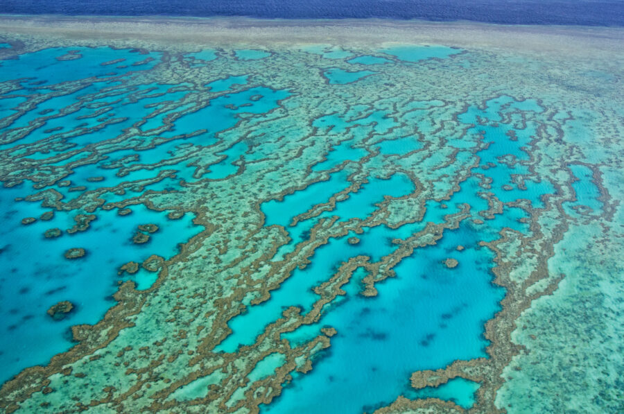
Scientists have identified 348,000sq.km of shallow coral reefs up to 20-30m deep thanks to new technology.
“The total area of coral reef ecosystems is more extensive than previously thought,” said Dr Mitchell Lyons from the University of Queensland’s School of the Environment, working as part of the Allen Coral Atlas project.
“We can now confidently say there are almost 350,000 square kilometres of coral reef, which is about 50,000-100,000 kilometres more than previous estimations.”
Dr Mitchell said researchers also found that about 80,000sq.km of reefs have a hard bottom, where coral tends to grow, as opposed to soft bottoms like sand, rubble or seagrass.
“This specialised data on area and composition will allow scientists, conservationists and policymakers to better understand and manage reef systems,” he said.
Making the map
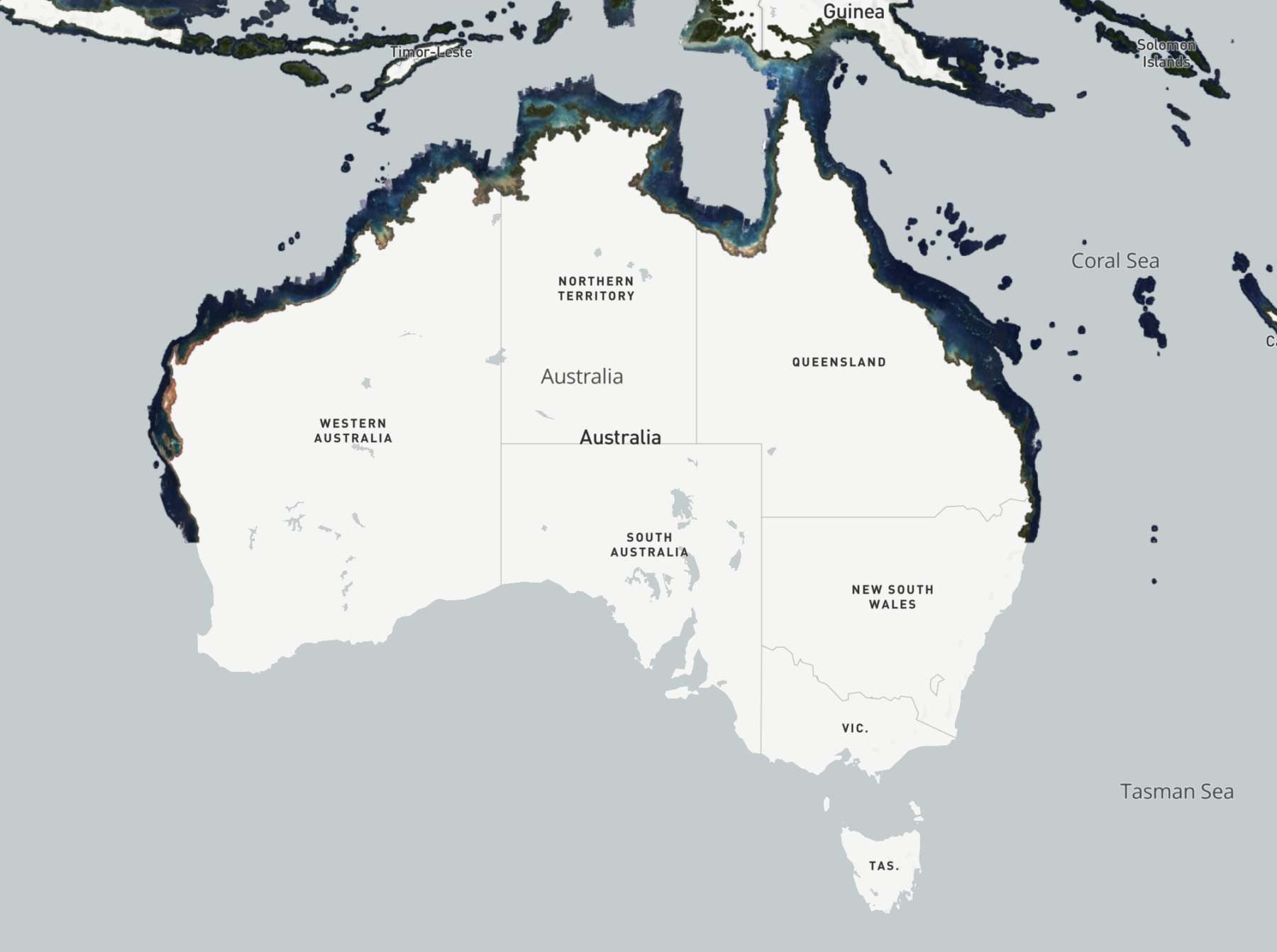
The map, known as the Allen Coral Atlas, was developed by the late Paul Allen’s Vulcan Inc. and is managed by Arizona State University and the University of Queensland along with partners Planet and Coral Reef Alliance.
Using fine-scale, high-resolution pictures from Planet Dove cubesat satellites and scientific-grade information from the Sentinel-2 satellite, scientists processed 100 trillion pixels to produce a global map of coral reefs.
The satellite images were then put through a machine-learning algorithm along with more than 1.5 million training samples curated from data collected by over 480 contributors identifying types of reefs, and the system then predicted any unmapped information to fill in data gaps.
Conserving coral
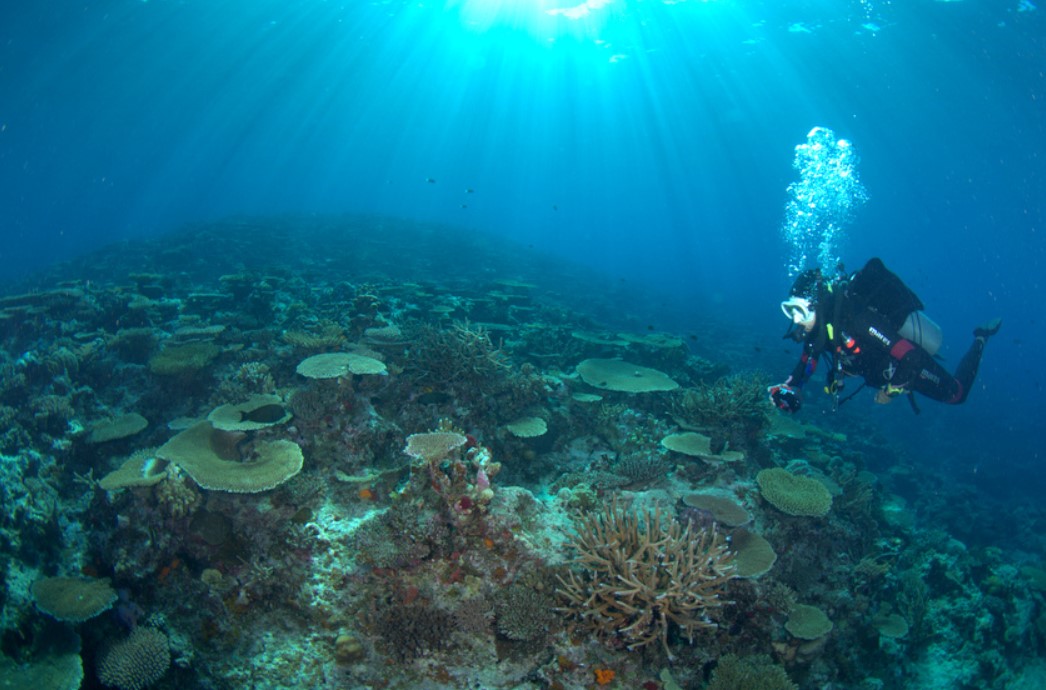
According to Dr Mitchell, although coral reefs account for only a small proportion of the ocean, they provide tremendous biodiversity that humans rely on for culture, commerce, scientific output and medicine.
“Coral reefs possess a quarter of all marine life and contribute to the wellbeing and livelihoods of a billion people worldwide,” Dr Mitchell said.
“Maps of ecosystems underpin many science and conservation activities, but until recently, there were no consistent high-resolution maps of the world’s coral reefs.
“Hundreds of thousands of people have already accessed the maps, and they are already being used directly around the world for marine spatial planning, marine protected areas, environmental accounting and assessments, restoration, and education.”
In 2022, more than 80,000 people accessed the Allen Coral Atlas, including conservation groups using the technology to advance their initiatives.
Groups include the Coral Reef Rescue Initiative, a global programme of scientists, NGOs and partners working in collaboration with governments and communities to safeguard reefs, food security and livelihoods against climate change; and the Philippine Reef and Rainforest Conservation Foundation, a non-profit organisation focused on environmental conservation on Danjugan Island.
The Coral Triangle Initiative, a multilateral partnership between Indonesia, Malaysia, Papua New Guinea, Philippines, Solomon Islands and Timor-Leste working to sustain marine and coastal resources by addressing food security, climate change and marine biodiversity, is also accessing the Allen Coral Atlas.
The information provided by the map will also have broader uses for Australian researchers and conservationists.
“We tend to be really interested in coral bleaching, so the map can help target locations where we know the reefs have hard substrate for coral to grow,” Dr Mitchell said.
“The Allen Coral Atlas also has a tool that allows pinpointing of areas affected by coral bleaching to help alert to the potentially growing issue.
“It’s more than just maps,” he said. “It’s a tool for positive change for coral reefs, and coastal and marine environments at large.”

