Centuries-old nautical maps reveal coral loss much worse than we thought
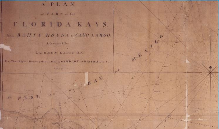
EIGHTEENTH CENTURY nautical maps of the Florida Keys area, which include a stunning amount of ecological information, have for the first time revealed large amounts of coral loss previously unimaginable to scientists.
By comparing these centuries-old nautical maps to satellite images of modern coral habitats across the Florida Keys, the team of researchers from the US and Australia discovered coral reefs that no longer exist, and were thus previously ignored.
When researchers added this coral loss to their current estimates, the percentage of coral loss over the past two and half centuries surged to almost 90 per cent in some locations, leading researchers to believe that the new study, published in Science Advances last week, will have dramatic consequences for the conservation of our coral reefs.
“Usually we monitor coral loss through time by going to reefs where we know there are corals or coral habitat and then measuring the decline in percent of coral cover through time. However, our work shows that there are abundant places where reefs used to exist but we would never even think to monitor coral cover there because they are not reef habitats anymore,” co-author of the paper, John Pandolfi told Australian Geographic.
“These reefs used to exist and they exist no longer, adding to our understanding of the scale of coral and reef decline. Adding a new kind of loss that we were generally unaware of… without studies such as ours, we risk having overly optimistic views of the current conservation status of Caribbean reefs.”
Using nautical charts to map coral reef change
The role of nautical charts in mapping changes across the world’s coral reefs is yet to be fully realised as they typically contained very little ecological information up until the 18th century.
“18th century British imperial mapping of overseas territories marked the first global effort to collect high-resolution spatial data on coastal areas; these charts often contained substantial amounts of ecological information, with coral of particular interest as a navigational hazard,” the paper reads.
“The degree of biologically relevant information recorded varied by cartographer, but the best of these British maps describes the depth, shape, and color of shallow-water corals and distinguishes them from other hard structures such as rocks.”
John explained that it’s possible that nautical charts could be used to map the loss of coral habitat across Australian shores, and that this is something they will continue looking into.
READ MORE:

