‘Super Typhoon’ Earth’s biggest storm in three years
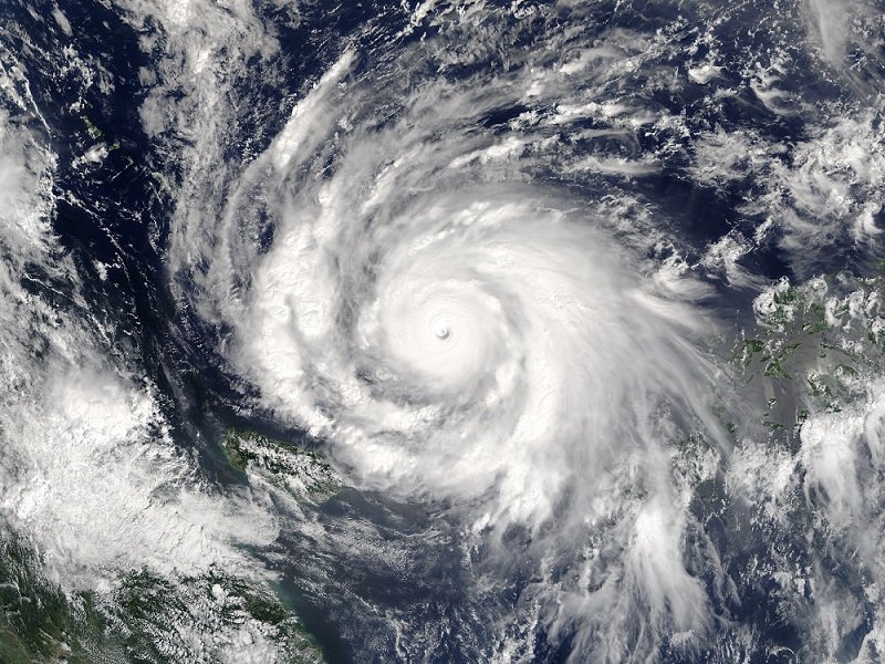
THE NORTH WEST Pacific has been hit by the world’s biggest storm in three years, after a thunderstorm over the equator intensified to ‘super typhoon’ status this week.
Typhoon Meranti struck towns with ‘hurricane-strength’ winds – with gusts up to 370km/hr – and torrential rains in Taiwan and China this week , causing immense damage and personal injury, with reports two people have been killed and many others injured.
Offices and schools were closed, many homes lost power, some were evacuated and residents have been warned of possible landslides and flash floods as heavy rain continues.
After killing one person, injuring 62 people and causing an estimated $100 million in agricultural losses in Taiwan, the storm travelled in a northerly direction, making landfall in China on Thursday morning, where a red-alert was issued – the highest level.
RELATED: The biggest storms in recorded history
Stuart Coombs, a duty forecaster at the Australian Bureau of Meteorology (BOM), said the first disturbance was detected near Guam, and through a process of intensification, what was initially a thunderstorm over the equator became a powerful typhoon.
“It was quite a few days in the making,” Stuart explained.
“These storms rely on the energy source of the very warm waters they pass over – which are a source of moisture and heat that fuel the thunderstorm, and the whole thing powers up into a typhoon. Ocean temperatures of about 30 degrees over a couple of days have provided it the energy to develop into these epic proportions.”
At its peak, Typhoon Meranti reached maximum wind gusts of 370km per hour, with hurricane force winds (averaging over 120km/hr) across a 200km diameter and gale force winds extending hundreds of kilometres.
“That’s […]* incredibly fast for wind to travel,” Stuart said.
The north-west Pacific is notorious for typhoons, with the warm, tropical waters providing optimal conditions for smaller storms to intensify – with potentially deadly results.
“The damage bills from these storms can be many millions of dollars and loss of life can be immense,” Stuart said.
Typhoon Meranti is the biggest storm since Typhoon Hi Yan, which made landfall in the Phillipines in 2013, causing a huge loss of life and structural damage.
After making landfall, Meranti is expected to weaken as it continues north, slowing significantly without its oceanic source of energy and friction from the land mass disrupting its circulation.
‘Typhoons’ in Australia
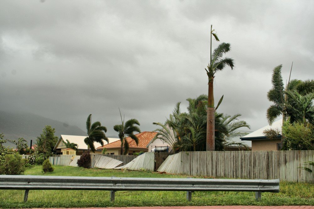
Tropical Cyclone Yasi storm damage in Townsville, Queensland. (Image: Rob and Stephanie Levy / Wikimedia)
Typhoons, or tropical cyclones as they are called in Australia, are not uncommon in our north, with Stuart estimating seven to 11 cyclones making landfall on the coast in a typical season, from November to April.
“These at least reach category one, and of those, you could expect a couple of severe cyclones (category three or higher),” he said, adding, “some years, if conditions are favourable, there could be five or six that hit landfall in northern Australia.”
One of the biggest to hit the country was Cyclone Yasi in February 2011, which made landfall between Cairns and Townsville on the northern Queensland coast.
With winds almost 300km/hr, it was classified as a category five and considered one of the most powerful cyclones to hit Queensland since records commenced – with two cyclones in 1918 and 1899’s Cyclone Mahina the only comparable.
*Correction: This article previously stated that at 370km/h, the wind gusts were half the speed of sound. The wind gusts are almost a third of the speed of sound (1235km/h).
READ MORE:
- Timeline: Australia’s most destructive cyclones
- How to cyclone-proof your house
- Cyclones: facts and figures

