Google program helping research
CONSERVATION AND SCIENTIFIC organisations are joining forces with Google to boost their projects.
The technology giant announced its Google Earth Outreach program is now available in Australia and New Zealand. The program offers not-for-profit organisations the knowledge and resources they need to use Google’s professional mapping products (Google Earth Pro, Google Maps Engine, Google Maps Coordinate and Google Maps API for Business) to deliver their messages in new, engaging ways.
“To date, we have worked with more than 4000 non-profits around the world to provide detailed tutorials and technical resources that help them address environmental and other issues using our mapping tools and our high-resolution satellite imagery,” Rebecca Moore, the Google Earth Outreach engineering manager told Australian Geographic.
Using Google for good
Across the globe, not-for-profit organisations have taken advantage of Google Earth Outreach to help demonstrate forest loss, clear landmines, provide disaster relief, promote human rights, preserve indigenous cultures, explore language traditions, protect wildlife, track native animal migrations and monitor landscape changes.
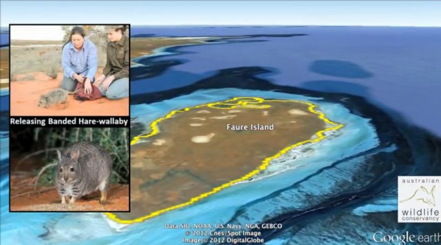
Eligible Australian non-profit organisations are now able to access Google’s products and learn how to use them for free. Organisations that have already partnered with Google include the Australian Wildlife Conservancy (AWC) and the Great Barrier Reef Marine Park Authority (GBRMPA).
“I expect, after making the software programs available and running the intensive training workshop, that we’ll see a surge of public benefit maps coming out in Australia,” Rebecca says.
At the program’s launch this week, AWC unveiled two Google Earth tours that demonstrate their commitment to protecting Australia’s threatened wildlife and ecosystems. Interactive maps created by GBRMPA, which allow students anywhere in the world to learn about the Great Barrier Reef and to follow a green sea turtle in real-time as it swims across the reef, were also made public.
“In the last few years, the fact that Google Earth has been available has opened up a whole new world of possibilities,” says Dr Elizabeth Madin, a researcher at the World Wildlife Fund and Macquarie University, in Sydney.
She partnered with Google two years ago and has been using the mapping technology to investigate the health of Australia’s coral reefs. “We’ve been using the maps and satellite imagery to look at how predators and prey may be interacting and to see how this leaves a footprint on the reef landscape,” she says.
Google data a boon for researchers
Without having access to Google’s data, Elizabeth’s research would not be possible, she says. “It just wouldn’t be an option. At the moment we look over very large swaths of reef – thousands of kilometres – and eventually we’ll be looking at the entire globe’s reef systems and it just wouldn’t be feasible to buy that kind of imagery. Google Earth has opened up a whole new world of possibilities in terms of my research and probably that of many others I’m sure.”
Rebecca agrees and says she feels honoured to be bringing the Google Earth Outreach program to Australia. “To be able to partner with these organisations, to foster the use of these tools for such an amazing variety of projects and to help these groups be more successful in the really important work they’re doing, is tremendously meaningful for me and for my whole team.”
RELATED ARTICLES
Mapping Australia’s sea floor
3-D maps reveal depths of the sea floor
Wifi creator CSIRO wins $220 million law suit
New material can safely clean up nuclear waste
Silkworms made to spin coloured silk
Training scientific dogs to sniff out pests
Why chillies are hot: the science of spice
Breath detector helps find earthquake survivors
Sun rises of tequila plant harvesting for biofuel
Scientists develop printable lasers
Boil water to charge your mobile after an earthquake

