Space tech maps out Australia’s water
14 November 2011
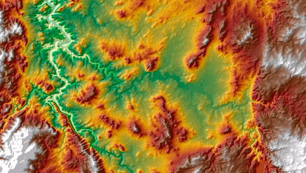
Topography of Canberra and the Murrumbidgee River using the 30m resolution Digital Elevation Model. (Credit: CSIRO)
Images from NASA’s Space Shuttle are being used to create maps that could help manage river resources and flood events.
RELATED STORIES

