
The South Coast Track, TAS
A truly remote experience – and one of Australia’s best multi-day walks. Access is via plane, landing at Melaleuca, and then it is six to eight days – and 85km – in the wilderness as you follow the South Coast Track from Melaleuca through some of southwest Tassie’s most spectacular terrain, to pretty Cockle Creek. You can tackle this monster independently or guided; Tasmanian Expeditions run guided adventures on the SCT but you must have previous multi-day trek experience and be able to carry a pack-load of around 15-20kg.
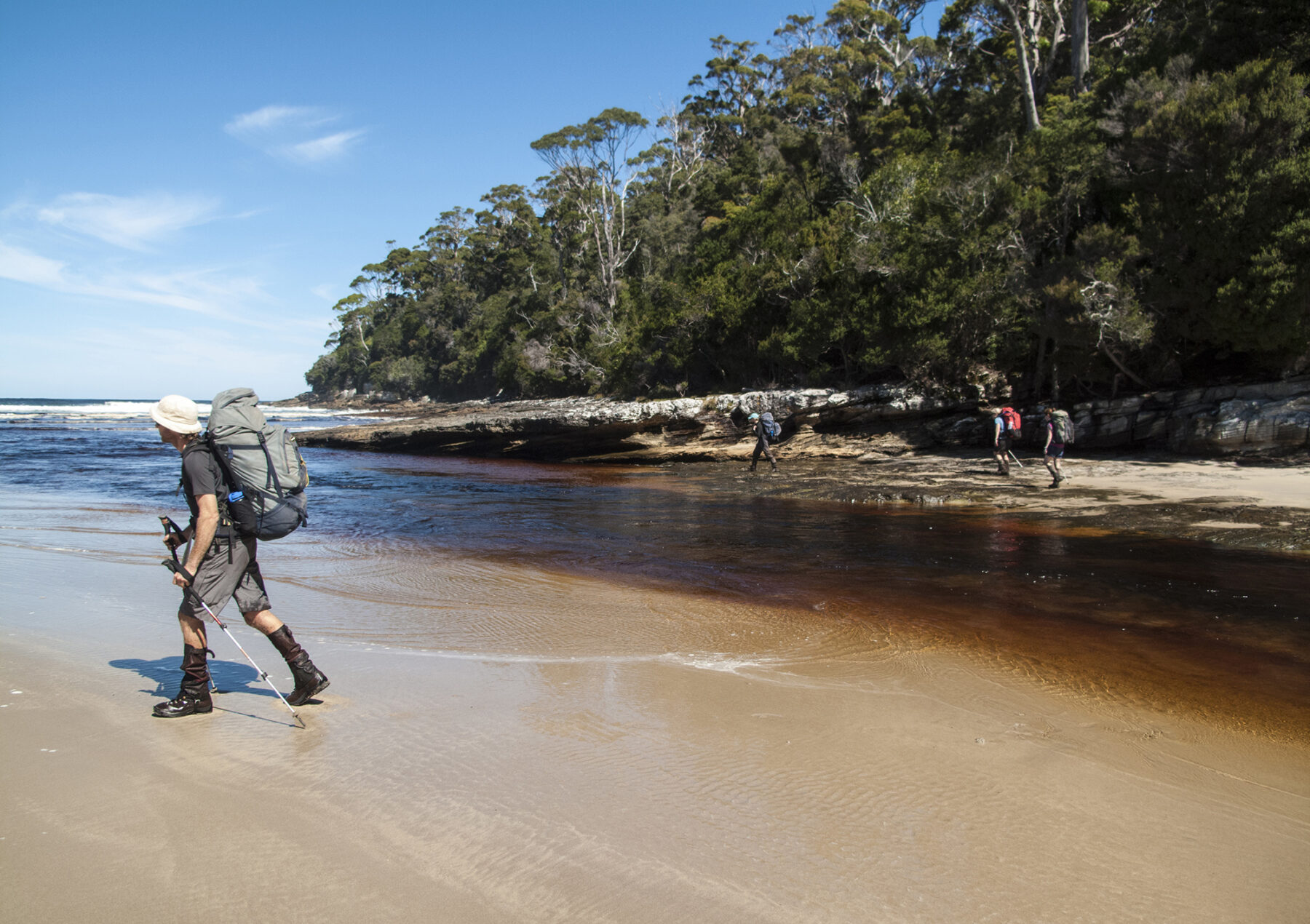
There are no huts on the SCT – you need to carry all your gear and food – and the track is challenging. The reward for all that hard effort is full immersion in a true wilderness. The weather this far south is volatile and unpredictable – be fully prepared for all conditions. AGA Editor Justin Walker walked the SCT in the middle of summer and experienced everything from wild storms and six-degree Celsius daytime temps to very warm, sunny days. The track is (in)famous for its muddy sections, some of which will see the unwary walker sink down to near-waist level, so be prepared for wet, muddy gear (especially boots/socks).
The first few days are a great intro; walkers experience deserted beaches, thick rainforest, river crossings (and a boat crossing) and sublime campsites. Then, midway, it is the big one: the crossing of the Ironbound Range, a full day climbing from sea level, up to over 1000m, and then back down to the beautiful Deadmans Bay campsite overlooking the Southern Ocean (a perfect base for an optional rest day). This day will test your trekking fitness but reward you with either amazing vistas (on a clear day) or a memorably wild buffeting from wind or rain up on the exposed top if the weather is not cooperating. Either way, it is a memorable experience. And the South Cape Range (around half as high as the Ironbounds) is nearly as much fun. The SCT has earned its reputation as a top trek for a very good reason: it is simply brilliant.
Ride the Timber Trail, NZ
One of NZ’s Great Rides, this 85km (two-day) bike journey takes riders through the spectacular Pureora Forest Park, in the Central North Island region. The Timber Trail can be ridden in either direction, but starting at Pureora in the north, and finishing at Ongarue in the south, is the more popular.
Opened in 2013, the highlights of this ride are many, and include riding through Mt Pureora’s Cloud Forest (there are some great lookouts here), old logging relics, eight suspension bridges (three of which are more than 100 metres in length), oodles of birdlife to observe (including the North Island robin), lots of awesome singletrack to enjoy and some true tall timber, in the form of rimu and totara, to provide shade along the way.
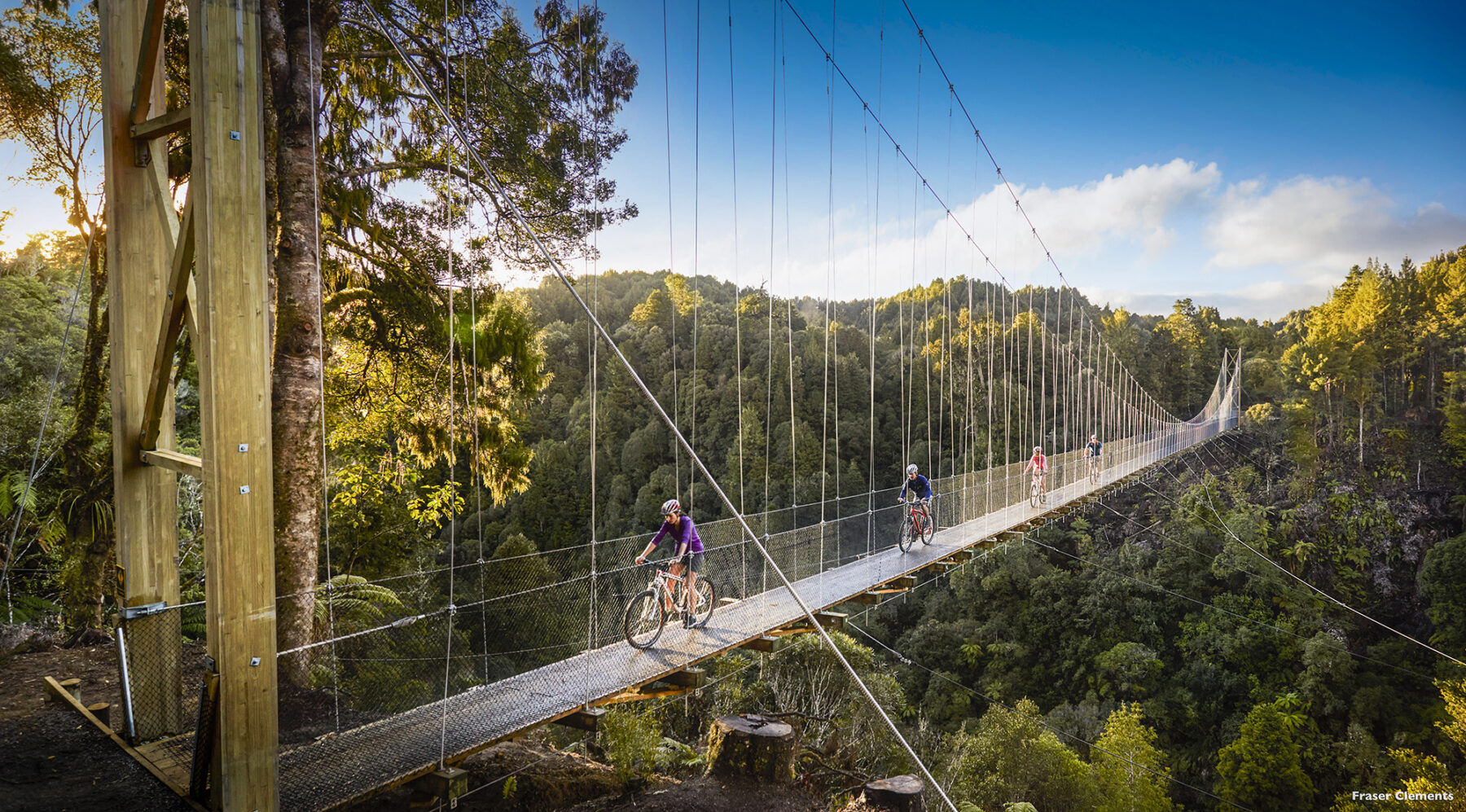
Starting in the north entails a slow climb covering around 15km in distance as you wind your way up the slopes of Mt Pureora and then through pristine Pikiariki Ecological Area (this area of virgin rainforest was spared the timber mills’ axes), with its podocarp trees and native birdlife. The ride continues with a side-track (ironically, taken on foot) to the 1135m Mt Pureora trig, before a belting 8km downhill section before the first of eight big bridges (this one, at 115m, is impressive). Camping options abound at the midway mark at Piropiro, with campsites, a lodge (fully serviced; bookings are required) and the aptly named Camp Epic, with self-catering and glamping options on offer (bookings are required here, too).
The following day’s ride total 45km and kicks off with undulating terrain before another huge bridge (the 141m Maramataha Bridge – NZ’s third-longest suspension bridge) before a 2.5km climb and then another awesome descent where, from the 47km mar, you’ll start encountering historic pioneer remnants (huts, bridges, etc.). Then it’s on to the Ongarue Spiral (at the 75km mark), an engineering marvel that is a loop in a tram line taking you through a tunnel, thus making the traverse of this rugged section notably easier.
The final leg is through more open terrain, including farmland (be sure to respect the private landowners’ decision to allow access through this area and leave not trace), before finishing at Ongarue for a well-earned meal and cold beverage.
Climbing in the Southern Alps, NZ
The rugged Southern Alps of New Zealand stretch some 500km – nearly the entire length of the South Island – and the area is highly regarded by the global mountaineering community as a top-notch and challenging climbing destination. The South Island’s many peaks and the routes up them offer sublime climbing during summer (mainly) or, if you are an ice climber, you’ll be over there in the winter, chasing frozen waterfall routes. For ice climbing fanatics, winter in the Southern Alps is gold. Whether you opt to do an ice climbing course, or a guided trip, there are great locations dotted around Queenstown and Wanaka
NZ’s highest peak – Mt Cook – is ‘just’ 3724m, but the mountains here can be very challenging; even though lacking in total height, the vertical gain – as in the actual distance you climb up – is equivalent to far taller peaks in the Himalayas, as climbing in NZ often starts from near sea-level (the Southern Alps in summer are popular with Northern Hemisphere climbers due to the technical challenges they offer). This makes for big days of climbing, and the weather is also volatile; get stuck on a peak up here and you can be snowed in/stranded for days.
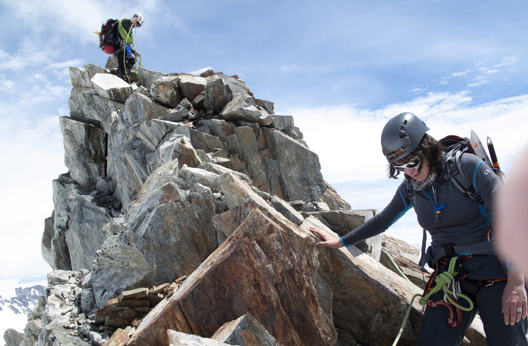
All this shouldn’t take away from the awesome experience of climbing in the South Island’s alpine regions. Mt Cook, Mt Aspiring and Mt Tasman are the most well-known targets for visiting mountaineers, but there are plenty of other mountains in the Alps that offer similar rewarding climbing, such as Mt Earnslaw and Mt Sefton. Thanks to NZ’s Department of Conservation (DOC) backcountry and alpine hut system, you can base yourself out of a hut, such as Pioneer Hut, on the west coast, and pick off the summits of the many surrounding peaks.
NZ is obviously famous for its mountaineers (yep, Sir Ed Hilary, of course) and it also has fantastic climbing guide companies such as Adventure Consultants, Aspiring Guides (both based in Wanaka) and Alpine Guides (based out of the Mt Cook area). Each offer guided climbs of famous peaks such as Aspiring and Cook, and fully guided ‘Summit Weeks’ in the mountains where you are based out of a hut and can climb (or tweak your technique) over seven days up in the Alps. AG Adventure has been fortunate enough to tackle a few peaks with these companies over the years and cannot recommend them all highly enough. If we had to suggest any one peak, we’d opt for Mt Aspiring, located in the national park of the same name, and known as the southern hemisphere’s ‘Matterhorn’ owing to its similar profile to that of the famous European peak.
For those just looking to get started in alpine adventures, the South Island has some great high-altitude trekking routes. Ball Pass and Jubilee Pass are two, with the Jubilee Pass offering a crossing of the Southern Alps (it replaced the infamous Copland Pass as the preferred route). Both of these are for experienced trekkers looking to go that next step. For those looking at a family option, a day trekking on Fox and/or Franz Josef Glacier is brilliant. Guided trips run most days over summer – and the kids will love it.
Walk the Yorke, SA
In December 2015, two coastal walking trails launched in Australia. One – the Three Capes Track in Tasmania – arrived with fanfare, becoming an immediate part of the national bushwalking psyche; the other remains a secret of sorts despite making an enticing, near-complete circuit of South Australia’s beach-lined Yorke Peninsula.
Shaped like a leg, as if naturally designed to be walked, this elongated peninsula is the setting for Walk the Yorke, a 500-kilometre (km) trail that takes the longest journey possible between Port Wakefield and Moonta Bay. Stringing together holiday towns, surf beaches, remote stretches of cliff-lined coast, samphire flats and lighthouses lined like pickets around the foot of ‘Yorkes’, the trail has a suitably holiday-like design – you can commit weeks to walking the entire route, or simply dip into highlight sections along various stretches of coast.
Divided into 16 sections ranging from 17.6 to 41.6km (though most commonly around 25 to 30km) and passing through every one of the peninsula’s coastal towns, as well as 19 dedicated campgrounds, the trail is accessible at multiple points, making it easy to break the greater journey into parts.
Despite the name, Walk the Yorke isn’t exclusively for walkers, with the trail also open to cyclists. For most of the route, the path is shared, diverging several times, especially around the peninsula’s foot, as hikers take to beaches and cyclists hurry ahead on roads.
The trail begins in Port Wakefield, 100km north of Adelaide, leaving the hubbub of Highway One and skirting the mangrove-covered Clinton Conservation Park to round the inner leg of the peninsula and begin the journey south. Here, it predominantly hugs the shoreline as it hops between fishing towns such as Ardrossan, Stansbury and Edithburgh. Each town offers reasons to pause – you could tour an oyster farm at Stansbury, or even work as a deckie for a day; or book a night among the seabirds and penguins at the lighthouse keeper’s cottage on uninhabited Troubridge Island, offshore from Edithburgh.
Walk the Yorke is at its most rugged in the south, as the trail rounds Yorkes’ craggy foot between Edithburgh, 150km along the trail, and Point Turton. This 200km section provides views across the sea to Kangaroo Island – at times just 40km away – as well as traversing surf beaches such as Pondalowie Bay, which is just as often home to dolphins as surfboards. Staked along this wild stretch are four lighthouses, providing a reminder of the ferocity of the sea around Yorkes’ dangling foot.
The last of the lighthouses, at Corny Point, marks a major turning in the trail, swinging back east along beaches to the Pines, and then turning back up the leg of the peninsula at Port Turton. The trail here is a glimpse into Yorkes’ enduring fishing culture, from the colourful tractors dispensing boats into the sea at Hardwicke Bay to the century-old wooden davits once used to hoist boats out of the water at Bluff Beach.
Past Port Victoria, the trail crosses the Nharangga Aboriginal Lands before making its final approach into the copper-mining boomtown of Moonta Bay, 500km of walking or cycling complete and yet just across the peninsula’s hip from where this amazing walking journey started.
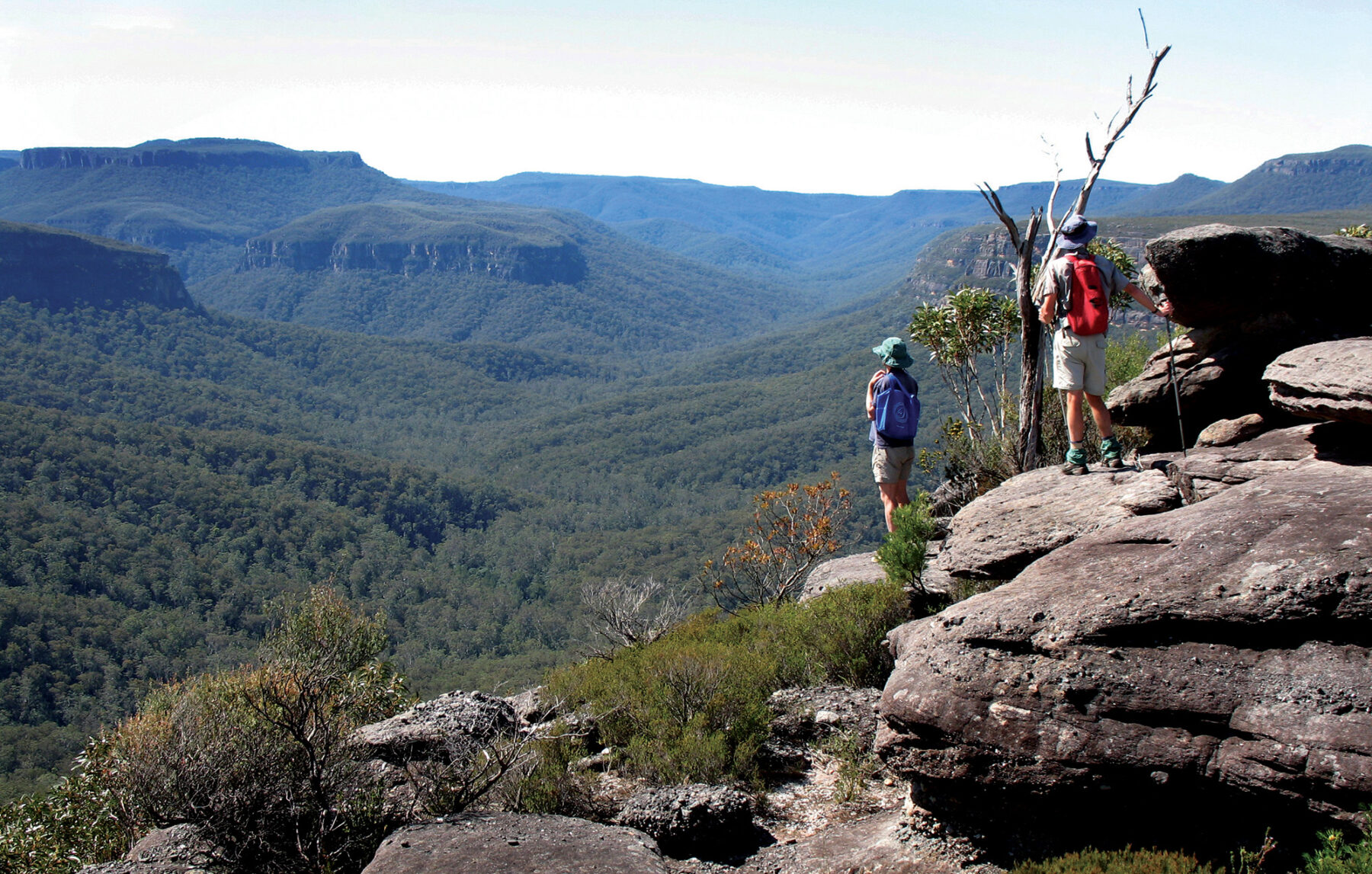
Trek Byangee Mountain, NSW
In the south-west of the Shoalhaven lies the dramatic Budawang mountain range, long a magnet for local bushwalkers. Roads lead only to the fringes of this rugged area which is designated as wilderness. Most Budawangs destinations are the preserve of self-sufficient multi-day hikers but Byangee Mountain is an iconic 11.5km-return walk accessible to fit and experienced day-walkers.
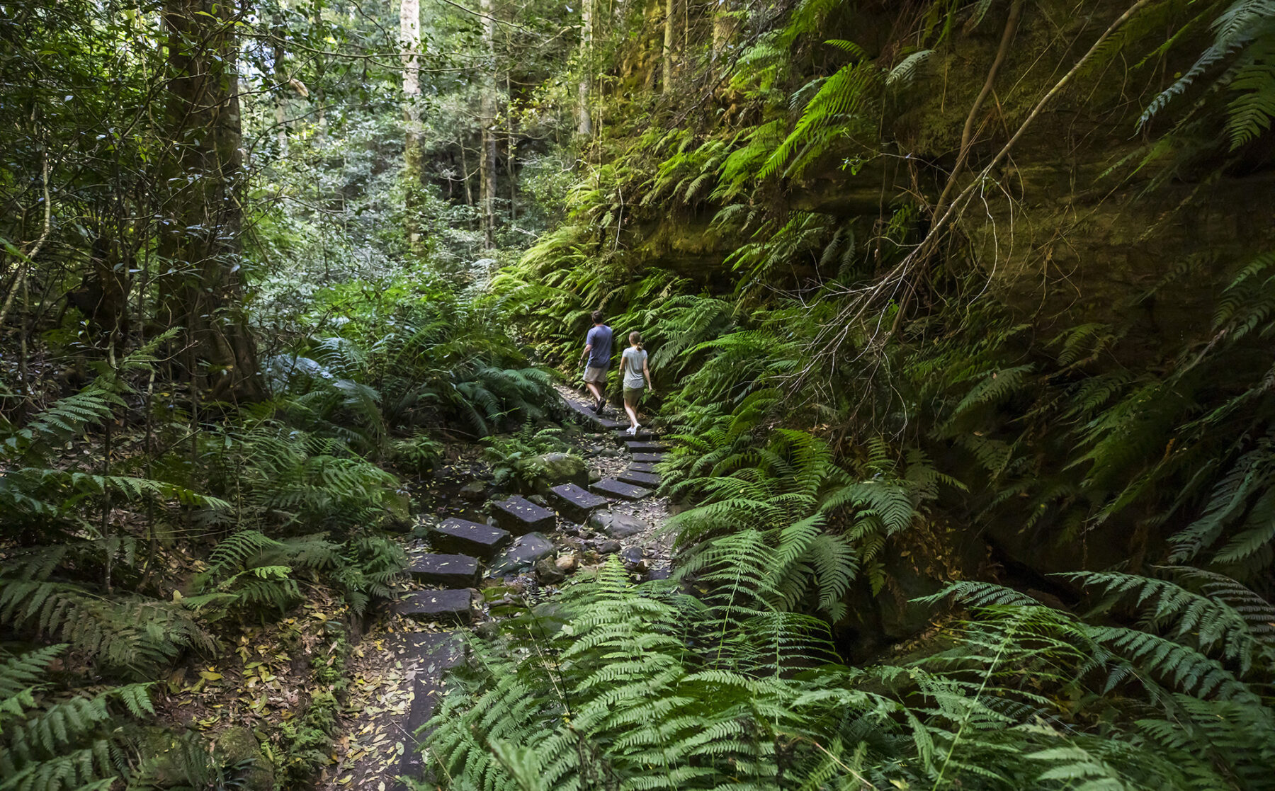
Northwest of local landmark Pigeon House Mountain stands an elongated mesa with sheer, forbidding walls. This landmark is often referred to as Byangee Walls and was long thought to be the preserve of climbers until a hidden, narrow chute was discovered that allows walkers to reach the plateau. The highlight for many walkers, however, remains the passage along the base of the walls – first of the Castle and then of Byangee – to reach the get-up. Once you’re on top, the views are dramatic and ever-changing as you roam around the plateau. There are no exposed sections on its rock scrambles, but this is an undoubtedly challenging walk.
The first section from Long Gully campsite, crosses the Yadboro River, then climbs steadily through open eucalypt forest. After almost an hour, the trail narrows to steps and a sharp nose on the lower tier of the Castle looms ahead. The path now sidles along the base of the rock walls, meandering around obstacles. After about 15 minutes a rough footpad off to the left leads to amazing Cathedral Cave where there is a garden of tall tree ferns. A view of Byangee Walls and Pigeon House opens up just before you reach Castle Gap, then you cross this saddle to reach the northwestern tip of Byangee. The path then skirts left, never straying far from the walls as you pass overhangs with spectacular weathering and walls with distinct bands of rock deposit. About 400m along, you reach a chute marked by arrows. This indicates the route up to the plateau and the spectacular views to come. Allow plenty of time for a lunch break on the plateau to soak up the vast panorama.
You’ll need a detailed guide and topographic map, or you can use the AllTrails app. Roads are mostly unsealed forestry roads and become slippery after rain.
Walk the Paparoa Track, NZ
New Zealand’s latest Great Walk (the 10th Great Walk, in fact) is a shared-use (hikers and MTB) extravaganza that takes ‘trampers’ (Kiwi-speak for bushwalkers) across the Paparoa Range and through the ruggedly spectacular landscape that is Paparoa National Park, on the wild west coast of New Zealand’s South Island. Unlike some other NZ Great Walks, this one can be walked all year round.
As a Department of Conservation (DOC) Great Walk, the 55.1km Paparoa Track is very well constructed and the three DOC Great Walk huts along the track are brilliant, featuring the usual Great Walk inclusions of bunk beds (with mattresses), gas cooking outlets, heating and (non-flush) toilets. There’s also water on tap (this is untreated so be sure to boil before use). As with all of NZ’s Great Walks, you need to book hut tickets before you go, but once that’s sorted, you can just focus on what is a brilliant three-day walking experience (there’s also a four-day guided version).
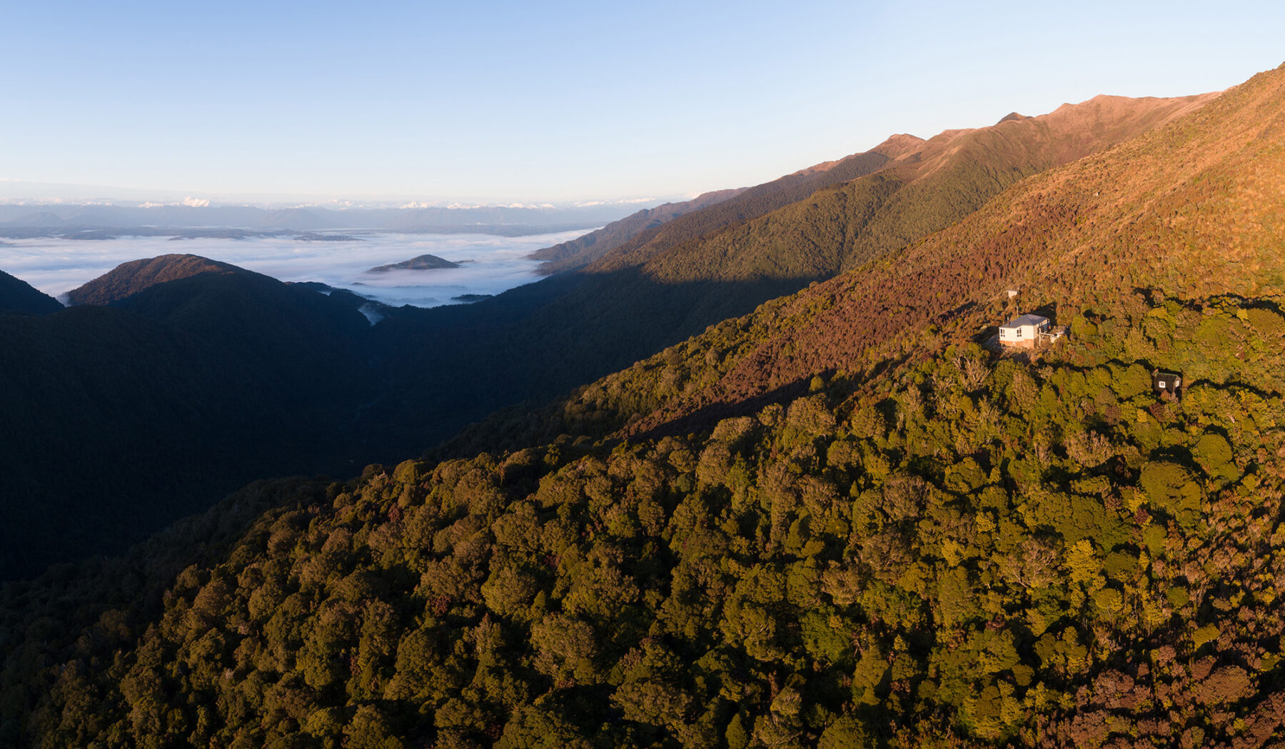
The Paparoa Track is best walked south-to-north, from Smoke-ho car park (near Blackball, 45 mins drive from Greymouth) and starts with walkers traversing the historic Croesus Track (a relic of the region’s goldrush days) then climbing to Ces Clark Hut before you traverse alpine terrain (scrub and tussock) while copping some cracking views to the Tasman Sea. Moonlight Hut is the first night’s accommodation before you tackle the escarpment and then descend through podocarp forest to Pororari Hut.
The final day means more descending through gorge country and beech forest before reaching the junction with the Inland Pack Track, and then dropping down to the beautiful Pororari River and on to the finish-point of Waikori Road car park. (Mountain bikers split off at the junction of the Inland Pack Track and ride through the Punakaiki River valley to reach the car park.)
The Paparoa Track is yet another example of how well NZ’s Department of Conservation has nailed the walking experience and, for those who have already ‘done the Great Walks’ this latest one is a must to add to that list.
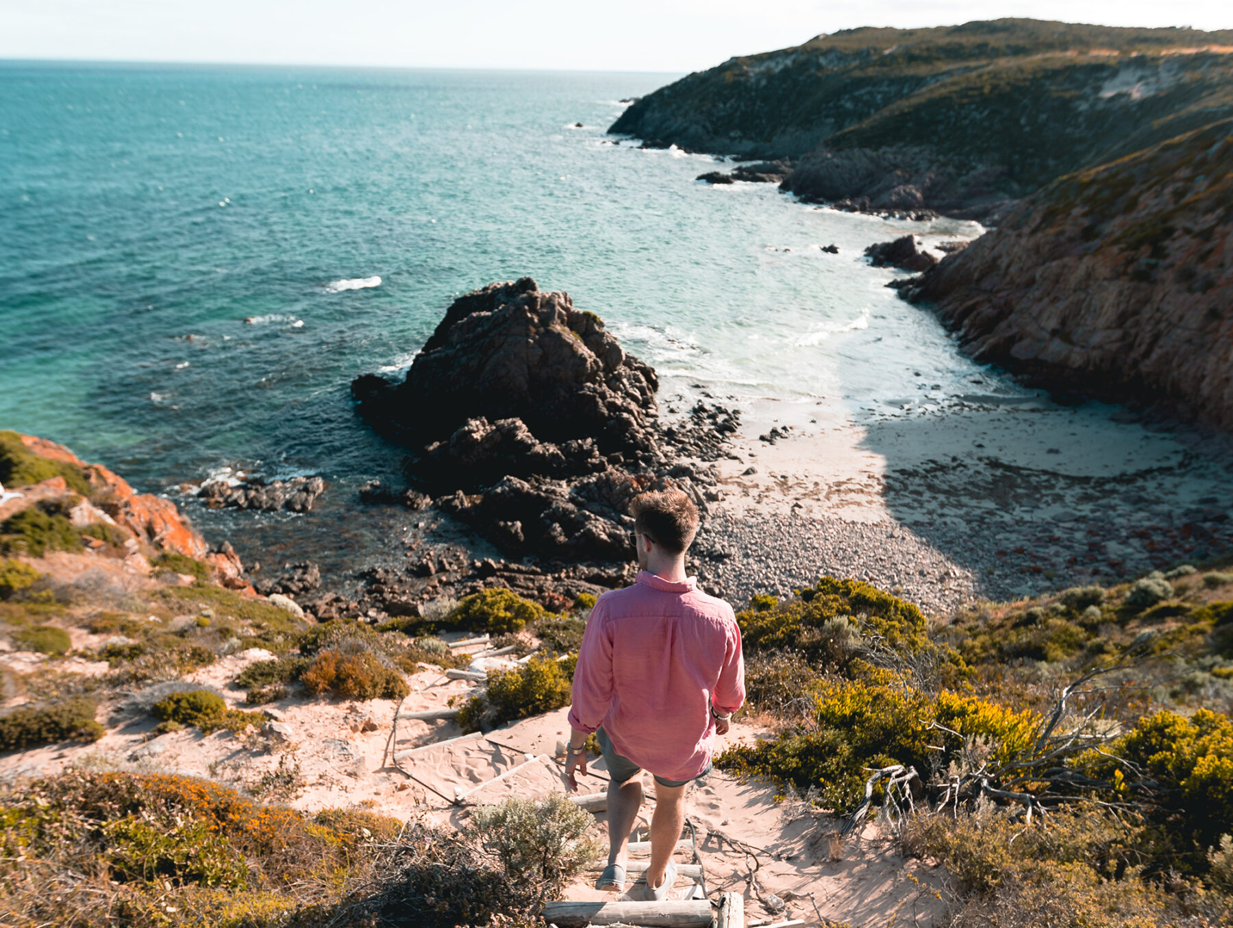
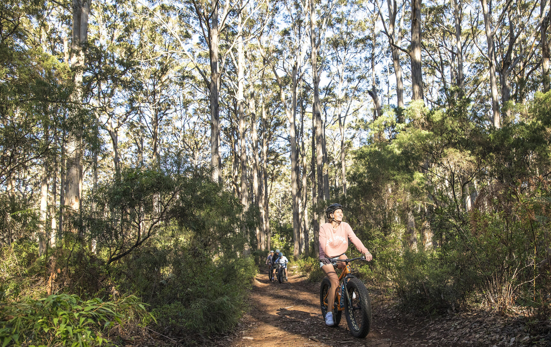
Explore Leeuwin-Naturaliste National Park, WA
Claimed to be the most popular national park in WA, this 19,092-hectare giant lays its claim to that crown thanks to the abundant outdoor activities inside it – surfing, swimming, diving, hiking (the famous Cape to Cape multi-day hike is located here), cycling, touring, camping, fishing and more – as well as the landscape combo of pristine coastline abutting the often-ferocious swells of the Indian Ocean meshed with heavily timbered forest behind the dunes.
The park has four campgrounds – Boranup, Point Road, Conto and Jarrahdene – with all of these being of the first-arrive, best-score type. Point Road has probably the most appeal as it is accessed via a 4X4-only track and is a small campground (it has space for roughly seven tents) sheltered from winds on the edge of the Boranup karri forest, with access to the nearby coastline via Point Road itself. Conto, with 116 camp sites, is ideal for larger groups – and those after a bit more space along with some ‘luxuries’, such as a campers’ kitchen, tables, toilets, and barbecues – and is right next to Conto Springs Beach. Boranup is another small campground located in the middle of Boranup karri forest and has only seven sites.
The 135km Cape to Cape walking track links Cape Naturaliste Lighthouse in the north and its Cape Leeuwin counterpart in the south (both are open to visitors). You can walk a number of the track’s sections as day-walks if you haven’t got the time to experience the Full Monty.
Swimming here is a no-brainer; the more sheltered Cape Naturaliste and Shelley Cove in the north offer perfect family swim locations, along with Bunker Bay, located on the northern side of Cape Naturaliste. Surfing is super-popular; the Indian Ocean swells are held in very high regard by the global surf community. Margaret River, Guillotines, South Point, Gallows – are just some of the popular surf spots here, and there are myriad others.
Away from the coast and it is time to head underground. The park contains numerous caves, with visitors able to explore any number of them, including Calgardup and Giants Cave. You can also opt for guided tours of Mammoth Cave and Lake Cave.
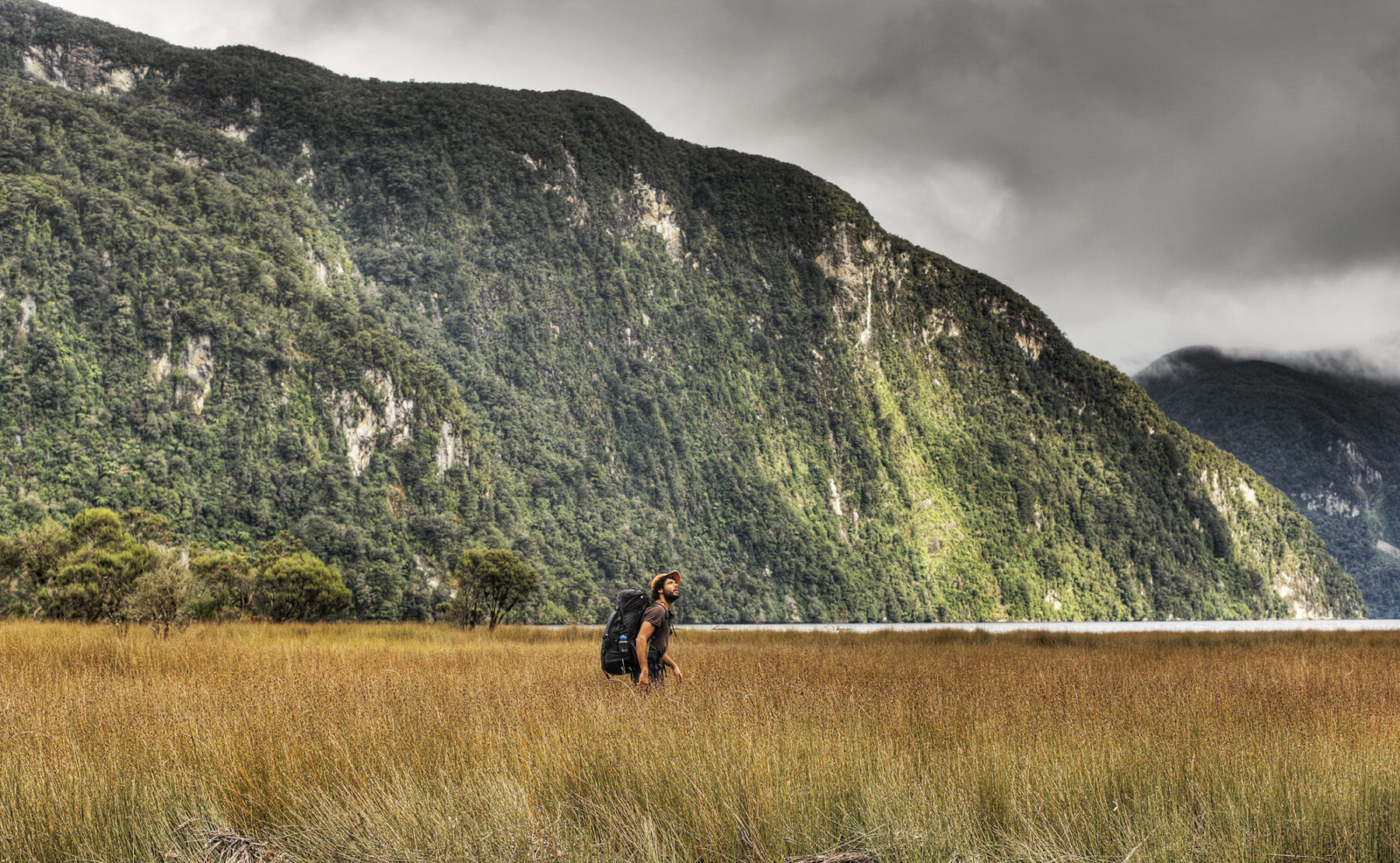
Trek the Dusky Track, NZ
Trekking this Fiordland giant is a serious undertaking. It is longer – and far tougher – than other walks in Fiordland, such as the Milford and Kepler tracks. The reward for all the hard yakka is some of the most stunning landscapes in the South Island as you traverse two mountain ranges (up to 1600m) and three major valleys – and cross 21 three-wire bridges.
The Dusky Track is around 84km in length, links Lake Hauroko (NZ’s deepest, at 462m) and Lake Manapouri, and can take anywhere between eight and 14 days (there is a two-day side trip to Supper Cove if you’re keen). It can be walked in either direction, but we recommend starting in Lake Hauroko, via boat to the track head, and making your way north to Lake Manapouri. The sidetrip to Supper Cover is an option, but we highly recommend it; if you’ve made the effort to get to this incredibly remote and wild part of the South Island, you might as well complete the full trek.
There are so many highlights, but a few standouts are the views from the top of the Pleasant Range, across beautiful Dusky Sound, with mountains in the background; the big climb up to Centre Pass, on the leg between Kintail and Upper Spey huts; and then the side-track from there to the summit of Mt Memphis. Oh, and after each day’s trek, there are also those welcoming backcountry huts to look forward to.
An important note: You need to be very fit, experienced and well prepared to tackle the Dusky Track. Pack your toughest weather gear and pack extra in lieu of potential delays on the track. Be sure to pack extra food; it’s a long trek – and yes, extra food adds weight – but it could be longer (and more miserable) if you get delayed by a day or two due to flooding and have skimped on supplies. (Don’t forget to also pack a stove, fuel, and extra matches; the Dusky Track huts do not have stoves.)
Due to the track’s remote location, NZ’s Department of Conservation (DOC) highly recommends taking a Personal Locator Beacon (PLB) or mountain radio, as well as topo maps of the track.
Walk the Grand Canyon Track, NSW
There are many outstanding bushwalks in Sydney’s Blue Mountains, about 130km west of the city, but the Grand Canyon’s expansive vistas, narrow chasms, striking canyon scenery, and a surprise around each corner, make this walk one of the most popular in the mountains. Much of the walk traverses a ledge that looks down into the canyon from above but there is a wonderful section where you’ll find yourself picking your way over stepping stones along the floor of the canyon.
From the most westerly carpark the Grand Canyon Track zigzags downwards through open woodland, soon turning into damp forest. The vegetation is colourful and varied, with an abundance of waratahs in spring and flannel flowers in summer. Passing the ‘Rotunda’, a large overhang and Aboriginal occupation shelter, you’ll soon go through a completely enclosed tunnel, created many years ago by a rock fall. Emerging on the other side, you’ll pass under the spray of a waterfall.
About 20 minutes after crossing a wooden bridge, the track meets Greaves Creek. It’s tranquil and sheltered here, surprisingly cool even on the hottest of days. At the end of this stretch, there is a perfect swimming hole on your right. A couple of minutes further on you arrive at the Rodriguez Pass junction, leading to Beauchamp Falls. From this point the track ascends steeply to Evans Lookout, where there are views over the Grose Valley and across to Mt Banks and Mt Tomah. From here, follow the easy footpath back to the carparks.
Despite the name, the Blue Mountains aren’t really mountains at all. The entire area is one huge plateau dissected by gorges and waterways. The canyons are formed by water running down planes of weakness in the rock and further scoured when flash floods toss rocks and debris along the canyon walls.
This walk can be busy on the weekend so aim for midweek if possible. If you want to continue walking, the Cliff Top Walk (6km return) is nearby.
Sea kayak Bathurst Harbour, TAS
Kayaking in Tasmania’s wild southwest can provide some remarkable contrasts. In the protected, tannin-stained waters of Bathurst Harbour, you can glide across mercury-smooth waters. Poke your nose out into the open seas of Port Davey and it can turn into a high-sea rodeo.
After a short but spectacular flight to Melaleuca from Hobart, trips with Roaring 40s Kayaking begin in the Melaleuca River with a gentle paddle north into Bathurst Harbour. From here, itineraries are flexible and dependent on the fickle weather. On any given week – or even day – conditions might range from breathless mornings to 25-knot-wind blasts stirring up metres-high swells.
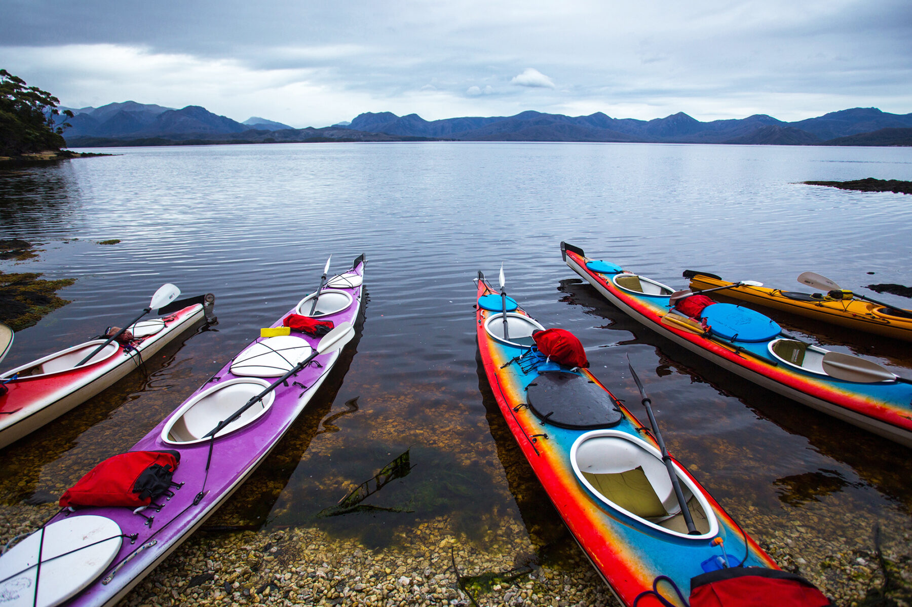
Typically, though, trips head through the Bathurst Narrows, paddling along the foot of Mt Rugby and poking around empty shores such as Bramble Cove and Balmoral Beach. Past Bramble Cove, the Narrows balloon out into Port Davey, with a protected approach guarded by the narrow Breaksea Islands. Turn south and it’s a short paddle into the long beach at Spain Bay or turn north and head for the old Huon pining camp at Settlement Point at Port Davey’s northern tip. If time permits, there’s the possibility of continuing further north into the little-known Davey River Gorge, a place once known to the area’s hardy piners as Hell’s Gates.
On a busy week in this corner of Tasmania, you might spot a yacht or two, but mostly this area is undisturbed by people. The only sounds might be the wind and your paddles, and nights are spent camped behind castaway beaches. Behind them rise low peaks such as Mt Stokes and Mt Beattie that entice paddlers out of their kayaks and onto the slopes for views across the harbour and deep into the Tasmanian Wilderness World Heritage Area, of which Bathurst Harbour forms one remote and remarkable edge – the dark waters here limit the penetration of light, resulting in deep-sea creatures such as sea pens and sea fans growing at depths of just 10 metres.
Eastern Plateau Walk, VIC
The Mount Buffalo Plateau was formed millions of years ago when volcanic activity created a highland almost triple the height of the current plateau. Since then, weathering has shaped the park’s granite spine that we see today. One of Victoria’s oldest national parks, Mt Buffalo’s diverse landscapes include colossal granite tors, 300m cliffs, plunging waterfalls, beautiful wildflowers, snow gum forests and mossy plains. Not to mention abundant wildlife and flora – gang-gang cockatoos, wombats, swamp wallabies, eastern pygmy possums, and the bogong moths – that drew the Minjambuta people here for summer feasts and ceremonies over the aeons.
This 9km circuit walk (graded as medium) covers many of Mount Buffalo’s most recognisable landmarks. Starting from the Gorge Visitor Area, the route follows the Gorge-Lake Catani track. Soon Billisons Lookout provides views of Mt Hotham and Mt Feathertop from a rock platform, then the walk continues to Lake Catani through stands of alpine ash and snow gum woodland. The lake is a lovely spot for a picnic or swim, and also supports a healthy population of brown trout for anglers. Take the Chalwell Galleries Track, near the campground, for an exciting route through a maze of large granite rocks that form curious passages. You’ll need to scramble down between the boulders and lower yourself through a narrow crevice using the handrails. Descending to Lakeside Road to pick up the Lakeside Walking Trail, the route heads west along the southern fringe of Lake Catani. Candle heath and thick mats of sphagnum moss grow in the boggy areas around the lake’s edge. There’s a short stretch along the bitumen of Mount Buffalo Road as the trail swings north to Grossmans Mill Picnic Area and the Monolith Track. The giant balancing rock stands at 1464m above sea level on a rugged granite tor. A staircase climbs to a viewing area that provides 360-degree panoramas of the plateau and Lake Catani. From here return to the Gorge via a quiet forested gully.
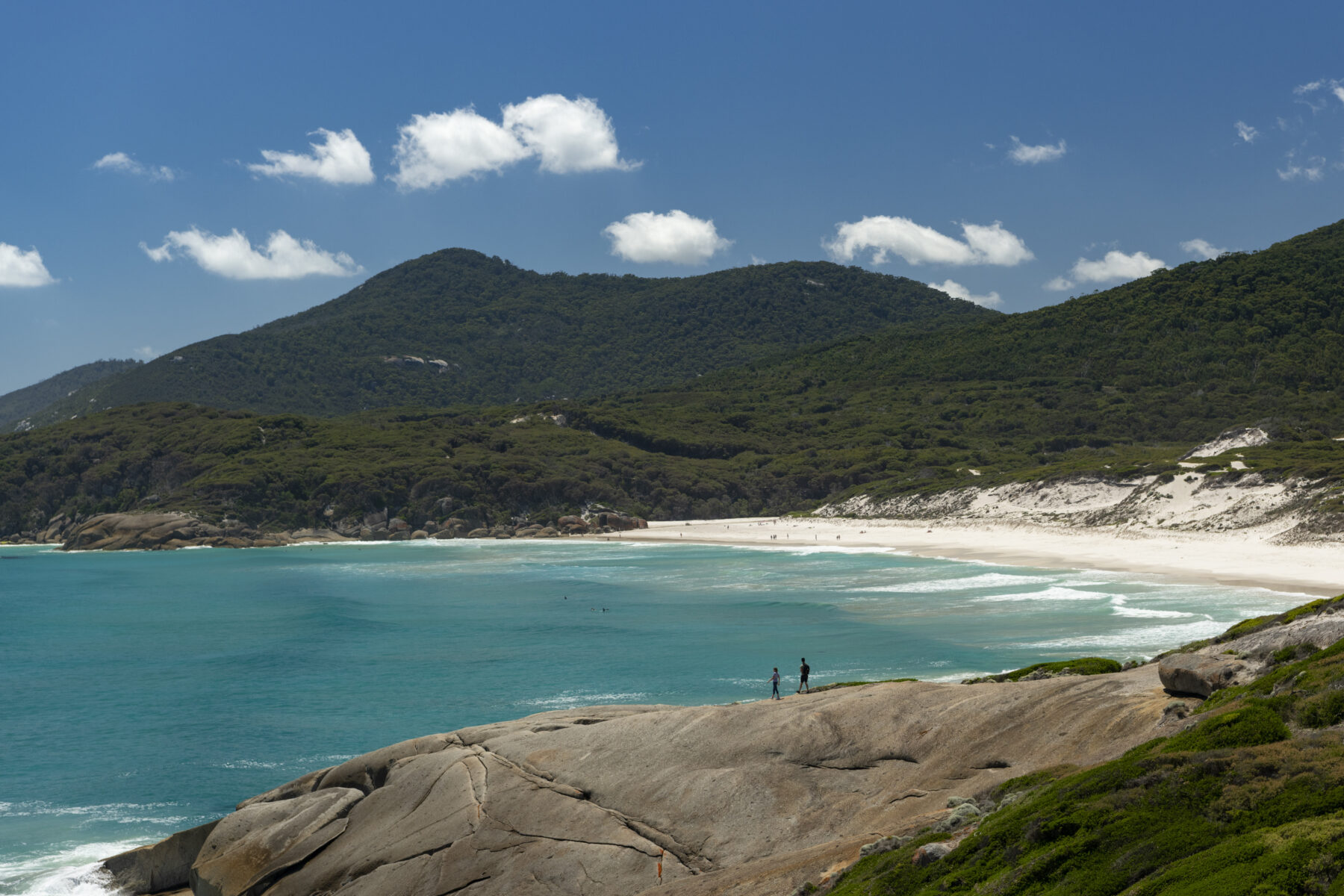
Adventures in Wilsons Promontory, VIC
To a bushwalker, camper or kayaker, a night at the Prom is indeed a special event. Dangling from the Gippsland coast like a hook, Wilsons Promontory forms the southernmost point of the Australian mainland and has long been one of Victoria’s favourite national parks, bringing together beaches, bush, a classic bushwalking circuit and a host of water activities.
The definitive Prom experience is hiking the Southern Circuit, which loops out from the slopes of Mt Oberon, crossing a series of white-sand beaches along the southern edges of the promontory. Typically taking between three and five days, and liberally dotted with campsites, the 41-kilometre walk passes through the likes of large Sealers Cove and Waterloo Bay as well as tiny Refuge Cove.
Broaden the loop (59 kilometres) and you can spend a night in a cottage at the Wilsons Promontory Light station, which is accessible only on foot, before detouring to South Point, mainland Australia’s southern tip. [Note that the track from Mt Oberon to Sealers Cove is closed until 2024, requiring bushwalkers to detour through the Telegraph Track.] The longer, wilder Northern Circuit journeys through a remote wilderness area and is better suited to more experienced walkers.
Camping is the lure for so many of the Prom’s visitors, with Tidal River among the most popular national park campgrounds in Victoria’s – through the summer school holidays, there’s a minimum seven-night stay at its 484 campsites. The camp provides easy access to sand and swims at Norman Beach, Squeaky Beach and Little Oberon Bay, as well as serving as a de facto finish for the Southern Circuit and a base for kayaking explorations in both the sea and river.
Tidal River’s namesake, tannin-darkened waterway provides flat, often-mirror-still paddling past the river’s signature granite boulders, or you can launch from the beach to explore bays such as Little Oberon, Picnic and Whisky.
In the park’s north, three-day Sea Kayak Australia tours depart from Port Welshpool, paddling the 13-kilometre crossing to Tin Mine Cove near the Prom’s northern tip. This is a rarely visited piece of the promontory, otherwise seen only by bushwalkers on the Northern Circuit. This kayak trip also takes you into Corner Inlet Marine Park, one of Victoria’s 12 Ramsar sites, attracting nearly 50 per cent of Victoria’s migratory wader birds each winter. (For the hardiest of kayakers, the Prom also serves as the starting block for one of the country’s toughest paddles – the epic crossing of Bass Strait to north-east Tasmania.)
To range further out into the Prom’s seas, book a boat tour with Wilsons Promontory Cruises. Its yellow boats depart from Tidal River and head south through Wilsons Promontory Marine Park to South Point and a chain of nearby islands. The tiny Anderson Islets house one of the largest Australian fur seal colonies in Victoria, while the neighbouring Cleft Island, aka Skull Rock, is a hulking granite monolith rising from the sea.


