
The mountain of dreams
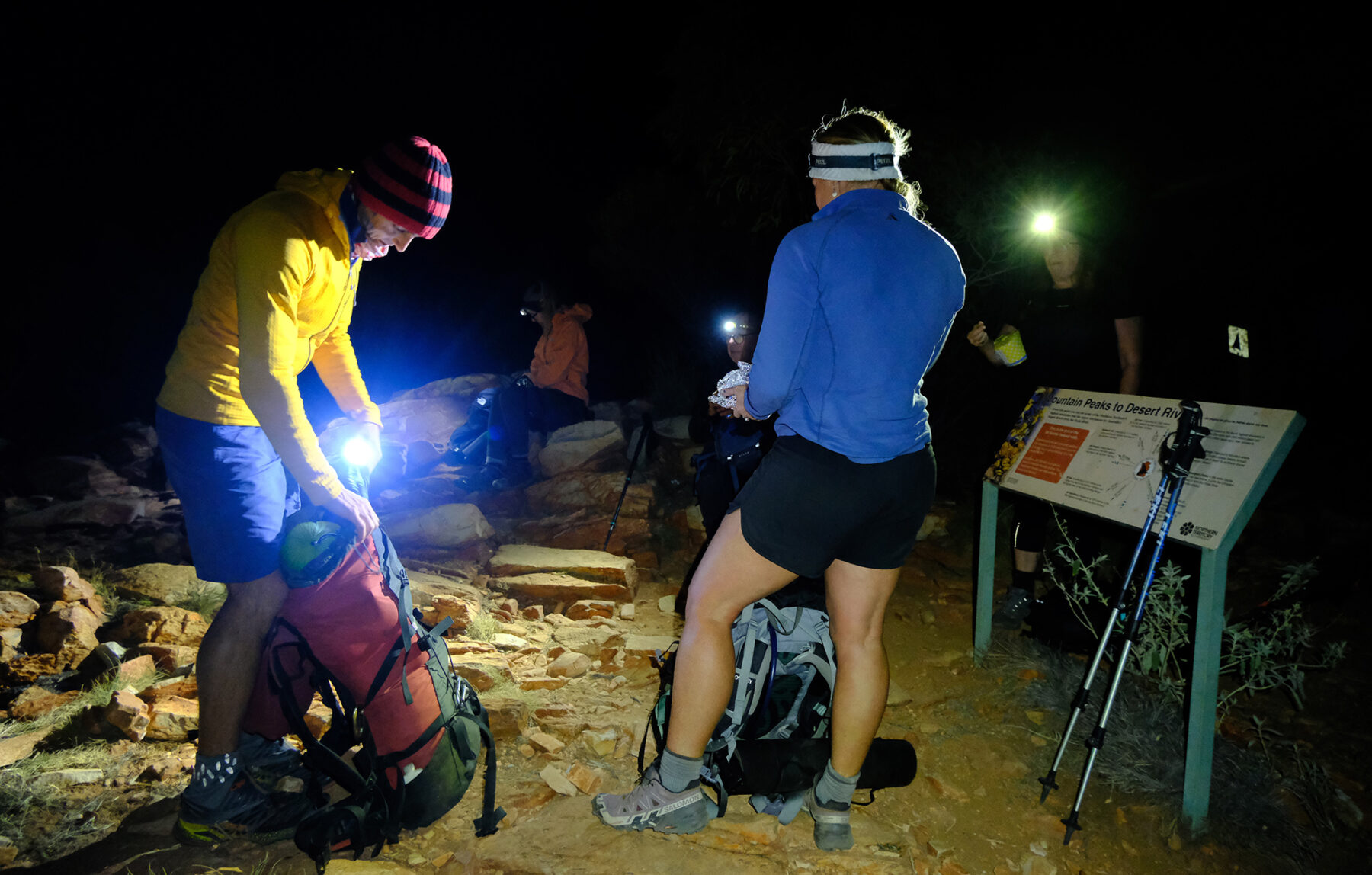
My alarm is set for 2am, but I knew I’d wake before; this could be due to not sleeping in my bed or the cold silence of our eco-comfort camp. Maybe the invisible shadow of Mt Sonder, the fourth-highest peak in the Northern Territory, looming south of my tent, wakes me at 1:15? Ahead of us is a group attempt on the 16km-return hike to the top of Mt Sonder, Section 12 (the last) of the Larapinta Trail. Traditionally, this is attempted through the night to get to the summit at sunrise, and hopefully, coming off the mountain and returning to the carpark – all going well – at around 10:30-11am. All this means we leave Sonder’s base at 3:15am.
I’ve several concerns and the first is with my head torch; it’s the rechargeable USB kind, so there is no swapping out double As if it fails on me. I’ve also never attempted anything like this before, walking through the night to a mountain summit. Today is not an endurance event, but I am conscious that I want to be at the highest point, selfishly for photographic reasons, just before sunrise, and there’s a real possibility we won’t even see the summit.
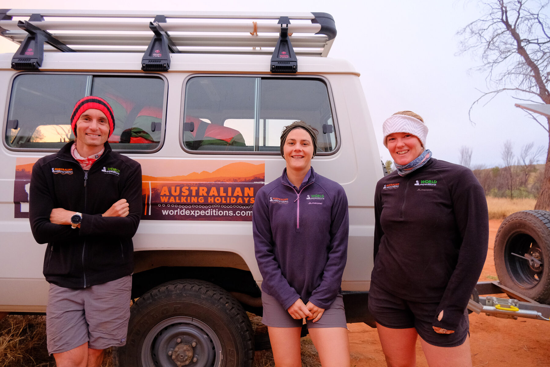
There are seven of us in the group, and two (I am happy to say) are experienced Larapinta Trail World Expeditions guides. As with all our adventures over the last week, the night before has been a time for briefing and questions about the challenge ahead. Abby points out that it’s always safety first. Her last two group attempts on the summit were cut short and turned around due to rain and a potential thunderstorm. Pete, who has guided the Larapinta for approximately 10 years, has seen it all and tells us that after checking the weather, it looks like we’ll have light cloud cover and no rain. What can’t be accounted for, however, is the wind. Sonder, he points out, seems to have its own weather system, and in Pete’s calm composure, he reminds us to enjoy the climb and whatever happens; just being here and attempting this mountain means something and is memorable enough.
Stepping off the bus, we are prepared for the challenge, water bags filled, and I’m carrying plenty of banana bread and energy bars. Annoyingly, I have a slight pain in my left knee, which I keep to myself; it’s a reminder of the ups and downs of the last few days. Rocky terrain is finally catching up with me, but I know I’ve got this section’s 16km in me; I’ve been told the first two kays are the steepest, and then it’s a steady assent to its summit.
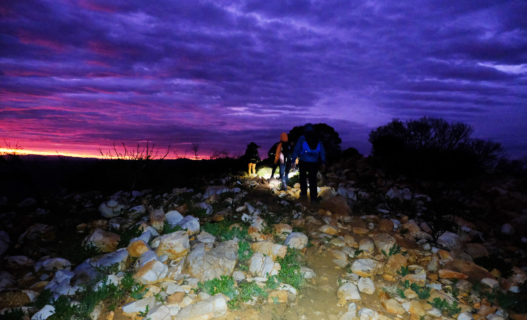
Leaving the car park, I now understand there are different degrees of darkness; most of us experience the night surrounded by some level of light pollution created by Australian cities. At 3:15 in the morning, Mt Sonder is in a completely black darkness. There’s a little cloud cover, so the stars make an appearance now and again, but for a significant amount of time, all I can see is the light from mine and Abby’s head torch who’s ahead of me as we slowly climb the stairs and follow the path on Sonder’s first few kilometres. Well into the climb, we pause to regroup and refuel, and it’s around this time that I genuinely feel like I’m climbing a mountain. However, visibility around me is practically zero; looking back, I see several bobbing head torches lighting the path and making their way up. Then, another line of lights pierces the night even further in the distance. It looks like we won’t be alone on this summit.
I remember Pete’s early advice: eat more than you think you will need at the beginning. You may not want it, this will help and give you the energy required for the final summit push. We make good progress, and although the wind starts to pick up as we close in on the top, it’s apparent it won’t be enough to halt our progress. Mt Sonder’s draw comes from the safety in its route, meaning there’s little risk in the walk from bottom to top; you must be fit enough to return climb a mountain, but there are no unnerving edges or narrow paths to worry about or even fall off.
I see the marker to my left, a simple white square, and the 1km to-go indicator in black. I must be honest. This last kilometre never felt so long. Rachel, my fellow climber, and I both joke about where’s the top, and the answer soon comes as I look to my left and see a bright red line cut horizontally through the horizon. First light; the sun is rising.
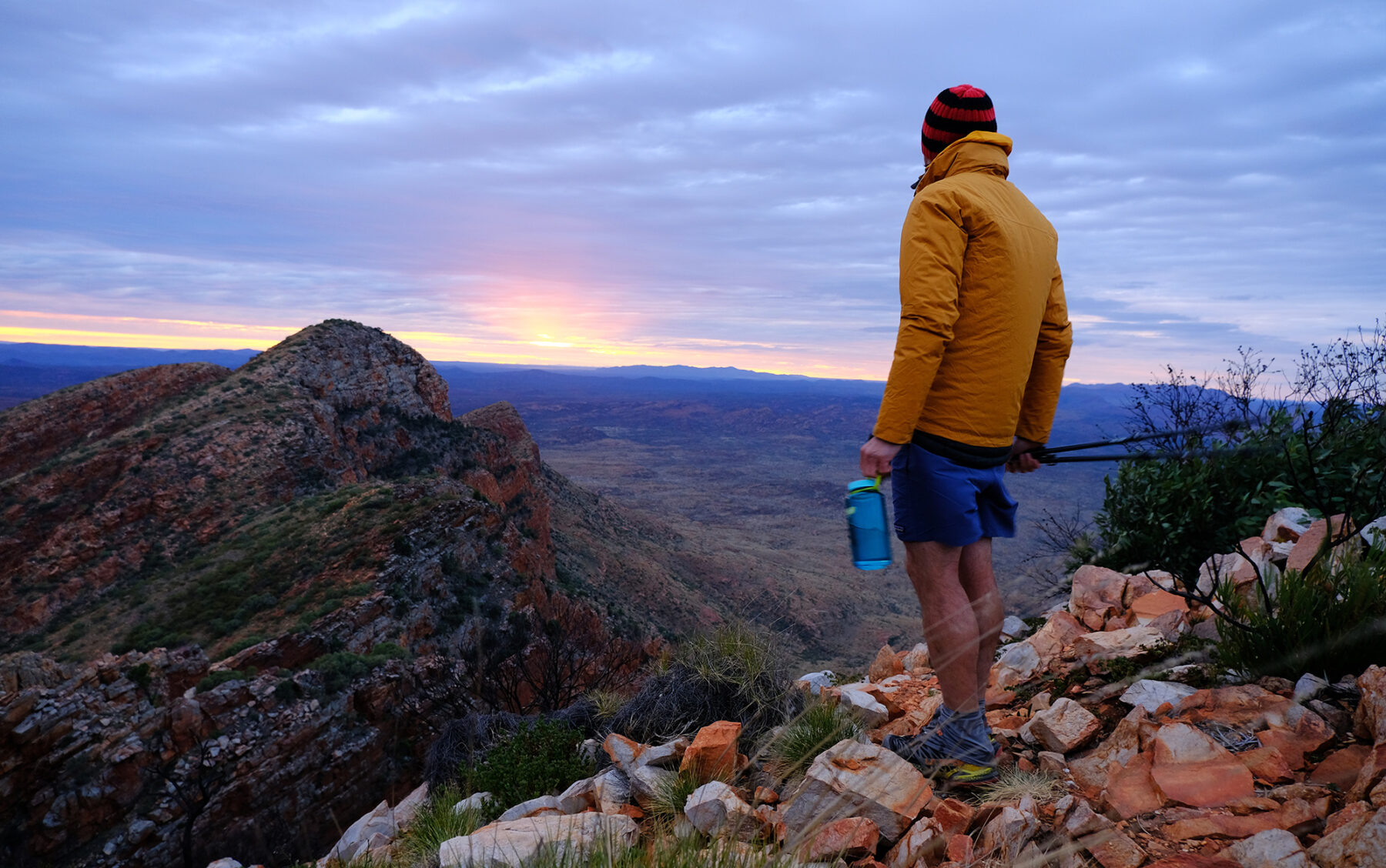
At the summit, there’s enough room for the multiple groups to rest. I try to relax but know this is a perfect opportunity for photography; after all, how often are you on a mountaintop at first light? With a 360-degree view, I see the length of the MacDonnell Ranges on my right and look down ridges and lines I’ve walked the days before. It’s an unforgettable visual reminder of the walk’s beauty and what it takes to complete it. I turn and read the mountains trig plate. Even though I’ve only tackled part of this walk today, this still feels like a tremendous accomplishment.
The Larapinta highlights package
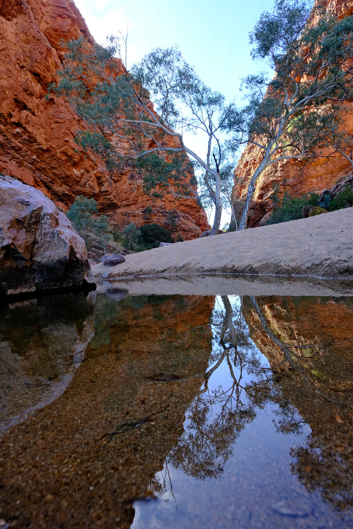
Over the last five days, I’ve been guided on what I guess you could call a highlights reel of the Larapinta Trial hosted by World Expeditions. Instead of what’s known as the complete trail – the end-to-end trek – I’m experiencing five days of walking different sections along the route, which adds up to approximately 45km. At this point, I must confess; this is my first time in the NT, and in my naivety, I thought central Australia was a hot desert. I had no idea of the rocky MacDonnell Ranges that form a unique half-pipe of parallel ridges running east and west through Alice Springs. On my first day out of Alice, I was surprised by the view that unfolded before me; on arriving on the trail, I’d seen this distinctive rock formation, dry sandy riverbed, single tree, and water hole. I knew it from the many photographs given to me for past magazine layouts; this is Simpsons Gap. A photo is one thing, but being here and learning about this spiritual site cannot be replaced. For example, the right-hand rock formation dips down and touches the water hole at its base; it’s pointed out to me that from a distance, this rock formation looks and mimics a lizard stopping for a drink, a sure sign to the local Indigenous community that this is much-needed water supply.
I’m secretly excited and pleased to experience some home comforts heading to camp. World Ex has three non-identical Eco canvas tent campsites at different points along the Larapinta. Okay, so we are not doing the hard yards and carrying significant packs and solo camping; I know this would take much organising with food drops and the potential lack of the basics is an issue for me. But with the amazingly designed camps, I am somewhat spoilt with hot water and hot meals every night. It’s all straightforward and well thought out; I’ve been told that most people pull their canvas swags out of their tents to sleep under the stars, getting that once-in-a-lifetime experience even for one night. After a healthy hot meal with fresh air and an unforgettable NT sunset, I fall asleep quickly, knowing tomorrow will be a test on the legs; Section 8 on the trail and just over 16km of walking.
Into the heat
Usually, I’m confident in walking 16km, especially if I have the whole day to complete the distance. But at the start of Section 8 (graded hard), it’s apparent that a few things could throw me more than a few challenges. First off, it’s hot, even though we are in the middle of winter. The mercury feels like it’s playing around the mid-20s. Throw into this our remote location and what’s looking like a complete walk that’s vertically up, then down. I know that the food and water that has been packed, is all we have for the day. Thankfully, we are being guided by Ruth (World Ex), and once again, I’m in complete awe by how much she’s carrying on her back. I know in that bag is one, my lunch and two, any medical supplies needed in the unlikely event we come unstuck. Also, her knowledge of today’s walk is invaluable; her experience on when to rest and her understanding of how far we are from camp is a comfort, knowing we want to get there before sundown. After taking in the beautiful Serpentine Gorge at the start of the section, we slowly follow the well-trodden trail that steadily climbs onto one of the ridge lines.

Passing a simple sign that indicates a food drop, I realised how much of a personal undertaking this whole trail would be if you were to tackle it alone or in a small group, given the surroundings’ remote beauty. Almost straight away, due to the heat, our little group starts shedding clothing layers. The initial part of today’s walk is the hardest and the steepest. The climb up to the ridge top is a good 4km, sometimes taking on challenging steps and switchbacks; luckily, the morning temp is just right for this extended effort. The texture underfoot has this constant feel of loose rock, not in an unsafe way because you always feel like you are on solid ground, but a constant reminder of this harsh landscape. Ruth tells me the most common problem she has guiding is the threat of blisters and warns us to speak up if we feel any hot spots on our feet.
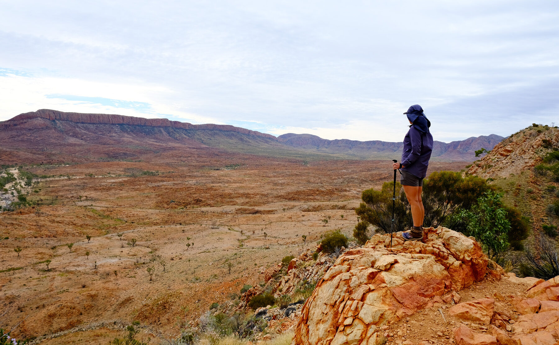
Naturally, our group of seven finds its rhythm as we make the top and walk along the ridgeline. Even though we are in the height of the Larapinta walking season, we see no other walkers all day; I’m constantly looking at the views with the ranges of rock formation ripples falling away and disappearing as far as the eye can see. At the highest point of the day, you’ll find Counts Point; looking at the spectacular view, it’s difficult to imagine a better one on the whole Larapinta Trail. It is named Counts Point simply because you can count all the mountain peaks on either side of the MacDonnell Ranges. The exceptional view is a classic keepsake from the trail, with Mt Sonder showing itself in the distance, a reminder of the space left to travel if you are attempting the complete walk.
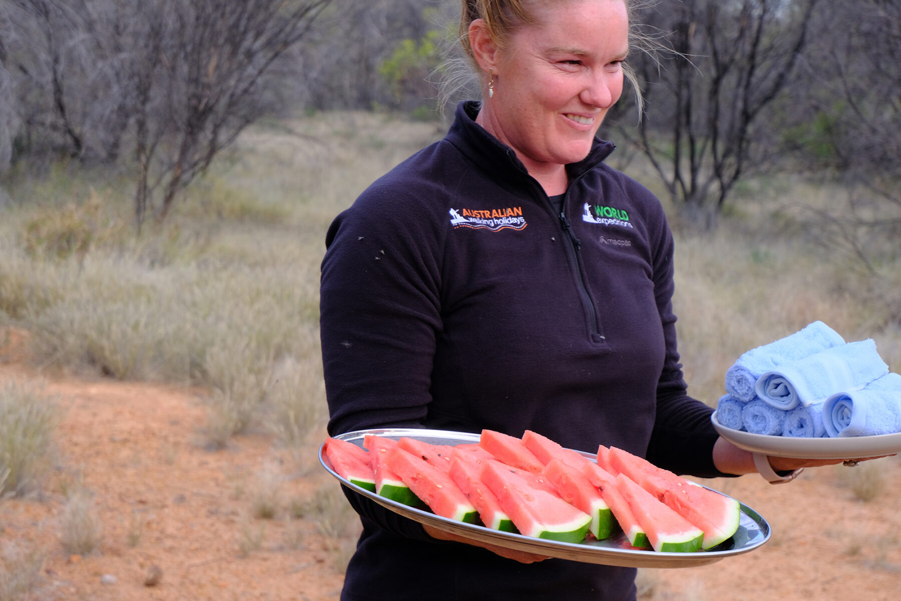
Turning and heading back onto the trail, I notice a manufactured horseshoe-shaped low wall of rocks, “Cowboy camping”, explains Ruth. “Just roll out your swag and sleep under the stars; my parents have camped in this spot”. Instantly I’m jealous and feel this is one of those bucket-list moments I need to return to and tick off. After a late lunch, it’s the last section of the day’s walk and the final push to get to camp. The day’s effort is starting to take its toll on my legs, and it’s easy to see why this section is graded hard. I’m beginning to feel the repetition in my left knee of the constant going downhill. With an hour of sunlight left to spare, our group makes camp, welcomed by Abby, holding soft damp hand towels, and freshly cut watermelon after a full day of hot, dusty, and challenging hike. These simple offerings have never felt or tasted so good.
Looping the Pound
Towards the end of Section 9, you walk along part of Ormiston Gorge; if you stick to the traditional Larapinta trail, you naturally carry on to Section 10; Ormiston Gorge to Finke River. After completing the 16km of Section 8 the day before, I’m happy to avoid Section 9, which Ruth tells me is a very long, strenuous day with potentially over 12 hours of walking as you undertake the 28.9km. Today is one of the World Expeditions highlights – the 10km loop of Ormiston Pound, which is, for a good reason, a very popular day excursion of the main trail. A steady start to the walk gently rises to one of the Pound’s lookouts; a perfect huge geological bowl formed in the MacDonnell Ranges presents itself. It feels wholly untouched and Jurassic, looking like a scene from a sci-fi movie where you imagine a herd of dinosaurs walking through this barren landscape. Dropping down from the ridge lookout, we continue towards the flat centre of the walk. We pause, with Ruth advising us that we should all walk silently and at least 50m apart to take in the natural surroundings at our own pace. Around this time, I began to understand the draw of the Larapinta; committing to this walk, either in part or whole, results in an unpredictable adventure where you are withdrawn from your daily grind, and placed into a true wilderness.
Of course, with my trip, so much of the stress, food and organising are sorted for me, but I still must get through each day with basically what’s on my back. Walking through this Pound, although I know this is a popular destination, the vastness, natural beauty, and clear headspace makes me feel like I am the first to walk this part of the Northern Territory. As we complete the final third of the 10km, it could not feel more picturesque, as we skip our way over large stone boulders on dry riverbeds surrounded by deep red cliff walls.
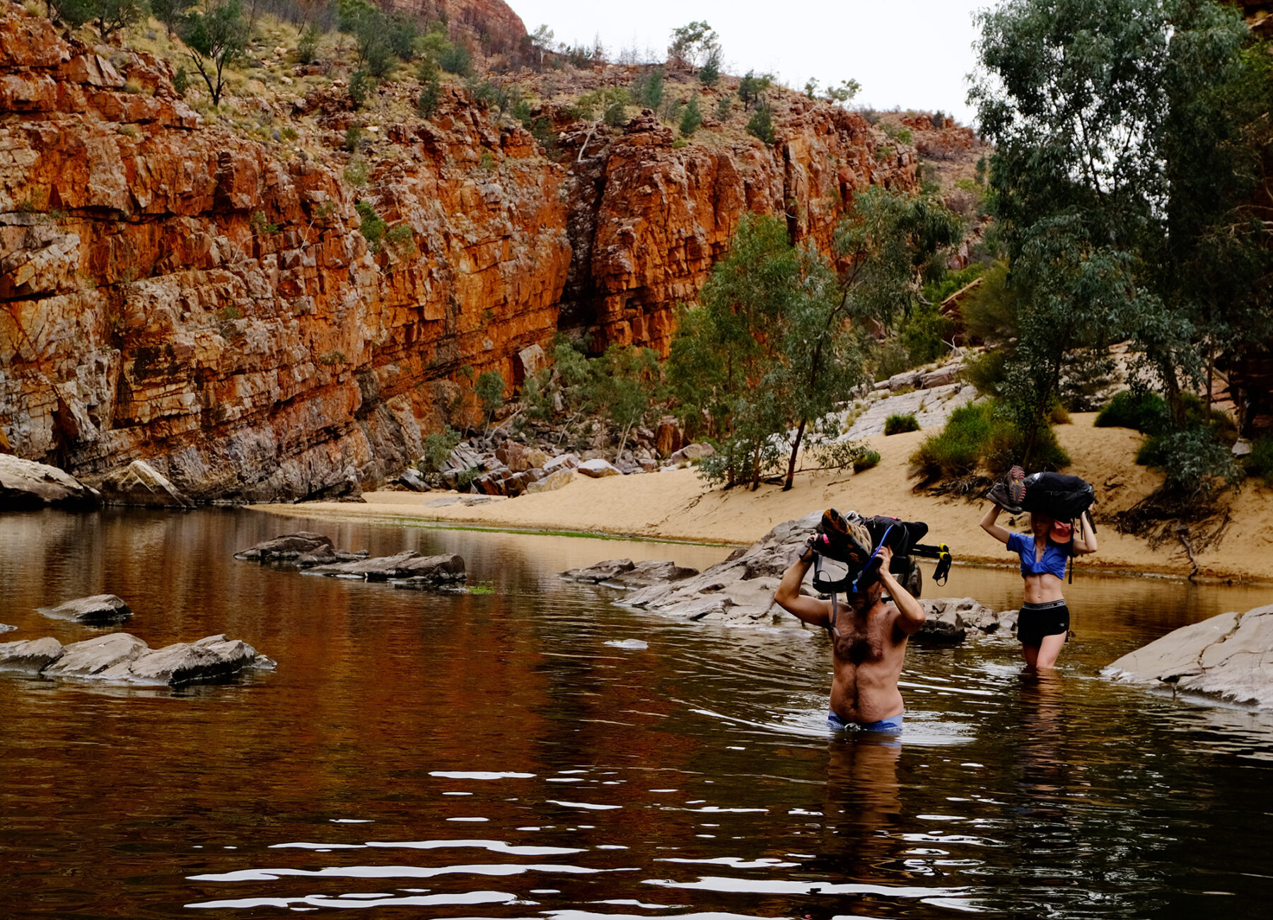
All day there are two words that we’ve been wary of as a group: ‘water crossing’. Although only a few 100m in length, the permanent water placed towards the end of the walk is something, we all must navigate. At the start of the day, we were warned that the water was only belly button deep, but we would need to be sure-footed to avoid going completely under. I’m prepared and bought along my swimmers, meaning I could finish the walk-in comfortably in dry clothing once out of the water. We gingerly wade across the freezing water, bags and walking boots raised above our heads. Thankfully, we all make the crossing with dignity intact and with no accidental dunking of camera equipment. With the water behind us, it’s less than one kilometre of walking between banked, red rock walls dotted with ghost gums back to the visitor’s centre and the end of the day’s walk.
A parting gift from the Larapinta
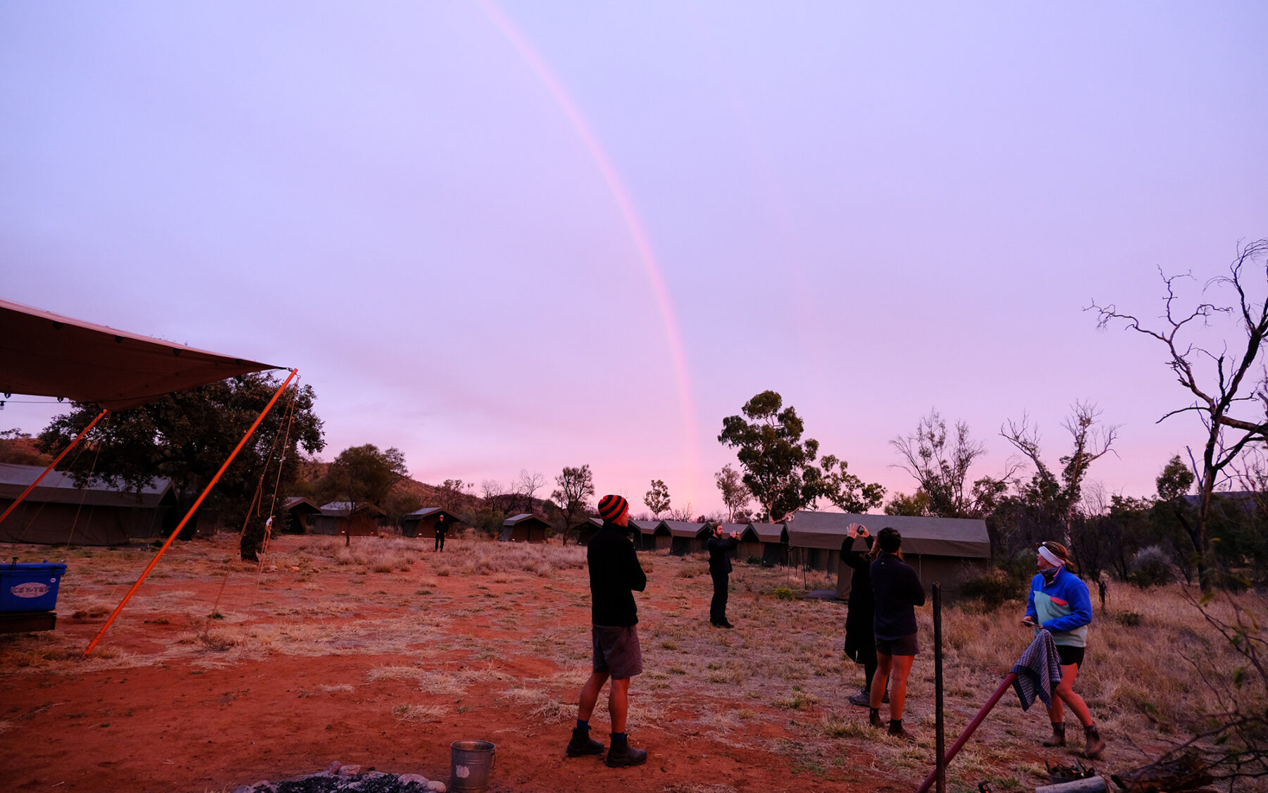
Packing up camp on our final day, there’s a sombre feeling floating through our group; we all know what we have witnessed and learned from this land over the last five days has been a rare and unforgettable experience. None of us wants to return to city life, but in true Larapinta fashion, the walk gives us one final gift. It drizzles at sunrise in Sonder’s shadow, a substantial perfect rainbow appearing across the camp. “I’ve never seen anything like that here, so early in the morning,” Abby remarks. With red dirt in hand, I take in this moment, seen for the first time, like so many walking firsts over the last five days.
Walking an icon
World Expeditions has multiple awards-winning guided Larapinta Trips on offer.
I joined and completed most of the Classic Larapinta Trek in Comfort, although longer and shorter trip options are available.
Check out the dedicated Larapinta Trail walks website for more info on this and other Larapinta Trail experiences.


