Kambah Pool to Pine Island
Distance: 8.5km one-way Time: 3 hours
From its source high in the Australian Alps, the Murrumbidgee River winds through the alpine regions of Kosciuszko National Park and the Monaro High Plains, and then through the Australian Capital Territory before joining the Murray River near Balranald, NSW. This wide, brown river – one of Australia’s longest at 1600km – is beloved by Canberrans for swimming, picnicking, fishing, day walks (and longer journeys).
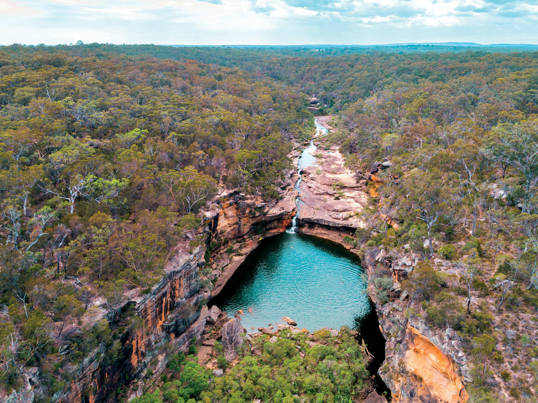
Kambah Pool to Pine Island is one of the best sections of the 27km Murrumbidgee Discovery Track. Much of the walk takes place high above the Murrumbidgee, with glimpses of the river below, through a variety of landscapes. As you near Pine Island the path draws close to the river and this is a good place for a swim. It is hard to believe that a large town centre and major government offices exist only a short distance across the fields. About halfway along this route there is a lookout over Red Rocks Gorge.
A jumble of rocks in the river below the cliffs have created a number of rapids, enjoyed by canoeists and rafters who have given them nicknames such as Junkyard and Shredder. After crossing Tuggeranong Creek look out for large holes in the river bank – these are wombat holes but as they are nocturnal you’re unlikely to see anything but their distinctive cube-shaped poo.
Next, you’ll walk for about 50m alongside a dry-stone wall originally built by convicts between 1867 and 1875 to mark the boundaries of two large rural properties in the area, Yarralumla and Lanyon/Tuggeranong. The walk finishes at Pine Island Reserve where you’ll need to arrange a pick-up or retrace your steps to the start. The first section has some shade but most of the walk is in the open, so can be hot in summer. While rewarding at all times of the year, the walk is particularly lovely in spring when the different varieties of wattle are in bloom.
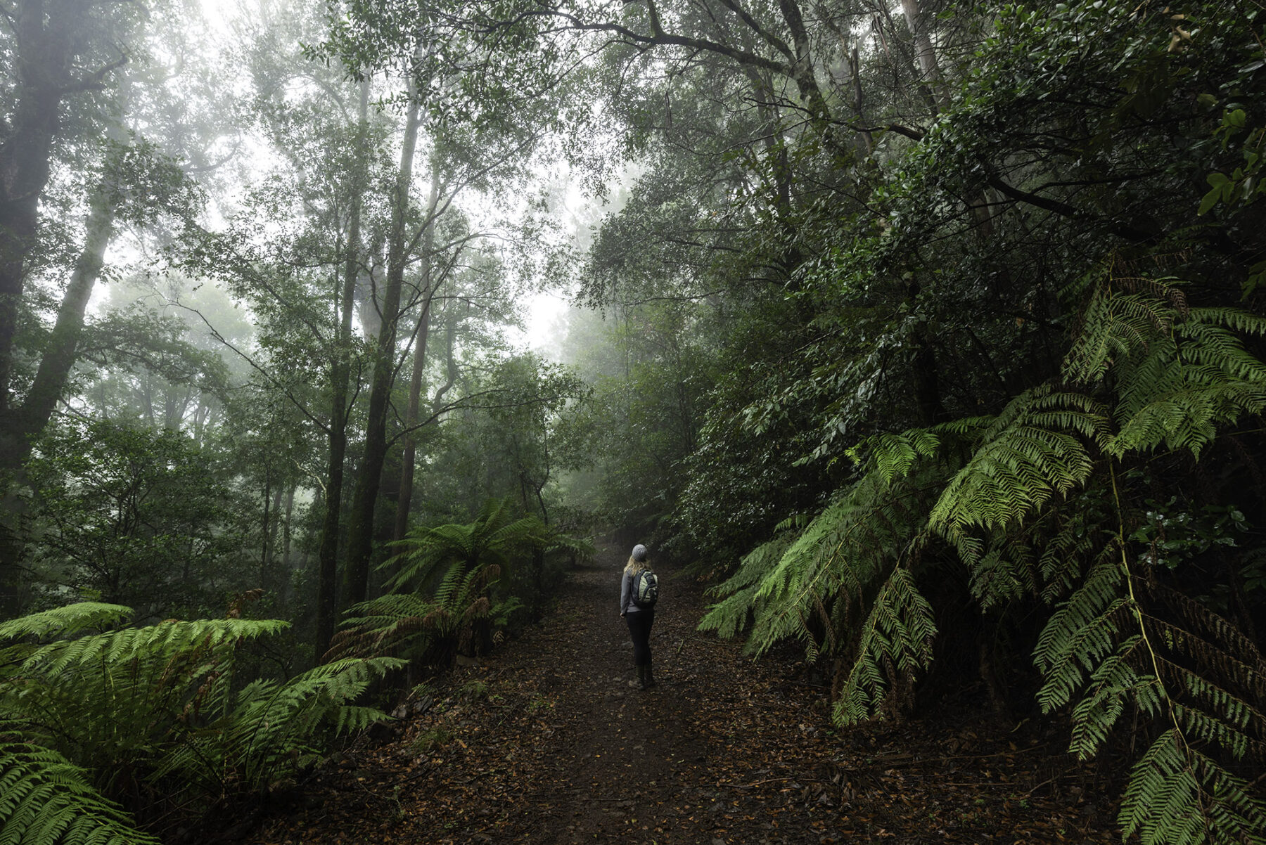
Gloucester Tops Circuit, NSW
Distance: 8km circuit Time: 3 hours
This wonderful rainforest walk is graded medium and combines three day walks in Barrington Tops National Park in north-eastern New South Wales. Clad with ancient forests and home to roaring waterfalls and brimming creeks, this park is a naturalist’s and bushwalker’s haven little altered by time. Centred on the Barrington massif – a series of crests forming part of the Mount Royal Range – Barrington Tops National Park is dominated by a 22km plateau that falls away steeply to the east, west and south. The high country, covered in snow-gum woodland and subalpine swamps, extends away in narrow ridgelines that drop suddenly into rugged escarpment country and numerous steep river valleys.
From Gloucester Falls picnic area, follow the Gloucester Falls track to the Andrew Laurie and Gloucester Falls lookouts where you can take in the endless scale of this park. On River walking track there is a good chance of seeing red-necked wallabies, wombats and grey kangaroos – and masses of wildflowers in spring. The most special section is the Antarctic beech track, a section of cool temperate Gondwanan rainforest.
Under the dense canopy, mosses, lichens and ferns carpet nearly every surface. This beech (Nothofagus moorei) dates back 90 million years and has relatives in South America, New Zealand, New Caledonia and New Guinea. Growing 25–50m tall with 1m-wide trunks, the Antarctic beech is extremely vulnerable to fire so has only survived in wet high-altitude areas. If you’re lucky you might spot the rufous scrub-bird, one of Australia’s rarest birds, or hear the vocal theatrics of a superb lyrebird.
Namadgi Settlers Track, ACT
Distance: 9km circuit Time: 3–4 hours
Namadgi was the name used by the local Aboriginal people for the mountain range south-west of Canberra. Gazetted in 1984, Namadgi National Park occupies almost half of the area of the ACT and encompasses spectacular views from its many mountain peaks. There are more than 160km of walking tracks in the park but this one (one of the park’s many day walks) explores the cultural heritage of the Australian Alps with a look at the lives of late 19th-century settlers. This lovely (easy grade) loop walk meanders through forest, then open grassland and finally grassy woodland to see three pastoralists’ huts, restored by community group, Kosciuszko Huts Association (KHA), who have also researched the stories and photographs of the settlers, workers and their families seen on information boards along the walk.
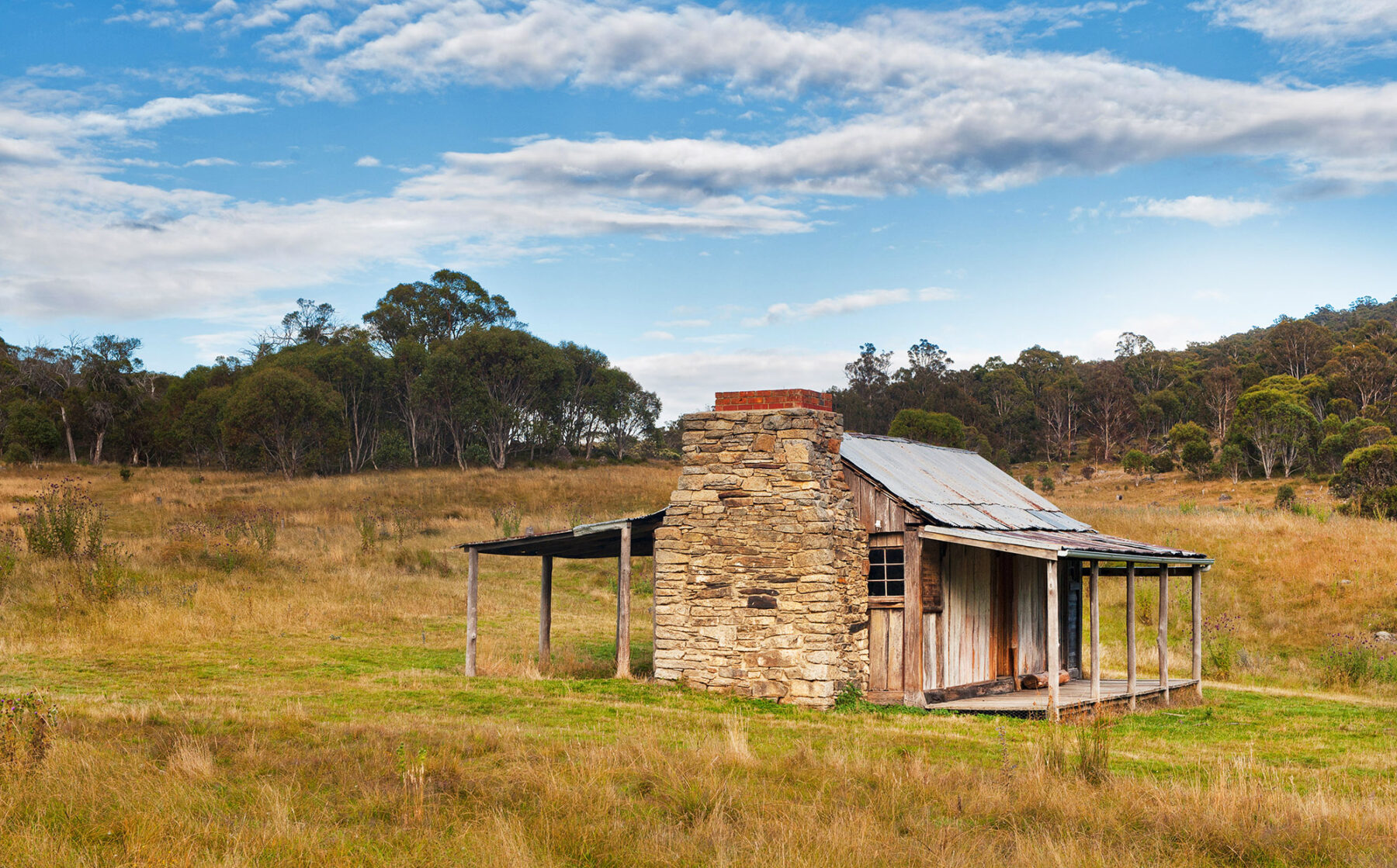
William and Flora Brayshaw settled here in 1844 and Thomas and Mary Jane Westerman in 1882. Several generations were born and buried in this isolated and unforgiving landscape. The walk starts at Brayshaw’s Homestead, built in 1903 from timber slabs with a stone chimney. This rudimentary two-room cottage housed a bachelor for 28 years. It had no stove, just a camp oven, and it wasn’t until a family bought it in the 1930s that the walls were papered with newspaper in an attempt to keep out icy draughts. The next hut, Waterhole, is even more rudimentary – built of corrugated iron in the 1930s to shelter stockmen who worked in the area, land-clearing and sheep drenching in the nearby stockyards. Westerman’s Homestead was built in 1916, the family’s third dwelling on this spot. There is a small graveyard and remnants of a garden with exotic trees.
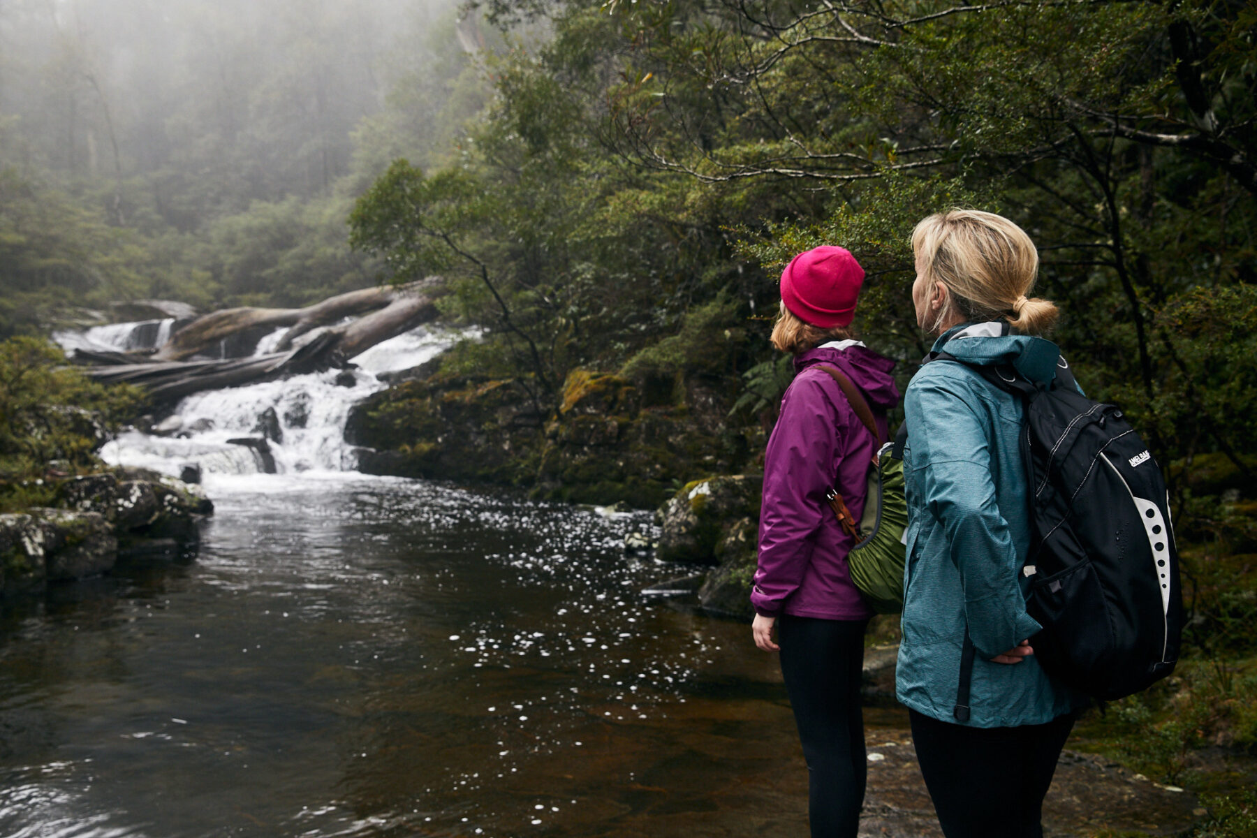
Mermaids Pool and Tahmoor Canyon, NSW
Distance: 8.5km circuit Time: 5 hours
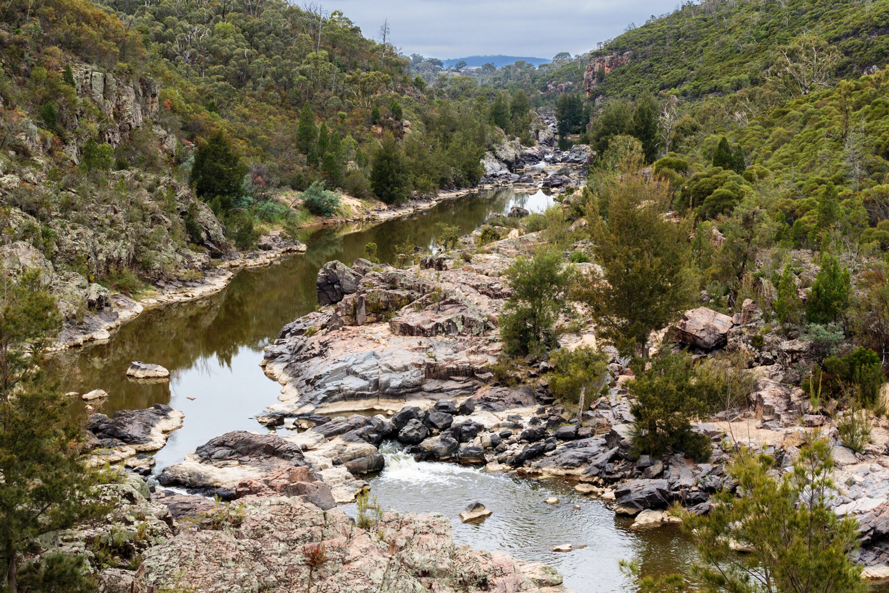
From the south-western outskirts of Sydney, the sandstone Nepean Ramp rises gently to the plateau. Named for the river that is now dammed at Warragamba, this upland Wollondilly district is an area well worth the attention of walkers. This spectacular circuit is one of the best day walks in Wollondilly, and is graded medium difficulty. It is best saved for a warm, sunny day. Just before the Bargo River nears the Nepean River, it has carved a sandstone chasm up to 110m deep to form beautiful Tahmoor Canyon with a succession of swimming holes and cascades. Tracks above it and a route along the canyon floor have been unofficially tagged and marked to form a canyon circuit that doesn’t require specialised gear or even waterproof packs. The first section to Mermaids Pool is relatively easy.
There is a choice of routes – the upper track is easier but the lower takes you to Bargo Falls and the delightful swimming hole just below known as See Through Pool. After Mermaids Pool turn right at the next junction, this is a loop route via Tahmoor Canyon. Competent rock-hoppers should have no problem, but the river ledges can be slippery after rain and you might get your feet wet if the river level is high. The walk starts under Rockford Bridge and can be hard to follow – the way is marked by metal tags and paint markers.
Main Range Walk, NSW
Distance: 22km circuit Time: 9 hours
This big bopper is for experienced walkers and is one of Australia’s greatest day walks, exploring some of the greatest alpine country on offer in NSW. The walk yields views of Blue, Club and Albina Lakes, climbs to the top of Mt Kosciuszko (2228m) and crosses the Snowy River twice. The views in clear weather extend over the vast mountainous landscape to the distant horizon. Suffice to say that the Main Range circuit is truly one of the classic day walks of New South Wales. If you want to stay overnight, there is a good campsite at Wilkinsons Creek (800m west of the trail).
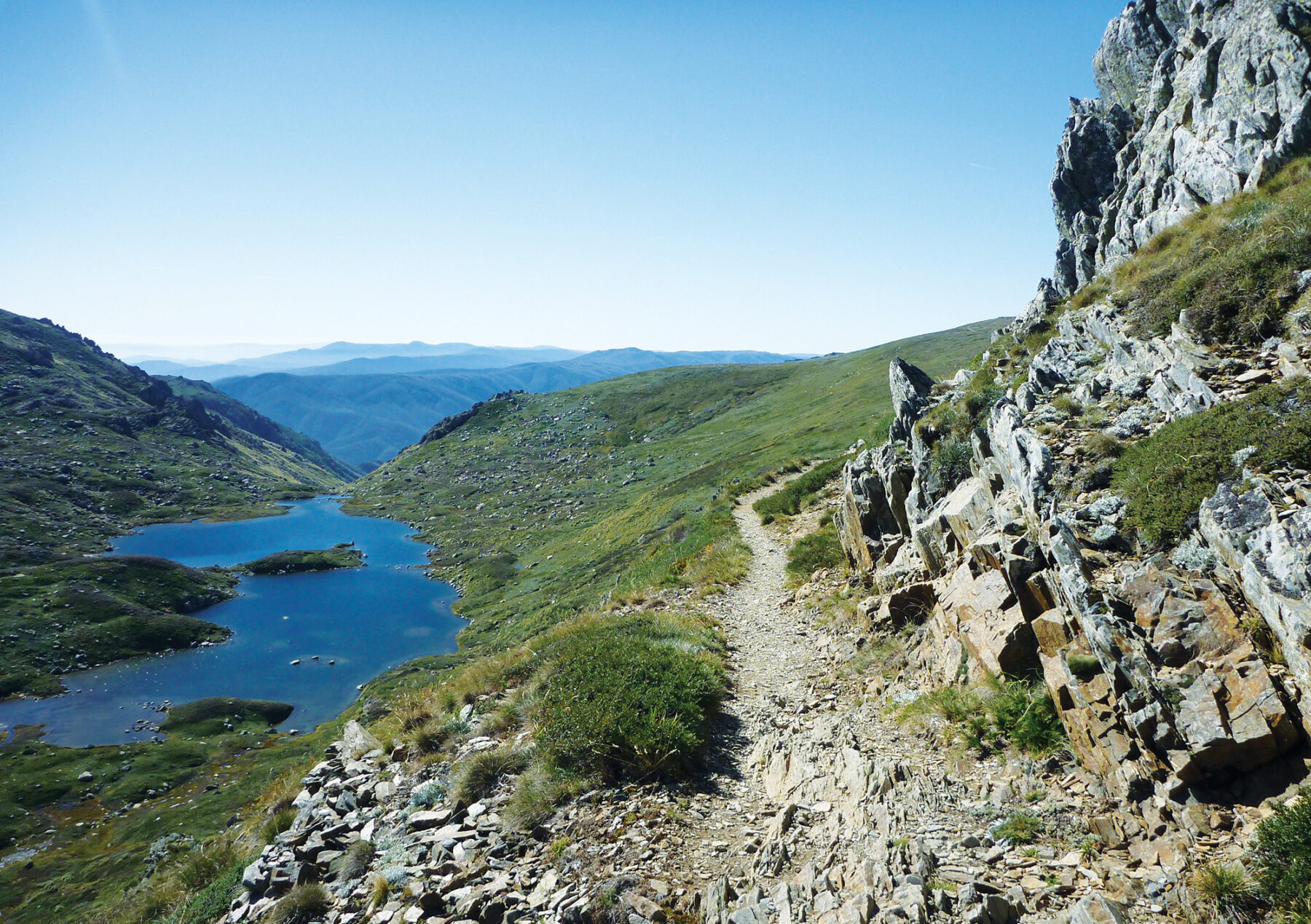
Setting out from Charlotte Pass, it’s about 4.5km to Blue Lake, the deepest and largest cirque lake in mainland Australia. At 28m deep, this lake was formed when glaciers, flowing from the Great Dividing Range, converged and carved out a basin in the rock.

Returning to the Main Range track, the route continues uphill. Not long after a three-way intersection, the track winds up the ridge to Carruthers Peak, with views of Club Lake and across the valley to Charlotte Pass. Now the route heads south-west, high up along the rugged Main Range, to Mount Kosciuszko’s peak. The summit track is relatively short and easy – thousands of people walk up each year. (You can bike from Charlotte Pass to Rawson Pass and then walk the 1.4km to the summit). On a clear day, the views are naturally magnificent from this, the highest point on the continent.
Head downhill via Rawson Pass (linking route to Thredbo) and Seaman’s Hut, an emergency shelter erected in 1929 and named for a young skier named Laurie Seaman who died in a blizzard when he was separated from his group. After leaving the hut, the return to Charlotte Pass is a steady descent along the Old Kosciuszko Road. When you get to a glorious grove of snow gums, you’re just 2km from the end of the walk.
Alpine weather can be extreme and unpredictable. You must be prepared for all conditions and be sure to advise a family member or friend of your plans.