
In Tasmania’s northeast shadow, you would be forgiven to not have Flinders Island on your adventure radar. Its variety of walks prove it is sometimes worth looking away from the obvious for your next escape.
I jumped at the chance to take a four-day trip with World Expeditions, not because I had heard of Flinders Island, it was more because I hadn’t and that intrigued me. So as my research began, I realised I was in for an adventure, a touch of physical exertion and some quality time with my thoughts.
Welcome to Castle Rock
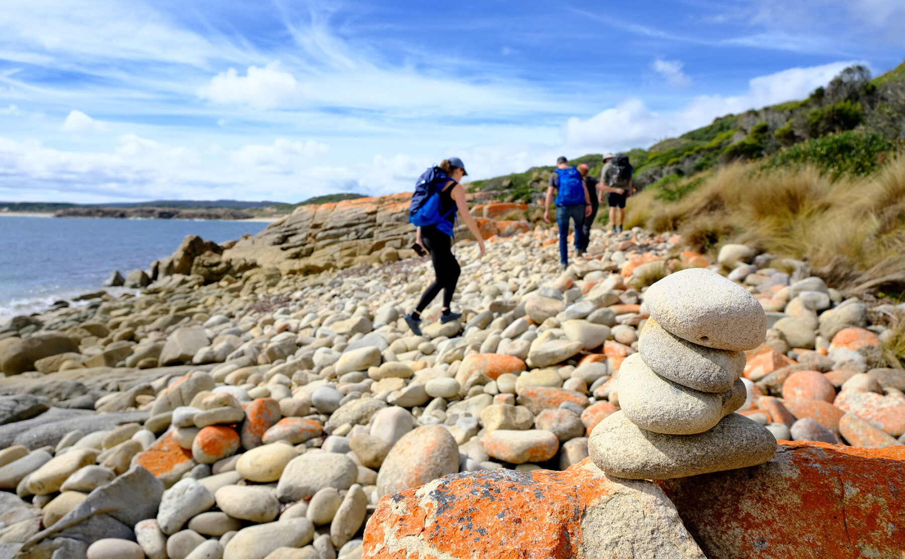
In the early 1930s the first passenger flights left Western Junction in Launceston to King Island and Flinders Island. Now, 90 years later, getting to Flinders Island has not changed all that much. Our single propeller plane is expertly packed and soon six adults feel like children again as our diminutive plane starts bouncing down a green field before quickly becoming airborne and heading north. Checking my phone, it’s apparent I no longer have any phone or internet reception. I put my phone away, knowing whatever happens outside this bubble will have to wait until my return. Landing on Flinders Island we waste little time, heading towards our first adventure, a 3km walk towards Castle Rock. This opening walk on Flinders Island could not be more relaxing. Labelled as a ‘multiple beach walk’, we soak up coastal views and make our way across, firstly, Allports Beach, before continuing north along the coast toward Marshal Beach.
In the build-up to this trip, I googled images of Flinders Island, mainly because I had no idea what to expect from this part of the world. Instantly my computer screen was filled with various images of Castle Rock, but nothing can prepare you for the sheer size and impact of this unmissable landmark. At the opposite end of Marshal Beach, a three-storey high granite boulder feels like it could easily roll into the sea. Up close, this huge standing stone is nestled amongst other lichen-covered granite, a texture I’ve been experiencing all day. To finish the day’s adventure, we spent time exploring and being shown interesting and unexplainable geological rock formations found in the area.
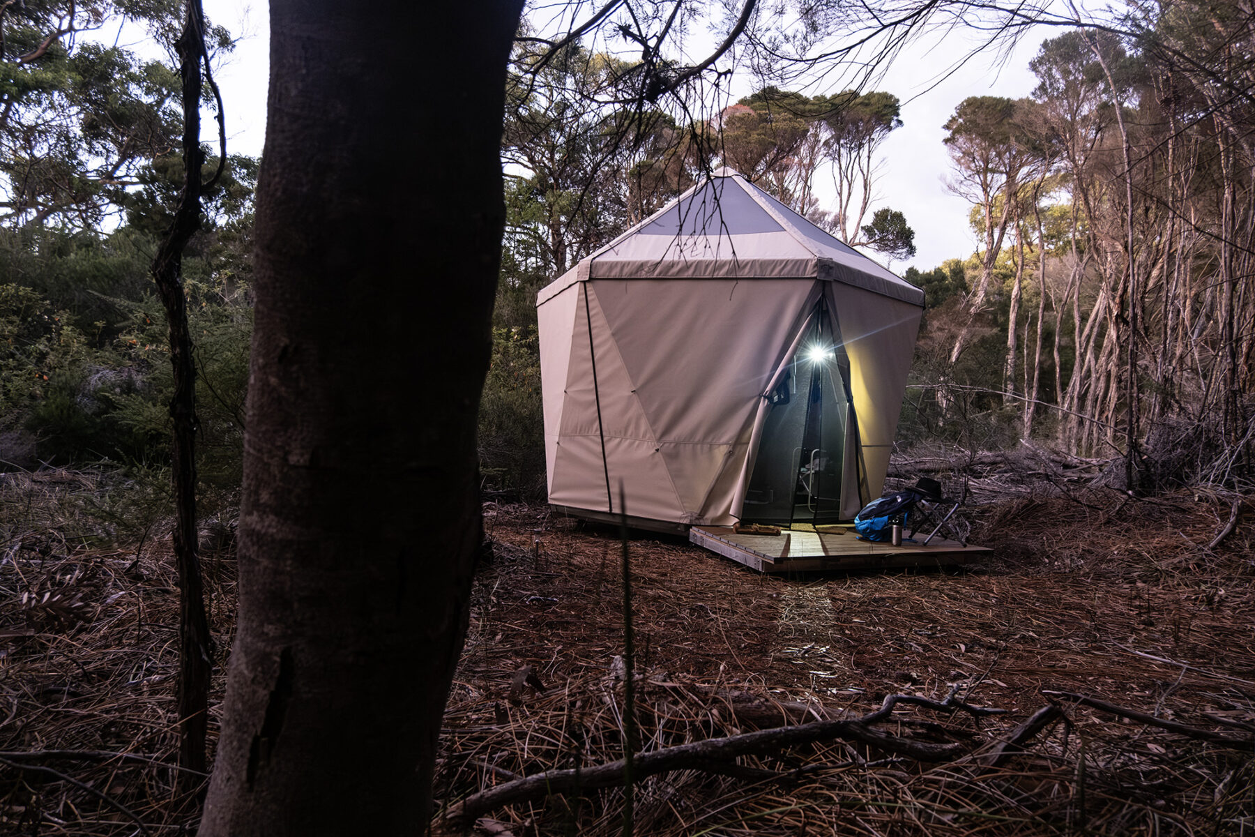
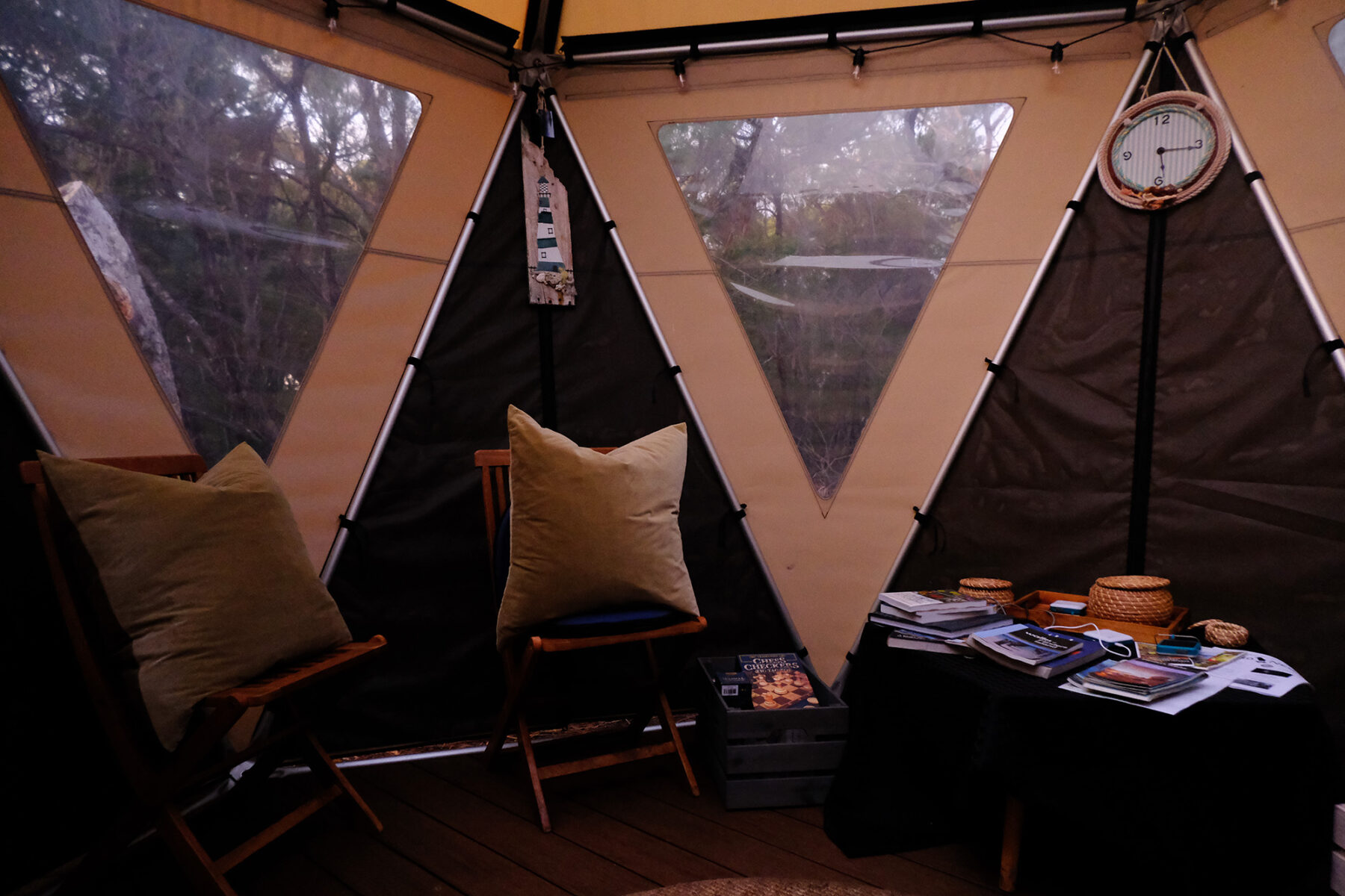
Too soon for me, we leave the mesmerising rocks and are back in the minibus heading to our little hidden island camp. The camp is home to seven individual clear roof pods, communal area, showers and drop toilets. The whole camp, based in Tanner’s Bay, is beautifully designed with consideration for the island and its natural surroundings. Large enough so you can break away from the group for downtime, with a private beach and bay to explore.
A vertical connection
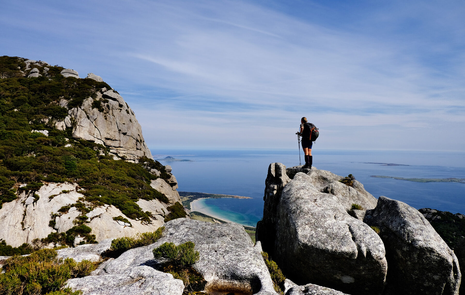
It’s difficult not to feel a connection to the land when climbing Mt Killiecrankie. At 315m high it’s a steady continuous ascent, not overly steep but with plenty of rock shelves for us to stop and look back on the morning’s progress. Climbing to its summit certainly feels hands on, with plenty of granite to grapple, navigate and work around. Mid-climb we shed our daypacks and hand-carry, so we can squeeze through a small natural granite tunnel placed in our path – making us work somewhat harder for the rewards found at the top. A standout feature of the climb is the large walking areas of granite, often populated with huge boulders. Each varies in shape, creating natural shelters you can sit inside or crawl through. Mt Killiecrankie summit is large enough so we can all sit and rest; with perfect weather it is easy to soak up the faultless image of Killiecrankie’s long sandy bay leading to its tiny township. At the mountain’s trig, the island and Bass Strait unfold around me as far as I can see – to North Palana, then further on to Inner Sister and, finally, Outer Sister Island. To my southeast is what looks like an untouched green lumpy carpet covering Flinders Island. Taking in the views its apparent there are few buildings and homesteads to see, and it comes to no surprise to me that the island’s population is below 1000 people.

With the afternoon still ahead of us, we begin to make our way down the mountain, heading towards the coast. At times huge granite rock formations break the path, and it’s not obvious where I’m heading. I follow our guide Nigel, and on closer inspection see he’s following an indicator line of three pebbles stacked on top of each other leading us back onto the trail. For the rest of the day, I keep seeing these pebble guides and it’s a beautiful reminder of the lack of infrastructure on the island, also speaking to World Expedition’s commitment to Big Adventures, Small Footprints.
Down and off the mountain, it’s a short walk to Stackys Bight Beach, and so far on this trip the only other people I have seen are in my group. We share our lucky feeling that we have this little corner of paradise all to ourselves. Stackys Beach could be on a Mediterranean Coast postcard; crystal-clear water parks up on soft yellow sand that’s pocketed by matching colour granite. I must admit, at the beginning of the day when ‘going for a swim’ was mentioned I was undecided; sometimes it just feels like too much effort when out hiking. These thoughts instantly faded when faced with a deserted beach boasting natural rock arches and calm waters.
Today’s walk has been marked as one of the longer walks on the trip at just over 10km, and the rest of the afternoon is spent following the coastline towards ‘The Dock’. It is a walk that sums up the island for me perfectly; rock-hopping over granite covered in orange lichen, but also broken up by picture perfect sandy bays, with the gently rolling blue sea to my left and on my right shoulder the large grey Mt Killiecrankie that we explored that morning.
There and back again
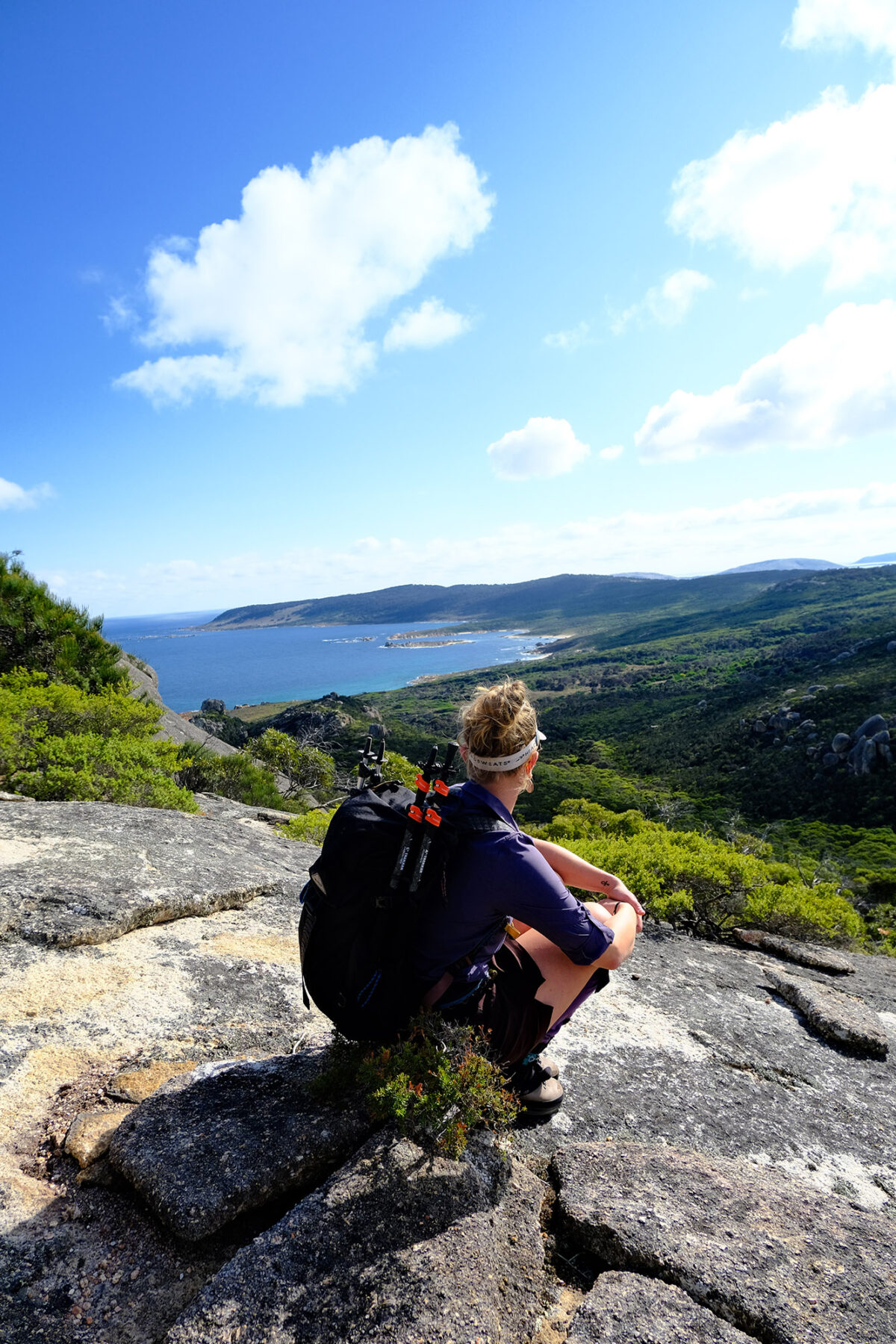
There’s an excited, slightly nervous, silence that’s fallen over the inside of the minibus as we leave camp. Today’s destination and return hike to the top of the Strzelecki Peaks has been championed as a definite highlight on this four-day trip. Last night, like every previous evening, our three World Expedition guides briefed us on what to expect from Strzelecki. The hike takes us to the highest point on Flinders, topping out at 756m. From the summit we’d have uninterrupted 360-degree views of not only Flinders Island (the largest in the Furneaux group), but several of surrounding smaller islands, including Cape Barron to the south. Thankfully, we’re told the weather is looking perfect, but are still reminded to always be prepared: “Make sure you bring plenty clothing layers, lunch, and at least two and a half litres of water.”

Travelling south, I begin to question where my adrenaline is coming from, and I realise throwing elevation into any hike gently pushes me outside my comfort zone. As a Grade 4 walk, I know this won’t be easy, but we’ve all been reassured that we are all more than capable to make it to the top and out again. I check my day pack worried I’ve forgotten something, I tell myself everything is in place and to stop fiddling with my camera, for fear of losing the battery and being unable to capture what’s ahead. Looking out on the moving green landscape, I play the game I’ve been enjoying with my fellow adventurers over the last few days: ‘wombat or rock’. The round stubby rock ahead sprouts four short legs and darts off with surprising speed. This time, a definite wombat.

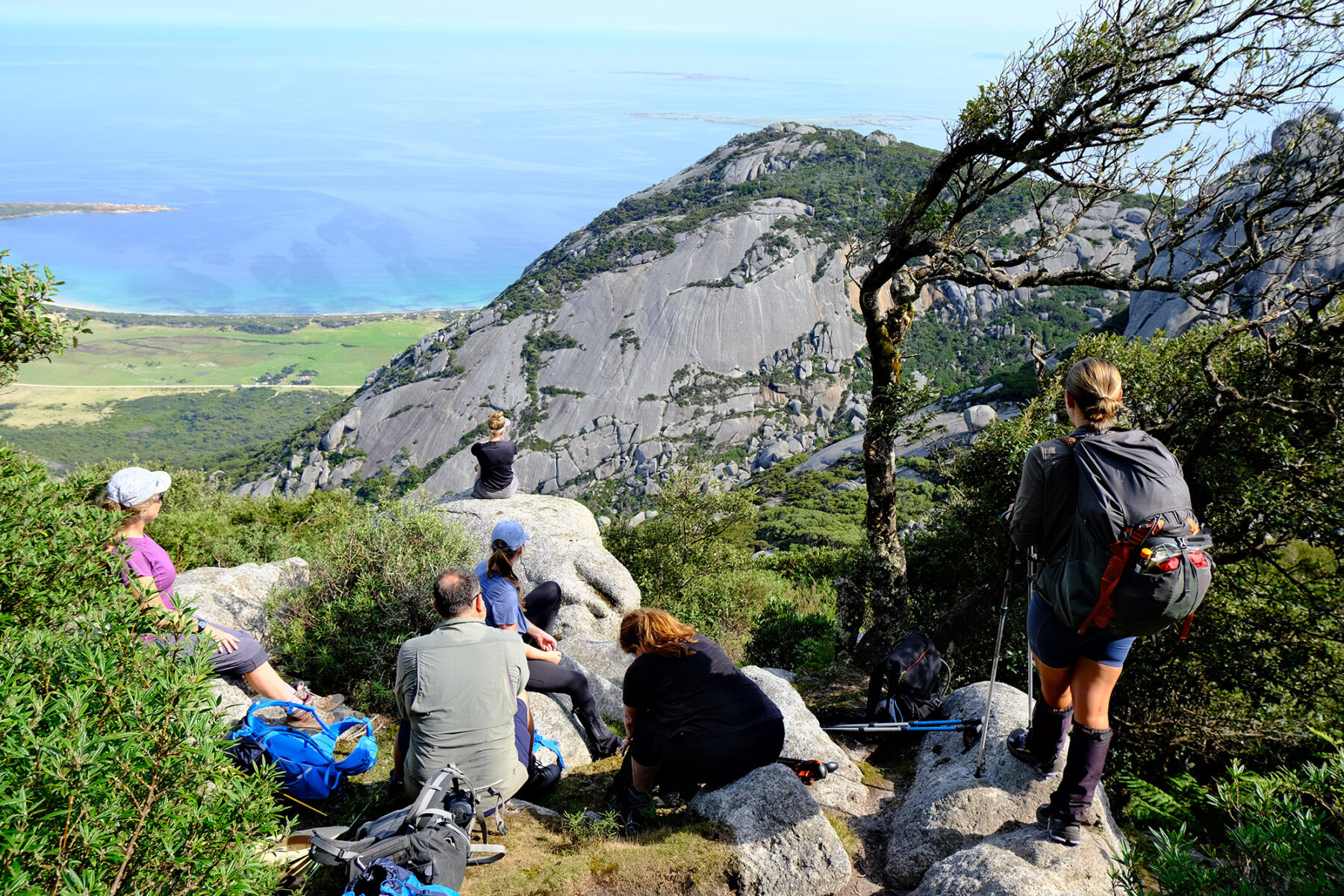
At its base, I stop to admire Strzelecki’s huge granite peaks, which are cut out against a perfect blue sky. The crisp morning has us all quickly moving forward and heading on to the trail. Now just trusting the well-worn path laid out in front of me, a thick woodland makes sure I soon lose sight of today’s high destination. As expected, there’s a lot of physical vertical steps to navigate, and throughout the morning’s climb we are all guided within our comfort levels. Taking our time and happy to regroup when needed, everyone accepting the welcome breaks to refuel and look out on surrounding peaks and blue sea punctured by tiny Furneaux Islands. The climbing effort stretches our little party of eight, slowly making our way up the mountain, at one point passing through Strzelecki’s unique micro cloud rainforests, before finding our way onto the granite saddle just shy of the summit. After a short break we all attempt the final push. As each of us successfully reaches the highest point on the Flinders, it is smiles all round. I know on any other day we could easily have restricted views from this summit, standing in or above cloud cover. But I’m surrounded by the glorious greens of Flinders and a beautiful blue horizon as far as I can see. It is difficult to imagine before the last glaciation melting, 12,000 years ago, you could have walked from this spot to Victoria. Looking south past Cape Barron Island towards Tasmania, the sea certainly looks more translucent our guide points out the average water depth from here to mainland Tasmania is only 60m, and if you look closely enough you can see darker features under the water from the original land before the Furneaux Islands were created.
It’s decided to take the hike down and off Strzelecki at our own comfortable pace; a few of us move on ahead retracing the same route down the mountain. The descent is not overly technical, but at the bottom my legs have certainly felt every part of this mountain route. The feeling of achievement completing this hike is huge. I know today has been a once in a lifetime experience. Speaking with Shelby and Stacks who’ve guided today, we note it’s taken us approximately six hours to complete the distance of just under 6kms. Sure, we took our time and stopped off for lunch, but it’s still an indication of what it takes to complete the climb. I ask the question regarding the demographic of visitors taking on this peak. Stacks tells me it’s always a mix of fitness, last week someone in their 70s confidently got up there and back with no problem at all. The guides want to make sure everyone gets to enjoy this experience, and to prepare people they always go up Mt Killiecrankie first.
Don’t forget your trousers
Our final morning involves packing and getting ourselves together as we say goodbye to our oasis by the sea. It’s not long before we are heading southbound to enjoy the last walk on this trip.
Trousers Point is a short 2km walk that hugs the coastline found on the south of the island, a stone’s throw from Strzelecki National Park. I take my time on this coastal path, the rich blue Bass Strait makes it easy to sit and stop, looking out at multiple islands constantly changing the horizon. And then looking inland to see the towering Strzelecki Peaks that we all conquered the previous day. We make our way to Trousers Point Beach; the guides have saved the best till last on this walk. This deserted bay, with its overhanging trees, perfect sand, dotted with coastal heath and crystal blue waters, is an idyllic spot to end our trip.
On leaving Flinders it’s difficult to describe the positive impact this short trip has had on me; never being to the Furneaux Islands before I had no idea what to expect. Three of Tasmania’s 60 short walks are found on Flinders (Strzelecki, Castle Rock, and Trousers Point), with each having their own degree of challenges and unforgettable breathtaking moments. All the walks over the four days have been expertly guided and supported, feeling safe and sure underfoot. Heading into the trip I knew I would be sharing this experience with other like-minded adventure hungry individuals, but I think none of us anticipated the exceptional exploration and the friendships that Flinders Island gave us. The experience that is still being talked about between us to this day.
See World Expeditions for more info on this and other Australian trekking adventures.


