Sydney outdoor escapes
Coolah Tops National Park
One of NSW’s lesser-known national parks, Coolah Tops offers a brilliant long weekend escape for families. About five hours drive from Sydney, via Coolah, the park packs in a ton of attractions, such as what are claimed to be the world’s tallest snow gums, massive grass trees, the largest population of our biggest possum (the greater glider) and beautiful waterfalls.

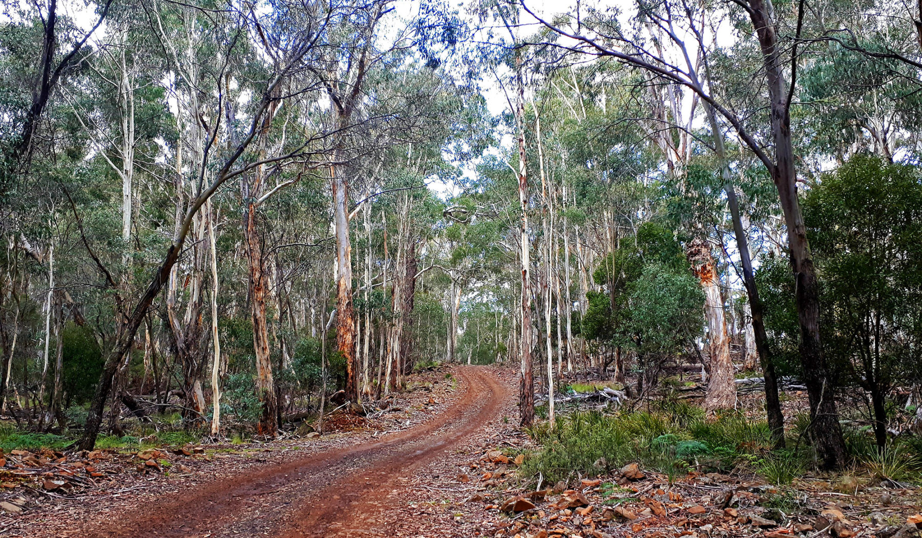
Coolah Tops NP is a rugged plateau that sits between the Great Dividing and Warrambungle ranges and surrounded as it is by grazing country. The tracks in the park are pretty tame, although they can be slippery after rain. There are numerous side-tracks branching off the main Forest Road. One, Talabragar River Road, is reached around 11km from the park entrance and is roughly 3km in length, taking you through dense, lush forest to a small carpark. From here you walk to a lookout that offers a view over Talabragar Falls. Other waterfalls inside the park include Rocky Falls, Bald Hill Creek Falls (both at the edge of the northern plateau) and Norfolk Falls.
A park highlight is its population of snow gums, with the Snow Gum Walking Track in the eastern section taking visitors through a large population of these eucalypts. Owing to the fact the park is subalpine, the snow gums thrive here – and reach heights unknown anywhere else in the state. The theory is the park is high enough for the snow gums to grow, but not too high to impede growth. Rather than the stunted, twisted examples synonymous with Australia’s alpine regions, the snow gums here are straight and tall.
For keen bushwalkers and mountain bikers, there are some great routes to choose from, such as Racecourse and Grasstrees trails for walkers, and Mullion and Bundella trails for cyclists (walkers can also use these trails). None of them are arduous, making them ideal for all ages and abilities.
Coolah Tops NP has three campgrounds and one unique accommodation option: Brackens Hut. The campgrounds – Coxs Creek, The Barracks and The Pines – are free; Coxs Creek and The Barracks are both located off Pinnacles Road, with The Barracks being slightly larger than Coxs, but Coxs has the appeal of Coxs Creek Falls nearby. The Pines campground is next to Forest Road, and is the park’s largest. For those keen on reliving a bit of history, you can stay at restored Brackens Hut.
Pinnacle Lookout is accessed via the road of the same name and is 5km from The Barracks campground. Once you reach the Pinnacle carpark, it is a 500m walk along a flat track to the edge of the plateau. From here on a clear day you’ll see the rugged ramparts of the Warrambungles to the north-west, and may spot a wedge-tailed eagle. Oh, and do yourself a favour on the way home: stop in for a coldie and lunch at one of Coolah’s awesome pubs.
Barrington Tops National Park and Chichester State Forest
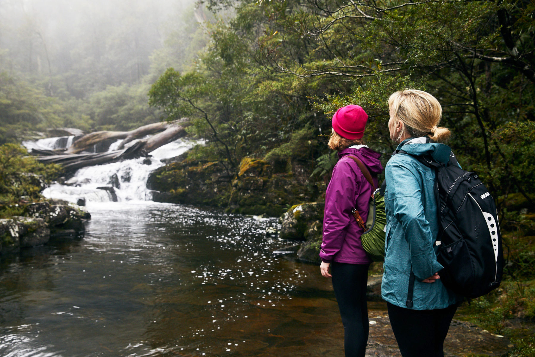
Visitors to Barrington Tops NP and neighbouring Chichester State Forest, around three hours’ drive north of Sydney, are spoilt for choice with what is on offer here for the outdoor family. Fantastic camping (including some of Australia’s highest-altitude campgrounds), bushwalks, mountain biking, fishing, spectacular rainforest (including gigantic Antarctic beech trees) and sweeping vistas mean a long weekend will barely do it justice.

From Sydney, these destinations are best accessed from the south via the township of Dungog; Chichester SF’s eastern (Telegherry) section (it is split by a southern section of Barrington Tops NP) is only around 20km north from Dungog (via Chichester Dam Road, then Wangat Road) and offers four riverside campgrounds (check access before you visit; heavy rain can cut these off). Each of the campgrounds in the Telegherry section offer direct access to the river of the same name, so bring your canoe and swimmers; Frying Pan Creek and Coachwood campgrounds are close together and reasonably spacious, so are great for larger groups. For those wishing to escape the crowds, we’d recommend Currawong Camping Area. This remote, 4WD-only campground offers brilliant swimming and canoeing in the Telegherry River.
The state forest’s western section – Allyn River – is a 40km north of Gresford, 28km west of Dungog. You will find three large campgrounds – Dobbie Rim, Pademelon and Old Camp – all of which offer spacious sites. Just north of Old Camp is Ladies Well, a beautiful swimming hole on the Allyn River that is perfect for families.
World Heritage-listed Barrington Tops NP is best accessed via the town of Gloucester. There are campgrounds aplenty throughout the park. The Barrington Trail is a seasonal 4WD track (October-May) that runs south along the plateau from the Bar-rington Trail picnic area off the Forest Road. This 15km route provides access to Little Murray and Junction Pools campgrounds, as well as Mt Barrington Picnic area. Little Murray campground is the launch point for the walk to Careys Peak Lookout, with its epic views, while Junction Pools offers great swimming and trout fishing. It also provides access to the 12km-return Aeroplane Hill track for hikers, or you can just sit in camp and watch the local wildlife forage in the sub-alpine grasslands. Keen cyclists can ride the Barrington Trail; base yourself at Junction Pools and set off on a half-day ride on the Trail with the kids.
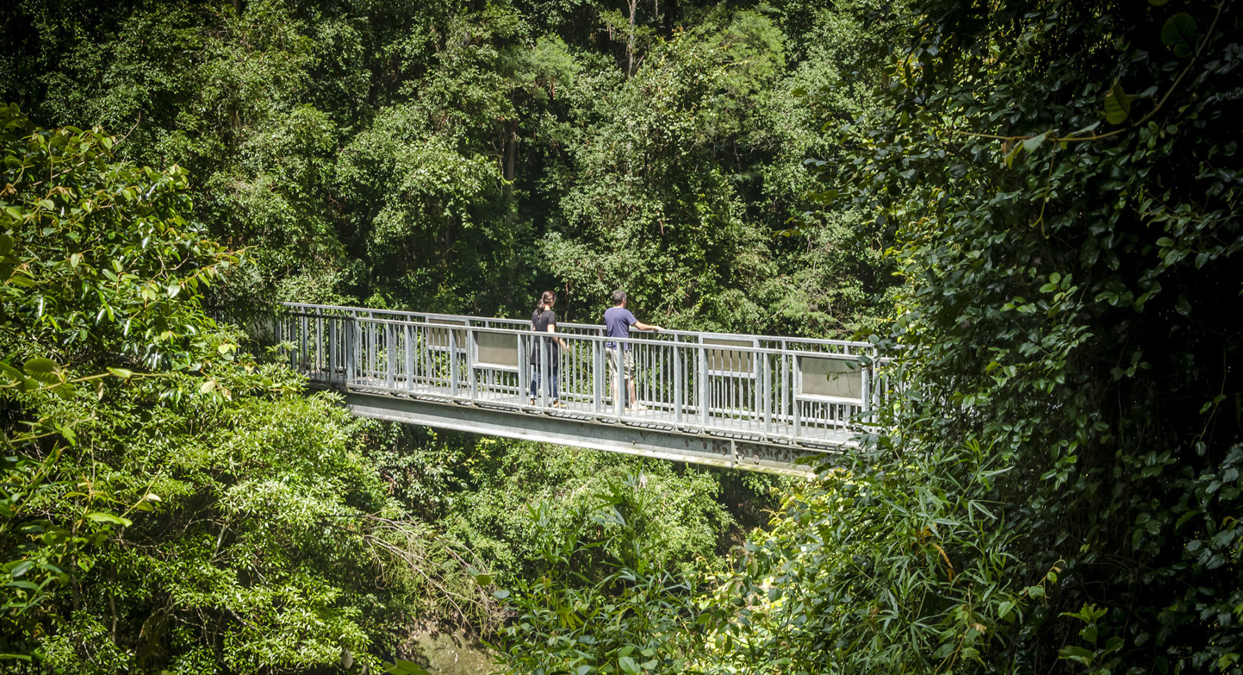
Bushwalking here ranges from short walks, through to day walks, such as the excellent Gloucester Tops Circuit. This half-day walk takes in three separate sights – Gloucester Falls, the River Walking Track, and the Antarctic Beech Forest Track. All of these walks can be done separately. For the more serious walkers there are overnight routes and multi-day epics that traverse the entire mountain range and drop down to the lowlands.
Canberra outdoor escapes
The Snowy Mountains
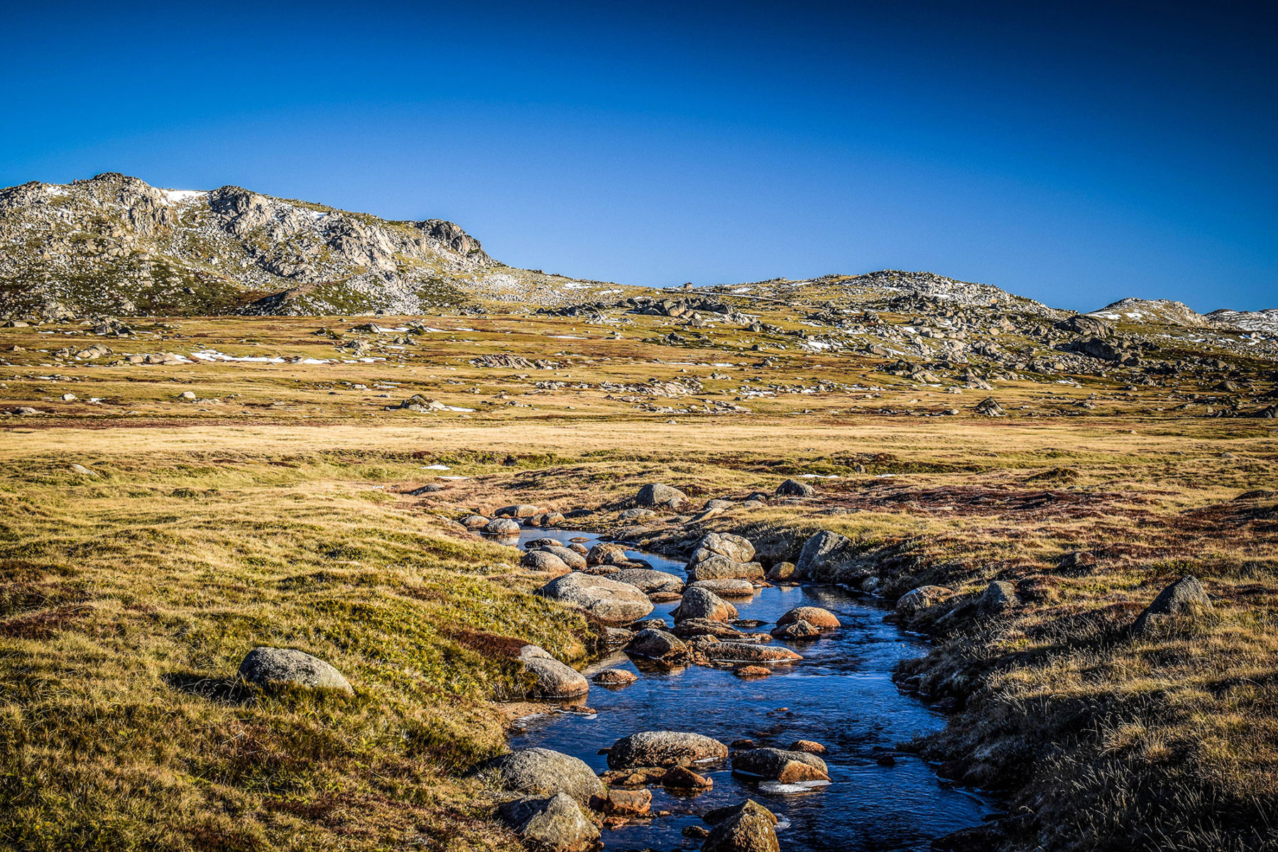
The ‘Snowies’ are chock-full of outdoor opportunities year-round. Located around two hours from Canberra, via the Monaro Highway, this mountainous region includes adventure towns such as Jindabyne, Cooma and the village of Thredbo (plus, on the way, there is Brindabella National Park – another mountain playground for Canberra residents, abutting the city’s southern suburbs). Spend a few days seeking your adrenalin fix down here and it will just be a taste of the vast amount of fun on offer, making the perfect excuse for a return trip.
Of course, the region’s ski fields are the big winter attraction for those looking for a short escape from our nation’s capital, and from June to September (sometimes into October) you can pick from a number of ski resorts down there, including Thredbo and Perisher. If you’re an experienced skier, the Snowy Mountains’ back-country also beckons, with world-class routes down some incredibly picturesque (and remote and rugged) peaks.
From October to May, the Snowy Mountains region is adventure central; activities include mountain biking, road cycling, hiking, fly-fishing, paddling, swimming, 4WD touring, and brilliant camping. If you don’t want to camp, there is excellent town-based accommodation at Thredbo, Jindabyne and Cooma, ranging from swish hotels to fantastic caravan parks.
The walk to the summit of Mt Kosciuszko is a must. From the top of the chairlift begins a medium-difficulty climb to mainland Australia’s highest peak. The three- to four-hour round trip covers spectacular alpine terrain and the view from the top lookout, across the roof of Australia, is unforgettable. Guided walks are available from Thredbo and hikes to Charlotte Pass and Blue Lake are worth checking out as well.

Bike trails around Thredbo, Jindabyne and Cooma are suitable for everyone from beginners to pros and the trail networks here have grown significantly over the last few years (especially in Cooma and Jindabyne), so there’s plenty to keep the MTBer busy. Thredbo’s trail network is awesome; whether you’re a beginner or hardcore downhiller, the resort’s MTB trail network – one of Australia’s best – is ever-expanding (more trails just opened in 2021/22), with the extension of the Thredbo Valley Trail (dubbed the Lower Thredbo Valley Trail and created by NSW National Parks & Wildlife Service as it runs through Kosciuszko NP) the latest example. Add in the long, winding sealed roads that link a number of smaller alpine towns together for road-based cyclists, and the Snowy Mountains region will satisfy the most discerning two-wheeled tourist. For those interested in paddling one of the country’s iconic rivers, Alpine River Adventures offers five- or six-day journeys along remote sections of the Snowy River (read about our trip down the Byadbo Wilderness section of the Snowy, here).