A complete guide to Georgetown, QLD
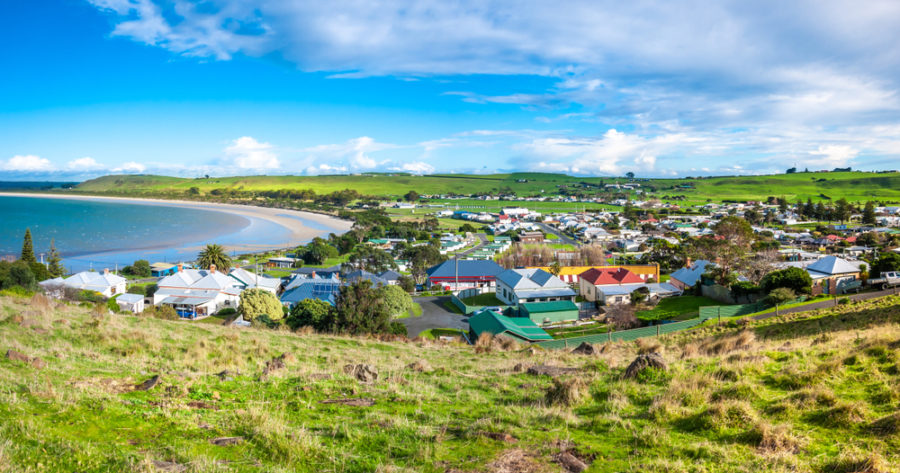
Georgetown is a pleasant, sleepy little place on the Etheridge River, in far north Queensland.
It’s famed for gemstones and surrounded by rich beef-cattle country, the district being known for Brahman and Droughtmaster cattle.
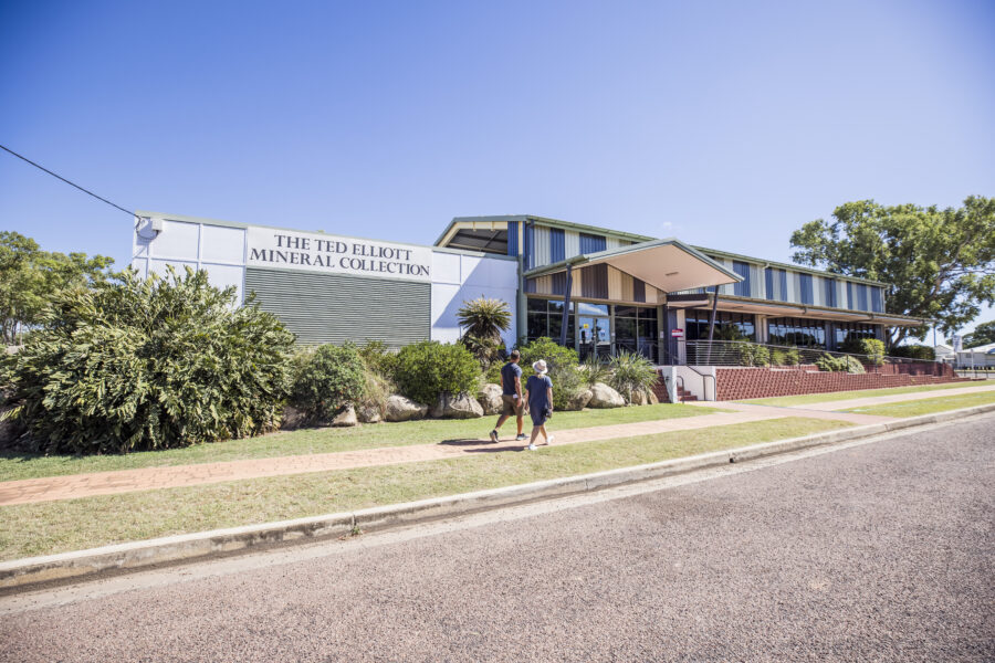
One of Australia’s most comprehensive private collection of gems, minerals and crystals – the Ted Elliott Mineral Collection – can be viewed at the TerrEstrial Visitor Information Centre. Nearby are the O’Briens Creek and Agate Creek fossicking areas.
And about 85km south of the town is the stunning Cobbold Gorge, which can be traversed by boat from Cobbold Gorge Village. In some places the walls of this narrow sandstone feature are no more than 2m apart.
Location:
Georgetown is located 1850km north-west of Brisbane, via Emerald and Mount Surprise. It is 377km south-west of Cairns and 302km east of Normanton on the Gulf Developmental Road (Savannah Way).
Origin of Name:
The settlement that grew on the goldfields here was first called Etheridge but by 1871 had been named Georgetown, after Howard St George – the assistant gold commissioner in the nearby town of Gilberton.
Useful Websites:
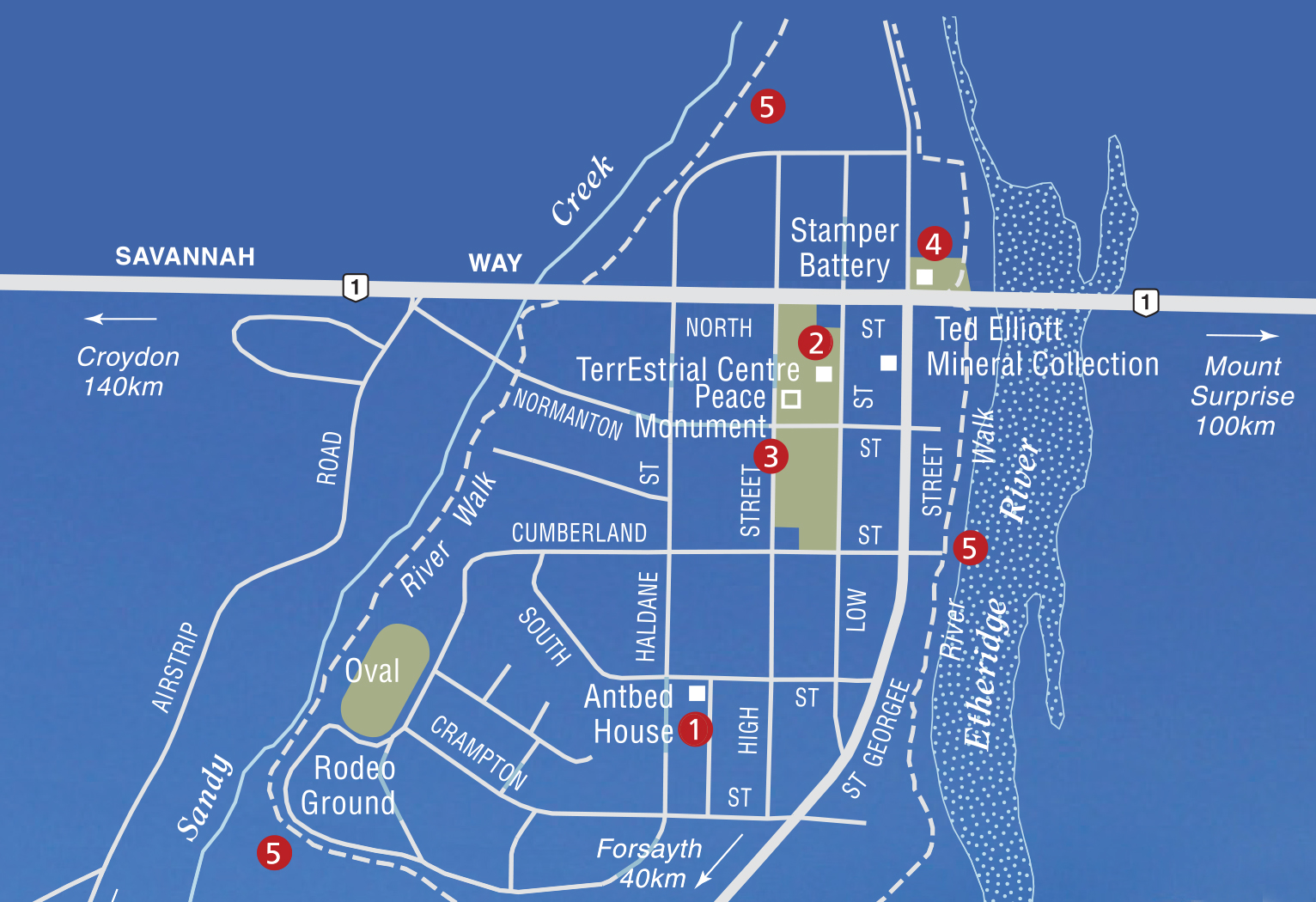
Places of interest
1. The AntBed House
Located in South Street and part of a Georgetown pioneer walk, the heritage-listed Antbed House was built in 1889 by Queensland government mining surveyor T.R. Geraghty. The Queensland Heritage Register describes it as “a rare adobe residence” and “an important illustration of 19th century difficulties experienced in Queensland’s far northern goldmining towns in obtaining available, affordable and appropriate building materials”.
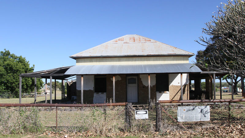
As well as being Queensland’s only substantially intact 19th-century adobe dwelling, it’s notable because of its use of termite mounds as a construction material, rather than mud.
2. TerrEstrial Centre
You’ll find the tourist information centre here and free internet. The friendly staff can advise on things to do and where to eat and stay in the area.
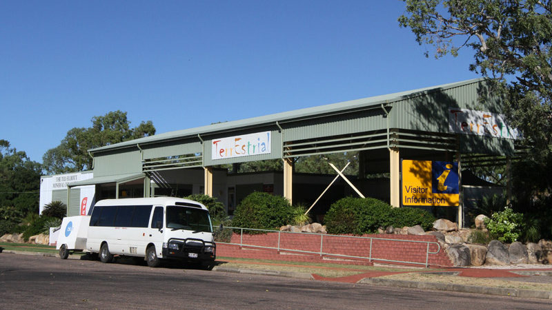
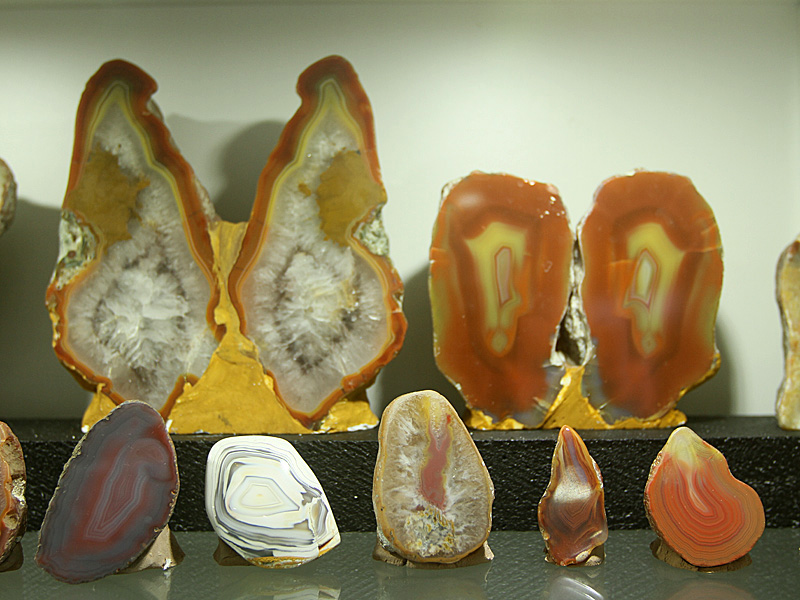
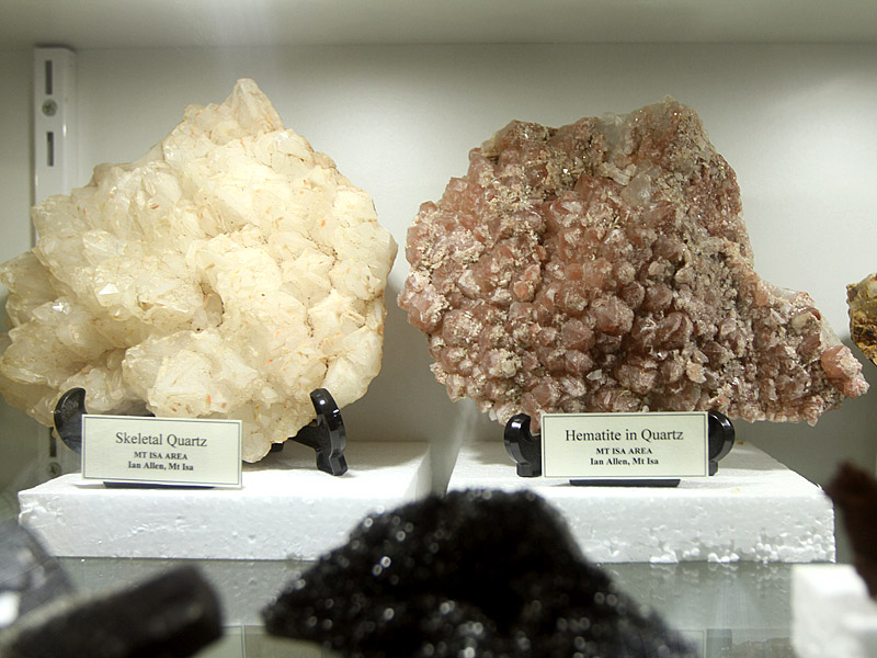
It’s also where you can see the famed Ted Elliott Mineral Collection, which has more than 4500 minerals displayed in a series of rooms, each dedicated to specific rock specimens.
They range from fossils and petrified woods, agates from the Etheridge region (including thunder eggs and agate bowls’ quartz), to gold and precious minerals and fluoresced minerals.
3. Georgetown Peace Monument
Located in a garden behind the TerrEstrial Centre, the Peace Monument is a collection of stones dedicated to great peace activists. These include Martin Luther King Jr, Mahatma Gandhi, Nelson Mandela, Dr Daisaku Ikeda,
Julian Burnside and Eddie Mabo.
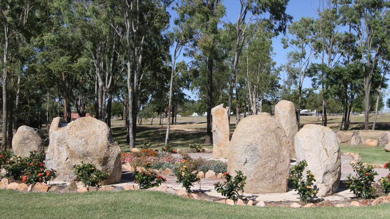
A plaque at the monument explains that its aim is to honour “the courageous efforts of men and women who have devoted their lives to a peaceful and harmonious world”. It goes on to say: “The people of the Shire of Etheridge acknowledge those known and unknown heroes of humanity throughout the ages. We also note the tremendous contributions of these champions of peace whose legacy will last for eternity.”
4. Stamper Battery
Located in a park beside the Etheridge River are the remains of a five-stamper battery, used to crush rocks to release gold.
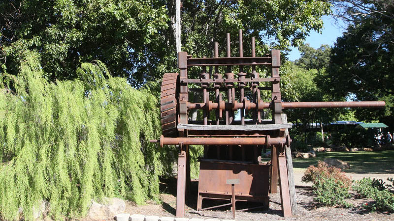
It was built in 1937 and owned and operated by Jim, Jack and Tom Nugent (the Nugent Bros), but forced to cease operations abruptly in 1941, because of interruptions to local mining caused by World War II.
5. Georgetown River Walk
This walk of about 6km passes along the banks of both the Etheridge River and Sandy Creek. Signs en route include information about Georgetown’s history.
It also provides a pleasant opportunity to observe local riverine tree species, including the river red gum, weeping paperbark, yellowwood, swamp mahogany, rain tree, sandpaper fig, lolly bush, batswing coral, inland bloodwood and corkwood wattle.
History
Before Europeans arrived the area was home to the Agwamin people.
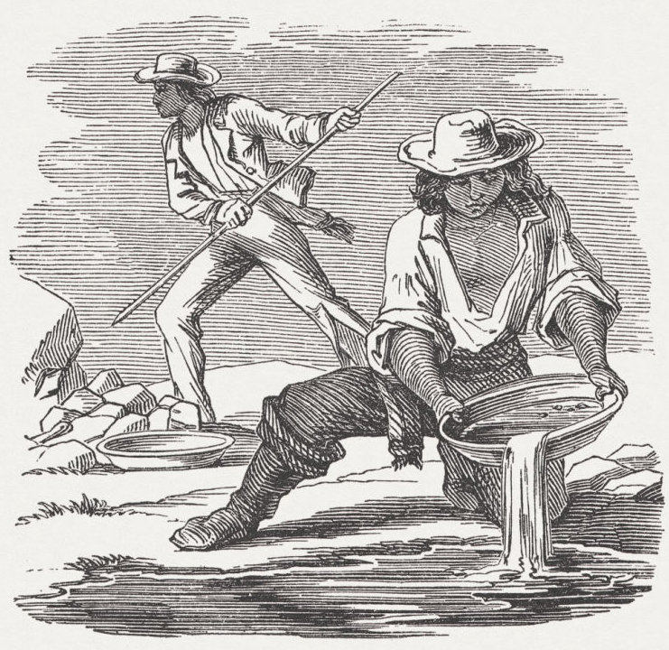
Alluvial gold found on Etheridge goldfields in early 1869.
By July 1869 the goldfields had 3000 prospectors.
The town formed in 1870 with the name of Etheridge.
The name was changed in 1871 to Georgetown. By this time the population was 600.
A post office and court house opened in 1872.
By 1876 Georgetown reportedly had 28 hotels.
Mining flourished in the 1880s and the town’s population reached 3000.
In 1888–89 the town was surveyed and divided into residential allotments.
The Bank of New South Wales opened in 1890.
By the 1900s goldmining was on the wane and the town became the administrative centre for the Etheridge Shire.
In 1908 the Shire Hall was built.
The TerrEstrial Centre was opened in 2003.
In 2004 the Agwamin people surrendered native title in exchange for access to traditional lands and housing in Georgetown
Image credit: Getty