Finding freedom in Tassie’s coastal wilderness

Coral Expeditions has been approved to cruise in Tasmania in 2021 so start planning your wild Tassie holiday today.
REGARDED AS A bushwalkers’ paradise, Tasmania arguably boasts Australia’s highest concentration of internationally renowned short and multi-day walks. But if you’re new to walking the Apple Isle, it’s not always easy to pick the most suitable track to get you started, especially if you’re unsure of your own fitness and suitability to tackle the famously rugged terrain and unpredictable weather conditions.
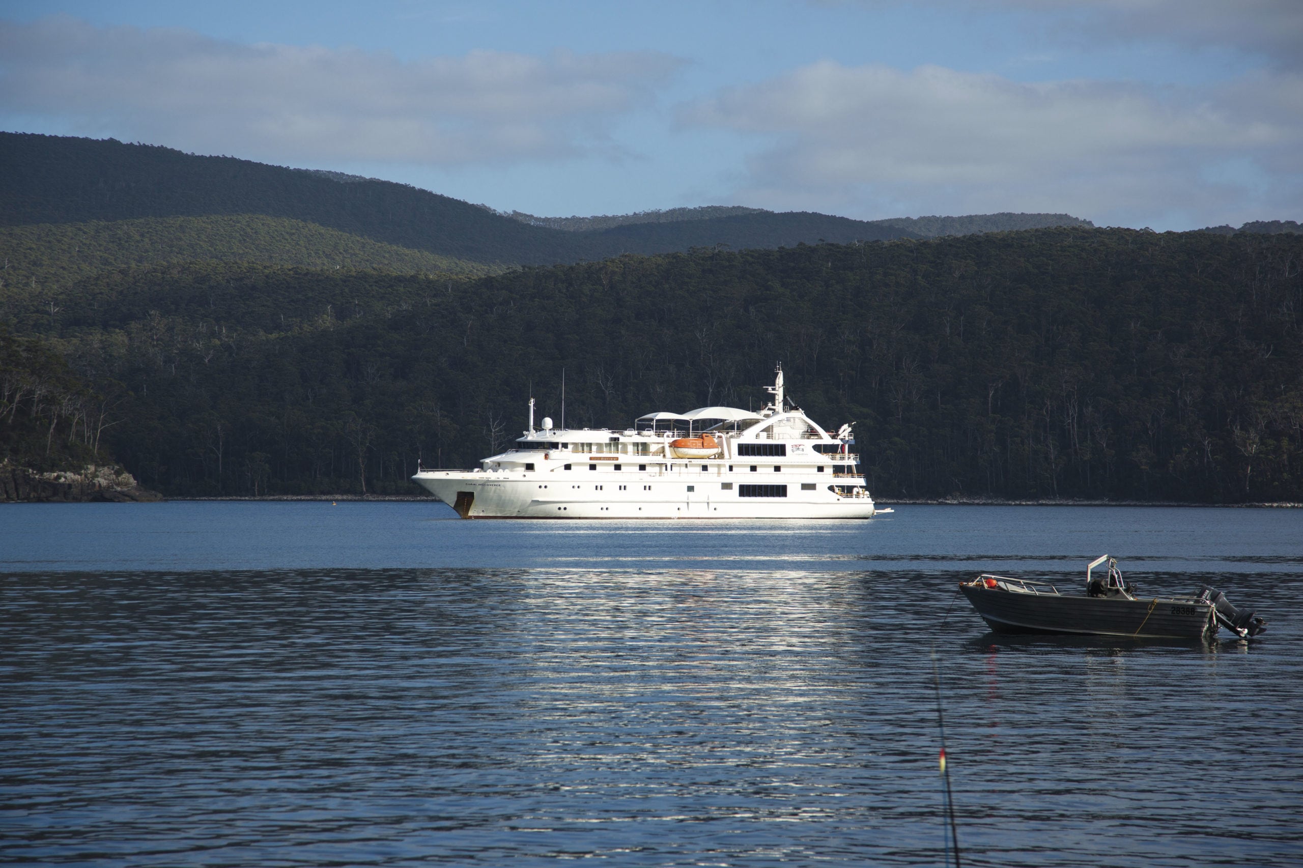
You can, of course, take your chances and simply jump in, boots and all (and you’re unlikely ever to be disappointed). But it’s possible to sample a variety of Tassie’s superb coastal trails on a special itinerary run by Coral Expeditions from the comfort of their 72-passenger Australian vessel, Coral Discoverer, without the need to rough it.
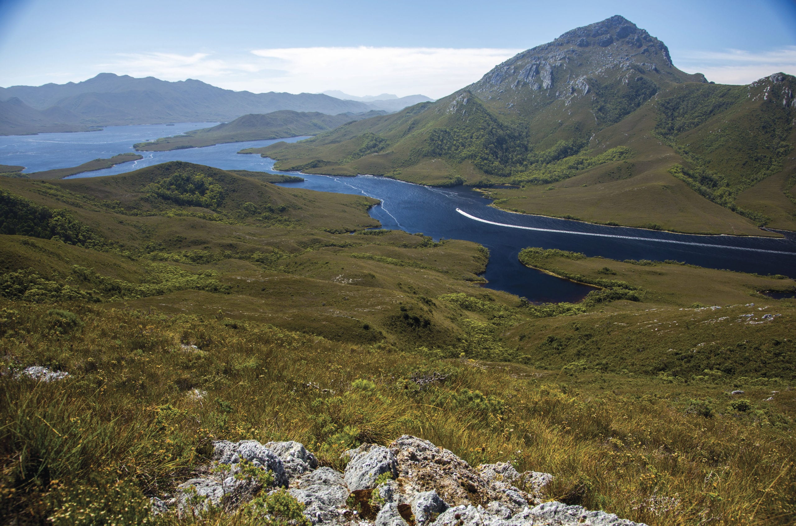
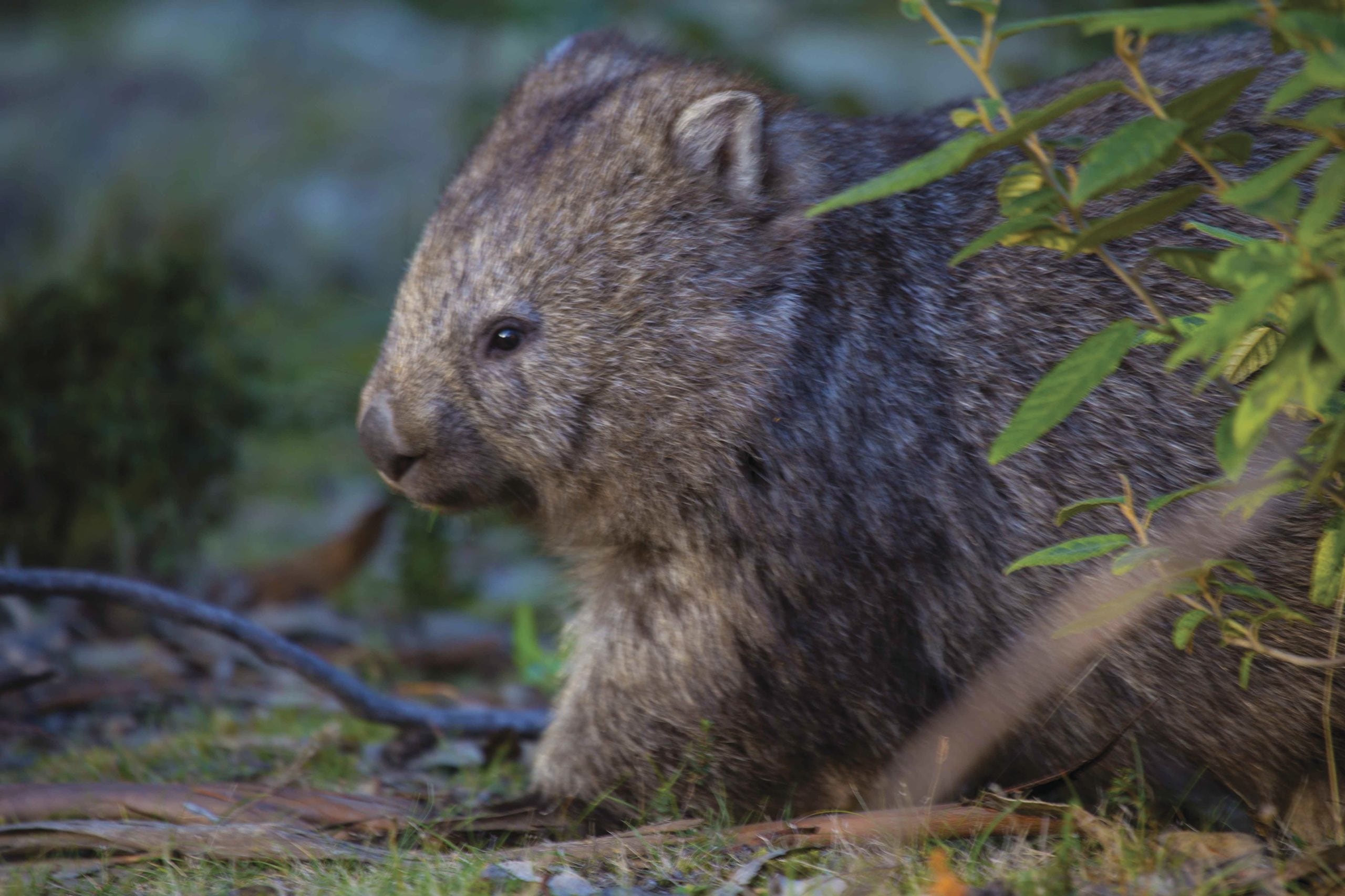
I’VE STOPPED FOR a quick breather on a narrow, wombat-maintained track on the upper slopes of Mt Milner. I spy Coral Discoverer far below, dwarfed by distance and the encircling rugged ranges. She’s moored in Port Davey, a deep breach in Tasmania’s wild and remote south-west coast through which the Southern Ocean roars until it meets the Breaksea Islands, a bulwark of rocky islets strung across the harbour that protect it from the turbulent waters beyond. I’m on the last day of a voyage aboard Coral Discoverer that began in Hobart seven days ago, when I was far less walking fit than I feel today as I scramble up the mountain with comparative ease. That such a dramatic improvement to my fitness can happen in a relatively short time is testament to the demanding nature of some of the walks on offer during this trip.
Ultimately, the itinerary is at the mercy of the prevailing sea and wind conditions and is necessarily flexible. On this mid-summer voyage, we begin a week of sailing and hiking with the two most strenuous walks of the entire trip. It’s the perfect baptism of fire to set a cracking pace and modify any inclination to over-imbibe at dinner or tarry too long at night gazing up at those star-studded southern skies from the ship’s top deck.
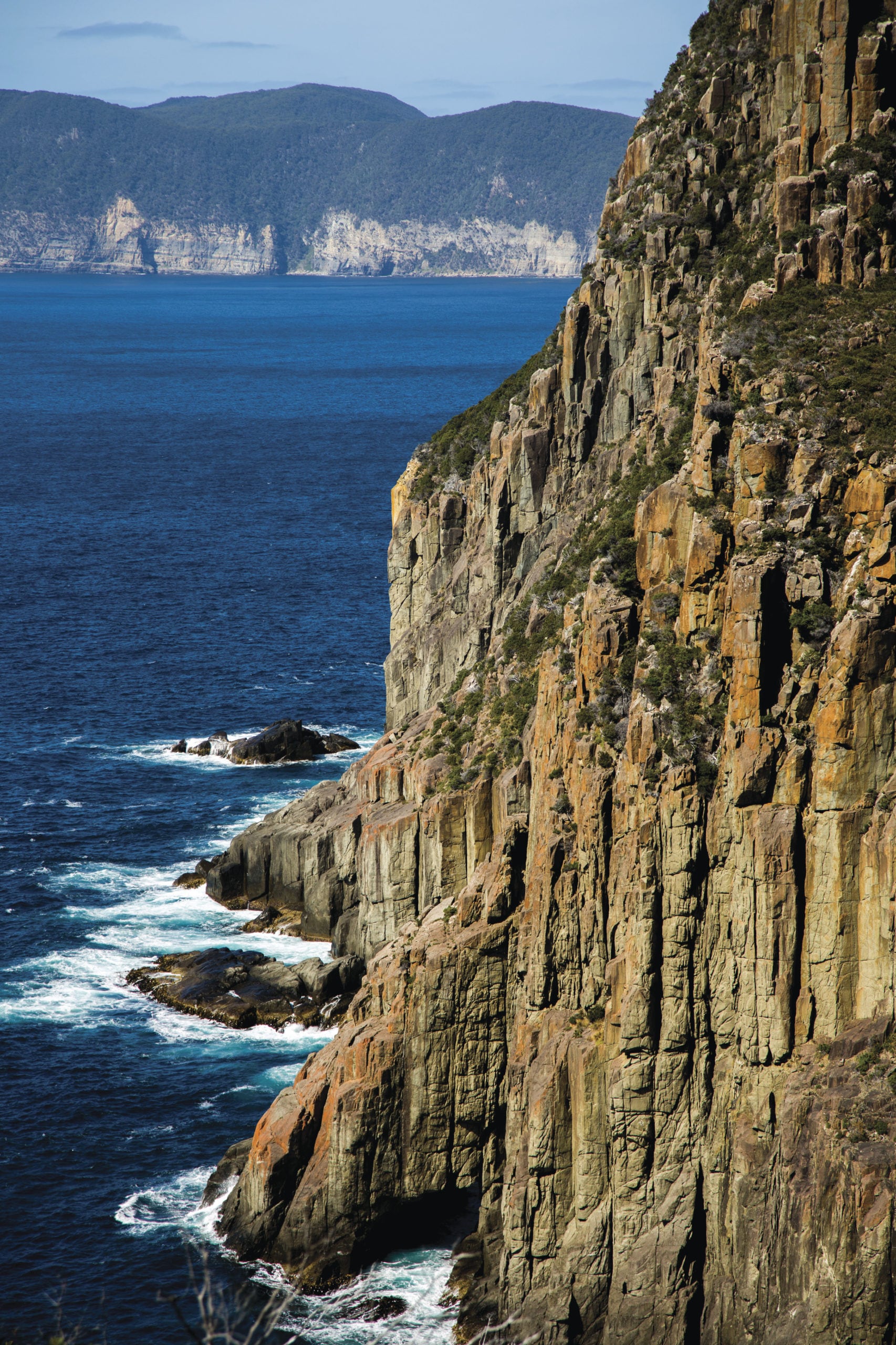
After sailing south from Hobart on a windy and choppy but sunny January evening, we’re woken early the next morning to tackle a section of one of the island’s newest walks, the Three Capes Track on the Tasman Peninsula. It opened for business in December 2015 and features a well-constructed track in excellent condition. We trek from Fortescue Bay to Cape Hauy and back again, a moderately rated hike of 4–5 hours that starts from the boat ramp near the bay’s popular campsite. All the walkers are shuttled ashore across calm waters in Coral Discoverer’s spacious tender, which is launched via an ingenious lift system at the stern of the ship. The mother ship’s glistening white hull remains in view for a while as we skirt the coastline through thickets of casuarina and coastal banksia before the track turns inland and rises sharply. We labour up hundreds of stone steps through dense dry sclerophyll forest and are grateful for the shade as the sun climbs ever higher and the temperature with it. The track finally emerges from the trees to steeply descend even more steps to a series of saddles that undulate towards the fluted cliffs and vertigo-inducing dolerite stacks of the headland.
The views revealed by the low-lying coastal heath vegetation are spectacular. It’s just possible to make out the peaks of Maria Island far away to the north. To the south Tasmania’s verdant landmass comes to an abrupt end, plummeting down to the sea in a row of dramatic cliffs relentlessly pummelled by white-capped breakers at their base. Our party crowds onto a fenced lookout perched high on Cape Hauy, where we snap away at endless blue vistas and enjoy a brief rest and a snack before heading back to the ship for a late lunch and more leisurely afternoon exploring the coastline by ship as we continue north towards Maria Island.
THE DISTINCTIVE TWIN peaks of 599m Bishop and Clerk dominate the northern end of Maria Island and are Day Two’s main objective. It’s a tough hike so the party splits into two. Some take the option of exploring the island’s famous fossil cliffs while my group tackles the 12km return hike to the summit. The climb looks daunting and I’m uncertain if I’m going to make it the whole way, but fear of missing out is as good an incentive as any to propel me onwards and upwards. The track runs perilously close to the edge of the denuded cliff tops of Skipping Ridge, climbing higher into the casuarina and Tasmanian blue gum forest towards the start of the scree field and final ascent to the top. The track zigzags up through a steep slope of loose rocks that become larger towards the top and I find it safer to scramble up this section on all fours.
Our group pauses just below the summit to feast on freshly baked muffins and admire the superb view across the Mercury Passage, which confirms just how high we’ve all climbed. I struggle to get a toehold on the last big step just below the summit but a helpful shove from behind by my companions propels me up the giant boulder and suddenly I’m there. There’s a palpable sense of achievement among the walkers as a few whoops and cheers go up. With a few Instagram-style extreme poses in the bag we set off down the mountain. This is often the riskiest part of any big hike with tired legs and gravity to contend with, but we all get down without a hitch and I’m grateful for my trusty walking poles, which keep me vertical on more than one occasion.
We return through Darlington, an assortment of ruins, restored huts and heritage buildings that make up the island’s main settlement and are maintained by Tasmania Parks and Wildlife. Sparkling waters lap a crescent of pale golden sand in the bay so it’s boots off and the blessed relief of cool sea water on hot tired feet. We re-board the ship exhausted but elated.
Each evening, in the ship’s lounge, we are treated to informative lectures by the ship’s expert guides and crew, but on this particular night, it proves hard to stay awake.
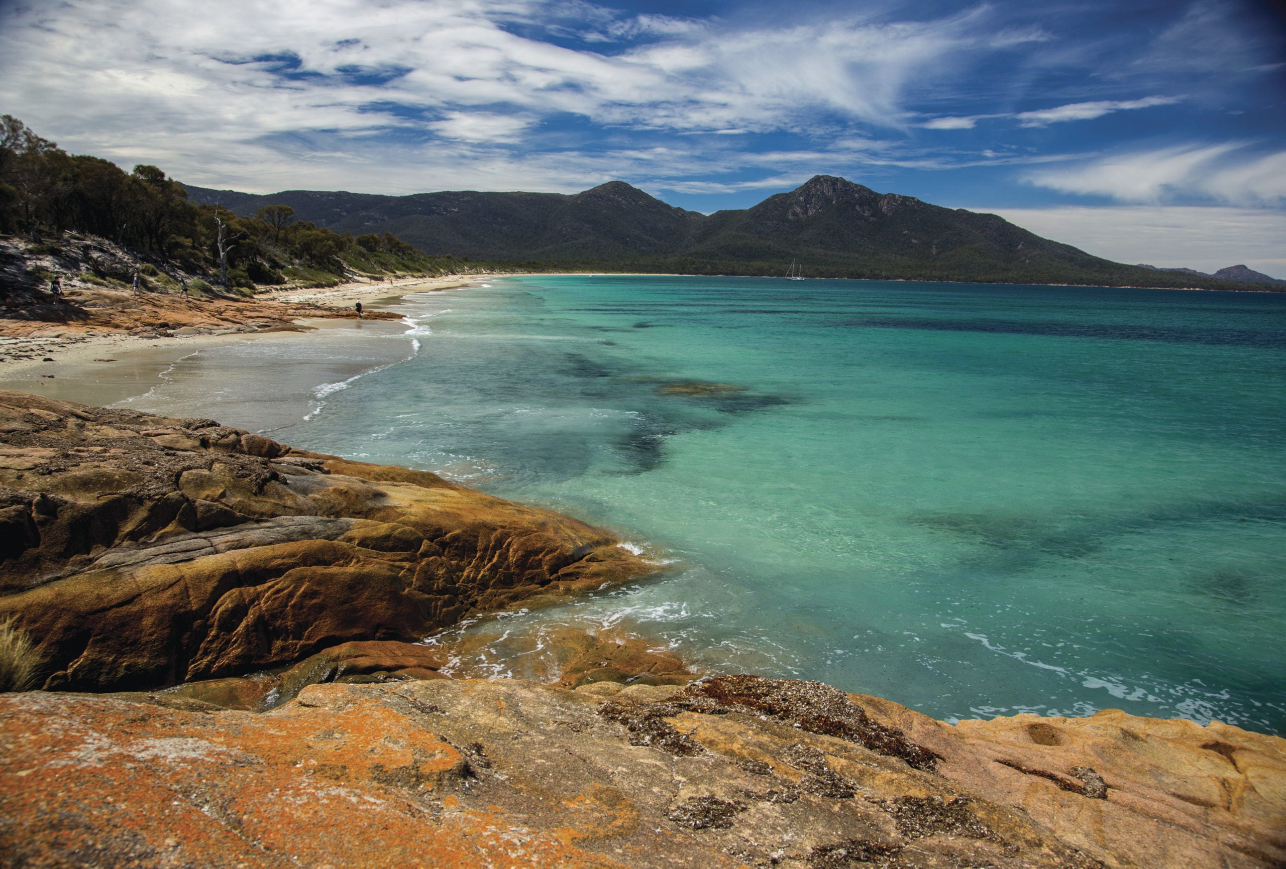
NEXT MORNING WE arrive at Coles Bay, tucked under the towering pink granite peaks of the The Hazards on the Freycinet Peninsula. We hike up to the famous Wineglass Bay lookout with the usual crowds but we’re early enough to avoid the worst of the daytripper traffic. We continue down the other side of the saddle via a steep track towards the bay’s celebrated arc of white quartzite sand. Today, big breakers are smashing onto the beach and only the very strongest swimmers among us brave the wild waters and swarms of bluebottles on this otherwise perfect summer morning.
We traverse the peninsula past Hazards Lagoon along the flat Isthmus Track towards Hazards Beach, from which point the ship’s tender will eventually pick us up. The beach is almost empty apart from the occasional family group and a few pied oystercatchers dabbling in the shallows. While some of us are keen to explore outcrops of orange lichen-covered rocks at the northern end of the beach, others change into swimmers and plunge into the calm and inviting waters of Promise Bay or simply stretch out on the sand and soak up the warm sun.
The following day we turn south again, rounding the Tasman Peninsula’s southernmost capes, passing the Southern Hemisphere’s highest cliffs – the Cape Pillar Sea Cliffs – and eventually arrive at a small township at the head of Bruny Island’s Adventure Bay. Here we scale 272m Fluted Cape. It’s a loop track, steep in parts, that ascends through stands of casuarina and then hugs the unprotected cliff edge on the way down. There’s no fenced lookout at the top and the sheer drop to the ocean below sets more than a few pulses racing, including mine.
The pretty bay is home to the privately run Bligh Museum that commemorates numerous European maritime explorers who landed here, including William Bligh who arrived in 1777 when he was sailing master aboard Cook’s ship Resolution. Those not climbing the cliff have time to visit the museum while another group explores the coastline from the tender.
With each passing day, the walks become easier and a delightful beach walk at Recherche Bay towards the southernmost tip of the mainland is no exception. The South Coast Track starts here – a challenging 85km, 7–10-day walk that ends at Melaleuca Inlet, our final destination by ship. Even though I’m becoming fitter and relishing every step on these daily walks, I’m happy to leave this hike to the truly hardcore bunch of serious adventurers that this testing track usually attracts.
THE SOUTHERN TASMANIAN coastline bears the full brunt of the Roaring Forties but our sea passage to Port Davey is relatively peaceful. This final chapter of the voyage has everyone excited, including experienced bushwalkers Denise and Ian Mackey from Bowral in New South Wales. “Port Davey would have to be the highlight; it’s so remote and you don’t get the chance to come here every day,” Ian says. “You could fly here in a couple of hours, but then you’re only here for an hour or so. But to be here for two days and be able to do all those walks is an opportunity of a lifetime.”
Former maths teacher Denise and retired businessman Ian and have undertaken some of Australia’s toughest treks including the 250km Great North Walk, in NSW, and Tassie’s famous 65km Overland Track. But they find this trip more to their taste these days. “It’s a privilege being here,” Denise says. “The opportunity to visit so many different national parks and enjoy such a great variety of bushwalking among like-minded people and then have all that luxury on the ship as well – I can’t think of any other way of being able to do all that in just seven days.”
Tassie’s south-west is true wilderness, remote and difficult to get to, accessible only by sea, private air charter or multi-day hike. Access to Port Davey by big cruise ships is strictly controlled, but 63m Coral Discoverer with her shallow draught is small enough to navigate the broad bay.
For two glorious days we explore Bathurst Narrows and Harbour in the ship’s tender, passing close to manicured grassy banks kept neat by grazing wombats and wallabies. We climb the quartzite peaks of 276m Mt Beattie and 186m Mt Milner, where we’re treated to sweeping panoramic views of an infinite network of channels and lakes in which the dominant peak here, 772m Mt Rugby, is perfectly reflected.
We marvel at the blindingly white quartzite airstrip hand-built by legendary bushman Deny King who lived at Melaleuca for 55 years and who was instrumental in having the region designated as a national park. We learn about the Needwonnee people at Melaleuca and try in vain to spot critically endangered orange-bellied parrots from the observation hut.
After a week of walking in the clean fresh air of Tassie, I’m feeling fitter, not fatter, despite the abundance of delicious food on offer. I wouldn’t describe myself as a hardcore bushwalker, but since returning home I’ve walked regularly and I’m hatching plans to return to south-west Tassie soon. This time I’ve got the summit of Mt Rugby firmly in my sights.
BOOK NOW with Coral Expeditions!
With a flexible deposit plan, complimentary deposit protection, solo traveller specials (reduction of sole supplement by 35%), group offers, and a partner offer of $500 per person for first-time travellers (with promo code AG-T21), now is the perfect time to book.
NOTE: Special COVID-19 conditions include a maximum of 60 guests onboard and a Strict SailSAFE Plan.

