The Ibis Aerial Highway connects 14 destinations across the Kimberley, giving visitors a bird’s eye view of the region.
Reopened in 1994, the highway utilises bush airstrips and light planes, as well as experienced scenic flight operators.
In a forthcoming relaunch, the Ibis Aerial Highway moniker will be changed to the Kimberley Aerial Highway.
The Kimberley region encompasses almost 423,000 square kilometres.
One aim of the aerial highway is to give visitors a comprehensive view of the expansive region, in a relatively short space of time.
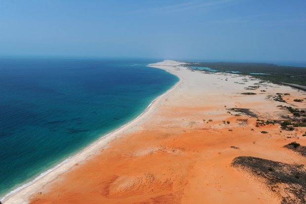
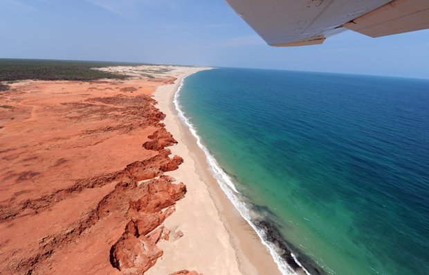
The WA coastline is Australia’s longest, with more beaches than any other state or territory in Australia.
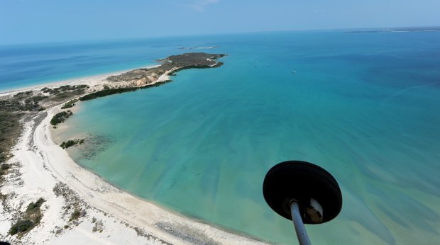
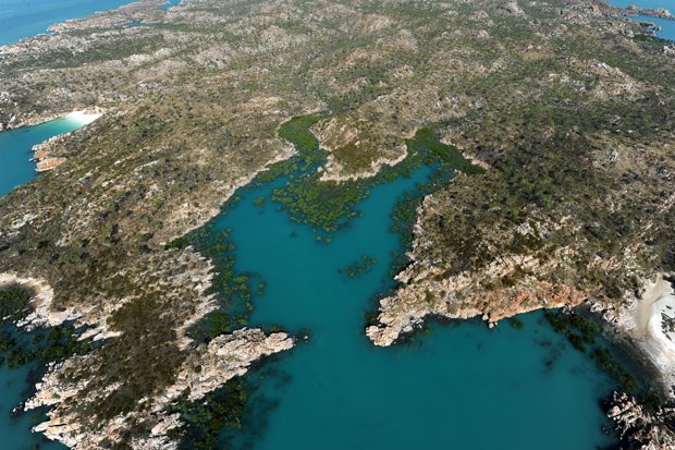
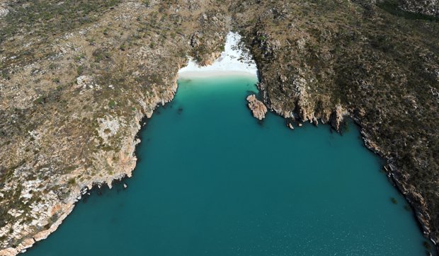
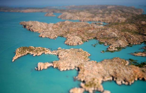
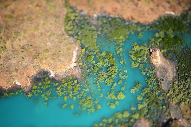
The Buccaneer Archipelago, a group of islands in the Kimberley region, is home to secluded beaches and rocky terrain, visible from the aerial highway.
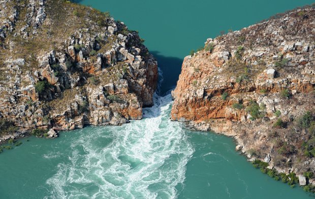
Aerial view of a horizontal waterfall in the Buccaneer Archipelago.
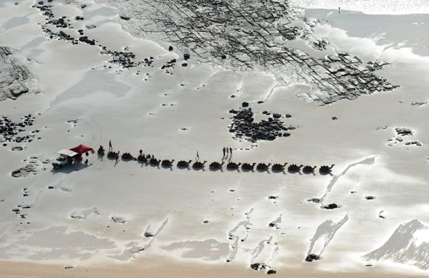
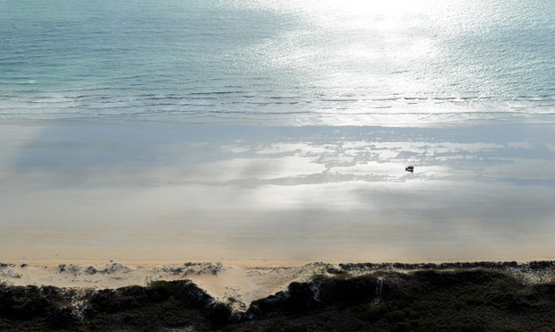
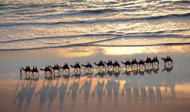
A camel trek extends along famous Cable Beach in Broome.
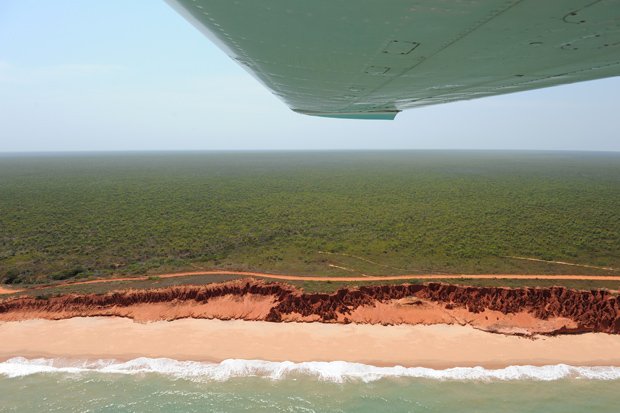
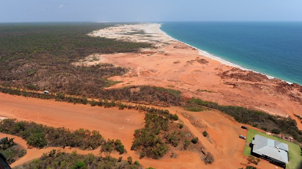
A charter plane soars over Cape Leveque, on the tip of the Dampier Peninsula, north of Broome.
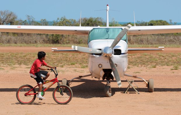
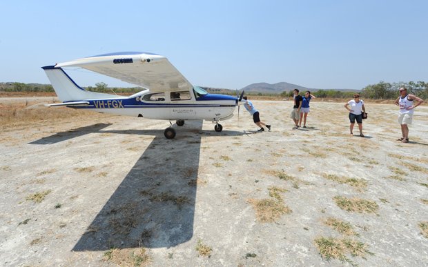
A local child circles a plane ready to fly the Ibis Aerial Highway at One Arm Point near Cape Leveque, WA.
In August 2011, 19 million hectares of the west Kimberley was heritage listed for cultural and environmental reasons.
The wilderness area within the Kimberley that was granted National Heritage status in August 2011 so became the largest area ever listed.
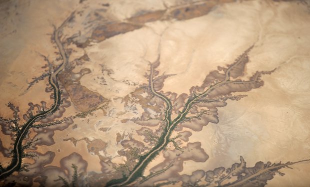
Scenic flights allow visitors to access parts of the Kimberley upon which few people have ever stepped foot.
Aerial view as a 4WD traverses Cable Beach.
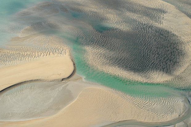
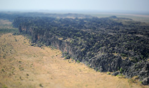
Landscape near the town of Derby, where tides are up to 11m, helping to create the visual phenomena.
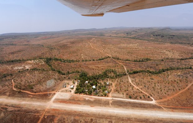
The airstrip at Mt Hart, accessed by heading northeast from Broome over the King Leopold Ranges.
A pilot readies the Cessna charter plane, preparing for the Ibis Aerial Highway.
There are more than 20 air strips servicing remote locations in the Kimberley. Around seven feature regularly on the itineraries of tour companies, though many flights pass over attractions, rather than making a stop.
A humorous sign at Mt Hart airstrip.
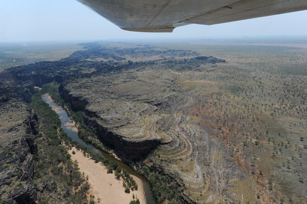
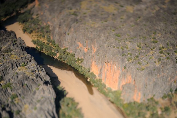
An aerial view of Windjana Gorge National Park.
Windjana Gorge National Park is home to a spectacular 3.5km long gorge carved out of the Napier Range, which was formed over 300 million years ago.
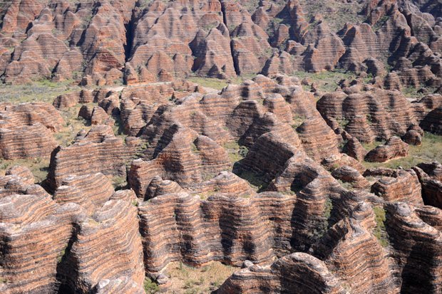
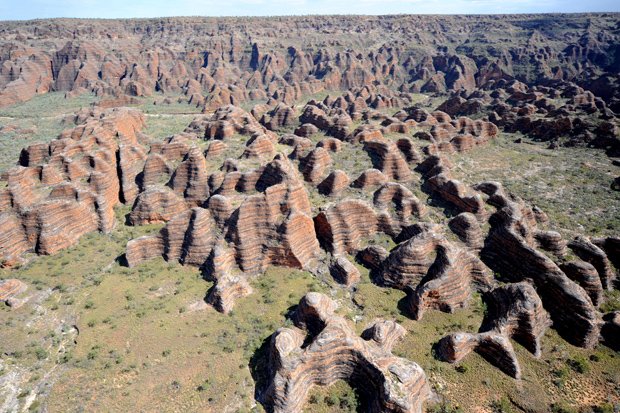
The Bungle Bungle Ranges in Pumululu National Park are among the attractions visible from the aerial highway.
The distinctive orange and grey striped beehive towers were created some 375 million years ago.
Sunset is the best time to watch the camel train along Cable Beach, whether you are on land or in the sky.