
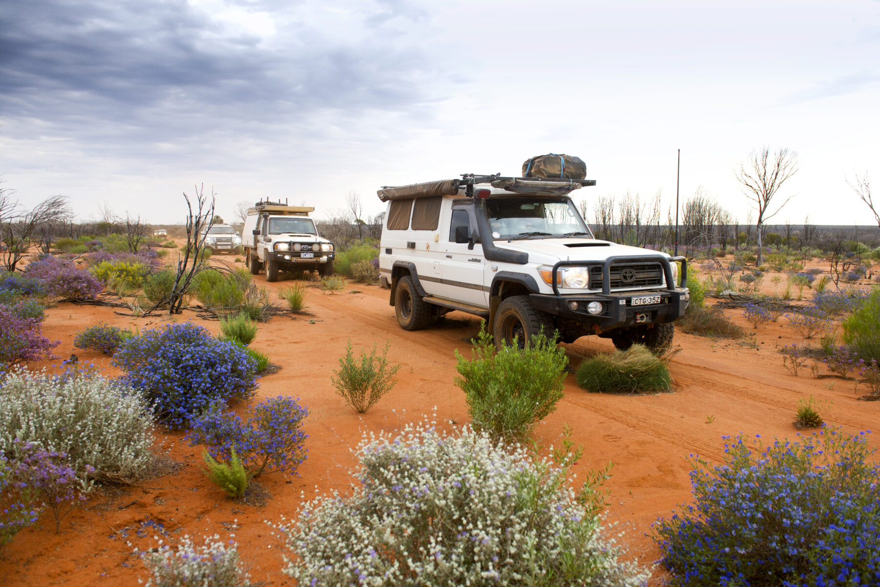
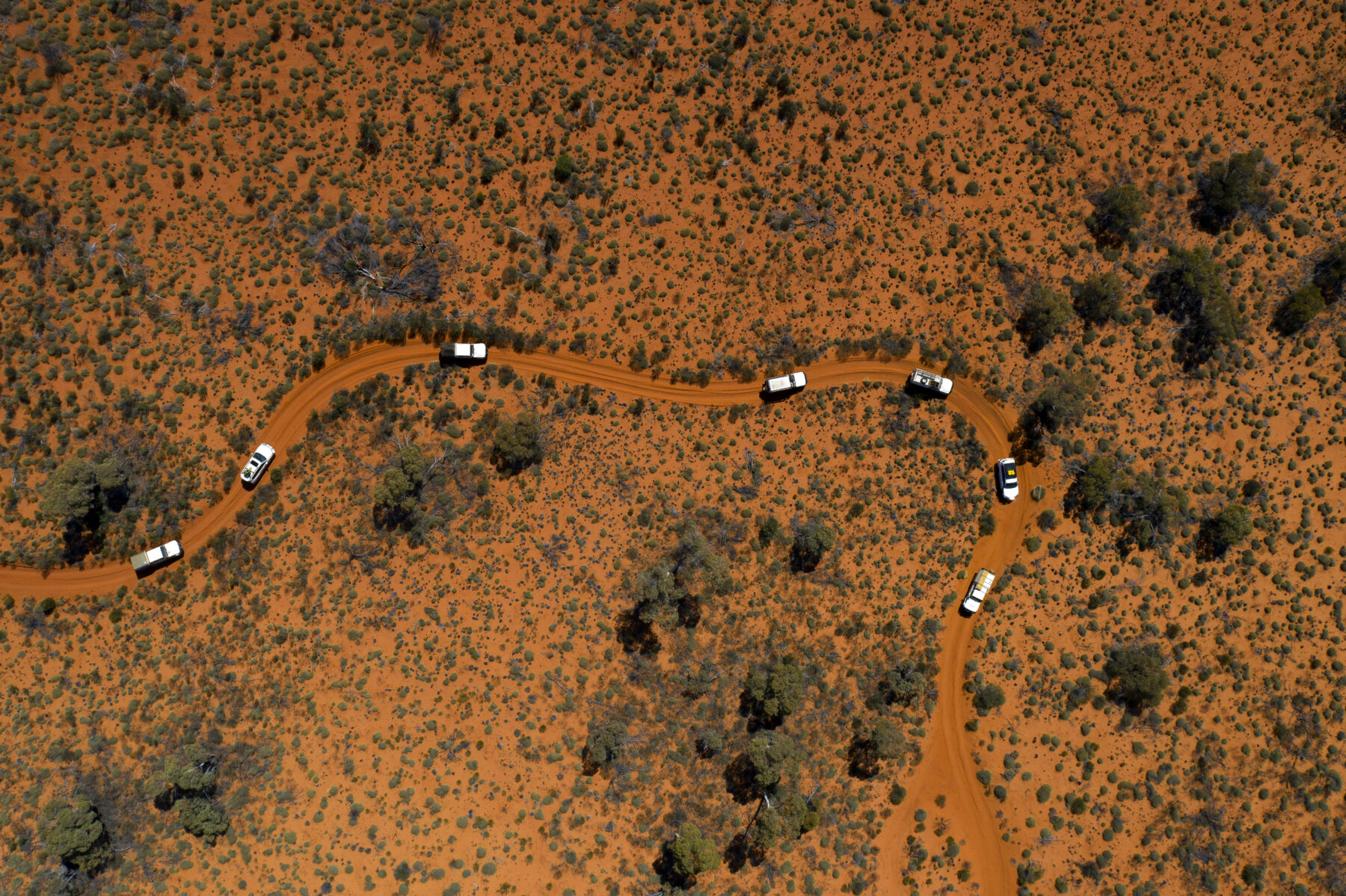
For five days I’ve been travelling along the straight line of the 1325km-long Anne Beadell Highway. This somewhat grandly named – but deteriorating – bush track stretches from the opal town of Coober Pedy in South Australia to Laverton in the Western Australian Goldfields. Along the way it traverses the Great Victoria Desert (GVD), which straddles the border between SA and WA. With a staggering size of more than 400,000sq.km – about twice the size of Great Britain – the GVD is Australia’s largest desert, covering about 5 per cent of the continent.
The term “desert” usually connotes images of dry, barren landscapes, recalling harsh and desolate wastelands. But so far these clichés don’t relate. The heavily corrugated and intermittently washed-out Anne Beadell leads through surprisingly dense vegetation, contradicting the common wisdom that deserts are characterised by a lack of plants, notably trees.


Andrew Dwyer, owner of the Diamantina Touring Company, with whom I’m travelling, has been roaming Australia’s deserts for 36 years. The GVD, named after Queen Victoria in 1875, is his favourite. “The space, the solitude, the pristine nature, the location, and the fact that it is in between the [ranges of] Central Australia to the north and the Nullarbor to the south” make the GVD a very special place for him. For this experienced desert veteran, however, the GVD does not seem like a typical desert. “It’s an arid region,” he says, adding that dictionaries define deserts as “dry and lifeless” places. “There is nothing dry and lifeless about [this],” he adds.
A desert is typically defined as an area receiving less than 250mm of rain per year. Australia’s deserts sometimes exceed this due to uneven rainfall distribution. In the GVD, the average annual rainfall is low and irregular, ranging from 200 to 250mm. Thunderstorms, mostly in summer, are relatively common with, on average, 15 to 20 per year dumping moisture onto the parched land below.
Surprising vegetation
I had my first experience of the GVD driving the Googs Track from Ceduna, on the SA coast, to the Trans-Australian Railway at Malbooma, near Tarcoola, in outback SA. The Googs Track is bulldozed straight through an undulating expanse of mallee-covered dunes that roll and heave towards the horizon.
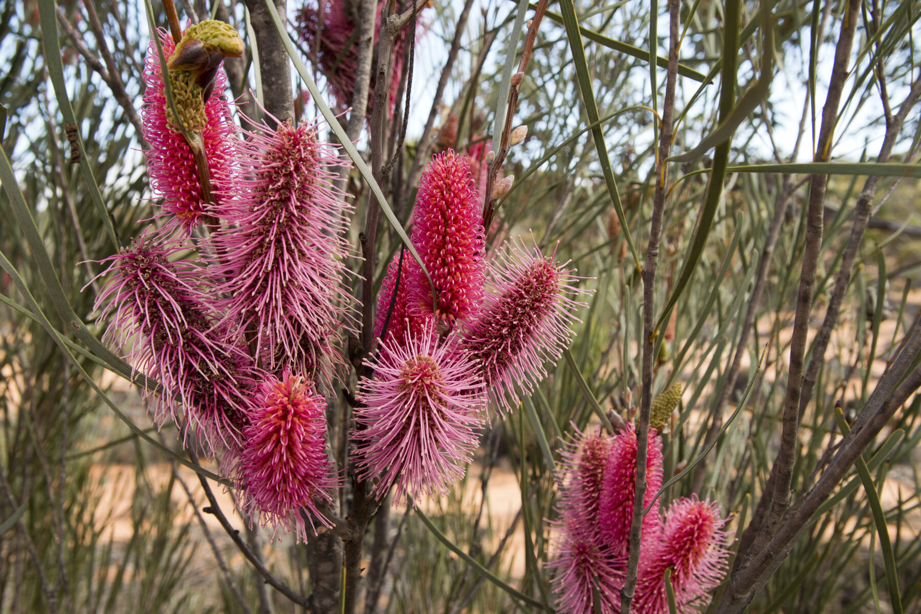
It’s a roller-coaster at the very south-eastern extremity of the GVD that’s a popular challenge for four-wheel-drive enthusiasts. What surprises me about it is the extent of vegetation. Often described as a “sea of mallee”, this section of the GVD is densely covered in these multi-stemmed eucalypt species. There is also an abundance of wildflowers. One of the show-off flowering shrubs in the area, the grass-leaf hakea, is in full bloom. Its clusters of bright- pink flower cones distract me from the – at times challenging – track. Carpets of daisies colour the understorey.
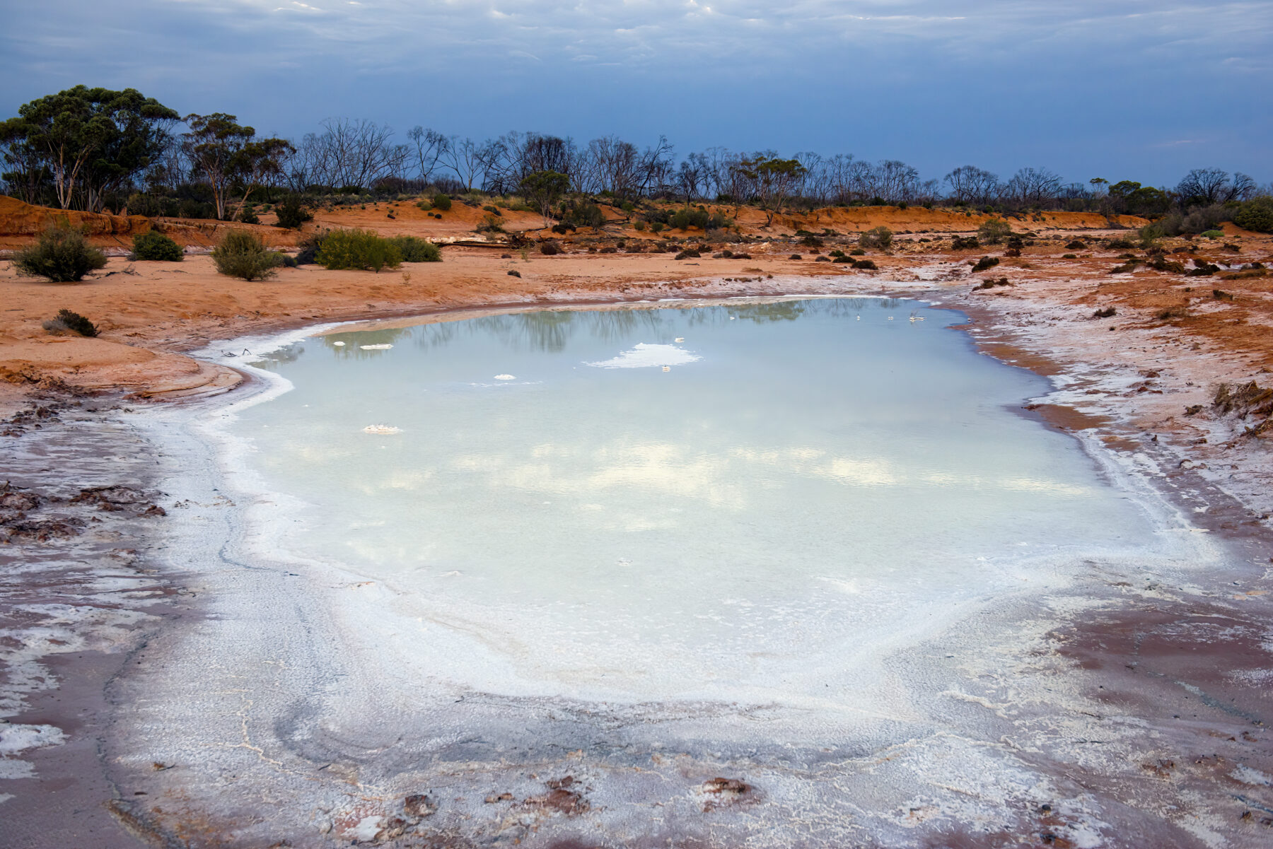
The Googs Track brutalises this desert’s rolling dunes by cutting straight through them. In contrast, the Anne Beadell Highway follows valleys between the long rows and rarely crosses them. Both routes reveal the true nature of the GVD. It’s Australia’s largest dune field, with long drifts aligned in a west–east direction. However, in a very real sense, it’s also a green desert, although it has no major watercourses except, perhaps, the saline Ponton Creek, which is located on the GVD’s southern extremity. There’s no permanent surface water, with rock holes and claypans scarce – although soaks do hold water during wet periods.
It’s only in sections cleared by bushfires or cultural burning that this ocean of sand is revealed. Everywhere else, plants, ranging from grasses such as Eragrostis eriopoda – ornamental woollybutt – to spinifex, and from stately trees to shrubs, cover the sand. The lofty perspective of a drone reveals thetree cover, while seemingly dense from a ground perspective, is actually quite sparse, with ample space between each tree.
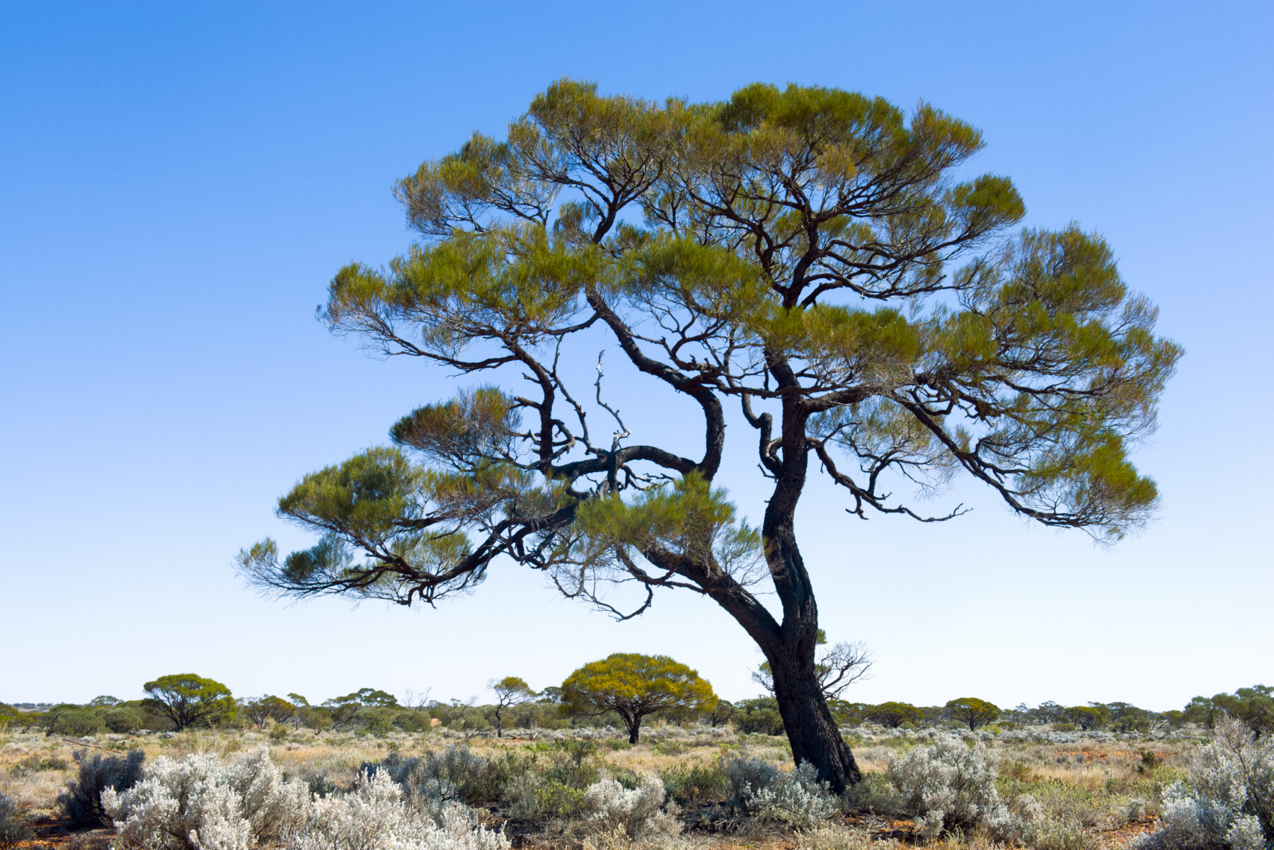
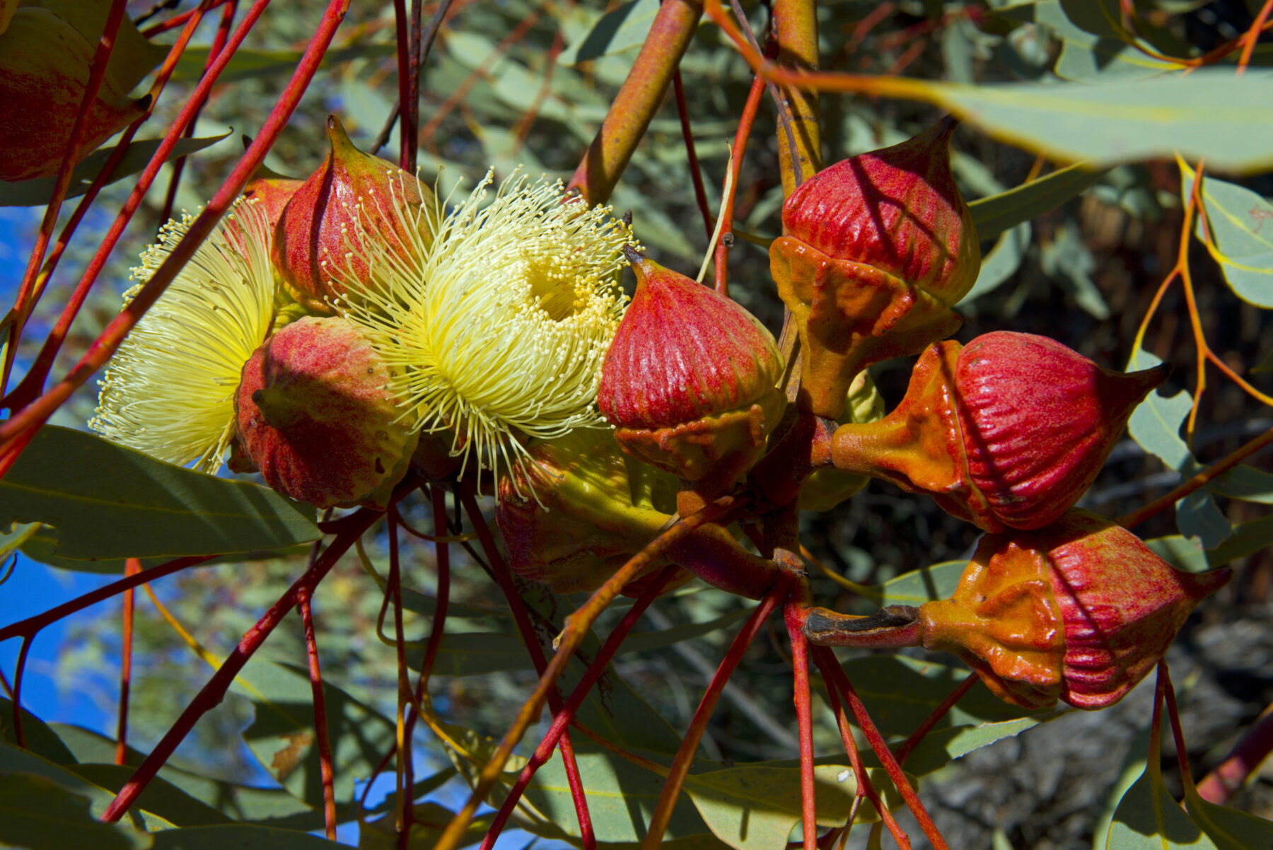
And yet, the botanical stars here are trees. The rare and aptly named Christmas tree mulga surprises with its tall, conifer-like shape. The desert poplar, with its lush, silvery-green foliage, is a favourite for roaming camels but seems alien among the desert vegetation. The large-fruited Ooldea mallee, with its stunning clusters of yellow flowers, appears overly flamboyant for such a dry area. The western myall, often described as a bonsai on steroids, seduces with its gnarly and photogenic shapes.
Then there is the marble gum, the signature tree of the GVD, with its sometimes stately size and ghostly mottled bark. These magnificent eucalypts often sit on the crests of dunes and become steady companions as you traverse deeper into the desert. As with the spinifex grasses, these beautiful eucalypts begin to appear about four days into our traverse. On the Coober Pedy side of the GVD there are no marble gums.
Australia’s most biodiverse desert
It’s easy to initially dismiss the GVD as monotonous, because its real beauty isn’t immediately obvious…at least to the uninitiated. If your eyes are only set to panoramic views, you might get the impression of endless sameness. To see this desert’s real nature, you need to rid yourself of preconceptions of what a desert should look like. The GVD demands a deeper connection and a closer look before it reveals itself. Far from being uniform, this desert is defined by constant changes in vegetation. For Andrew, “it’s a virtual botanical garden”. “It’s the most biodiverse desert in Australia,” he says. “The extraordinary thing about the Great Victoria Desert is that it has so many different plant colonies. You’ve got the casuarina pauper forests over limestone, you’ve got the dune communities, you’ve got mallee and you’ve got these beautiful flowering eucalypts. It’s just so diverse.”
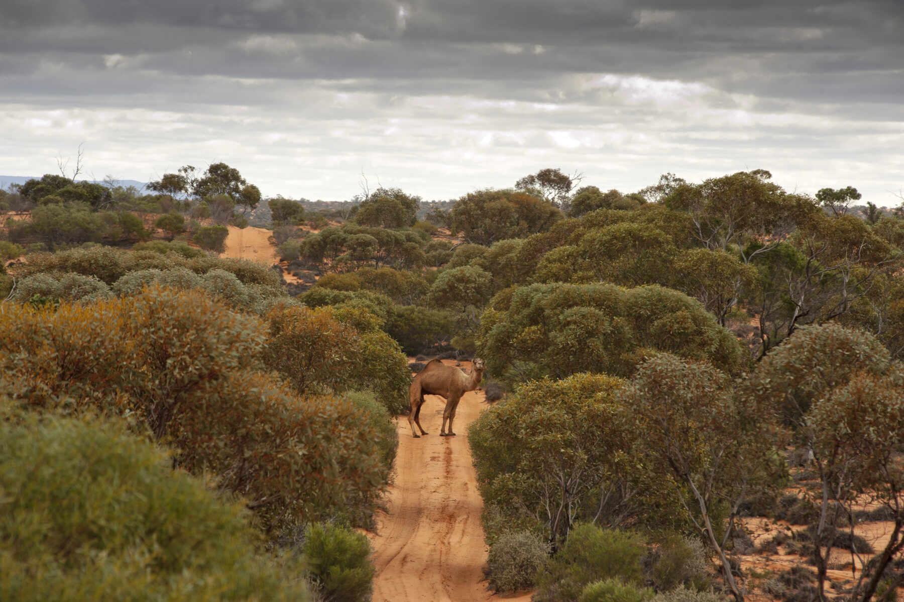
As if to underscore Andrew’s words, the desert throws in a surprise when we encounter dunes that localised rains have turned into flowering gardens. Contrasting with the deep-red sand, the colourful bouquets on display consist of masses of striking poached-egg daisies, delicate purple parakeelyas and small yellow button daisies. Far from being a barren wasteland, the GVD is a biologically rich bioregion, with a vast array of animals and plants that have adapted to the harsh conditions. While the vegetation is there for all to see, the fauna is much more secretive. Wildlife sightings during the day are sparse. We see the occasional feral camel family group, a brown falcon with a small snake in its talons, a mob of red kangaroos in the distance and, every now and then, a thorny devil.
The real picture of what populates this arid wonderland is revealed in the sand. A multitude of prints divulge the abundance of animal species in the GVD. Visitors with the skills to interpret these animal tracks might find prints made by several species of dunnarts, mice and kangaroos.
The desert’s reptile fauna is especially diverse. The GVD is considered one of the richest areas in the country for reptiles, with approximately 90 species living among the dunes. Snake and lizard tracks are common. Every now and then, beetle tracks and prints made by birds add to the picture. Some of the more common bird species are the brown falcon, crested pigeon, ringneck and mulga parrots, fairy-wrens, and honeyeaters. Bird enthusiasts can also expect to glimpse two of Australia’s most beautiful, yet elusive, bird species here: the scarlet-chested parrot and princess parrot.
A dark history
There is, however, another side to this ecologically largely intact wilderness. Three days into our journey, we deviate from the Anne Beadell Highway and follow a short, dusty track north. It leads through magnificent stands of mature western myall. Some are in full bloom, completely covered in yellow flowers. Then the trees stop and an undulating, sparsely vegetated area opens up, with grasses and bluebush stretching to the horizon. This is Emu Field.
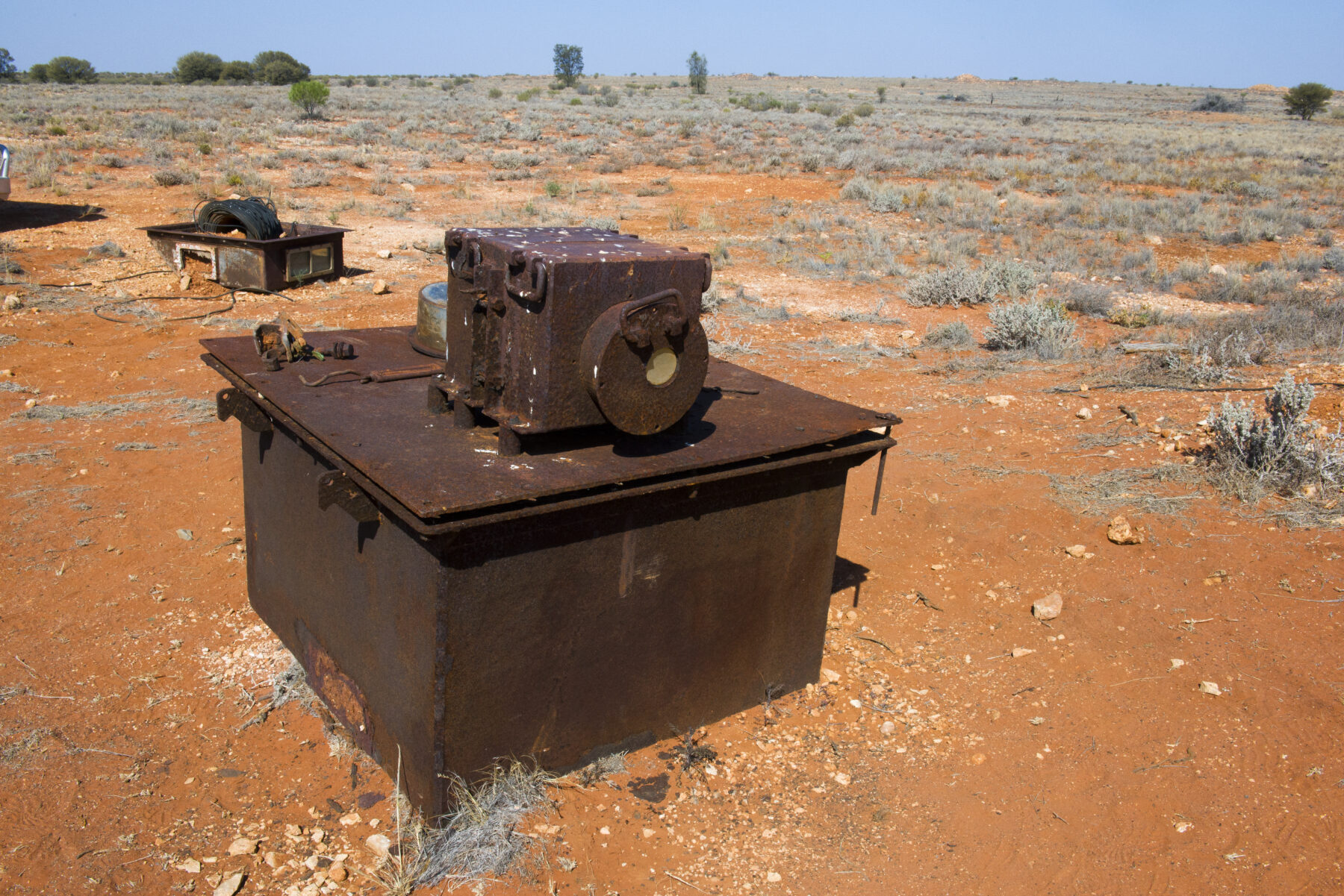
Located about 260km by road west of Coober Pedy, this place has a dark history. In 1953 the British detonated two atomic bombs here, Totem I and II. Two concrete plinths mark ground zero and warn of radiation. Atomic glass – molten sand transformed into glass by the immense heat of the explosion – litters the ground. Barrel-sized concrete foundations that once held up scientific instruments and other items, as well as twisted metal, are some of the very few leftovers of a once extensive infrastructure. Nearby is the large claypan that served as an airport during the test operation. We stop at Observation Point, a lookout from where British scientists observed the two explosions on the horizon.
“The great dichotomy of the GVD is you’ve got this stunning nature, and yet most of the infrastructure was built to blow things up,” Andrew says. Large sections of the GVD are classified as the Woomera Prohibited Area and, to this day, a permit is required to enter it. The Anne Beadell Highway, our pathway through this enormous desert, was in fact constructed in connection with the rocket range projects at Woomera.
Only 180km south of Emu Field, on the southern edge of the GVD and within a few kilometres of the almost treeless plains of the Nullarbor, is Maralinga, the second atomic test site within this extraordinary desert.
Robin Grant Matthews is the site manager and the only permanent occupant of Maralinga Village. “Been coming to this place since 1972,” he says. “It’s my wife’s traditional land. Now that she is sadly passed away, I’m feeling really connected to the land through her.”
Robin’s interest in history drives him to explore the test sites. “The British left so many secrets here and I try to unravel them all,” he says, admitting that many of his questions about the site will remain forever unanswered. “Maralinga always will hold those secrets,” he says. “If you find something, nine out of 10times it opens a Pandora’s box of questions.”
His wife succumbed to cancer a while back, and Robin recently survived Hodgkin’s lymphoma. “It comes from this place,” he says, recalling how for years they’d dig through the dirt here and become covered in dust. Now he always carries a radiation monitor and carefully checks everything he unearths. One of his discoveries is a series of buried steel bunkers close to ground zero, where volunteers huddled during the detonations. Another relic of the test period is the heavy lead casing of a camera used to photograph the detonations.

Seven atomic bombs were detonated in Maralinga between 1956 and 1963. Taranaki was one of these test sites and was once considered the most contaminated site on earth. The contamination, however, stemmed not from the fall-out of the bombs but from so-called minor trials, which involved testing the performance of weapon components. Among other extremely toxic substances, plutonium was blown up and spread over a large area.
From the lofty perspective of a drone, the scale of Taranaki’s scarred landscape, where some 330,000 cubic metres of plutonium-contaminated soil was scraped off and buried deep in a massive pit, becomes visible. The effects of the detonations are still visible at the blast sites – the vegetation hasn’t recovered in the intervening 70 years. The sterilised ground is still stunting plant growth.
“I really believe it was necessary in one way, because Britain wanted to get into the nuclear arms race, but they came here and took this place over,” Robin says. “They said it was supposedly an uninhabited desert. But it wasn’t. Anangu people were walking around here. It’s a really bad piece of our history.”
More surprises
After our side-trip to Emu Field, we return to the Anne Beadell Highway and are once again swallowed up by the ever-changing vegetation of the GVD. There is an acute sense of remoteness now. Left and right of the track, untouched bush stretches to the horizon, giving the GVD great ecological integrity. Mark Shephard, author of The Great Victoria Desert – no longer in print – called this desert the “hidden jewel of Australia’s outback”. Apart from the excursion to Emu Field, other attractions are sparse. Two short detours interrupt our journey west – one to the crash site of a Goldfields Air Services plane that came down in 1993, and the other to the Serpentine Lakes, a series of claypans along an ancient river course.
A visit to two waterholes, the Mulga and Djindagara rock holes, and to an area with large stone arrangements, brings the area’s history of human occupation into focus. Despite being one of the most sparsely populated areas in Australia, the GVD has long been occupied by the people of Tjuntjuntjara, known today as the Spinifex People, or Anangu.
“People were always on the move,” Andrew says. “People would journey from the Musgrave Ranges south all the way to Ooldea Soak and other water points.” These water points – rock holes containing water – were vitally important in the otherwise waterless expanse. Scattered throughout the desert, they were linked by travelling routes, especially in the eastern half of the GVD.
On the western side – within the Anangu Tjutaku Indigenous Protected Area, which represents the latest step in the Spinifex People’s articulation of their traditional and cultural connection to, and ownership of, the region – is Ilkurlka roadhouse. This is the first tiny enclave we encounter after leaving Coober Pedy. Ilkurlka is owned by the Tjuntjuntjara community, which is based 130km south of the roadhouse.
Philip Merry, of English descent, is employed by the community as the manager of this lonely post, which some consider the most remote roadhouse in Australia. “I was fortunate to be allowed to work here,” Philip says. He’s used to isolation, having spent most of his working life roaming the vast Australian interior as a mineral explorer.
The roadhouse was built in 2003, funded by money paid as compensation following the nuclear tests. “We are in the centre of culturally very sensitive Country,” Philip says. In summer, when there is less to do at the roadhouse, he gets the chance to experience the beauty of the GVD and the culture of the Spinifex People. He’s been taken around rock holes, told stories about Country and seen bushcraft in action. He considers himself a truly lucky man to be given a glimpse, every now and then, of this ancient culture. For us, just travelling through, it stays a hidden world.
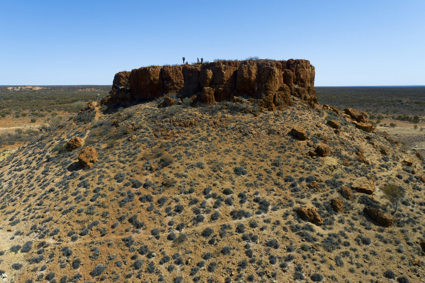
About 300km west of the roadhouse and close to the western extremity of the GVD, the landscape dramatically changes. We’ve now reached breakaway country. The most striking landmark is the rock bastion of Bishop Rileys Pulpit – a freestanding mesa, or flat-topped landform – surrounded by steep rock walls. From the top, the view reveals sparse vegetation. The overgrown dunes have disappeared. So have the marble gums and spinifex grasses. The ground is rocky and barren. Although the landscape is still not entirely devoid of vegetation, some of the terms often associated with deserts now finally apply here; it seems a harsh, bleak, parched and hostile place.


