A zing across a cracked mud plain stretching all the way to the horizon while occasionally peering into a spotting scope to try to spy wildlife at a faraway waterhole, you could be forgiven for thinking you’re on the African savannah. So it’s little surprise this five-day, four-night tour of the River Murray in South Australia is described by its operators as a safari.
The Murray River Safari is a small-group luxury experience operated by Tony Sharley, a former officer with the Murray-Darling Basin Authority. His deep knowledge of this iconic aquatic system, coupled with his passion for the environment, has crafted the perfect short break that’s rich in history and nature, and with just enough adventure to provide a challenge without putting anyone under too much pressure.
It’s a long drive drive from Adelaide to the starting point on Day 1 but we’re not too far up the road before the river begins to weave its way into our hearts when we cross our first bridge over the Murray at Blanchetown. The view of the river and its side channel Cumbunga Creek to our left is startling in its scale; it’s the first hint that everything about the Murray is big. The road mostly follows the river from Waikerie onwards, and we catch the occasional glimpse of magnificent red cliffs as we draw closer to our houseboat mooring a few kilometres upstream of the port of Renmark, where we’ll spend the first two nights of our adventure.
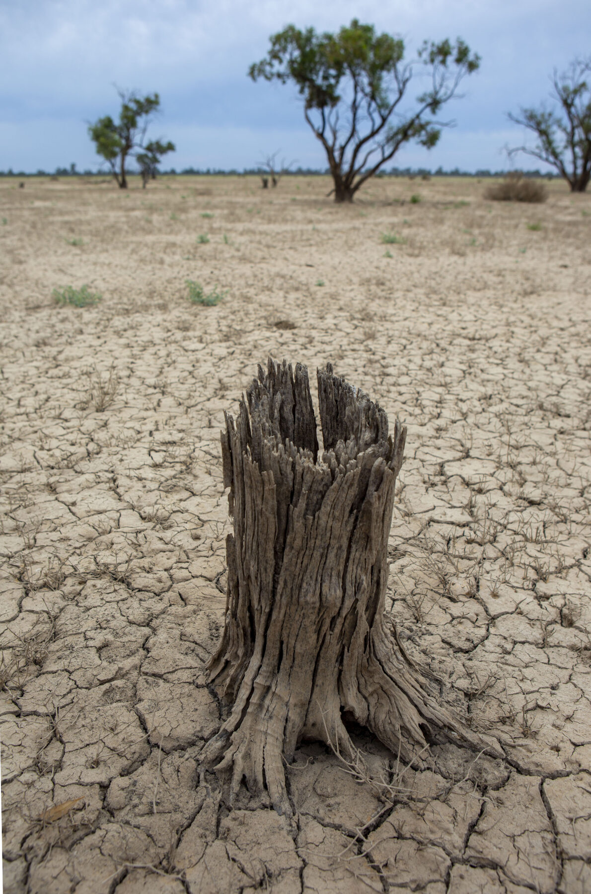
The impacts of a recent major flooding event are evident. The riverbanks are uniformly dressed with a thick layer of dried grey mud, and the high-water mark is clearly visible on the trunks of stately river red gums, some of which still have their feet in the water. The river level remains high as floodwater continues to drain down through the Murray–Darling system from as far away as central Queensland.
It’s great to finally stretch our legs after the bus journey and at Paringa we jump into a tender that will speed us to our superb houseboat, prophetically named High River. Brand new and the biggest houseboat on the Murray, it boasts five ensuite guest bedrooms, and a chic and spacious living–dining area. The roof is vast, and features a big heated spa. It provides the perfect place to stargaze, or set up the tripod to take photos of the spectacular sunrises and sunsets that ignite the red-gold ramparts of the cliffs along the opposite bank.
Tempting though it is to settle into the comfort of High River, there are adventures to be had – and no time to lose – so our host, Heather McNaughton, whisks our party of 10 off to explore the riverplain and those lofty red cliffs that dominate our stretch of the river, known with customary country humour as Crooked Straight.
We make a visit to a former World War II internment camp at Woolenook Bend where Japanese pearl divers from Broome were forced to move after Japan entered the war in 1941. It’s a pleasant spot nowadays and there are relics to explore, including a cricket pitch, faded signage and a few rusted outbuildings.

FAST FACTS
The Murray is Australia’s longest river at 2508km.
It’s believed to be the third-longest navigable river in the world. Only the Amazon and Nile are longer.
It’s part of the Murray–Darling Basin (MDB), which covers about 1 million square kilometres – about one-seventh of Australia.
It supplies water for 1.5 million households.
It supports 16 important wetlands.
There are more than 40 First Nations groups connected to Country in the MDB.
The river has many Indigenous names at various stages along its length, including Milloo at Swan Hill and Murrundi, where we stayed on the houseboat High River.
The MDB is the nation’s breadbasket, producing about 40% of Australia’s agricultural produce.
We visit the vast Murray floodplain for the first time. We’ll spend Day 2 exploring several ephemeral lakes on the plain that have been recharged since the big flood; they are teeming with waterbirds. But today’s parched mudflats draw those comparisons with Africa; it’s just possible to make out mobs of emu and grey kangaroo in the far-off shimmering haze.
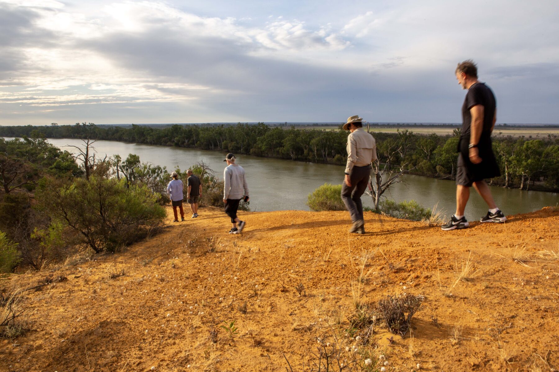
We climb the red cliffs and gain a better perspective of the topography from here. The Murray and associated wetlands, floodplains and billabongs were once part of a larger inland sea that covered much of central and south-eastern Australia. This huge inland aquatic feature, known as the Murray– Darling Basin (MDB), formed during the Jurassic Period some 201–145 million years ago, when Australia was still connected, as part of Gondwana, to Antarctica and South America.
During millions of years the inland sea slowly receded, leaving behind a vast plain covered in sediment and rich in nutrients. The Murray and its tributaries cut deep channels into this plain about 600,000 years ago, creating the meandering waterways and floodplains still visible today.
Within SA the MDB is an important agricultural region, producing crops such as wheat, barley, grapes and citrus. Its wetlands and billabongs are home to a rich variety of wildlife, including waterbirds, fish and reptiles.
Today the river and its wetlands face numerous human-induced challenges, including managed flows that reduce the natural frequency of small floods that are vital for life and biodiversity in a dry landscape. Efforts are being made to protect and restore the ecosystem through the implementation of water-management plans, securing more water for environmental flows, salinity reduction, habitat restoration projects and improved agricultural practices. Tony Sharley hopes visitors will take away a more optimistic view of the troubled watercourse after a few days in its company. His passion is to demonstrate that economies based on nature and ecotourism can far outweigh the irrigation economy – and therefore a better water-sharing agreement must be found. “The Murray has become a very political river,” he says. “Water is so valuable. I think the general public who hear about the river while living in Sydney and Melbourne might think it’s all too complex to understand. The lovely thing about this [tour] is that when we get people out on the river, everyone calms down and they are more in the mood to start understanding it all a bit more.”
From high on the cliff, the challenges facing the river are easily forgotten as the broad ribbon of slow-moving water perfectly reflects the late-afternoon sky, providing us with a prompt that it’s time to descend and embark on a spectacular sunset cruise complete with wine and nibbles.
We’re greeted on Day 2 by a fiery sunrise that can be enjoyed without even getting out of bed. Today, we’ll spend the morning birdwatching on the network of lakes out on the plains and the afternoon kayaking. Heather and her family previously ran a sheep station on the banks of Crooked Straight. Her farmer’s knowledge of these landscapes enhances our understanding of the agricultural history of the region.
We begin our morning safari at Chowilla, a station adjacent to Heather’s former property that’s now in the hands of the Australian Landscape Trust. A section of Chowilla is still owned and run by its original family, and we disembark the tender near its characterful old iron woolshed before boarding a minibus to explore the lakes. As the bus bumps its way along the unsealed road, we hear about the failed 1960s Chowilla Dam proposal that would have inundated most of what we can see to our right, while to our left, a shining silver line of newly erected pylons marches across the landscape– part of a much more modern infrastructure project. The SA–New South Wales interconnector will enable power to flow more easily between states, providing access to much greater numbers of electricity generators.
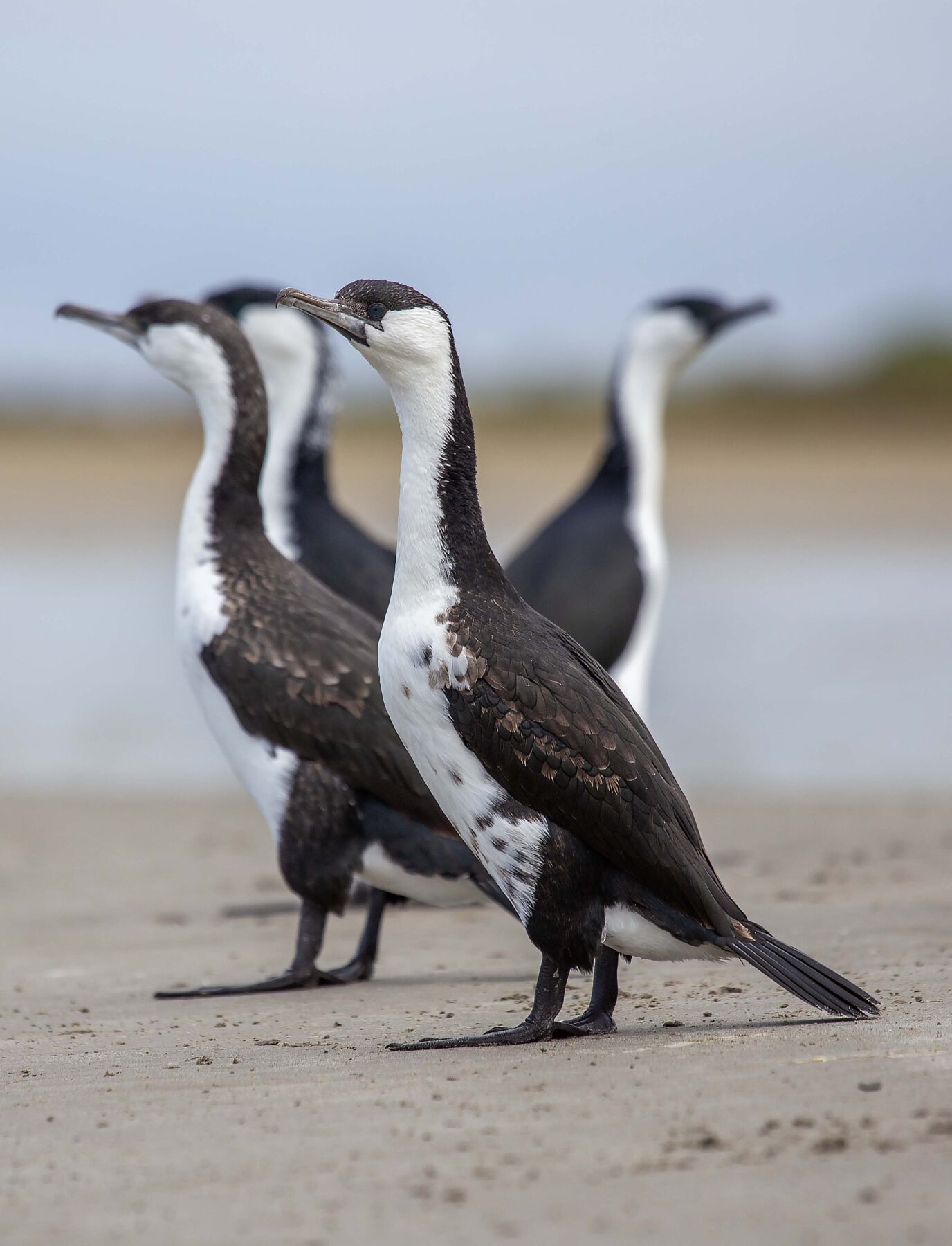
We spot multiple heron and ibis species, spoonbills, pink-eared ducks and tiny waders across a series of permanent and ephemeral lakes, including Coombool Swamp, Gum Flat and Lake Littra. The birds are skittish and easily startled so we keep our distance. Dan Gilgen, our co-guide, extracts a sleeping yabby from its muddy burrow, and we pass weekend hunters rounding up feral goats for sale to lucrative markets in Saudi Arabia.
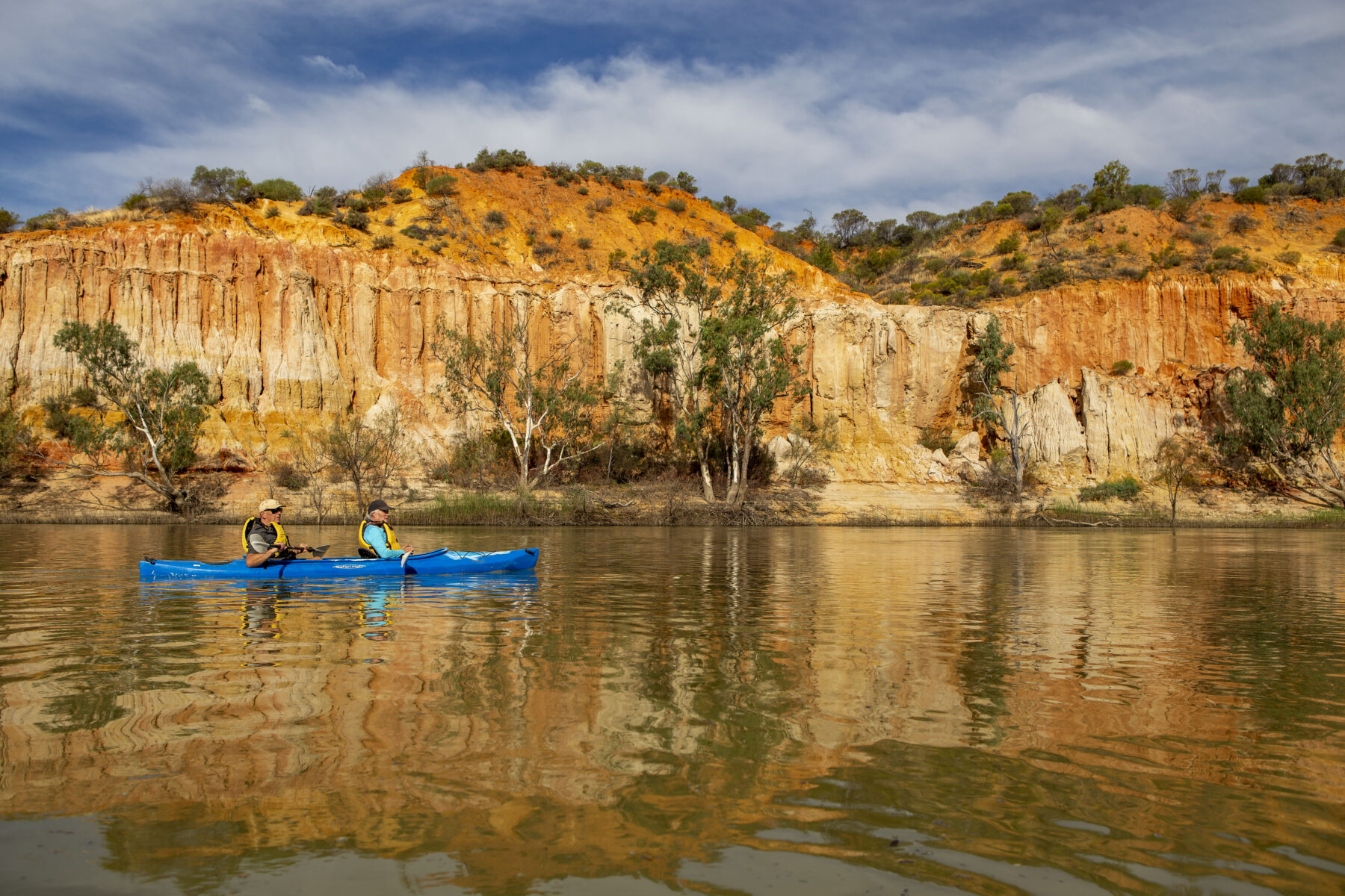
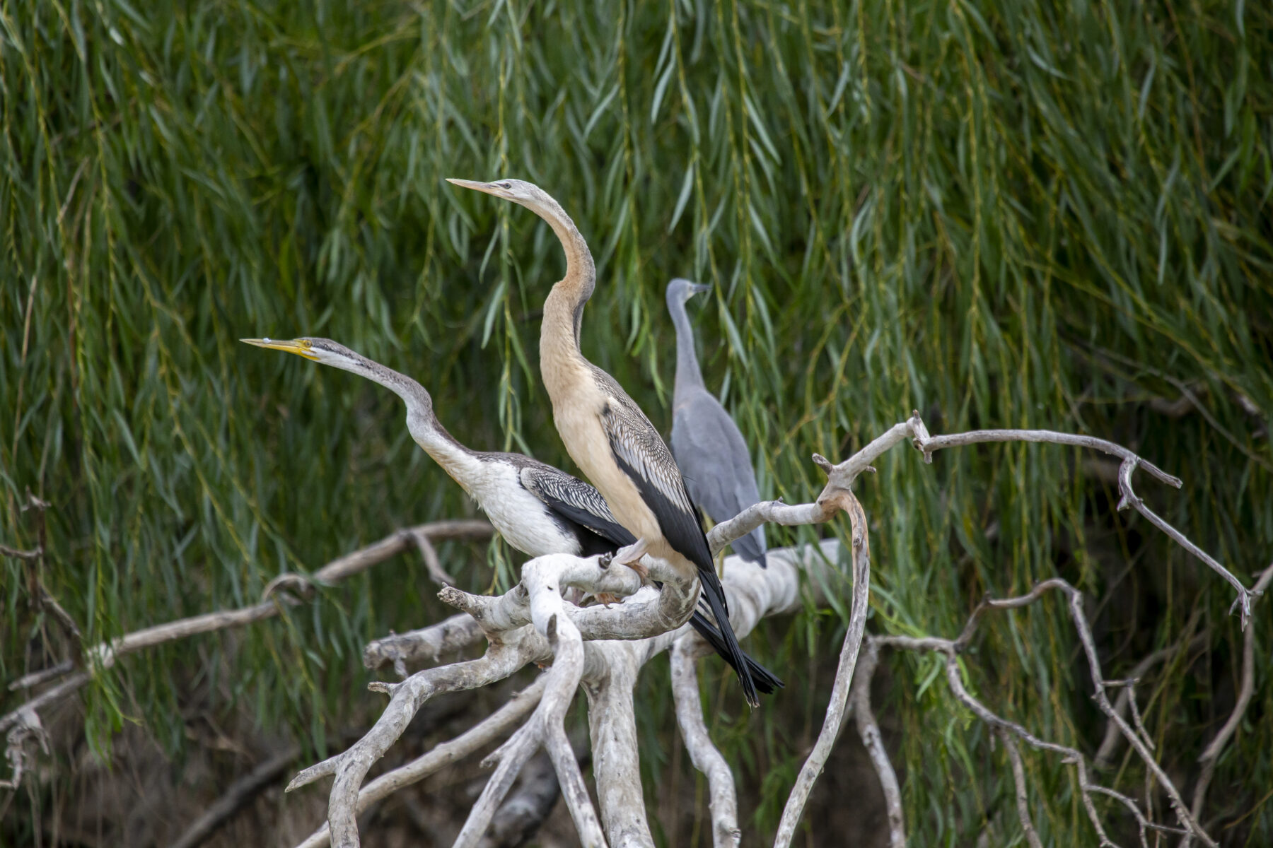
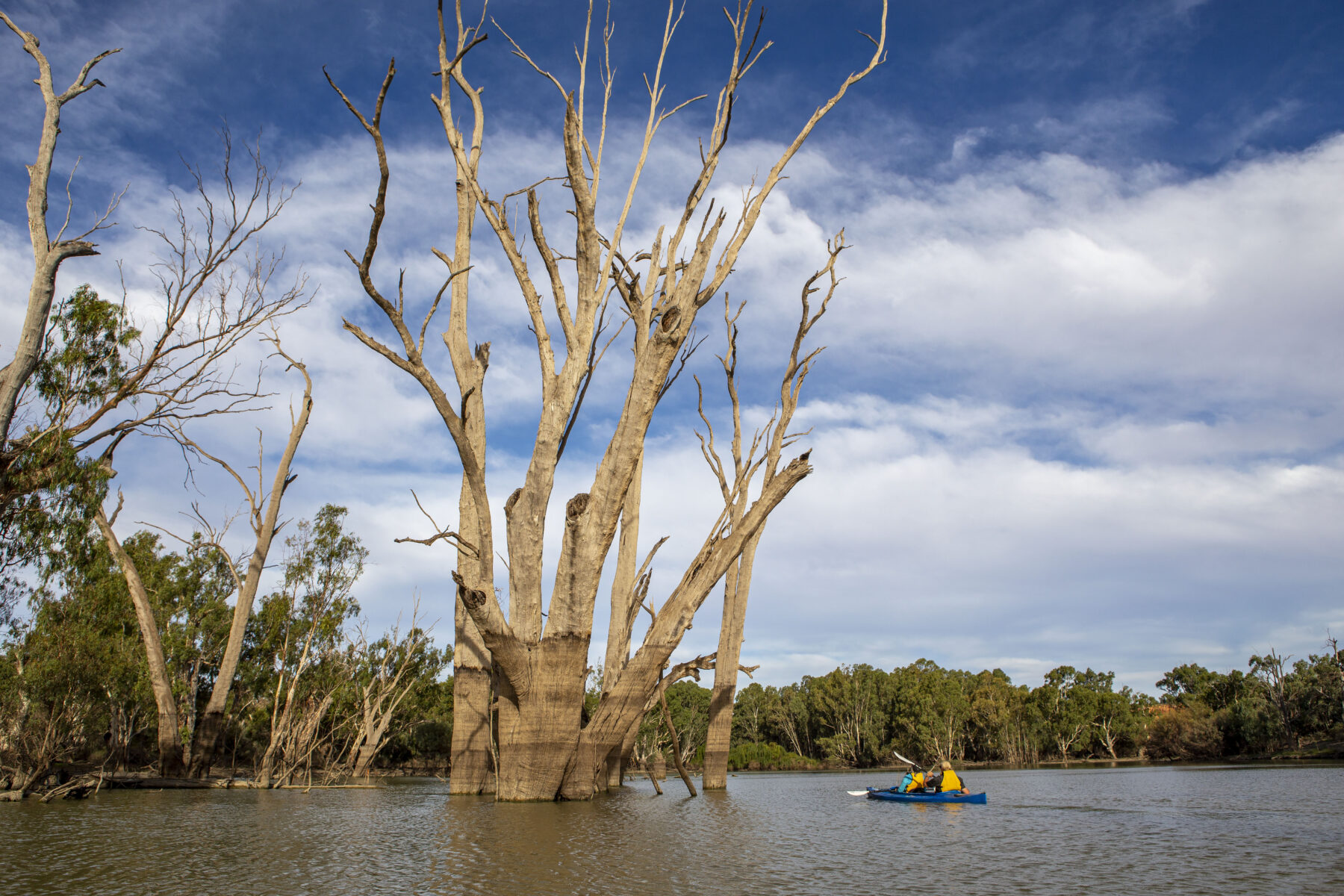
In the afternoon, it’s time for a close encounter with the river and we take to our kayaks. The weather is perfect as our little flotilla drifts downstream, and we exert minimal effort to keep moving. These silent watercraft enable more intimate encounters with the avian denizens of the riverbank. Royal and yellow-billed spoonbills, white-faced herons and Australasian darters abound, while whistling kites circle overhead. The occasional plop betrays the presence of carp in the turbid waters. The river is teeming with this feral fish species. They’re bottom feeders that stir up sediment and are responsible for the murky green hue of the river. Native fish have also increased during the biggest flood in 66 years.
We head down a side channel. The red gums are stupendous – hundreds of years old, gnarled and twisted with exposed roots that feel too shallow to support the bulk towering above. We weave in and out of those that stayed too long in the water and drowned. Their hulking trunks show the levels of more recent floods, but these grand specimens died decades ago and today provide well-established roosts for birds and useful habitat for fish in a perfect example of nature’s closed-loop economy.
All too soon our time in the Murray Riverland region is over. On the morning of Day 3, High River is our conveyance and, with Tony Sharley’s son Kieran at the helm, she moves upstream towards our disembarkation point, moving at a leisurely pace that echoes those paddle-steamers of old that once plied this section of the river.
We join friendly driver and guide Kelly Kuhn aboard a luxury limousine-style bus for the journey to Goolwa in the Coorong, where we will spend the next two nights on land. We stop at Waikerie to see the painted silos and again at Big Bend to take in the extraordinary panoramic view of this broad sweep of the river and its massive cliffs. It’s jaw dropping and hard to capture in a single photo, try though we may.
At Ngaut Ngaut Conservation Park, 17km south of Swan Reach, we meet three members of the Campbell family: Ivy, Sam and Riley. The park is of great cultural and historic significance to the Nganguraku people and contains some of SA’s best examples of ancient petroglyphs (rock carvings). The site also contains other evidence of Aboriginal occupation, including the remains of stone tools, campfires, and hearths. Visitors can usually explore the area on walking tracks or take guided tours, but today the main cultural site at the base of the cliffs is closed because of flood damage.
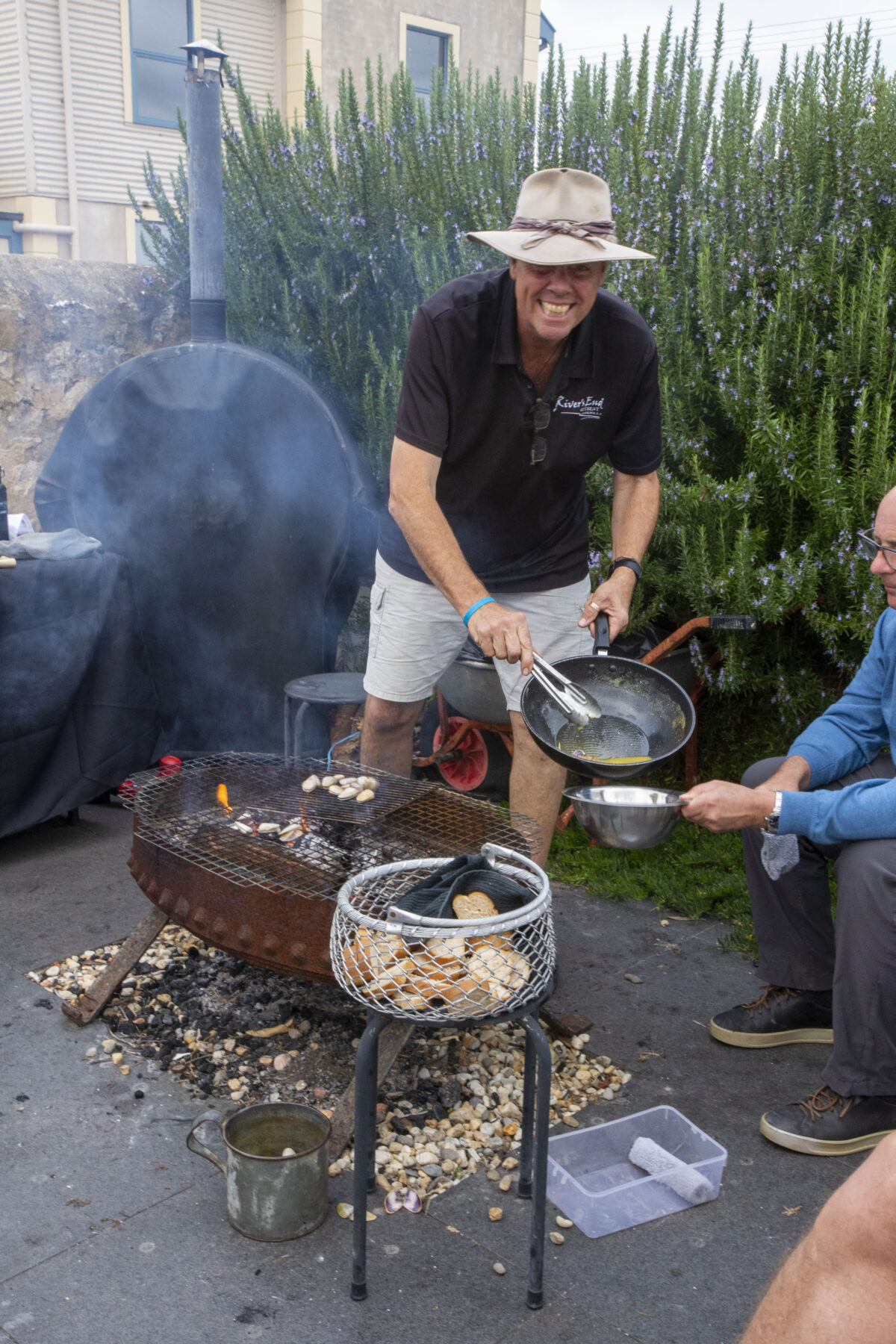
Jamie Bishop, cheerful proprietor of River’s End Retreat, serves up a feast of locally harvested pipi shellfish. 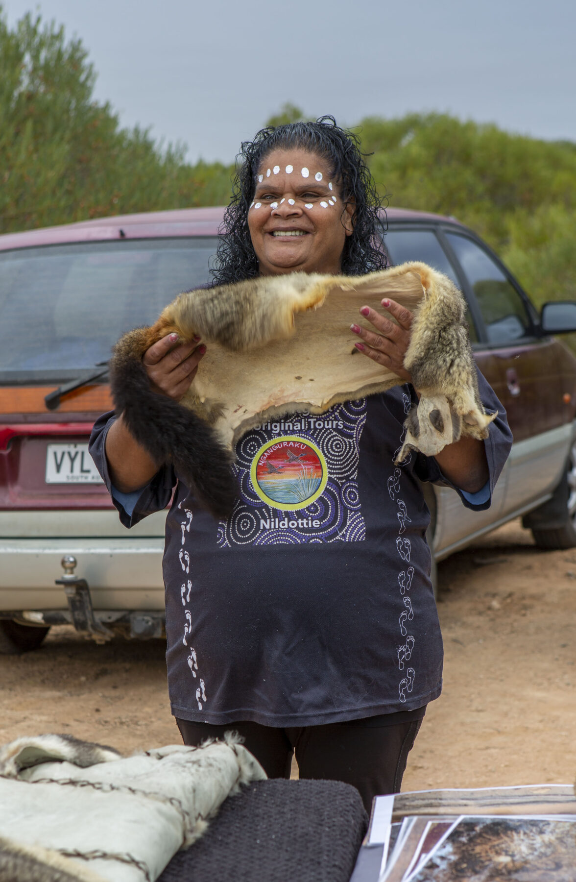
Nganguraku woman Ivy Campbell demonstrates possum-skin cloakmaking at Ngaut Ngaut Conservation Park.
Ivy and her family have prepared an alternative presentation for us. Sam uses smoke to welcome us to Country and Ivy shows us tools, possum-skin cloaks and artefacts and tells stories of her family’s past. Nine-year-old Riley steals the show with his larrikin humour, and it’s clear that Ivy and Sam have a talented future tour guide in the making.
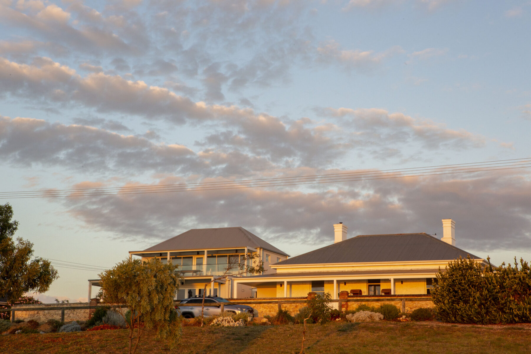
Later that day, we arrive at Goolwa and our home for the next two nights, River’s End Retreat. We’re welcomed by Jamie Bishop, whose family bought the historic home in the 1950s. It was originally built in 1854 by politician and businessman William Younghusband, after whom the nearby Younghusband Peninsula is named. Jamie has restored and extended the colonial building and it’s a comfortable and elegant retreat for the next stage of our river adventure. High on the bank above Goolwa’s historic old wharf and railway station, the verandah provides breathtaking views across this final stage of the Murray before it flows out into the Southern Ocean.
Our last full day on this Murray River Safari will be spent mostly in kayaks exploring Lake Alexandrina and the Coorong dunes close to the Murray mouth. The next morning will bring a chance to visit one of the barrages, constructed to limit salt water from entering the lower lakes so they remain fresh to protect the ecology and sustain irrigation. These audacious, ambitious engineering marvels have attempted to control nature since the early 20th century and define the Murray throughout its course, from when it tumbles off the Alps in NSW right along its 2508km course to the sea. There are three major storage dams and 14 weirs, all of which, except Yarrawonga in Victoria, include a navigation lock. Five barrages were built near the river mouth and tomorrow we will visit Goolwa Barrage. Today, we head over the graceful arc of the Hindmarsh Island Bridge to our rendezvous with the kayaks and Brenton Carle and Leon Mead, our paddling guides for this unique waterway.
The Coorong is a natural wonder – a unique coastal lagoon stretching more than 130km along the SA coast. It’s a Ramsar-listed wetland of international significance due to its rich biodiversity and vital role as a breeding ground for myriad bird species. The Ngarrindjeri, who have inhabited the Coorong for thousands of years, have a deep cultural connection to its land and waterways, and we see evidence of this long custodianship while exploring the dunes. Sheltered natural depressions are carpeted with discarded pipi shells from gatherings that have been held here for millennia. The Coorong is also an important source of commercial seafood, with local fishers harvesting a range of species including cockles, mulloway and flathead.
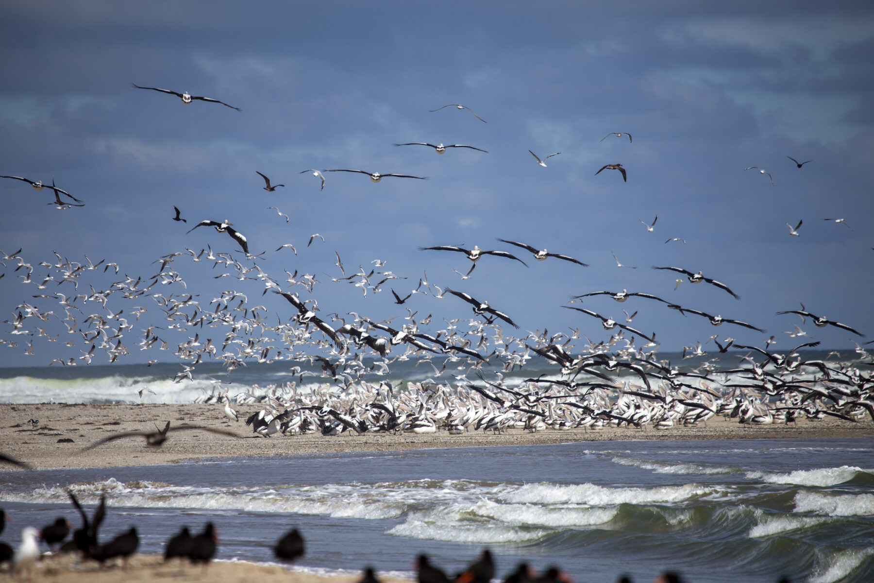
The kayaking on Lake Alexandrina is pleasant as the skies clear and the sun shines on our final day on the water. The murky green of the river becomes brackish and finally turns blue as we approach the Murray mouth in our little boats. We discern the very line where fresh and salt water meet, and it’s possible to taste the difference. On beaches either side of the channel are thousands of shorebirds, mostly pelicans. The sight of this avian assemblage is thrilling, and a birdwatcher’s delight.
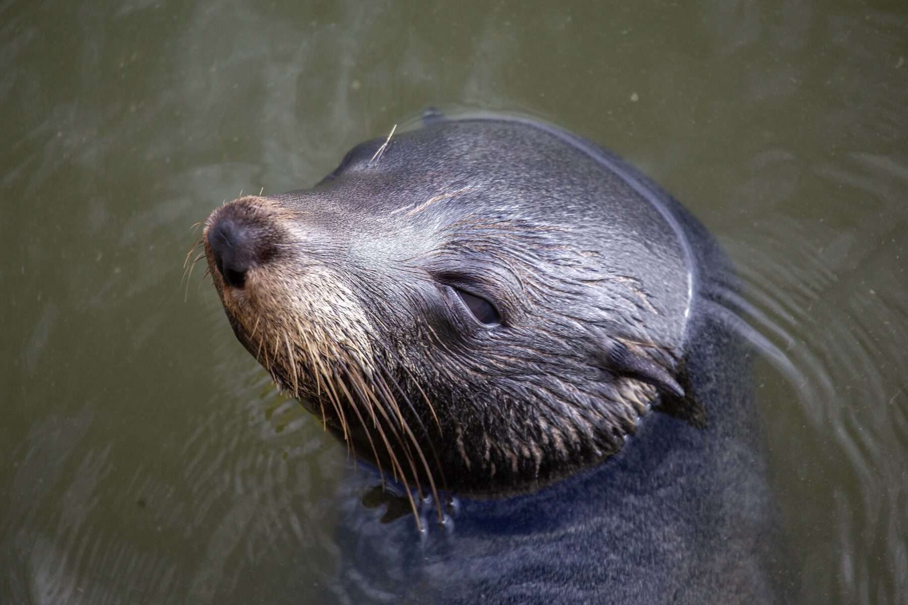
Next morning, we fit in a quick visit to the Goolwa Barrage before heading back to Adelaide and then home. The interpretive signage is helpful to understand its mechanics, and the scale of the barrier as we walk across it is impressive. But it’s a family of resident long-nosed fur seals that provides the surprise natural encounter. Some are precariously sprawled on the struts of a timber trestle, while others frolic and fish in the water. The spot is close to a fish ladder built in the middle of the barrage to assist fish, heading upstream to breed, to navigate the barrier. It creates a perfect funnel directing fish towards one single narrow channel, and it’s one the seals are clearly capitalising on.

We’ve heard much about the environmental and political issues that beset this broad and noble river, and seen evidence of how closely managed it is. But as we prepare to go home there’s something satisfying about the antics of these endearing animals and the way they’ve harnessed all this human infrastructure for their own benefit.
Chrissie Goldrick was a guest of Murray River Trails. She also thanks Australian Wildlife Journeys and Canoe the Coorong for their assistance with this story. Find out how you can travel the mighty Murray with Australian Geographic Travel.