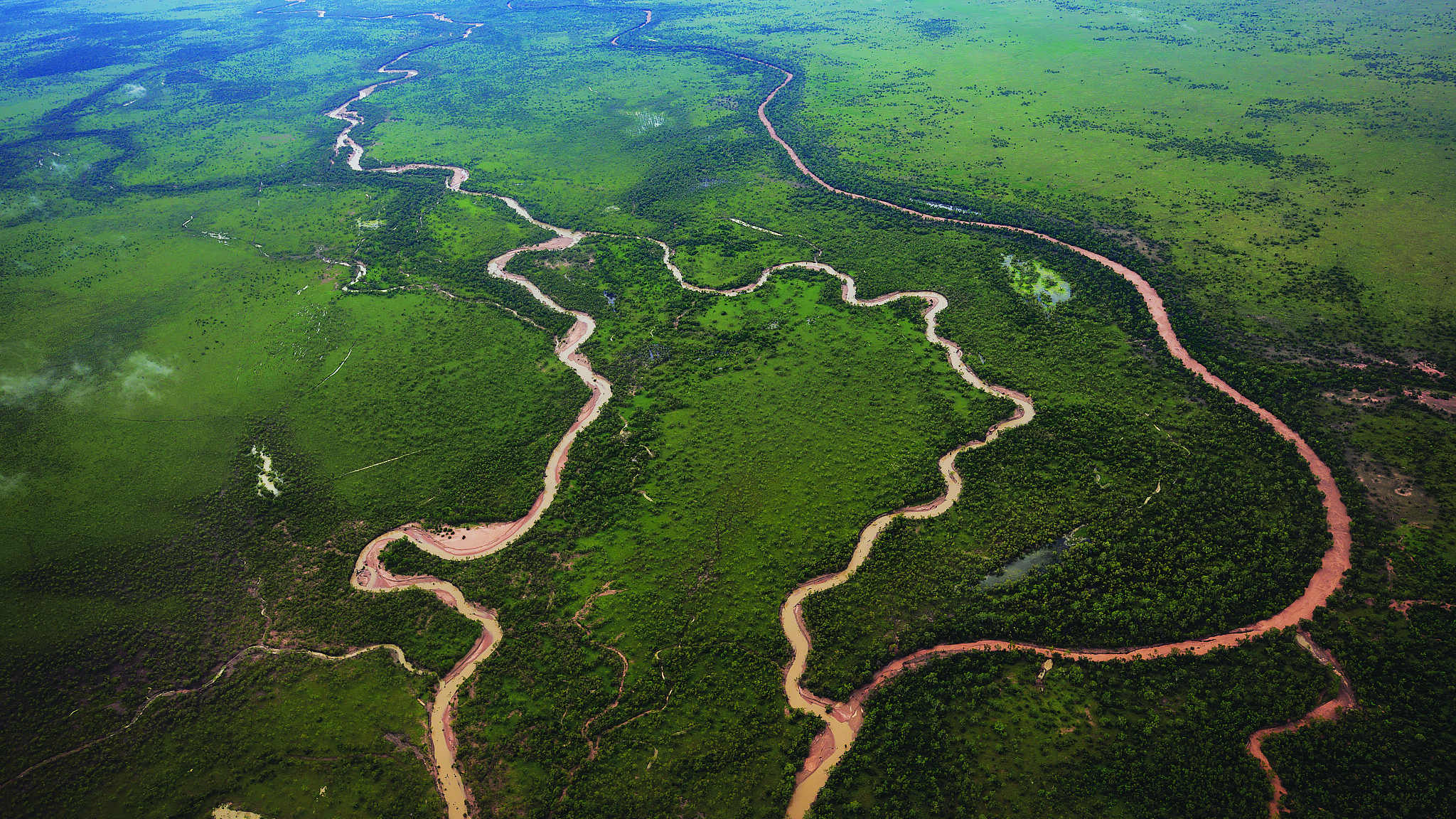
In flood, Martuwarra (known also as the Fitzroy River) becomes one of the planet’s highest volume rivers. Together with its tributaries, it drains much of Western Australia’s Kimberley region as it winds through steep-sided gorges and across savannah floodplains before reaching its delta. From there, as a maze of crocodile-infested tidal mangroves at King Sound, it meets the Indian Ocean.
Heritage-listed nationally because of its extensive cultural and environmental values, Martuwarra, at 735km long, is also WA’s largest listed Aboriginal cultural heritage site. The River and its 20 tributaries flow over the lands of at least nine Indigenous nations, crossing Ngarinyin, Worla, Bunuba, Gooniyandi, Kija, Walmajarri, Mangala, Warrwa and Nyikina countries.
Culture is strong in these parts and Martuwarra is central to identity, law and legend. It is revered as a living ancestral being.
It’s also a volatile watershed that can be reduced to little more than a trickle in places during the Dry, with species that rely on it for survival being restricted to remnant pools. At other times, the entire system floods with monsoonal rains, carrying enormous volumes of water across the landscape.
I’ve experienced this raging river system firsthand multiple times since my first descent of it in 2010. And I’ve led many whitewater rafting and kayaking expeditions on Martuwarra, mostly with friends but sometimes alone.

To reconnect with this truly wild landscape, I’m embarking on a two-week, 400km expedition with a team of fellow adventurers. Our goal is to follow Martuwarra in a 16ft (4.9m) inflatable raft, from the system’s upper reaches to Fitzroy Crossing, about 355km east of Broome. From that point, the threat of saltwater crocodiles becomes too great.
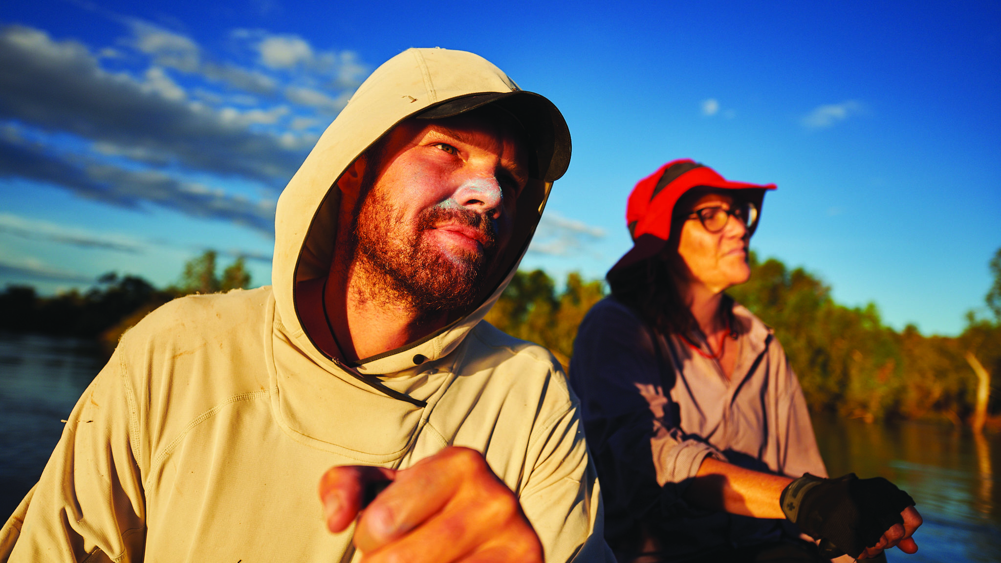
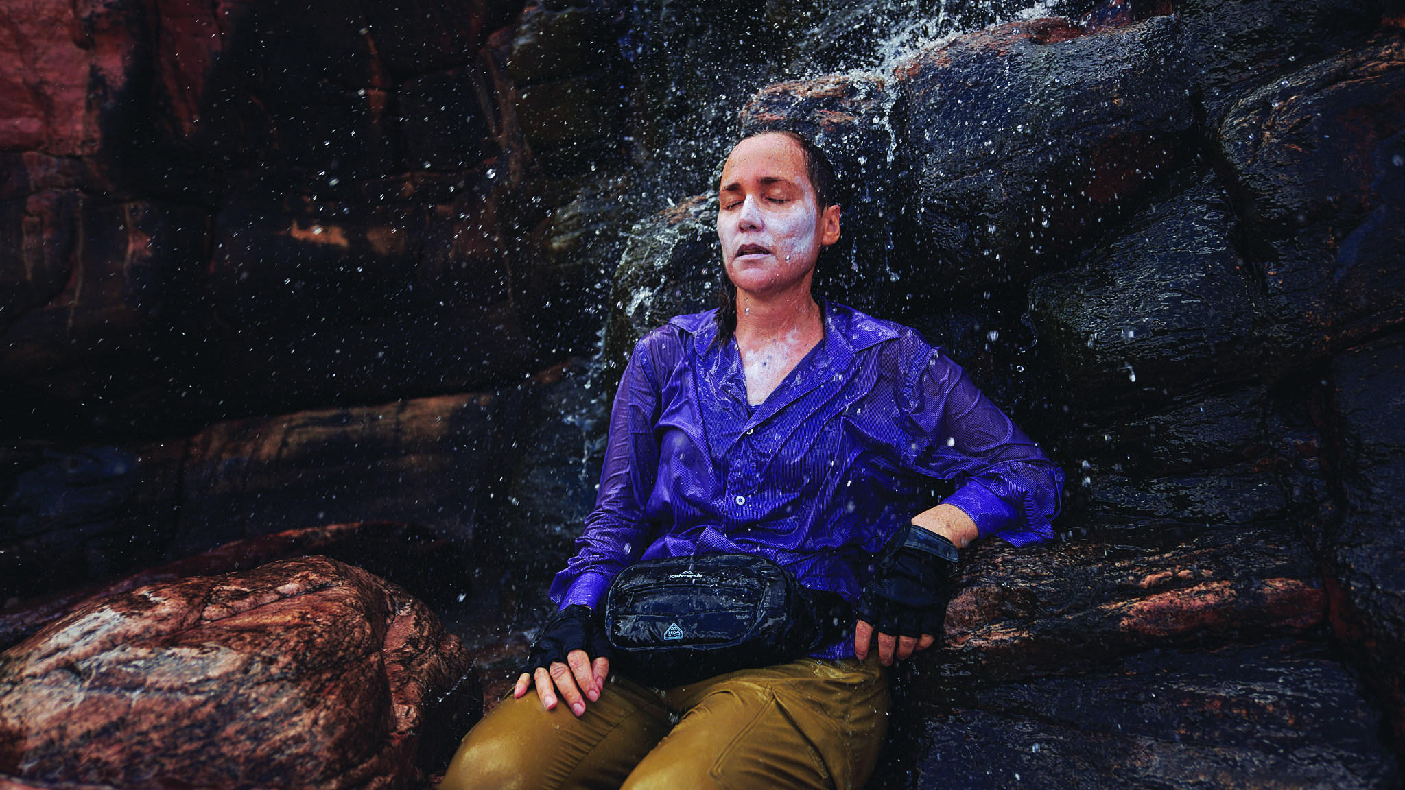
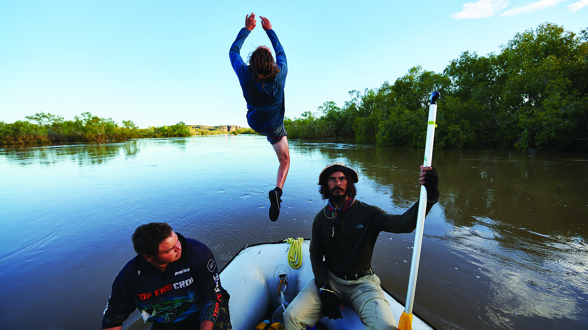
Our team of seven includes Martuwarra rafting veteran and Bunuba man AJ Aiken, his son CJ Aiken, renowned Nyikina artist Mark Coles Smith, photographer Jackson Gallagher and myself, a seasoned whitewater rafter. Also with us is Marianne ‘Ria’ Jago, an acoustic ecologist completing her PhD in “listening to Country” at Queensland’s University of the Sunshine Coast and John Fredericks, supporting the expedition in a kayak that will serve as our safety boat.
With Australian Geographic Society sponsorship, we are self-supported and modestly provisioned for 14 days. It’s March, late in the Wet and the only access to Martuwarra’s headwaters is via light aircraft. Our plan is to fly from Derby, which is situated on the edge of King Sound in far north WA, to our starting point on the Barnett River, one of Martuwarra’s tributaries.
Conveniently for us, the Great Northern Highway meets the River at Fitzroy Crossing. That will be the end point of our on-water journey.
Small, single-engined high-winged planes like this one taking us to our journey’s starting point are the workhorses of the Kimberley. It rattles like the gates of a rodeo chute holding back a bronco, and as its wheels leave the hot tarmac, a breeze streams through the slightly open window, offering reprieve from the stifling humidity.
Once we’re properly airborne, I get a sense of what we’re in for. Seemingly endless expanses of open space stretch below us, punctuated with rocky orange escarpments and scattered blankets of brilliant green vegetation. Water vapour rises from the earth, confirming we’re in the Wet. There is only one way forward now and I’m nervous.
I try to convince myself that all will be well, despite the remoteness and inaccessibility of this river system and how unpredictable the conditions can be. “It’s all good. You’ve got this,” I tell myself. “Get some rest.”
I close my eyes but can’t sleep.

the River.
Our first strokes on the Martuwarra system are in the Barnett River, in Ngarinyin Country – home to the Wandjina, powerful Creation spirits associated with rain.
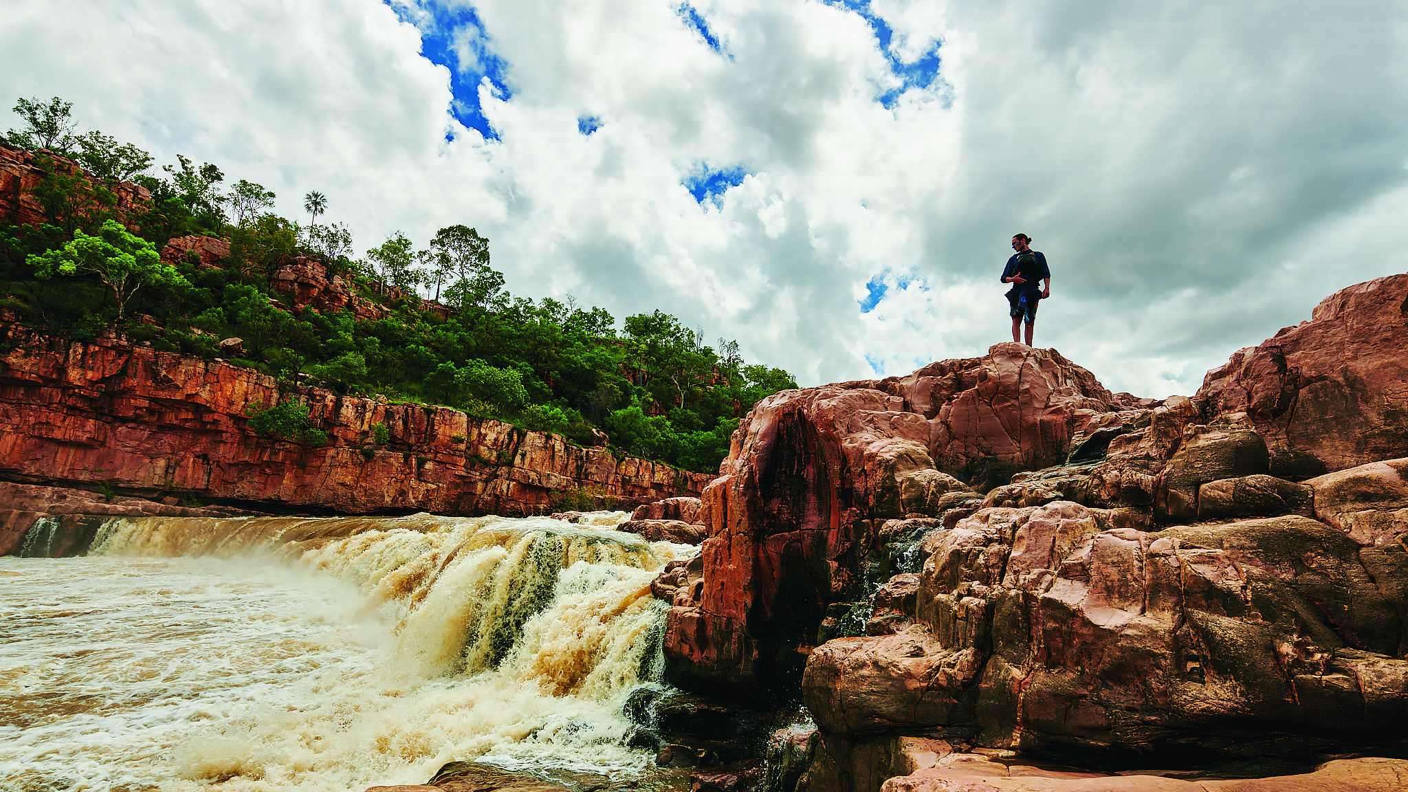
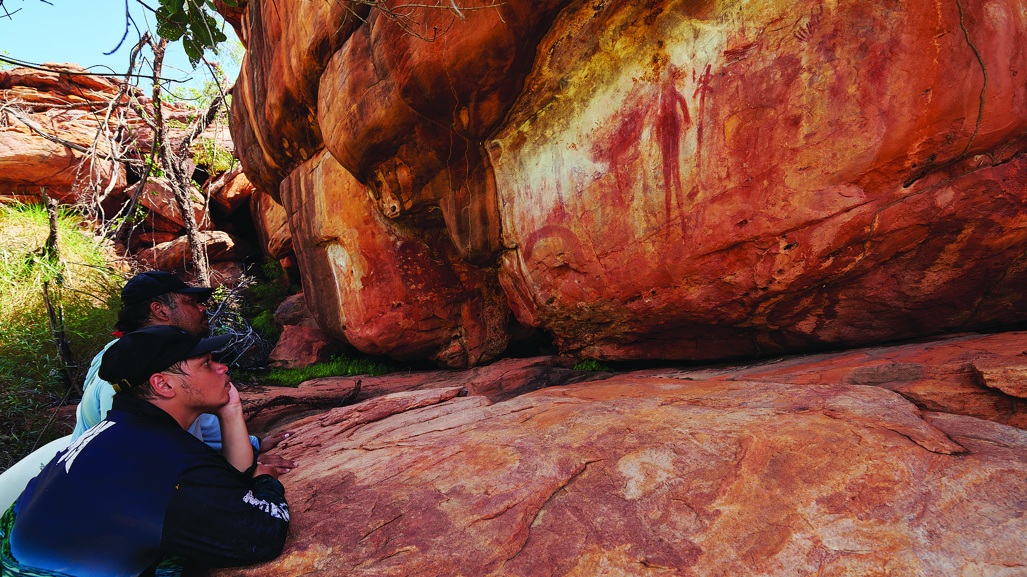
What a place to start. Representations of Creation beings adorn the ancient landscape’s sacred rock faces. We settle into the rhythms of life on the River, hopeful there will be enough water to carry us all the way through the remote passage to Fitzroy Crossing. March is historically not a high-water month on the Martuwarra system, but thankfully the skies are black. Dropping water levels are a concern for our safe passage.
“Bring the rain; send us all the way,” AJ yells in Bunuba. Just as he finishes his entreaty, the rattling boom from a large thunderhead cloud silences the team and makes the hairs stand up on the backs of our necks. It feels like the Wandjina have heard AJ.
Don’t tempt fate, I think, respecting the immense power of the country we are in.
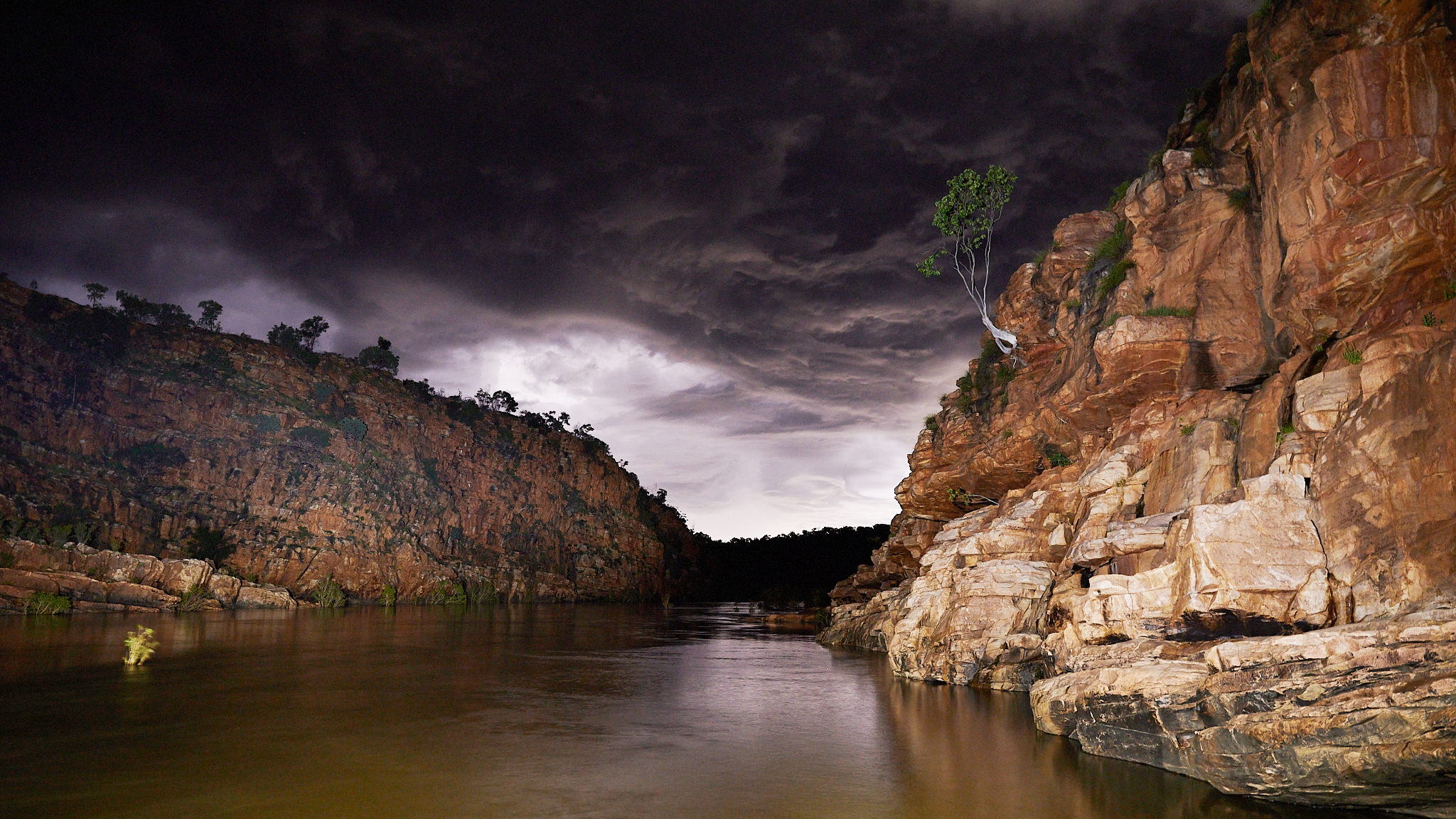
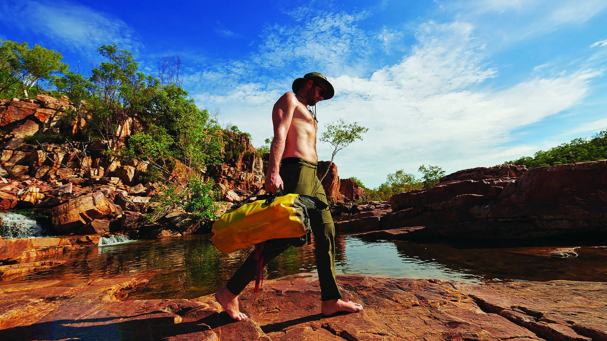
We are soon surrounded by summits that reach up to 600m above sea level. They drop steeply into deep ravines, cutting through shelves of sandstone. This section is particularly inaccessible and seldom visited. Permission is needed from the Traditional Owners to enter.
These ranges were the final frontier for colonists who only fully penetrated the region to establish pastoralism after the fall in 1897 of Jandamarra, leader of an Indigenous-led armed resistance. But the canyons are too rugged to be easily navigated on horseback, so have remained relatively untouched. Looking up from a boulder-strewn, walled-in canyon, I can see why these ranges are so rarely visited.
The first two gorges we travel through dissect the ranges and are drop pool–style rapids full of white water. We take our time in these sections. In places, the River itself almost feels lonely.
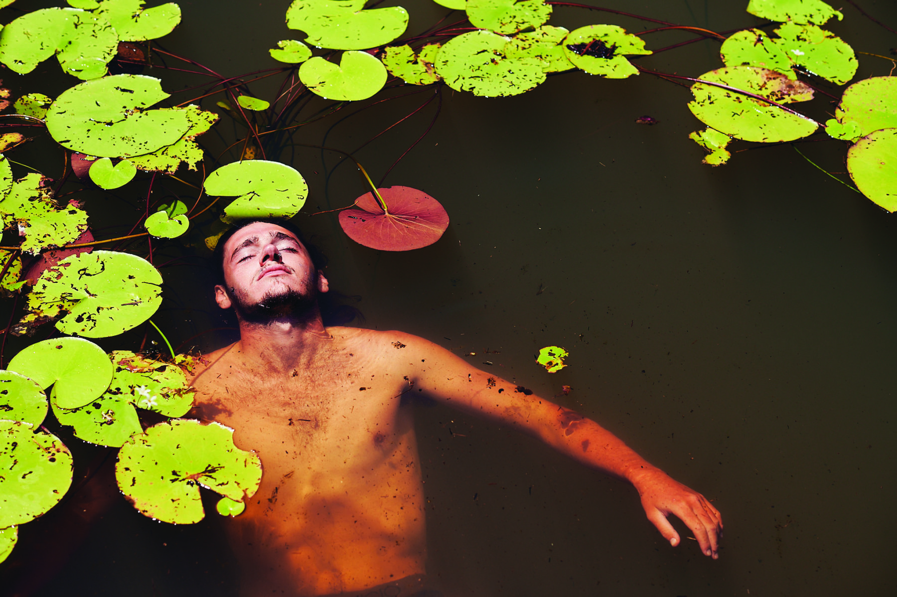
The sounds of the prolific bird and insect life are deafening; a goanna splashes into the water and curious freshwater crocodiles check us out. It is an ancient landscape, seemingly untouched by time. We fish, laugh and swim. AJ keeps calling for rain.
Looking up from a boulder-strewn, walled-in canyon, i can see why these ranges are so rarely visited
After five days we emerge at the bottom of our first major portion of white water. We rush to set up camp – it looks as if we have some big rain coming. The sky blackens, thunder rattles though our bones and lightning cracks all around us.
Just as we finish cooking our dinner, the rain starts and it comes down hard. We retreat, trying to keep our sleeping space dry as the downfall intensifies, hammering down on us. It’s torrential and comes in sideways. In Nyikina they have a word for this: larrb (a heavy downpour that thrashes and beats down).
A grey dawn emerges from a blanket of cloud and drizzle. Everyone is cold and no-one has slept, but we load the raft and continue on. The next 100km meanders across the largest wetland in the Kimberley. This section has a few names: the Badlands, Yoda’s Swamp and Gladstone Lake. Badlands seems most fitting.
The monsoonal rain continues as we navigate along an endless maze of corridors. Huge spiders cling to webs in the canopy above us. Large huntsmen crawl all over the raft. A golden orb-weaving spider as large as my fist runs up my neck and onto my hat searching for higher ground. It’s the first of many to do so. They don’t bother me, but I soon learn Mark is scared of them: despite us having been good mates for years I didn’t know this about him until now and take great amusement in his discomfort.
“Left or right channel, Mark?” I ask as we hit a fork. Hundreds of large spiderwebs hang over each channel. Mark makes a nervous noise. I laugh. It’s nice to see a little chink in the big man’s armour. “Left it is!” I say, gleefully. For the next couple of days, the vegetation remains thickly covered with webs.
The Badlands are testing. The days of paddling are long: bat colonies flank the River; as well as the spiders we encounter freshwater crocodiles; and, in the vast water body, we easily lose sight of the riverbanks and stray off track. Tangled in a thicket of melaleuca and pandanus trees, I check the GPS. The River is 5km away. There is so much water here we’ve veered off course – once a little creek, the water body now covers the floodplain. My earlier concerns about there not being enough water are replaced by fears that there may be too much. We joke that we may never escape the purgatory of the Badlands.
The water level is constantly rising. It hasn’t stopped raining for days, and from horizon to horizon the sky is filled with dark, heavy clouds. As we approach the Wunaamin Miliwundi Ranges, a number of major tributaries join Martuwarra. The catchment is now massive – half the size of Tasmania. We are paddling on what seems like an ocean. It takes almost an hour to travel from one side to the other of the vast, complex current before we reach our next canyon.
I’ve never seen so much water seething between the rock walls here. The first rapid is full of giant whirlpools. The Elders of this country say the water serpent Gala-ru lives in the depths and if you swim out there it will kill you. Looking out over the churning water, I agree that attempting to swim there would be suicidal: you’d be giving yourself to the River.
Our next day is a rest day. We all need it. At this stage of our expedition, the days are merging into each other. We are fully engulfed in our quest, working together like tiny ants to make our way down the giant flooded River, hoping we’ll make it. It’s humbling to follow the River further into the flood. We’re perched above the most dangerous section of white water. I’m concerned about the conditions, worried there may be too much risk involved for us to continue.
We joke that we may never escape the purgatory of the badlands.
John heads out on his kayak to “surf a wave” while the team cooks dinner. After a while Ria notes that he’s been gone for a long time. Night settles in and there is still no sign of him. Eventually he appears…without the kayak. “I was sucked out of my kayak by a massive whirlpool,” he says, clearly shaken. “It’s gone – I almost didn’t make it to dry ground.”
The situation just got a lot more serious. We now have no safety boat, so all seven of us, as well as two weeks’ worth of expedition gear, will need to fit in the raft. The River is higher than I’ve ever seen it and we are in an extremely remote canyon.
Our safest bet is to leave the gear here and hike to a station to be airlifted out. I call one of the best bush pilots the Kimberley has to offer on the satellite phone. “No chance, mate,” he says. “Maybe in five days if this low-pressure system clears up.”
I know from my numerous trips into the gorge that the biggest rapids are just around the corner. I’d intended for us to portage these drops, carrying our gear overland to skip these rapids and rejoin the River downstream.
But with the water lapping against the vertical canyon walls, it’s clear this is not an option. At these flows, with seven people in the raft, we would capsize upon entering the current. The chance of us not losing at least one person to the tremendously powerful River would be slim.
After a day of contemplation, the group and I make the only call we can. We don’t have enough food to wait for the water level to drop, so we decide the team will hike out of the canyon and continue on foot beyond the dangerous section. We’ll then rejoin the River and complete the journey with all seven of us in the raft, despite no longer having the safety kayak.
The only problem is there is too much gear for us to carry. John and I decide to stay behind to navigate the raft through the rapids. We wish the team a good hike, pull on two life jackets each and get into the raft, which is now significantly lighter.
This isn’t fun anymore.
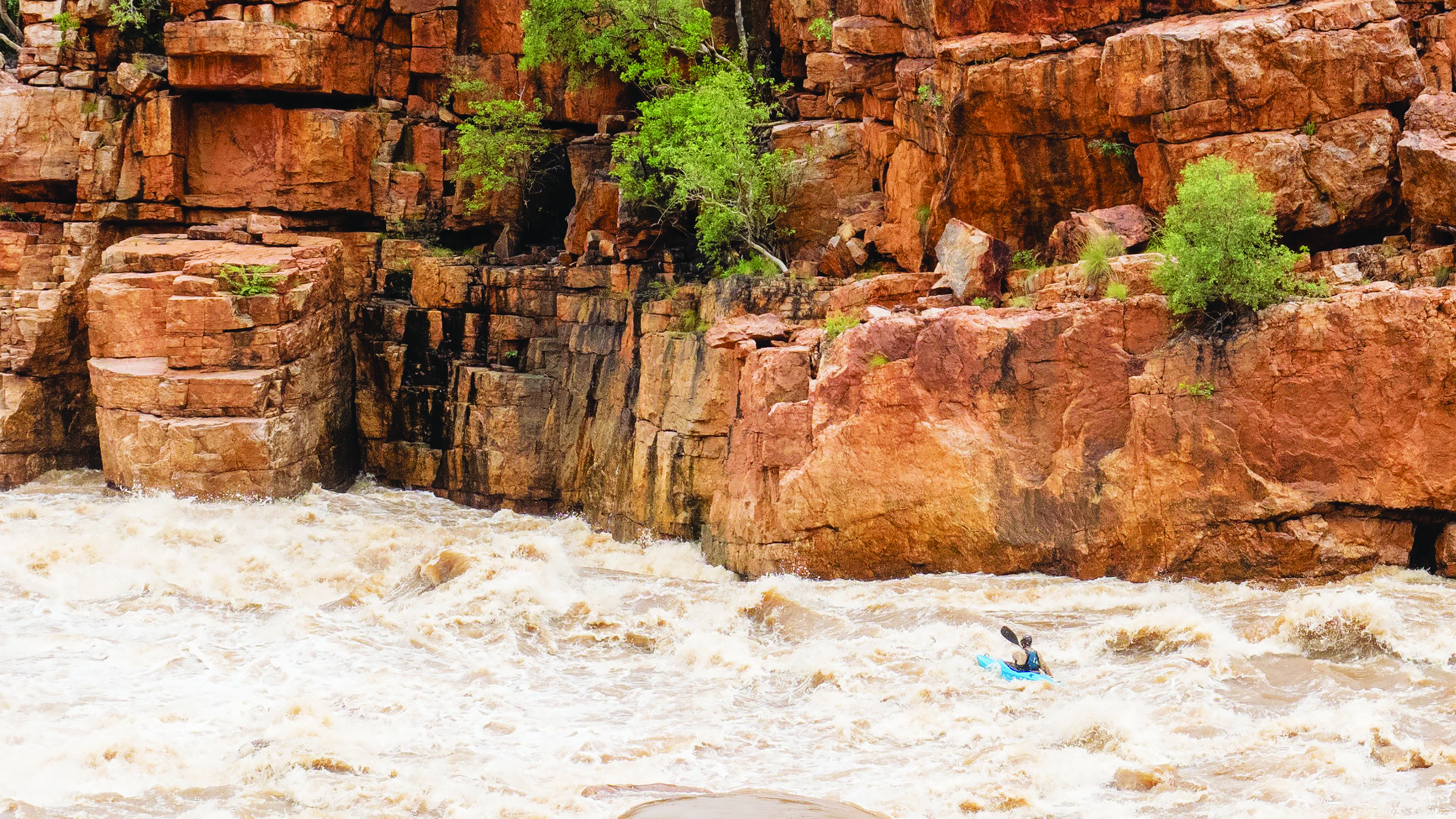
I don’t want to roll the dice with the River gods, the serpent or any other transcendent force waiting in the depths for me to make a mistake but it’s our best option. After five minutes on the River, John and I get out and walk along the canyon rim for the better part of the day. We look down at the massive rapid forged for giants. The 15m-high cliff jump we usually do while on this section of the River is now completely under water. On the canyon walls, rock art estimated to be 40–60,000 years old has water lapping at it. Looking down, we can see whirlpools much larger than our raft developing. These powerful vortices could suck us so deep underwater that chances are we wouldn’t resurface.
By the time we get back to the raft the sun is setting. Truth be told, I’m terrified. I just want to be safe at the bottom, reuniting with the team. With only 20 minutes of daylight left, it seems too risky to get back on the water. I ask John what he thinks we should do. “Let’s go; let’s get out of here,” he says.
“Do you have at least two flips in you?” I ask. He says he does. Already exhausted, I’m not sure I have the energy to manage two capsizes, but with the daylight fading, I know we don’t have time to keep talking about it.
Paddling white water of this size is a unique experience. The immense volume of water refracts and churns in every direction, bouncing off walls, circulating in vortices, and funnelling into underwater caves. There are dumping waves the size of small buildings.
I don’t want to roll the dice with the River gods, the serpent or any other transcendent force waiting in the depths for me to make a mistake but it’s our best option.
We push out into the current. Hacking at the water with our paddles, we feel defenceless against the assault of white water. We hack, hack and hack, desperately trying to position the raft on the narrow navigable path.
The largest rapid is just ahead of us and we both know the raft is going to flip. If we can make it far enough left at the top, we won’t be pushed into a siphon that is drawing up to 75 per cent of the River’s flow and where the water is sucked through a pile of rocks that could trap us under the surface indefinitely. We dig in with all we have, pulling with every bit of strength we can muster. We make it over the first big wave. The second one flips us over. We’re still above the siphon and could easily be pulled in. I hold on for dear life. The paddle is torn from my hands, but I don’t let go of the raft. My shoes are the next thing the River takes. They’re ripped off my feet. I feel as if I’m in a washing machine that’s been thrown off a cliff.
The violence momentarily subsides and I see that we are past the siphon. I don’t know whether John is still holding on and I climb on top of the upside-down raft to look for him.
John is there. I pull him up and we right the raft. John hands me his paddle and unties a spare in the boat. It’s now pretty much dark, and we’re in the thick of it.
“Jump left! Now jump right!” I scream as I attempt to square up the features I can see in the diminishing light to stop us from flipping again. Night falls, and we’re still in the white water.
We push on into the darkness, and within half an hour reach the bottom of the gorge. There is no sign of our crew. We set up camp. The next day, again nothing. Still no sign of our teammates.
About 40 hours later the team finally limps to the rendezvous coordinates. Mark hands me a super-heavy bag and collapses on the ground. Everyone else is quiet. It’s clear the hike was brutal. What we’d thought would be a half-day walk turned out to be a 30km slog through a knee-deep sludge of black soil.
At the top of the next canyon, with all of us aboard, the raft is flipped by a wave but the conditions here are far calmer than what John and I experienced upstream so I’m not stressed. I can’t say the same for CJ. As he returns to the surface, he gasps for air with wide eyes after having been sucked under water to a great depth. We push on.
Night falls and we arrive at Danggu Geikie Gorge. It’s bathed in the light of the full moon. The shapes of animals come alive from the limestone walls and we’re regaled with stories by an ecstatic AJ who is finally back in “his place, his Country”. The road is within earshot. It’s day 16 of the expedition. We drag the boat out of the water and simply lie down. For me, sleep comes quickly.
By 10 the next morning, I’m standing in an air-conditioned cafe ordering an iced coffee and a smoothie, still covered in mud. I ask Jackson and Ria if they’ve had fun. Looking tired, dehydrated and traumatised, they don’t respond.
Once we’re hydrated and unpacking what’s happened, AJ lets us know we’re in Bunuba Country. We’re surrounded by some of the first pastoral leases set up in the Kimberley (c.1886), including Fossil Downs, Leopold Downs and Brooking Springs. These places are of great historical significance in the story of Jandamarra’s resistance to the pastoralisation of the Kimberley. “Threats to the area continue to this day, especially as we now approach the lower catchment,” Jackson says, referring to water harvesting, fracking and mining. “The main stakeholders are already the wealthiest in Australia.”
What’s evident from our expedition is that Martuwarra does not exist in isolation; it’s a complex web of ecology, hydrology, community and culture. What affects one section of the River affects the whole system. In Nyikina they say “yimardoowarra”: I belong to the River, not the other way around.
To help protect the river system, the Martuwarra Fitzroy River Council of Traditional Owners is starting a River Keepers program that encourages young Indigenous people from various nations to work together to care for the whole catchment, incubating sustainable economic development with a focus on environmental and cultural preservation.
The skies are blue and I’m left with a sense of hope for the future.
Lachie Carracher thanks Martuwarra for providing safe passage, and the Council of Traditional Owners for allowing the team to visit. Learn more about Martuwarra and the Council of Traditional Owners at martuwarrafitzroyriver.org