From the sea to the mountain
Tropical North Queensland (TNQ) is renowned for its magic coastline. From Cardwell in the south (with the hike and paddle icon of Hinchinbrook Island offshore), to the TNQ ‘capital’ of Cairns, it is easy to explore this amazing landscape. From the beautiful beaches and water of the Coral Sea, to the green hills of the hinterland, from gorges and waterfalls, to 4WD touring and fun mountain bike trails, you will want to take your time on this route.
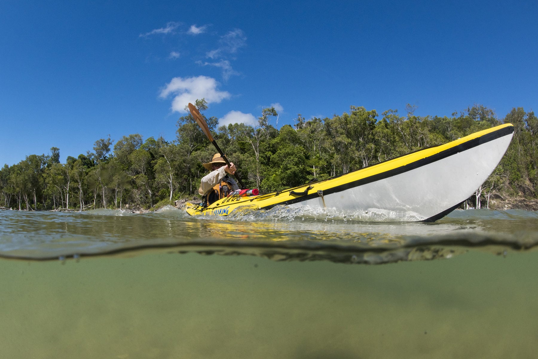
For kayakers, a sunrise paddle off Mission Beach is a definite. The chance to spend time in this pretty village, paddle a few offshore islands (the Family Islands) and spot plenty of marine life makes a great start to this journey. Speaking of being fortunate, if you are even more so, you may spot the elusive cassowary wandering along the beaches here – this part of TNQ has a high density of these native flightless birds. A note of caution: the cassowary is not road-aware, please drive carefully.
For more in this magic part of the coast, check out Mission Beach Charters’ snorkelling and diving trips – you can even camp on your ‘own’ island for a night.
For MTB explorers, the next stop is northwest, into the forest-clad ranges of Tully Gorge and Wooroonooran national parks. Here, in the Misty Mountains, you can access tracks that offer the chance to really explore these two national parks. Each track or road is graded either Green (easy) or Blue (intermediate) and there’s one Black (hard) grade route – the Cardwell Range Track. Top rides include the Blue-grade Gorrell Track (25.8km one-way; the trailhead is via the town of Mena Creek, northwest of Silkwood) and, for families, we’d recommend the K-Tree, Bora Ground and Maalan Roads track (15km one-way; Easy). The trailhead is off the Palmerston Highway and it is a loop that takes you back to the Palmerston Hwy and then it’s downhill to your car.
One final activity y you can’t miss on this Cardwell-Cairns journey is the hike up Mt Bartle-Frere which is, at 1622m, Queensland’s tallest peak. The 15km return trek from the eastern side is a challenge but one that any fit person can accomplish in a day with an early start (you can also hike it from the western side, with the start point a quarter of the way up the mountain – nice!). The hike begins at Josephine Falls carpark and you will cross numerous creeks, before the steep climb up to Eastern Summit Camp. If you do have the time, it’s well worth camping a night here. After the campsite, you continue on to the rugged, rocky summit. It’s a big day but a brilliant achievement and the views from the top are incredible. Plus, at the end, back at Josephine Falls, you can reward yourself with a swim before continuing north on to Cairns.
Chasing waterfalls
We’re not sure if Australia actually has a “waterfall appreciation society”, but if there were such a thing, Tropical North Queensland would be its spiritual home. The region’s combination of high rainfall, powerful rivers and steep escarpments, result in an abundance of waterfalls, fed by myriad streams that run off the surrounding high peaks. As a basis for a memorable TNQ road-trip, it is hard to beat, with your only ‘problem’ (and we use that term loosely) being how many you can fit in. Here’s our suggestion for a two- to three-day waterfall loop starting and finishing at Cairns.

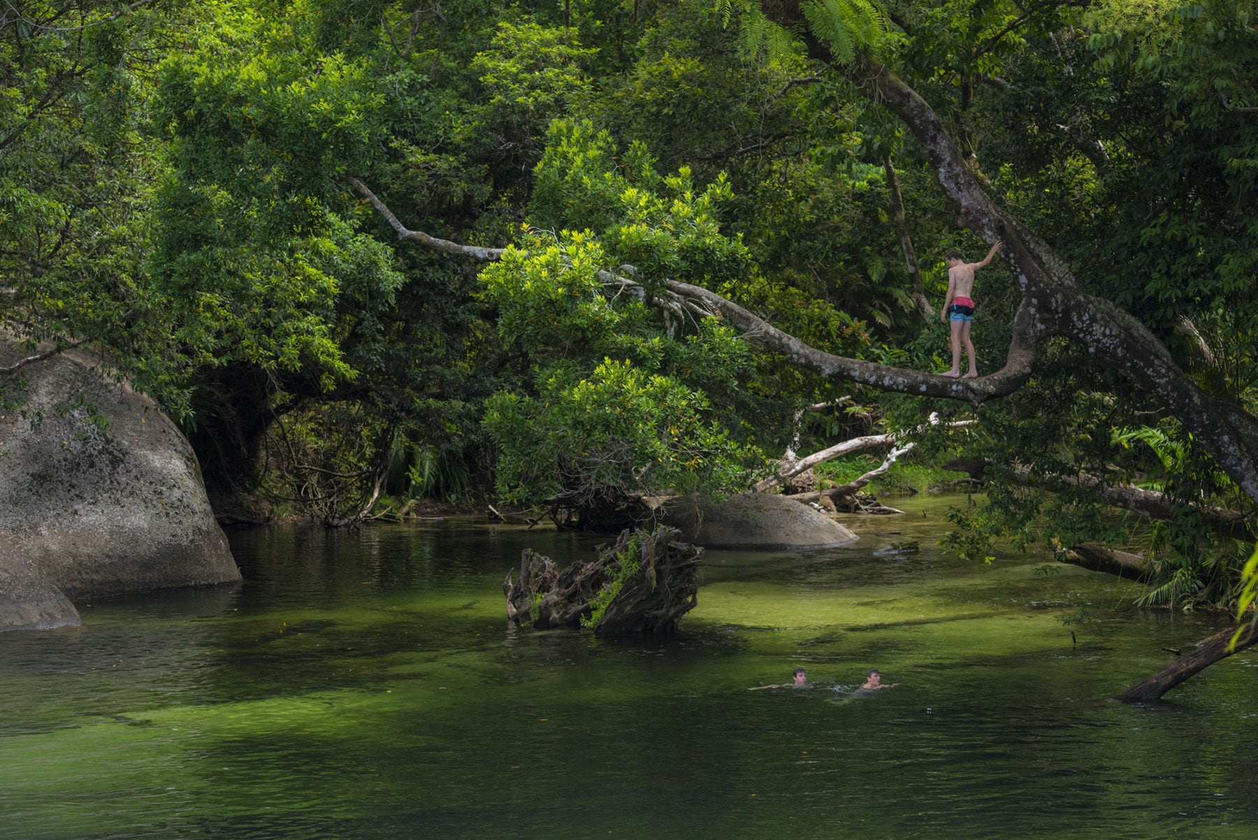
Located at the base of Mt Bartle Frere (Queensland’s highest peak, at 1622m) in Wooroonooran National Park, Josephine Falls is a spectacular, multi-tiered waterfall, and one that is very easy to access, being only an hour’s drive south along the Bruce Highway (A1) from Cairns. From the carpark, Josephine Falls is about a five-minute (600m) walk through dense rainforest to the Bottom Pool. This pool is the most popular for swimming as it is wide, relatively shallow, and spacious.
There are three separate pools that make up the falls, with Bottom Pool and Middle Creek accessible and open for swimming. Top Pool and the smaller pool above are considered off-limits as the cliffs and rocks here are steep and slippery. There are two viewing platforms (at Bottom Pool and Middle Creek) that provide excellent photographic viewpoints. These, plus the swimming, make it very easy to spend a full day here – but we have other plans…
From Josephine Falls, take the Palmerston Highway west to the Tablelands. There’s a good reason for the Palmerston Hwy suggestion: Nandroya Falls is the third waterfall of a cluster in the Palmerston area of Wooroonooran National Park, that includes nearby Wallicher and Tchupala (you can do a half-day hike that takes in all three, starting at Henrietta Creek camping area). Nandroya is different in appearance to its southern neighbours, with the waters of Douglas Creek flowing over a straight 50m drop from a tree-shrouded basalt parapet. This waterfall is best seen after heavy rain but even when not at full flow, is still worth a visit; the large swimming hole below the falls is brilliant in itself. You can reach the waterfall quite easily by crossing the footbridge over Henrietta Creek and then, when you reach the first track junction, taking the left path for about 1.6km up the Douglas Creek valley. If you go this way, you will also pass Silver Creek Falls.
Claimed to be the most photographed in Australia; Millaa Millaa Falls’ spectacle is only matched by the ease of which it is accessed from its namesake township of Millaa Millaa in the southern part of the Atherton Tablelands. The waterfall is just off the Palmerston Highway, and then via Theresa Creek Road (about five minutes from town), hence its popularity with day visitors. It is also the start of Aus Geo Adventure’s own personalised waterfall loop. This includes the signposted ‘official waterfall circuit’ that comprises Millaa Millaa, Ellinjaa and Zillie, along with our own additions – Pepina, Souita and Mungalli. It’s a full day of touring, but absolutely brilliant.
Best described as a cascade-style waterfall, Millaa Millaa Falls drop 18m to a pool below that is perfect for swimming. It will be busy when you visit, which makes it even more amazing that you may – if you’re lucky and patient – spot the reclusive platypus here – most likely in the early morning or afternoon (you may also see them at Pepina Falls around the same times of day). Like most of the waterfalls in this region, Millaa Millaa is the result of the erosion of volcanic basalt that, in this case, has created easily discernible vertical pillar-like formations that contribute to its photogenic appearance. Yes, it really does look like a fantasy land come to life.
After Millaa Millaa Falls (and any of the aforementioned five above) you can stay up in the Tablelands (Yungaburra or Atherton have great accommodation options) and then return to Cairns along Gillies Range Road. This is a great way to finish this route, with the village of Yungaburra a must-do; great food and coffee await, here. Then, you get to enjoy the leisurely descent through a rainforest wonderland. Not a bad way to finish off a brilliant few days in TNQ.
The reef and the rainforest
Known as the Great Barrier Reef Drive, this route snakes north from Cairns, following the coast beside pristine Great Barrier Reef Marine Park. It takes you through the ancient rainforests of the Daintree, taking a side-trip to the coastal gem that is Cape Tribulation, and then tackling one of the most amazing off-road routes in Australia – the Bloomfield Track – before you reach history-rich Cooktown. It is also worth noting that this is part of the beautiful Wet Tropics Rainforests. Yep, amazing.
This week-long journey is a microcosm of TNQ. The mix of sandy beaches, ancient forests, mighty waterways, a plethora of native fauna, the rich aboriginal culture, bushwalks, diving, fishing, paddling and 4WDing mean you’d be hard pressed to pack in any more TNQ adventure.
The first section links Cairns to Port Douglas, hugging the coast with pristine beaches and that blue of the Coral Sea as company. Near Port Douglas is a side-trip to Mossman Gorge, with the indigenous tourism-developed Mossman Gorge Centre a must-visit. You are on the south-eastern corner of the Daintree National Park here, so a night at Mossman allows for exploration. Alternatively, stay at Port Douglas and head out to dive the GBR.

From Mossman, continue north along the Mosman-Daintree Road, before reaching the turn-off to Cape Tribulation, where the vehicle ferry crosses the Daintree River and then continues north (the Daintree Discovery Centre, is a worth stop here). It’s then on to Cape Tribulation. We’d recommend a night (or two) here, specifically so you can walk to the beach and watch for the elusive cassowary. Then, you can tackle a few of the walks in the area.
North of Cape Tribulation, the 4WD fun beings. The Bloomfield Track is a 30km road that takes you from Cape Trib, across creeks and rivers and then some steep sections of track through the Donovan Range, on your way to joining the CREB Track, the main road to Cooktown. Along the way, have a dip at Woobadda River and check out Bloomfield Falls as well as the aboriginal community of Wujal Wujal.
The Bloomfield Track rejoins the CREB Track just south of Bloomfield itself and then becomes the Bloomfield Road as it continues north to Cooktown. This part of the drive offers a mix of aboriginal culture and relics of early European settlement. One such relic is the historic Lions Den Hotel, a timber/iron pub built in 1875, that has accommodation available. It’s the quintessential Cape York pub.
You will rejoin the sealed surface of the Mulligan Highway and then it is a straightforward run to Cooktown. In this final section there are side-trips to Archer Point, a top fishing spot in Annan River (Yuku Baja Muliku) NP. Just before Cooktown is the Keatings Lagoon Conservation Park – popular with birdwatchers. Then, you’re in Cooktown itself, with its mix of historic buildings, botanical gardens, epic fishing, and the chance to take a cruise along the Endeavour River to spot saltwater crocs. The town is celebrating Cook’s landing in 2021 (it was postponed in 2020 for obvious COVID-related reasons).
For hikers, the 6km/4hr-return trek up Mt Cook, south of town, is a must-do, and there’s plenty to see here. Once you’ve enjoyed Cooktown, take the ‘other way’ back to Cairns, via the Inland Road. It showcases the Tablelands and TNQ outback perfectly!
See Tropical North Queensland road trips for more info on these and other awesome adventures.