How to read a topo map
GPS DEVICES AND MOBILE phones with Google maps make getting around a whole lot easier these days. But for times when your trusty gadget has run out of batteries or you’re out of range, knowing how to read a topgraphic map is a useful thing!
A topographic map – aka, a topo – is a detailed and accurate 2-D representation of natural and man-made features on a given area on the ground. It is different to a road map, in that it shows cultural structures and features such as roads, buildings, railways, and place names; hydrography – water bodies like lakes, rivers and streams; relief – things like mountains, valleys; and slopes and vegetation like wooded areas, cleared areas and vineyards.
Follow these tips on how to read a topo map and never get lost again.
Map scale
The scale bar tells you the ratio between distance on the map and the actual distance on the ground. For example a 1:250,000 scale calculates as 1 cm = 2.5 km. This scale is great for pre-trip planning as it covers an area of about 18,000 sq. km, and shows the variety of terrain. A closer scale of 1:50,000 (1 cm = 500 m) covers around 1100 sq. km, is highly detailed, showing landmarks, vegetation and water bodies, and is ideal to take with you on your trip.
Map legend
Use the legend to identify features on the ground – there are symbols for things like roads, tracks, lakes, powerlines, fences.
Relief shading
This shading helps you visualise mountains, hills and valleys – the heavier the shading, the steeper the slope.
Contour lines
Use contour lines to determine elevations of mountains and flat areas. The closer together the lines are, the steeper the slope.
Colour
Blue is typically used for water features, black for culture and green for vegetation.
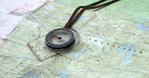
Using a compass with a map
Lay your map flat and hold the compass above it and then turn the map to ensure the grid lines that run north (always top of the map) line up with the north point on your compass. You need to then shift your compass about 13º east, to adjust for magnetic north.
Using a map with a GPS
Your location in terms of latitude, longitude and height can be obtained very quickly with a GPS, providing you with exact coordinates to then reference on your topo map.
Warning
Information can change over time so check that you have a map that has been produced in the last few years. Orient your map before you start using it – identify your surrounding features and then rotate the map to correspond to what’s in front of you.
Source: Australian Geographic Adventure Nov/Dec 2009

