Lake Burley Griffin, ACT
Distance: 35km Grade: Easy Bike: Road/Hybrid
When Walter Burley Griffin designed a lake at the heart of Canberra, he could easily have had cyclists in mind. Its shores are flat, its 35km circumference makes for a perfect few hours of pedalling, and almost every national public building of note sits huddled along its edges. The lake is entirely ringed by a shared-use path, which clings to the shores of the lake most of the way. The major deviations from its shores take you around Government House in Yarralumla, and through the Jerrabomberra Wetlands at the lake’s eastern end.
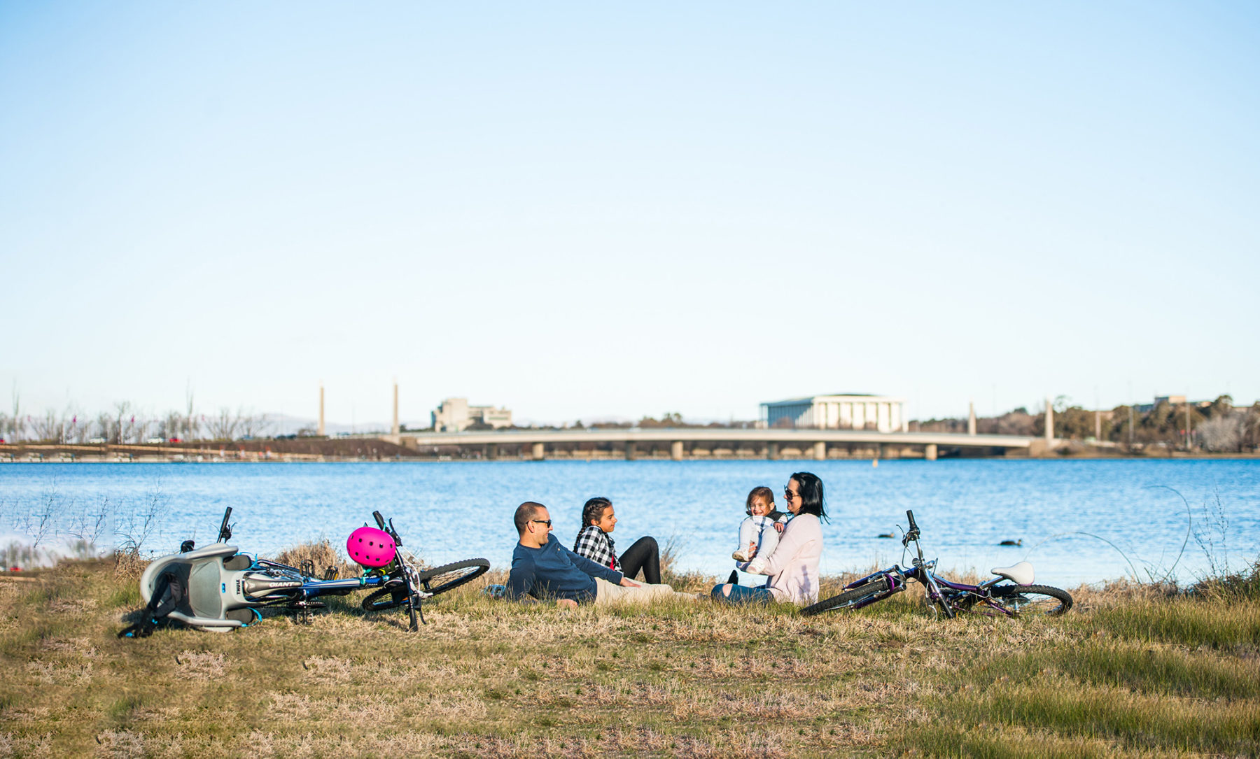
Doubling as a sightseeing tour of the national capital, the ride can be started anywhere along the lakeshore, and be cycled in either direction. Navigation is simplicity itself – simply keep to the mostly sealed path beside the water. Highlights include the Parliamentary Zone, where the ride passes the National Gallery, the flag-festooned High Court and the monolithic National Library, with Parliament House set on a low hill behind. The foreshore precinct in Kingston – where the path returns to the lake after arcing out through the wetlands – and the avant-garde New Acton district offer more distractions.
The ride is pretty much a choose-your-own adventure. You can lap the lake in a two-hour burst, or linger in the National Arboretum, National Museum or any of dozens of other lakeside diversions to draw the ride out across a full day. If you’re an early riser, it’s a beautiful dawn ride, when the rowers are on the waters, the hot-air balloons are in the sky, and the day and the lake are likely as still as a meditation.
Perimeter-Long Track, NSW
Perimeter-Long Track, NSW
Distance: 21km Grade: Easy Bike: MTB/Gravel
This magical there-and-back-again ride is found at Terrey Hills, in Sydney’s Northern Beaches area. This ride combines two designated tracks – Perimeter and Long tracks – to deposit riders at one of Sydney’s, and arguably NSW’s, most beautiful viewpoints: Peach Trees lookout. From this high-up natural wonder, there are expansive views across the Hawkesbury River to Cowan Creek and Berowra on the northern banks of the river. Reaching Peach Trees is a lovely ride along primarily firetrail (Perimeter Track is signposted and there is ample parking on streets near its start point), through dense bush dotted with eucalypts, grass trees and loads of wildlife.
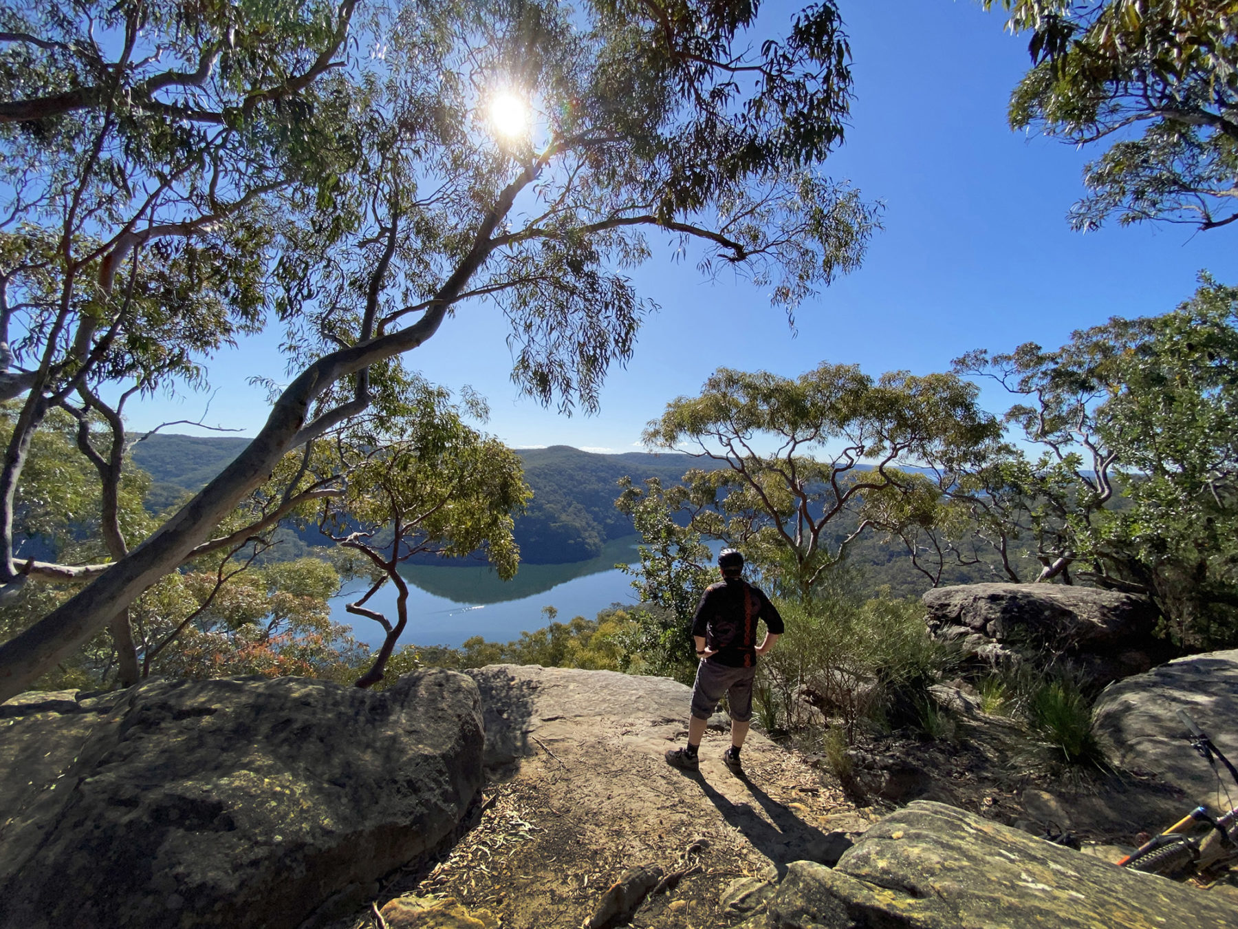
The Perimeter Track comprises the first section and is a wide, undulating firetrail (keep an eye out for horse riders and walkers here – and give way to both) that loops north and west around the top end of Terrey Hills for a touch over 6km before you reach the Long Track turn-off that takes you north. From here, the track is slightly rougher under your wheels and continues its undulating profile for just under 4km before you reach the lookout. You cannot ride up to the rock that offers the best views but can leave your bike just nearby and walk the last 10 metres. The ride is ideal for families, and it is well worth taking a picnic and to spend some time admiring the view before the return journey.
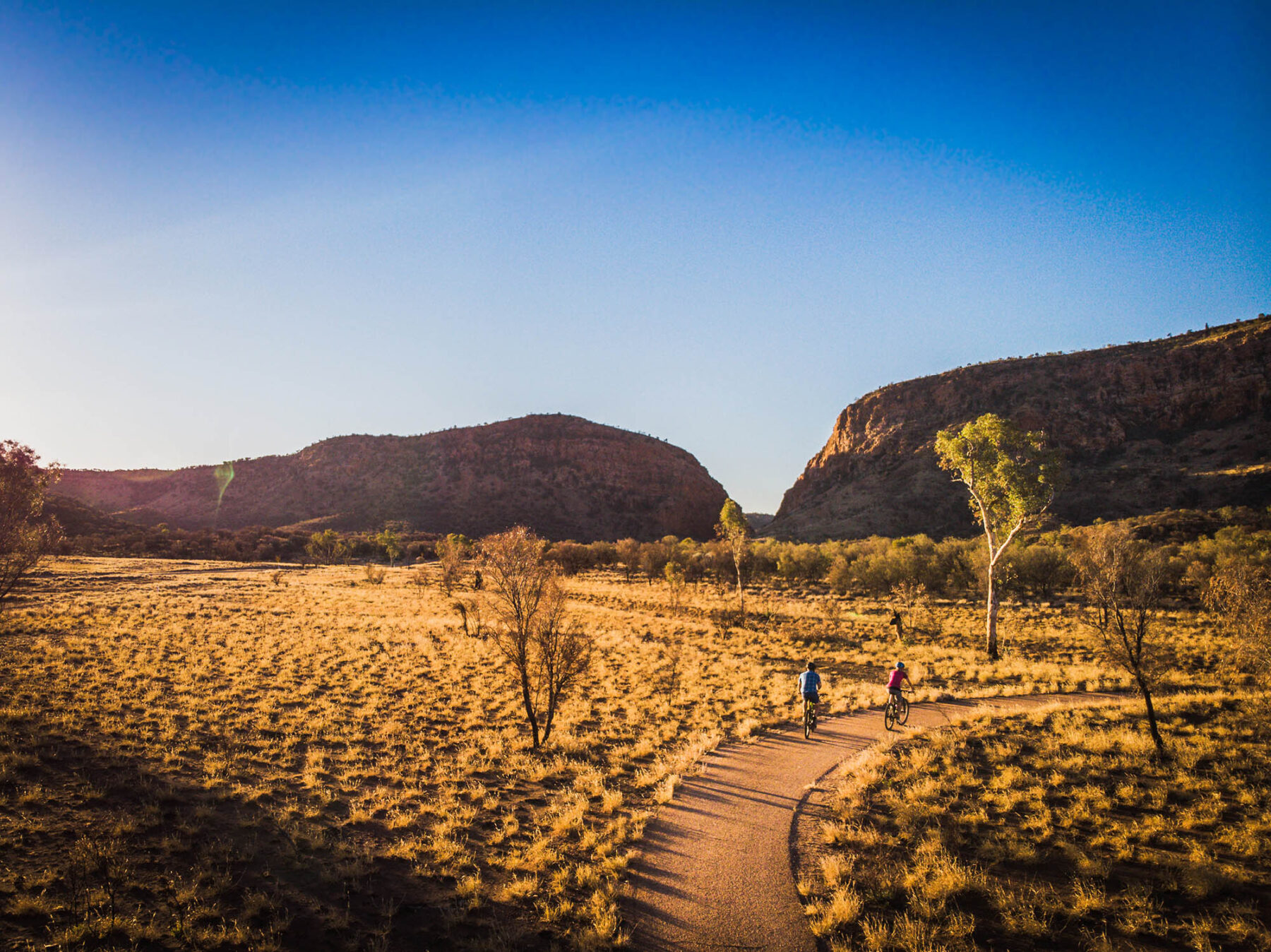
Simpsons Gap Bike Path, NT
Distance: 17km Grade: Easy Bike: Hybrid/Gravel/MTB
Running umbilically between Alice Springs and Simpsons Gap, the nearest of the West MacDonnell Ranges’ multitude of narrow gorges to the city, this fully sealed bike path is a desert delight. Beginning beside the boulder-topped grave of John Flynn, founder of the Royal Flying Doctor Service, the path rolls gently through the Alice Valley, pinched between the rust-red mountains of the West MacDonnells and the Heavitree Range.
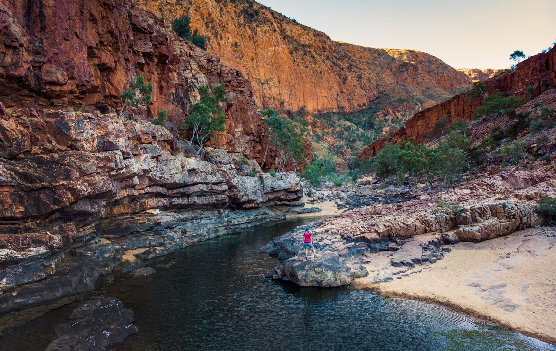
For all but the first kilometre, the ride is inside Tjorita/West MacDonnell National Park, winding between low hills but making few climbs of its own. The open landscape is brightened by ghost gums, desert bloodwoods and the flowers of the mulla mulla. There are two picnic tables (with bike racks) tucked into the shade of ghost gums along the path, and a 1.8km walking trail to Cassia Hill (named for cassia shrubs that cover it) that starts from the path’s edge as it makes its final turn towards Simpsons Gap.
The last 700m of the ride is on a roadside bike lane (where it also crosses the Larapinta Trail), ending in the Simpsons Gap car park, from where it’s a 400m stroll along the sandy creek bed to the Gap. This break in the mountains creates a spectacular scene – in full sun, the orange cliffs seem to glow like coals above the permanent pool (swimming is banned) inside the gorge. Black-footed rock wallabies are commonly seen among the rocks that litter the slopes outside its mouth. With average summer temperatures out here reaching 36°C, this is a path best pedalled in the cooler winter months.
Encounter Bikeway, SA
Distance: 31km Grade: Easy Bike: Hybrid/Gravel/MTB
Showing off one of South Australia’s favourite holiday coasts, this seaside cycle stretches along the southern edge of the Fleurieu Peninsula, taking in the likes of Victor Harbor, Port Elliot and Middleton Beach as it journeys from The Bluff to Goolwa.
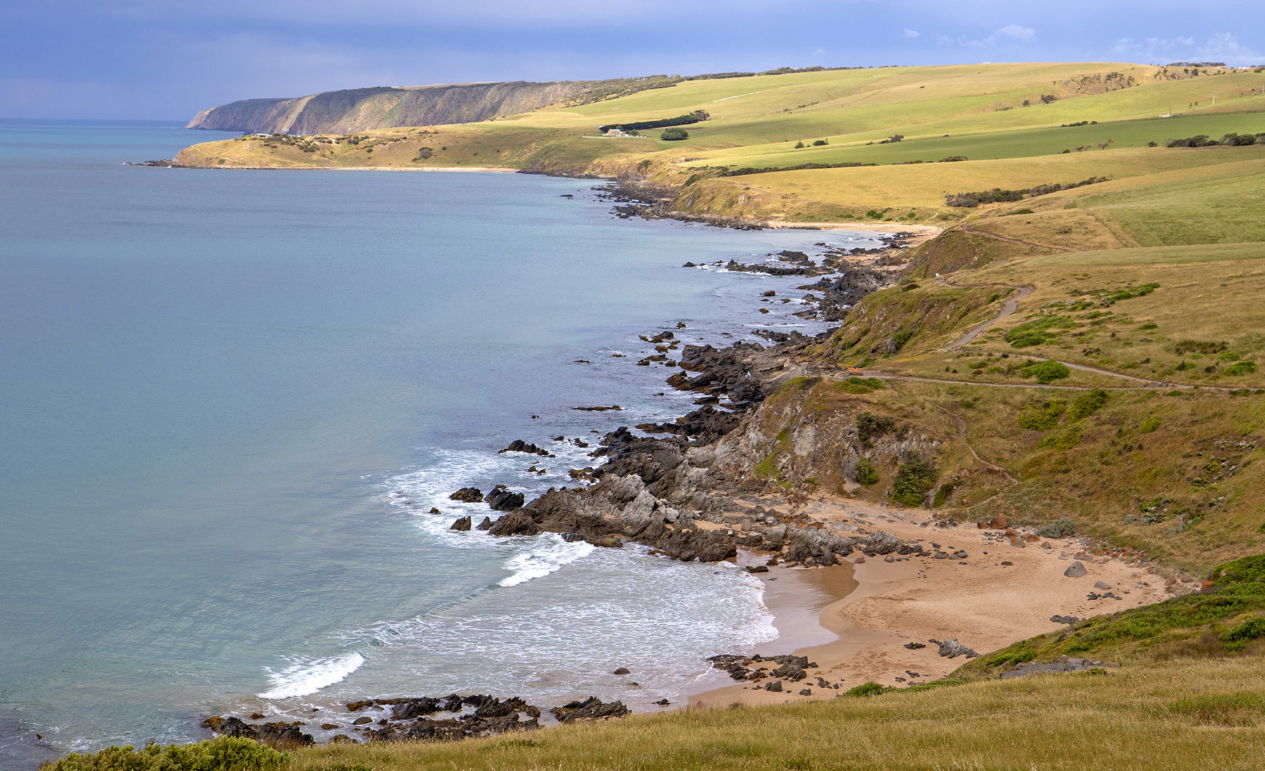
From a car park on the slopes of The Bluff (it’s worth walking to the top of the 97m-high headland for a view over Encounter Bay and much of the ride ahead), the bikeway drops to the shores of Encounter Bay, following a foreshore path into Victor Harbor. As Victor’s causeway stretches across the water to Granite Island, the ride turns with the coast, continuing to run pinched between the sand and the town. Crossing under a railway bridge and over the Hindmarsh River, the ride becomes a combination of bike paths and streets, but it always stays close to the coast – if you’re riding between May and September, keep a watch on the sea, especially along Boomer and Basham beaches, where southern right whales are regularly sighted.
The ride stays with the coast to Middleton, where it cuts briefly inland to Goolwa, the town sitting on the final bend in the Murray River’s long journey – the river mouth is just 10km away from here. The bikeway heads upstream from Goolwa, finishing abruptly and anticlimactically at Laffin Point. A more fitting finish is at the Goolwa Wharf (3.5km before Laffin Point), beside the Hindmarsh Island Bridge. It’s home to a distillery, eateries and a cellar door/craft brewer. Time the ride right and you (and your bike) can return to Victor Harbor on the Cockle Train, riding Australia’s oldest steel-railed railway.
Clarence Foreshore Trail, TAS
Distance: 14.5km Grade: Easy Bike: Any
This trail follows Hobart’s picturesque Derwent River, kicking off at Geilston Bay and finishing at Howrah. Consisting of mostly flat footpaths, with the odd gravel section, a few roadside connections and a couple of hills, the trail is accessible for all abilities and skill levels, with plenty of entry and exit points. A highlight for families? Playgrounds galore for those inevitable refuel and rest stops. For those riders with little legs, a shorter version sees you set off from Geilston Bay and finish at Bellerive Park, with its playground and – yes! – the chance to indulge in fish and chips by the beach.
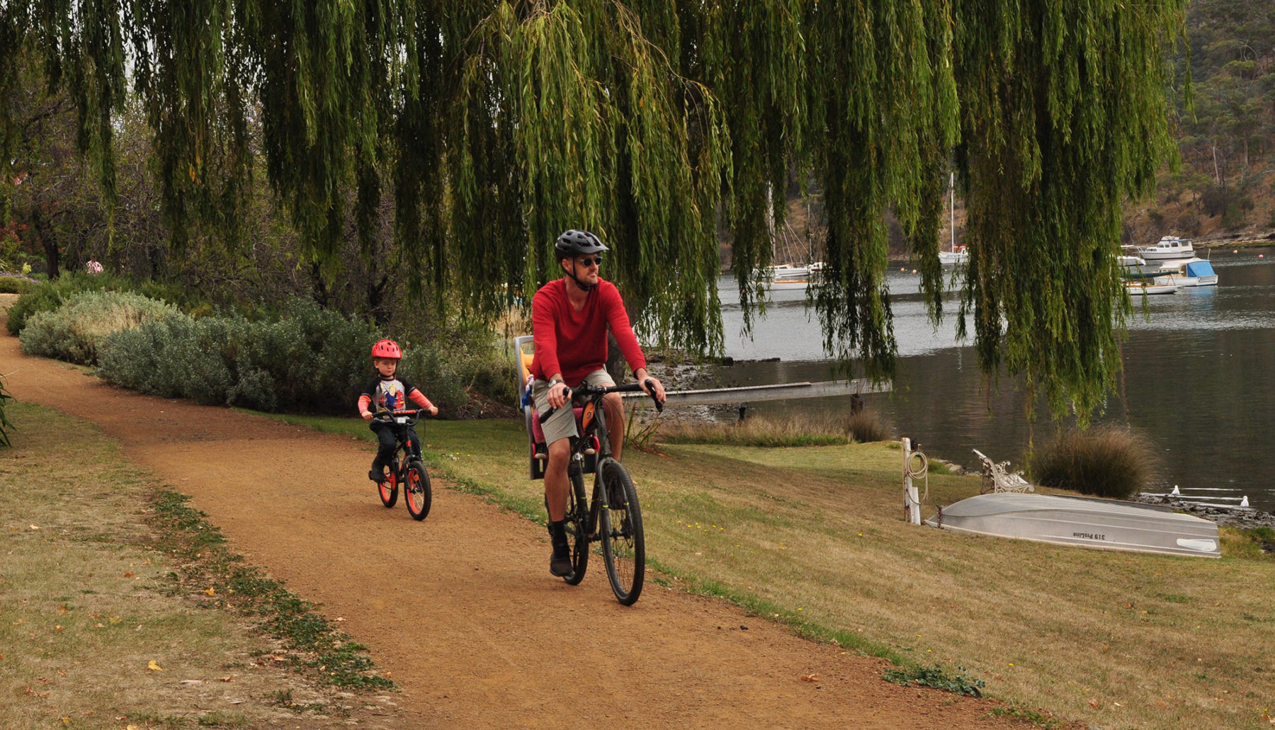
The ride encompasses magical views, from yachts bobbing on their moorings, to willow trees dangling over the trail. Passing under Hobart’s famous Tasman Bridge is a highlight, especially for the youngest cyclists, with the chance to test the echoes bouncing off the huge concrete pylons.At Kangaroo Bay, about 9km from the start, you may time it right for local market stalls. The beach here is beautiful, plus those fish and chips are available nearby. The final leg around a headland leads Bellerive Beach and then on to Howrah Beach.
Bass Coast Rail Trail, VIC
Distance: 17km Grade: Easy Bike: Hybrid/Gravel
Victoria’s only coastal rail trail is a 90-minute drive from Melbourne and combines mild and wild coastal views with one of the country’s most spectacular trestle bridges and the ghosts of the coal-mining days that spawned the railway and the towns along it. The ride connects Wonthaggi to the bus interchange at Anderson (there are plans to extend the trail to Woolamai) and can be cycled in either direction – most cyclists will end up riding it both ways, returning to their car.
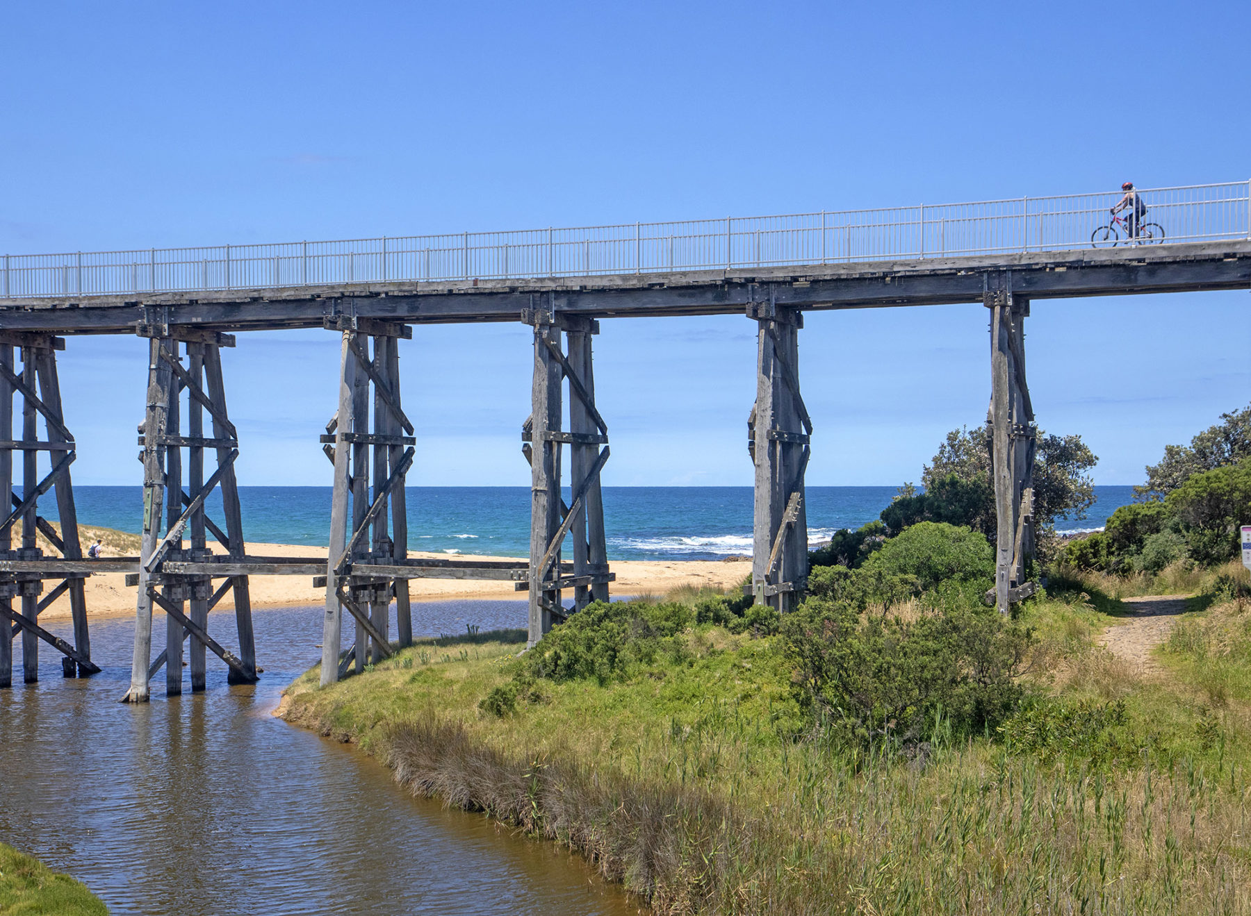
At the Anderson end, it threads through the old Kilcunda coal-mining area – said to be among the oldest coal mines in Victoria – before reaching the coast at Kilcunda. It stays on the shores only briefly, but spectacularly. Standing high above Bourne Creek, as it flows out onto Kilcunda Surf Beach, is a 91m-long trestle bridge that is one of the most striking structures along any of Victoria’s rail trails. To get perspective on the bridge, park your bike and head down onto the beach.
The trail veers inland again beyond the bridge, passing behind the coastal dunes and the six turbines of the Wonthaggi Wind Farm. A corridor of bush encloses the trail as it cuts through farmland and crosses another small trestle bridge, before passing the abandoned McBride tunnel entrance, another reminder of the area’s mining past. It’s just a few metres off the trail, and worth a look. The trail – hard-rolled earth until now – turns sealed as it makes the final approach into Wonthaggi, finishing beside the old railway station, built in 1912 and now reconfigured as the town museum.
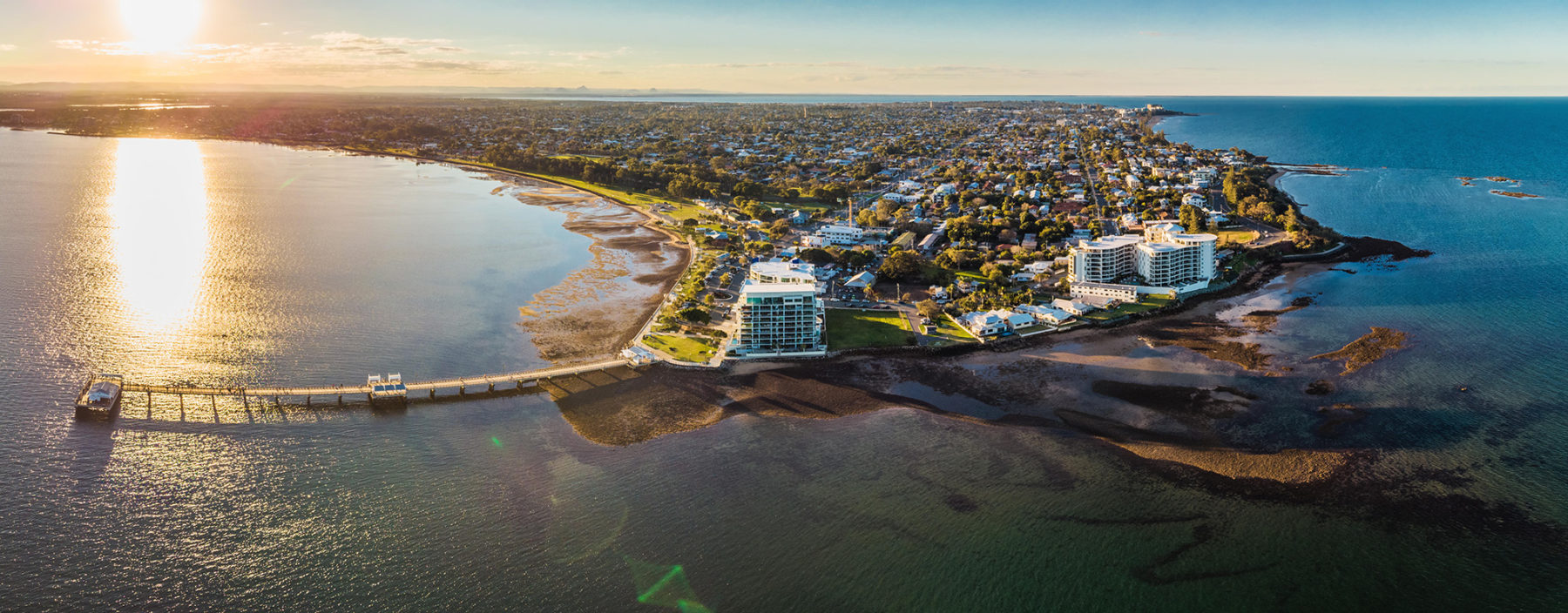
Moreton Bay Cycleway
Distance: 11km Grade: Easy Bike: Any
While the city of Brisbane boasts a cycleway along its river, Moreton Bay can be proud of the 11km cycleway that skirts this bay near Redcliffe. Sea breezes, the smell of the ocean, a promise of fish and chips and the wind in your hair – sounds ideal, right? There’s room to park at Scarborough Beach before pointing south (keep the ocean on your left) and heading towards Ted Smout Memorial Bridge. If you need to earn your fish and chips, keep the legs moving and you’ll have no problems on the uninterrupted route, making for a neat 22km return, but you’d be crazy to miss some of the more scenic places to stop on the way.
Settlement Cove Lagoon is a place to pause, with amenities if the need arises. Once you’re back in the saddle, keep your eyes peeled for Gayundah Wreck below the cliffs at Woody Point. The shipwreck occurred in the 19th Century, and the resting place for this Navy ship is popular with photographers. Crockatt Park is past the wreck, and a worthy bargaining chip for young legs that may be tiring – the park has a long flying fox. Otherwise, Pelican Park is just before Ted Smout Memorial Bridge and the ride’s turn-around point and is named appropriately! Time to turn back north and stop wherever the fish and chips smelt best.
Rottnest Island, WA
Distance: 4-22km Grade: Easy Bike: Any
Picture an island in the Indian Ocean fringed with 63 beaches, where the only motorised traffic is a bus, and an island-based rental company has almost 2000 bikes in its fleet. Welcome to the cycling beauty of Rottnest Island. Perth’s favourite holiday island is one of the country’s most bike-friendly destinations. Sealed roads run to its myriad beaches, and climbs of any note are rare, with the island barely peeping above the sea – its highest point is just 46m above sea level. Three cycling routes are promoted on the island, from a 4km Rotto Mini Loop to a 22km Island Ride that runs the length and width of the island. All routes begin in The Settlement, where ferries from Perth and Fremantle dock.
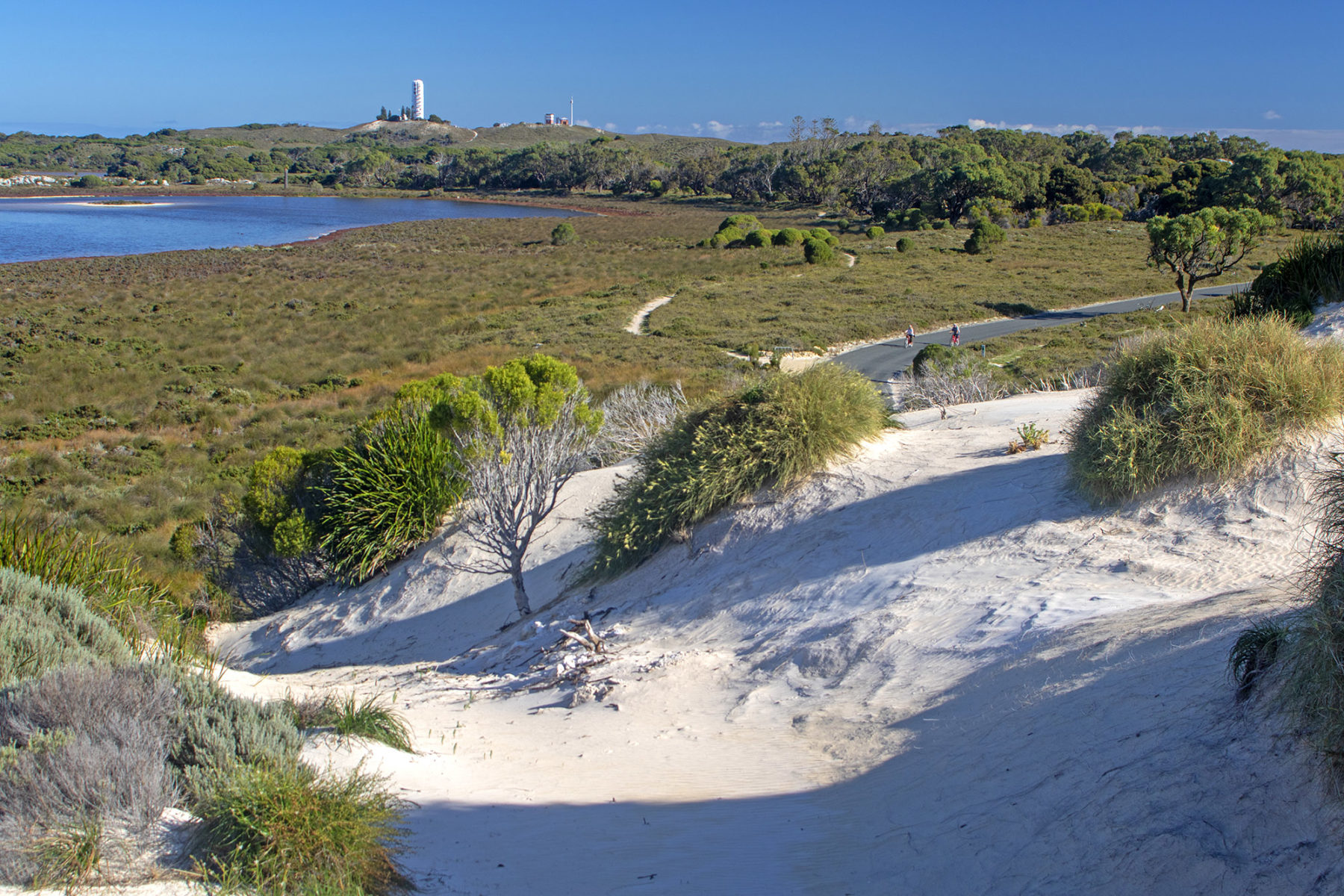
The Island Ride’s end goal is Cape Vlamingh, at Rottnest’s western tip, home to a colony of New Zealand fur seals as well as a boardwalk with clifftop views. This ride skirts Rottnest’s south and north coasts, which have their own distinctive characters. The north coast is more developed, with beaches such as Pinky Beach and Geordie Bay backed by tourist apartments and campgrounds. The south coast feels more remote, but each beach has its own individual attraction – there are remnants of a shipwreck at Henrietta Rocks, and a popular snorkelling trail at Little Salmon Bay.
Almost every beach has bike racks, making it possible to while away an entire day on the Island Ride, but other than a coffee van at Cape Vlamingh and a general store at Geordie Bay, there are no dining or drinking options outside of The Settlement, so plan ahead if setting out for the day.
To read about more awesome Aussie bike rides, check out Australian Geographic’s Australia’s Best 100 Bike Rides, on sale now.