Day walks are one of the most popular outdoor activities for Australians of all ages and, thanks to the immense size of our country, there are literally hundreds to choose from. Here are some of our favourites from each state and territory. Check them out, then lace on the boots and get out there!
Hollow Mountain, VIC
Distance: 2.2km return Difficulty: Hard
The less-visited northern region of Gariwerd-Grampians National Park repays the time it takes to get there with its rugged outback feel and its dramatic climbs. Wubjub-Guyun (Hollow Mountain) is at the far north of the national park, right on the edge of the vast Wimmera-Mallee plains, which stretch as far as the eye can see. Its outlandish jutting rock has been a popular place for climbers and boulderers for many years, yet it is also home to sensitive Indigenous sites, which now means that some access is restricted.
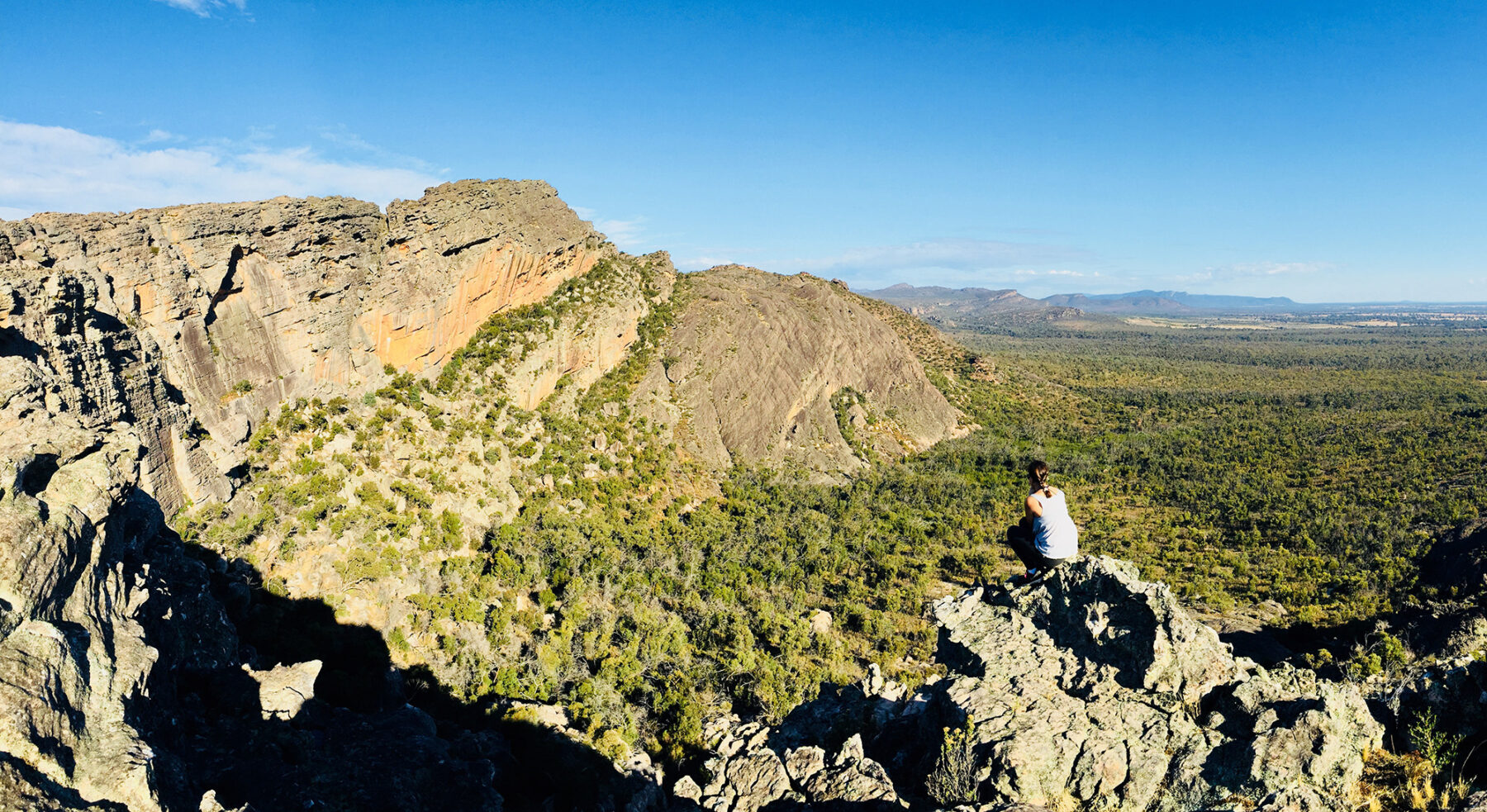
This surprising and spectacular walk starts easily enough through regenerating bushland (which was devastated by the 2014 bushfires) and soon clambers steeply along exposed rocky ridges. Steady hands and nerves will be required for some serious scrambling, but this will be rewarded by the rock hollows, wind-carved caves and expansive views after the short and dramatic climb to the top. The summit itself is a bit of a guess as there is no ‘top’, just a series of outcrops, but you’ll be able to see Taipan Wall, Mt Stapylton, Mt Zero and the plains stretching away into the distance. Watch carefully for the sparse yellow track arrows on the rocky route.
Cape Hauy, TAS
Distance: 10.5km return Difficulty: Medium
The Tasman Peninsula’s spectacular sea cliffs are Australia’s highest and are rightly celebrated in the multi-day Three Capes Walk (48km) but you can also walk shorter sections such as this vertiginous and wonderful track to Cape Hauy from Fortescue Bay. Named for the well-known French mineralogist Rene-Juste Hauy, the cape sports a group of sea stacks with intriguing names, such as the Candlestick, the Lanterns, and the Totem Pole. These soaring columns of dolerite standing amid crashing waves are a rock climber’s playground.
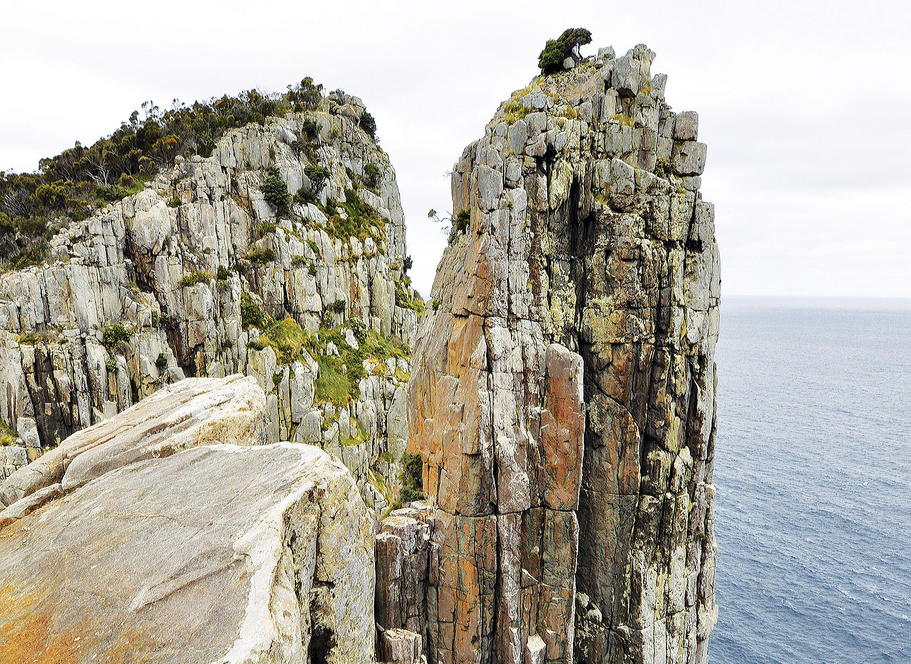
The track initially follows the coast as it rises through eucalypt forest with an understory of blanket bush, dolly bush and prickly box. Some friendly Bennett’s wallabies roam this area. As you gain height you will be able to get clear views of pretty Fortescue Bay on your left and if you are in luck, you may be able to spot whales or dolphins that often visit this area. A steepish climb up some well-built steps leads to the top of the first knoll from where the track veers right. From here it’s a steady tramp to the track junction to Mt Fortescue. This halfway point is where the walk gets exciting. Now you can see all the way down the ridge to the cape and its rock stacks – and the many steps, up and down, you’ll take to get there! Enjoy the dizzying views to the north along the coast of the Tasman and Forestier Peninsulas, Maria Island and as far as Schouten Island south of Freycinet Peninsula. North-east is Hippolyte rocks where seals are known to breed. The cape to the south is Cape Pillar with Tasman Island beyond.
The full Three Capes Walk can be done as a luxurious hut walk or as a self-guided Tasmania PWS walk, staying in stylish timber cabins with bunkbeds and simple kitchens but carrying your own food, clothing and equipment.
Hallet Cove, SA
Distance: 3.8km Difficulty: Easy
This coastal conservation park is one of Australia’s outstanding geological sites and is of important scientific and educational value. Professor Ralph Tate recognised the value of the area when he discovered glaciated features on the coastal rocks in 1877. Further examination found that the glaciated pavements, sediment and the huge boulder erratics were records of an Australian ice age that occurred 280 million years ago.
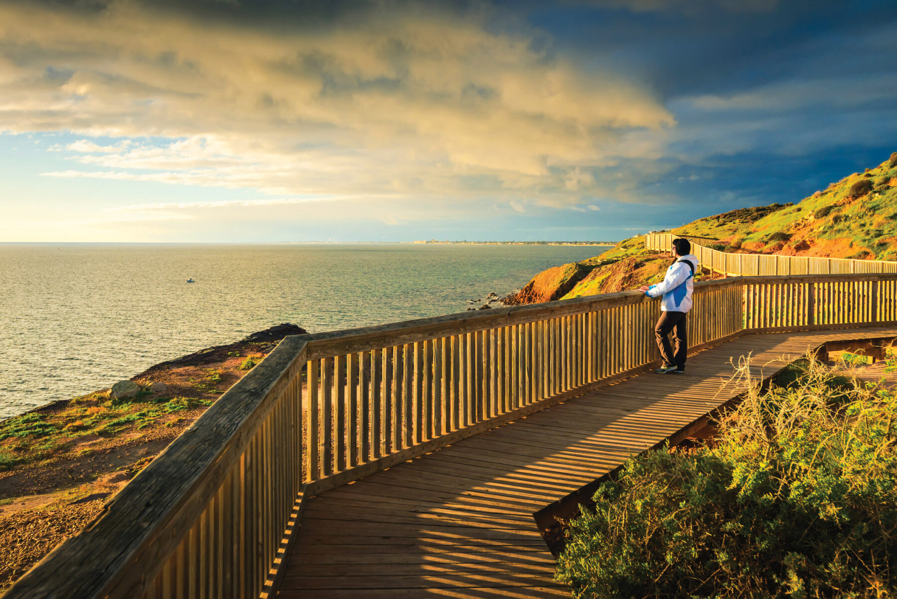
This easy walk combines the park’s Coast Park Path and Glacier Hike into a satisfying loop. A series of tracks and boardwalks are designed to give close-up views of the geological sites, such as the Sugarloaf and glacial pavements, and interpretive signs explain the significance of the area.
Beginning at the Boatshed Cafe, take the Glacier Hike path to see the almost Martian scenery of the Sugarloaf, formed from lake sediments as the glacier retreated, and the Amphitheatre. Continue north to cross Waterfall Creek, then turn right, away from the sea. Follow a fire track north through open forest, past the Shepherd’s Hut ruins, to the Second Street carpark, then swing left and head downhill back to join the Coast Park Path. Cross Waterfall Creek again to reach a clifftop section with magnificently developed glacial pavements – smoothed, scraped and polished by ancient Permian glaciation. Head down to the beach for a closer look at impressive slabs of pavement tilted at 45 degrees. Return to the cafe via Black Cliff lookout.
Mt Gower, NSW
Distance: 14km Difficulty: Hard
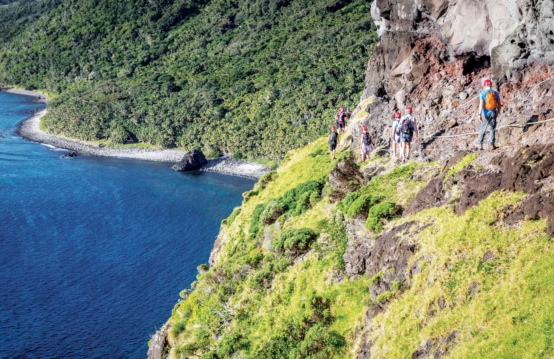
The hike up Lord Howe Island’s Mt Gower is not for the faint-hearted. One of Australia’s toughest but most spectacular day walks, the trek to its 875m cloud-forested summit can only be undertaken with a licensed guide (mostly due to the sensitive wildlife). The return journey takes a full day, through a lot of unmarked track, with some sections so steep that ropes have been fixed to help you climb up.
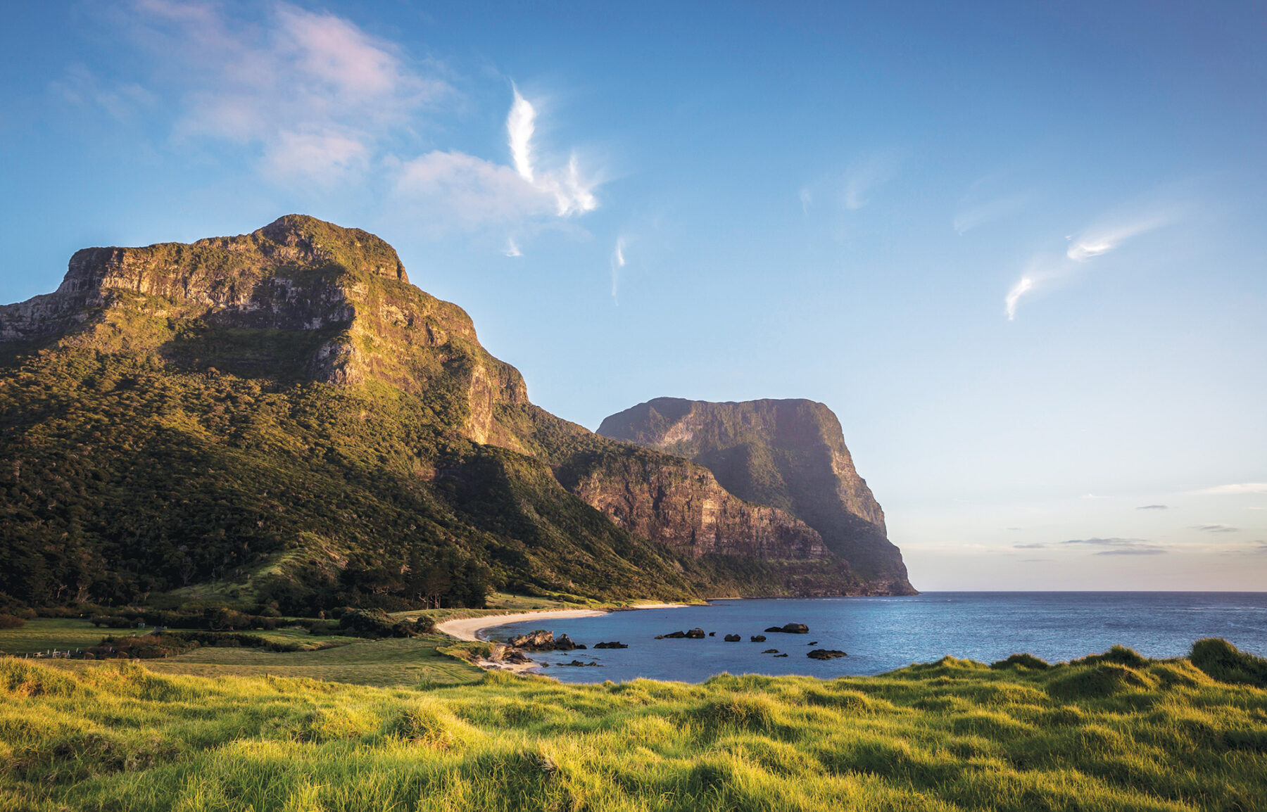
However, all the hard work will most certainly pay off when you reach the summit, with stunning views of the neighbouring Mt Lidgbird (777m), castle-like islet Balls Pyramid, and much of the rest of this stunning 11-by-2km island and its marine park. Some of the flora and fauna of Mt Gower cannot be seen anywhere else in the world; if you’re lucky, you might even spot a Lord Howe Island woodhen, an endemic bird brought back from the brink of extinction in recent decades. And an unusual wildlife experience awaits you at the top – the providence petrels almost fall from the sky to your very feet if you make lots of sound. Bookings need to be made with Lord Howe Island Tours.
Weano and Hancock gorges, WA
Distance: 3.5km circuit Difficulty: Hard
Deep gorges with abundant waterfalls and icy rock pools have given Karijini National Park the reputation of WA’s water wonderland. This remarkable park lies in the Pilbara, the iron-rich heart of WA’s mining industry, 1300km north of Perth. Despite being one of the country’s most remote national parks, Karijini is among WA’s most visited parks outside Perth’s metropolitan area. There is simply nowhere else in Australia like it and a walk clambering through its narrow, stepped gorges is not to be missed if you have the agility to manage it. Great care must be taken in the gorges as the rocks can become slippery and note that the water can be extremely cold.
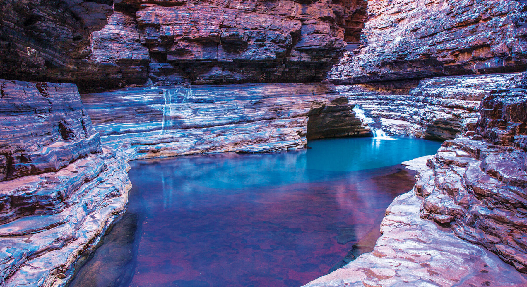
This walk combines all the walks in the Weano Recreation Area. Beginning with an easy walk to Upper Weano Gorge through snappy gums and golden spinifex, the trail narrows as you work your way along the stream and becomes increasingly difficult, and spectacular, as you clamber down via Lower Weano Gorge to Handrail Pool. The rail here helps you descend into a beautiful green pool, entirely enclosed by the gorge walls. Retracing your route to the junction of Lower and Upper Weano trails, a set of steps leads up to Oxer Lookout, overlooking the site where four gorges meet. Heading back towards the carpark, an emergency radio marks the trail junction to take for Hancock Gorge. The descent to the gorge floor is very steep and is aided by sturdy metal ladders. The route leads downstream, wading through the gorge to Kermit’s Pool via the famous ‘spider walk’, a narrow slot that requires you to spread all your limbs out for balance.
The astonishing layers of dark red rock that feature in this walk are known as banded iron formations. These ancient quartz- and iron ore-rich layers were deposited as silt, mud and clay up to 3.2 billion years ago around the edges and floor of primordial oceans. Their alternating stripes of iron-rich red separated by black, grey and sometimes even blue or green shales and cherts adorn the Pilbara like massive geological works of art.
Valley of the Winds, NT
Distance: 7.4km circuit Difficulty: Medium
The domes of Kata Tjuta lie about 30km to the west of Uluru, visible across a low sand plain. Although lesser known than the great rock in the distance, they are easily as beautiful, if not more so. The Anangu name means ‘many heads’ and there is something curiously lifelike about the smooth, high domes huddled together. Between them, the cool, deep valleys have the mystery and silence of a cathedral. Unlike the more accessible snake legends of Uluru, the meaning of this place must remain mysterious. Its sacred stories are considered men’s business and under Tjukurpa (law) cannot be revealed to the uninitiated. Many people don’t find the time to visit Kata Tjuta but those that do often find it surprisingly moving and impressive.
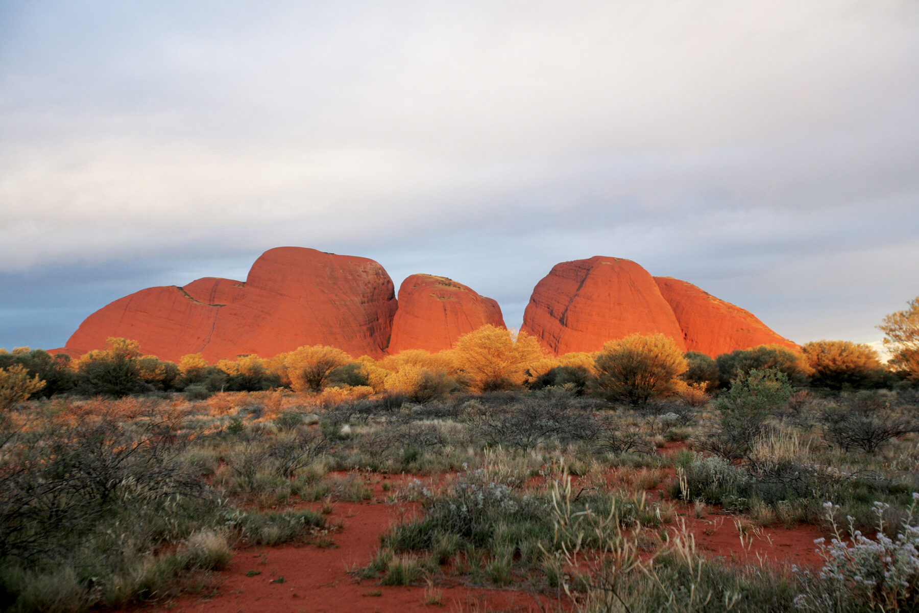
The walk takes you deep into the heart of the domes. From the carpark the path heads east to Karu Lookout, where there is a striking view into the valley. From here the trail switches back downhill and then continues east, passing close to a rock wall where you can inspect Kata Tjuta’s conglomerate more closely: the explorer Ernest Giles described it as rocks “mixed as plums in a pudding”. Reaching the valley floor, a trail junction marks the start of a loop where you turn right to climb towards Karingana Lookout. From here you pick your way carefully down the steep, rocky slope to cross a creek bed and emerge in open scrubland, before swinging north-west to a ridge where there are sweeping views back down the valley. Passing a water tank, the route heads south to follow the creek bed, lined with river red gums and bloodwoods, to complete the loop. From here you retrace your steps for half an hour to the carpark via Karu Lookout.
Warrie Circuit, QLD
Distance: 17km Difficulty: Medium
Springbrook National Park lies within the Gondwana Rainforests of Australia World Heritage Area, protecting its subtropical and temperate rainforests full of rare flora and fauna. This area contains rainforests like those that once covered the ancient supercontinent of Gondwana but have now contracted to isolated pockets on the eastern coast. The Warrie Circuit is an outstanding walk deep in a tangled oasis of trees, ferns, palms and vines, surrounded by cascades of water. In fact, there are so many waterfalls on this track that you will probably lose count. Along the way you might see pademelons, carpet pythons, large and glossy black skinks known as land mullets, and hear the rare Albert’s lyrebird, yellow-tailed black cockatoos or brown cuckoo-doves.
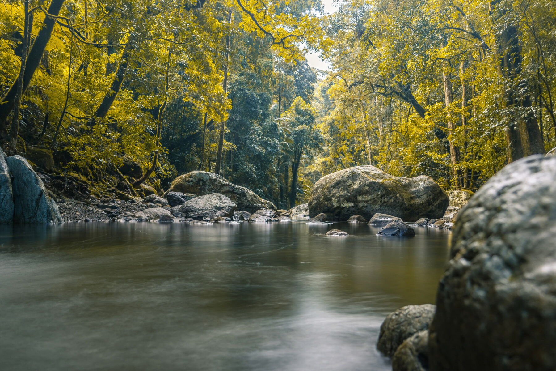
Starting from Tallanbana picnic area, the walk follows the base of the Canyon cliffs to Goomoolahra Falls, passing behind Rainbow Falls and providing distant views across the forested ridges out to the skyscrapers of the Gold Coast. Crossing the multi-tiered Goomoolahra Falls, you’ll descend through lush, mossy subtropical rainforest, crossing many creeks, to the next set of falls, Ngarri-Dhum and Meeting of the Waters. This very beautiful gathering of large boulders and converging creeks is the perfect place to rest or have lunch before climbing out of the valley. Ascending alongside Little Nerang Creek, there is a good swimming spot at the base of Gooroolba Falls. From here a series of switchbacks help you climb up the western side of the gorge, before passing over the top of Blackfellow Falls and along the cliffs back to Tallanbana. The track can be slippery and muddy after rain. Wear shoes with good grip and be prepared to get your feet wet. In cooler temperatures you might want to take a raincoat.
Namadgi Settlers Track, ACT
Distance: 9km circuit Difficulty: Easy
Namadgi was the name used by the local Aboriginal people for the mountain range south-west of Canberra. Gazetted in 1984, Namadgi National Park occupies almost half of the area of the ACT and encompasses spectacular views from its many mountain peaks. There are more than 160km of walking tracks in the park, but this one explores the cultural heritage of the Australian Alps with a look at the lives of late 19th-century settlers. This lovely loop meanders through forest, then open grassland and finally grassy woodland to see three pastoralists’ huts, restored by community group, Kosciuszko Huts Association (KHA). This group has researched the stories and photographs of the settlers, workers and their families seen on information boards along the walk.
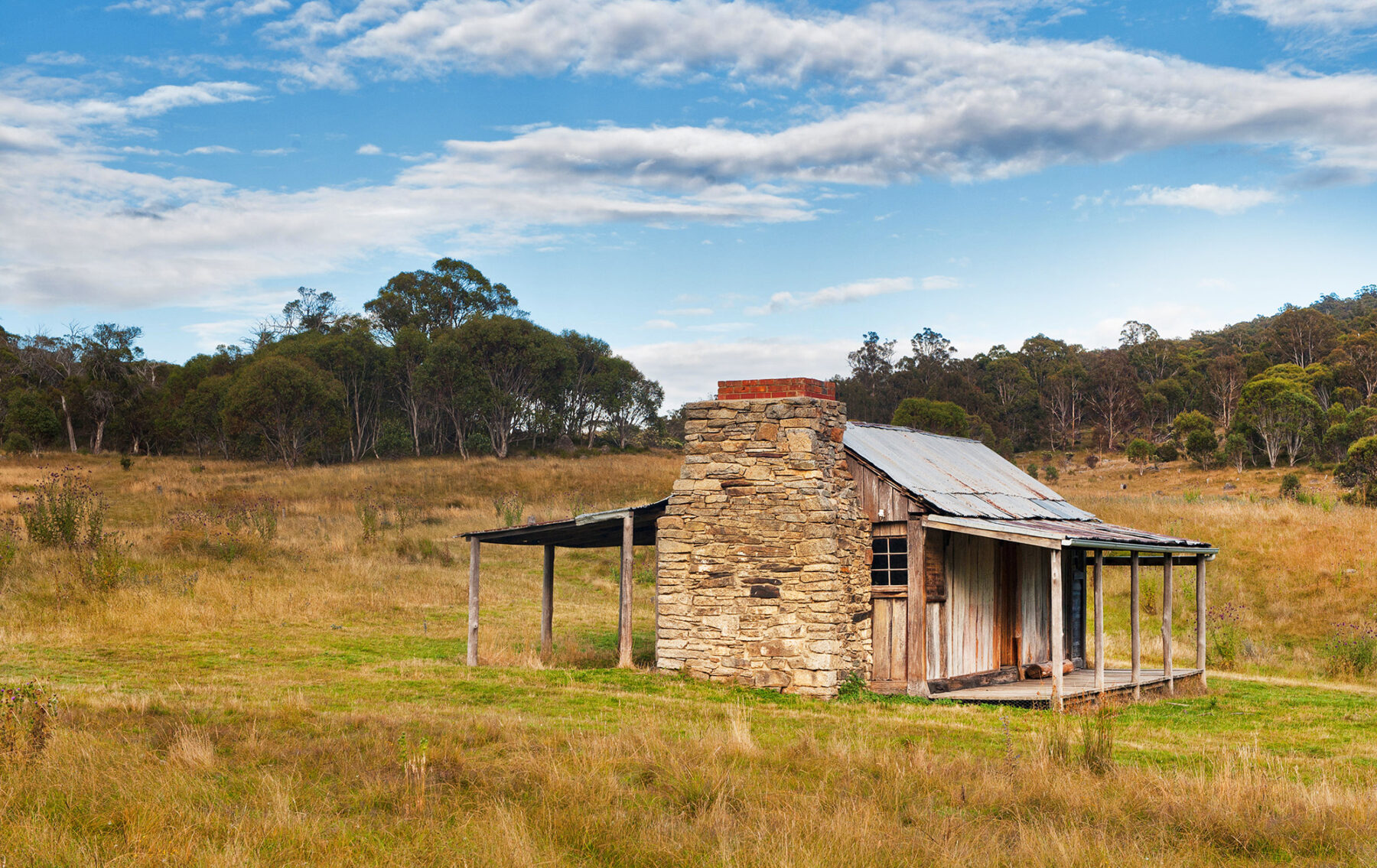
William and Flora Brayshaw settled here in 1844 and Thomas and Mary Jane Westerman in 1882. Several generations were born and buried in this isolated and unforgiving landscape. The walk starts at Brayshaw’s Homestead, built in 1903 from timber slabs with a stone chimney. This rudimentary two-room cottage housed a bachelor for 28 years. It had no stove, just a camp oven, and it wasn’t until a family bought it in the 1930s that the walls were papered with newspaper in an attempt to keep out icy draughts. The next hut, Waterhole, is even more rudimentary – built of corrugated iron in the 1930s to shelter stockmen who worked in the area, land-clearing and sheep drenching in the nearby stockyards. Westerman’s Homestead was built in 1916, the family’s third dwelling on this spot. There is a small graveyard and remnants of a garden with exotic trees.
For more great day (and longer) walks, grab a copy of Australia’s Best 100 Walks, by Australian Geographic.