Yep, it’s that time of year again. The days are getting warmer – and there are more daylight hours – all of which translates to an abundance of epic summer adventures to be had. Here are some of our favourite adventures for 2024.
Hike Frenchmans Cap, TAS
When Sir Edmund Hillary described Tasmania’s Federation Peak as ‘Australia’s only true mountain’, he probably had his back turned on Frenchmans Cap. Though the 1446-metre peak stands around 100 metres lower than other Tassie mountain darlings such as Cradle Mountain and Barn Bluff (but more than 200 metres higher than Federation Peak), it appears so much larger, with its summit draped in 400-metre-high white quartzite cliffs.
It’s been the scene of some huge adventures, including epic rock climbs, airy BASE jumps and a $1.1-million bequest from Dick Smith to reroute the track and do away with the notorious Sodden Loddon slog to get here. No longer does the hike slop through knee- or hip-deep mud in the Loddon Valley, rising instead onto firmer slopes above the river.
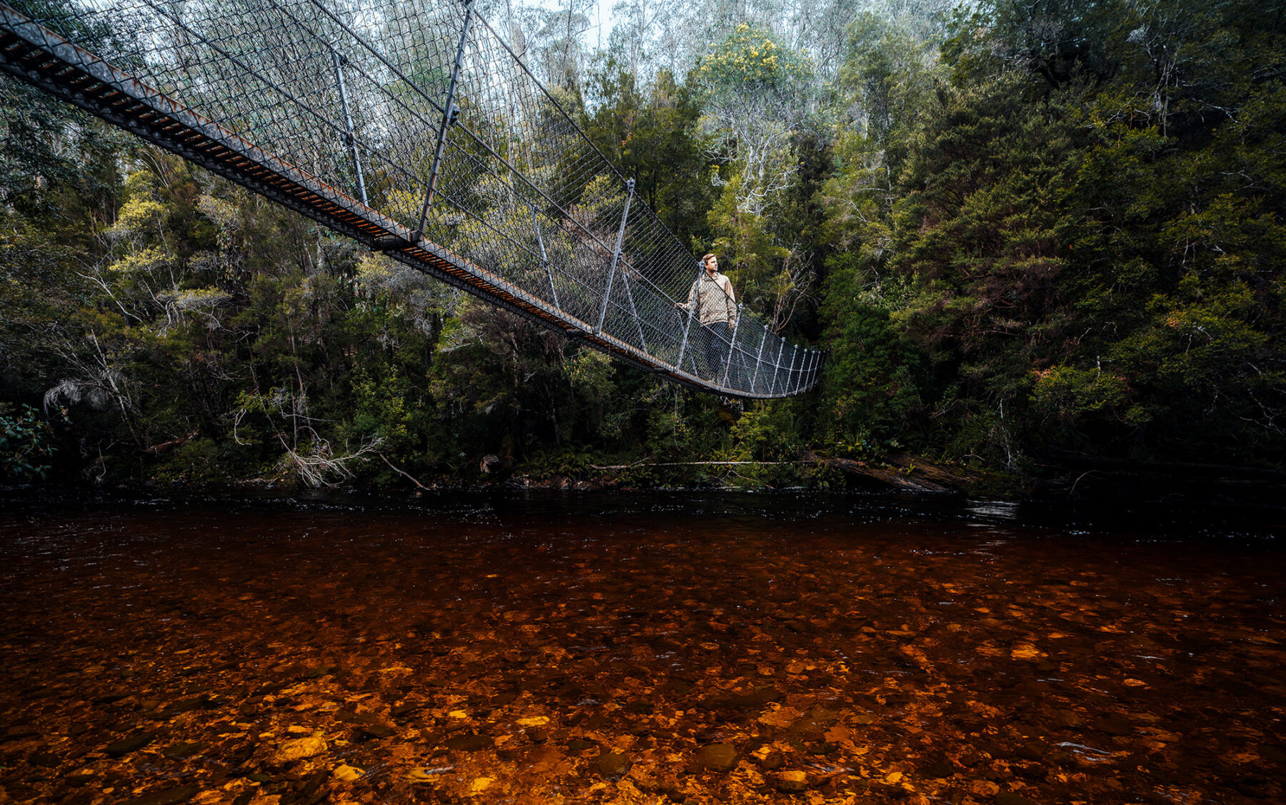
In the wake of that trackwork, Frenchmans Cap has once again become one of the most enticing and rewarding of Tasmania’s bushwalking trails for those who don’t mind stretching and scrambling to reach the summit. The 54km out-and-back hike from the Lyell Highway begins with a brush with another place of Tasmanian fame – the hard-won Franklin River – crossing its dark, tannin-tainted waters on a swing bridge and setting out into the Franklin-Gordon Wild Rivers National Park.
In decent weather, there’s an early glimpse of Frenchmans Cap as the trail rises over the shoulder of low Mt Mullens, but the track’s real beauty begins beyond a hut on Lake Vera, which is the usual first night’s stop for hikers.
Edging around the lake’s shore, the track is decorated with Huon pines and ribbed with tree roots and log ladders, slowing the pace even before the hike ramps up the steep slopes of Barron Pass. Emerging atop the string-thin pass, you get your first up-close-and-personal views of Frenchmans Cap, with Sharlands Peak rising beside you like a pin cushion. It’s such a stark and startling view that the sense of suddenly being somewhere ominous and thrilling at once is inescapable.
The track turns off the pass, dipping beneath Sharlands Peak’s cliffs and into the beautifully named Artichoke Valley to arrive at Lake Tahune, immediately beneath Frenchmans’ massive summit cliffs.
On the lake’s shores is Tahune Hut, built in 2018 to replace the rickety hut that previously stood here for 50 years. The first Tassie hut to be powered by a hydro generator, it’s symbolic of the fancy new face of mountain huts – second only to the huts on the Three Capes Track for bush decadence – with heating, lighting, heated drying racks and even USB ports. But the most luxurious thing here is the view – step outside and the bone-white cliffs of Frenchmans loom overhead like a wave from a disaster movie about to break over the hut.
The push to the summit begins almost immediately beyond the hut, leaving the lake to rise steeply towards North Col, with ridiculously good views back down to Lake Tahune, before zigzagging across terraces at the base of the cliffs to the climb’s crux.
For a time, the climb requires more stretching than a yoga retreat as the track scrambles up boulders and sections of cliff – think of it as a puzzle more than a punishment – finally marching up to the barren summit.
If you’ve come for sunrise, as so many hikers do, anticipate biting cold, but also (fingers crossed on the weather) views over peaks near and far, including Frenchmans’ companion mountain, Clytemnestra, and distant Cradle Mountain, Barn Bluff and Mt Ossa. The Franklin River curls around the mountain’s toes far below, and Lake Burbury and Macquarie Harbour are pooled away to the west near Queenstown and Strahan. It’s like standing at the top of the world, and yet no more than 1500 metres above sea level.
Note that a registration system for hikes to Frenchmans Cap was implemented in 2021, so plan as far ahead as possible. Under the program, a maximum of 10 hikers can set out each day.
Cycle the West Coast Wilderness Trail, NZ
Summer is often a favourite time for reading, and the hefty Booker Prize-winning novel The Luminaries can almost be both your guide and companion on the South Island’s West Coast Wilderness Trail. This 133-kilometre trail – more than 120 kilometres of which is off-road – threads through the long-gone goldfields that drove Eleanor Catton’s story, but it’s the ‘wild’ in the ride’s name that is the WCWT’s most memorable feature and sees it a must-include for this selection of adventures.
One of New Zealand’s 23 Great Rides, the trail begins (or ends) in the town of Ross – the site of New Zealand’s largest ever gold strike – and stretches to Greymouth. Along the way, it stitches together singletrack, disused tramways and packhorse tracks, skimming one of the country’s most dramatic coastlines and diving deep and dark into rainforest, all the while backed by the craggy peaks of the Southern Alps.
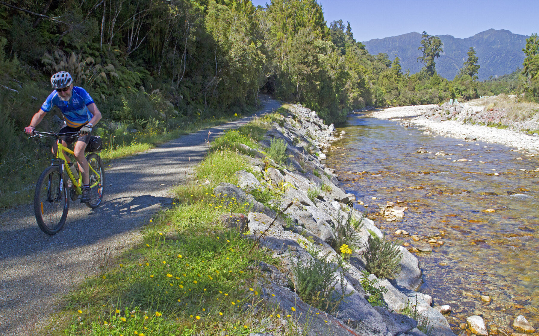
Typically taking between three and five days, it’s a ride in which the mountains are more views than impediments, with the trail barely sneaking over 300 metres above sea level. At its southern end, out of Ross, the ride is largely flat, following an old logging tramway, still ribbed in parts with old sleepers, and burying itself so deep in rainforest that its emergence at the West Coast Treetop Walk – an elevated walkway 20 metres up in the forest canopy – seems only natural.
For cyclists not on a self-imposed clock, the ideal first night’s stop is Hokitika. Just 33km from Ross, the town’s combination of ocean, port and rivers was liquid gold at the height of the 19th-century mining rush. Like most gold-mining towns, its wears the grand architectural reminders of its glory days like jewellery, but it’s just as noteworthy for the mass of driftwood that washes up on its beach, which locals have turned into a sculpture park of sorts on the black sands. In the Māori language, Hokitika means ‘place of many returns’ because it’s where people kept coming back to gather greenstone. And then gold. And now to cycle.
Behind Hokitika’s back, the land is pitted with glacial lakes and streaked with wide braided rivers that drain down from the mountains. It was here that much of the story of The Luminaries panned out, and here also that the WCWT next ventures, turning inland to follow the remains of an old mining water race that connected Lake Kaniere to the goldfields at Kaniere.
Catch a fine day and there’s a chance for a chilly splash with a mountain view in Lake Kaniere before the WCWT makes one of its few noticeable climbs. Ascending over a low ridge, it drops again into the adjoining Arahura Valley, which typically beams with green health from its 1.5 metres of annual rainfall (yes, bring a raincoat).

Generous over the centuries with greenstone (for Māori) and gold (for European settlers), the valley is split by the translucent Arahura River, the waterway that guides the WCWT upstream towards the slanderously named Cesspool. A short walk from the trail, the Cesspool is arguably the most beautiful stop along the WCWT’s length, with a narrow swing bridge poised above perfectly blue glacial pools.
From the Cesspool trail junction, the ride begins a series of tight switchbacks, doing its best to flatten out the WCWT’s biggest climb as it rises into Cowboy Paradise, a replica cowboy town that briefly turns New Zealand’s wild west into the literal Wild West.
The WCWT’s highest point comes just beyond Cowboy Paradise, where it commences a long descent towards the town of Kumara, the site of New Zealand’s last great gold rush. From Kumara, the coast beckons again as the trail continues beside the Taramakau River to the edge of the Tasman Sea and a final 19km tucked in behind the coastal dunes. In Greymouth, the west coast’s largest town, the ride ends along the Grey River, riding atop a floodwall that was built in 1988 after a series of floods. All up, the days behind have totalled up around 2000 metres of climb – mostly gently – making the WCWT one of the most approachable of New Zealand’s Great Rides. And all the while stringing together black beaches, green forest, golden history and finally the Grey River.
Kayak Sydney Harbour, NSW
In the hour before dawn, even a city as large as Sydney slumbers. In Lavender Bay, yachts sit as though painted into the harbour landscape and not a ferry can be seen. The waters are typically so peaceful and placid that it’s prime time to be here in a kayak.
The harbour’s natural design makes it easy to view the city icons – bridge, opera house, the PM’s residence, the madcap grin of Luna Park – on a short paddle ahead of the day’s rush of boat traffic. Be it alone, with the kids in tow, or on a kayaking tour, it’s a Sydney highlights reel, with sunrise thrown in.
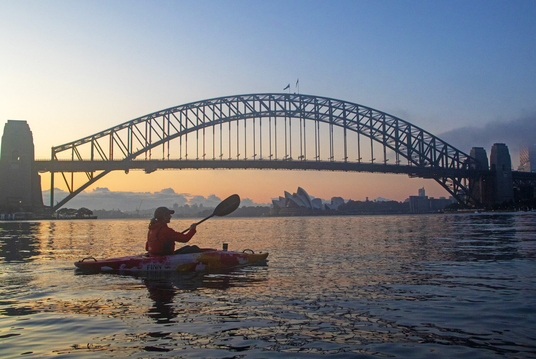
Lavender Bay is the ideal launch site, paddling out from a small beach at its head. Wendy Whiteley’s Secret Garden lies hidden (ergo the secret…) to one side and the polarising Blues Point Tower – once named Sydney’s ugliest building – rises to the other. Time it right and you can pause here as the sun hauls itself into the sky from behind the arch or pylons of the Harbour Bridge.
Setting sail into the sunrise, the best route is east, under the Harbour Bridge (just don’t ponder the fact that there’s almost 53,000 tonnes of metal bridge above you) and along the Kirribilli shores. Sydney’s tower-topped skyline and the punk hairdo of the Opera House rise across the water, and the paddling is simple and straightforward – from Lavender Bay it’s just a couple of kilometres to the cliffs below Admiralty House and Kirribilli House, the Sydney homes of the Governor-General and Prime Minster, respectively.
From here, a more open-water paddle beckons if you want to scoot around the castle-like Pinchgut Island and Fort Denison (noting that ferries begin taking to the water from around 5.30am), or you can simply turn back, retracing your paddle strokes beneath the Harbour Bridge – it’s a view that never gets old, no matter how many times you paddle back and forth.
Want to experience the Sydney Harbour dawn with interp and coffee? Local tour operator Sydney by Kayak runs sunrise paddles under the bridge and along the Kirribilli shores. Place an order for your morning brew and it’ll await you, complete with cup holders built into the kayaks.
Hike the Tongariro Northern Circuit, NZ
Such is the world’s love for the Tongariro Alpine Crossing, almost universally referred to as New Zealand’s best day walk, that more than 100,000 people walk its 19.4-kilometre length every year. To confine yourself to the Crossing alone, however, is akin to reading a chapter on NZ’s most spectacular volcanic region but failing to finish the book.
The Alpine Crossing is just one piece of the longer and more engrossing Tongariro Northern Circuit, a Great Walk that makes a 44.9-kilometre lap of the perfectly conical Mt Ngauruhoe (Mt Doom to the Lord of the Rings fans in the room), the central of the three volcanoes at the heart of World Heritage-listed Tongariro National Park. All the features of the Alpine Crossing – the jewel-box lakes, the hissing vents, the red and raw craters – are here, but spend a fine summer night among the old lava flows and waterfall around Oturere Hut, watching sunset and sunrise bake Mt Ngauruhoe into numerous shades of red, and you truly appreciate life beyond the fast lane of the Alpine Crossing.

The Northern Circuit can be hiked in either direction and is typically walked over three or four days – the Alpine Crossing is just part of one of those days. If walking clockwise, the Circuit steps away from the Crossing (goodbye rambling rat race!) beside the sparkling Emerald Lakes, descending into the Oturere Valley and a barren and beautiful stretch of walking dotted with lava bombs – rocks spat from the volcanoes during eruptions. Along this eastern flank of Mt Ngauruhoe, the hike skirts the bleak edge of the Rangipo Desert (a desert in name and appearance, even if not in rainfall) before swinging back west at Waihohonu Hut to funnel between Ngauruhoe and the ever-rumbling Mt Ruapehu, the highest peak (2797 metres) on the North Island.
Desert turns to water along this home stretch into Whakapapa, with a side trail detouring up to the twin Tama Lakes – the beautiful blue eyes on the slopes of Ngauruhoe – and the main track continuing on to Taranaki Falls, where a stream pours powerfully over a 20-metre-high cliff.
All three huts along the Northern Circuit – Mangatepopo, Oturere and Waihohonu – also have campsites and, like all the Great Walks, bookings are required to hike the Circuit, so plan ahead.
The Snowies Alpine Walk
While the rest of the world was baking sourdough and stockpiling paper through the COVID pandemic, the NSW National Parks and Wildlife Service was cooking up a new multiday hike. Approved in 2020 and four years in construction, the four-stage Snowies Alpine Walk connects Guthega to Thredbo, Charlotte Pass, Perisher and Lake Crackenback. Along the way it passes Australia’s 10 highest mountains, its highest lakes and the country’s highest suspension bridge. High times, indeed.
It was a plan that had the genius of geography, requiring no huts or other accommodation to be built – each night is spent in one of the ski villages. All that was required to puzzle together the 55-kilometre walk was a touch over 28km of new track.
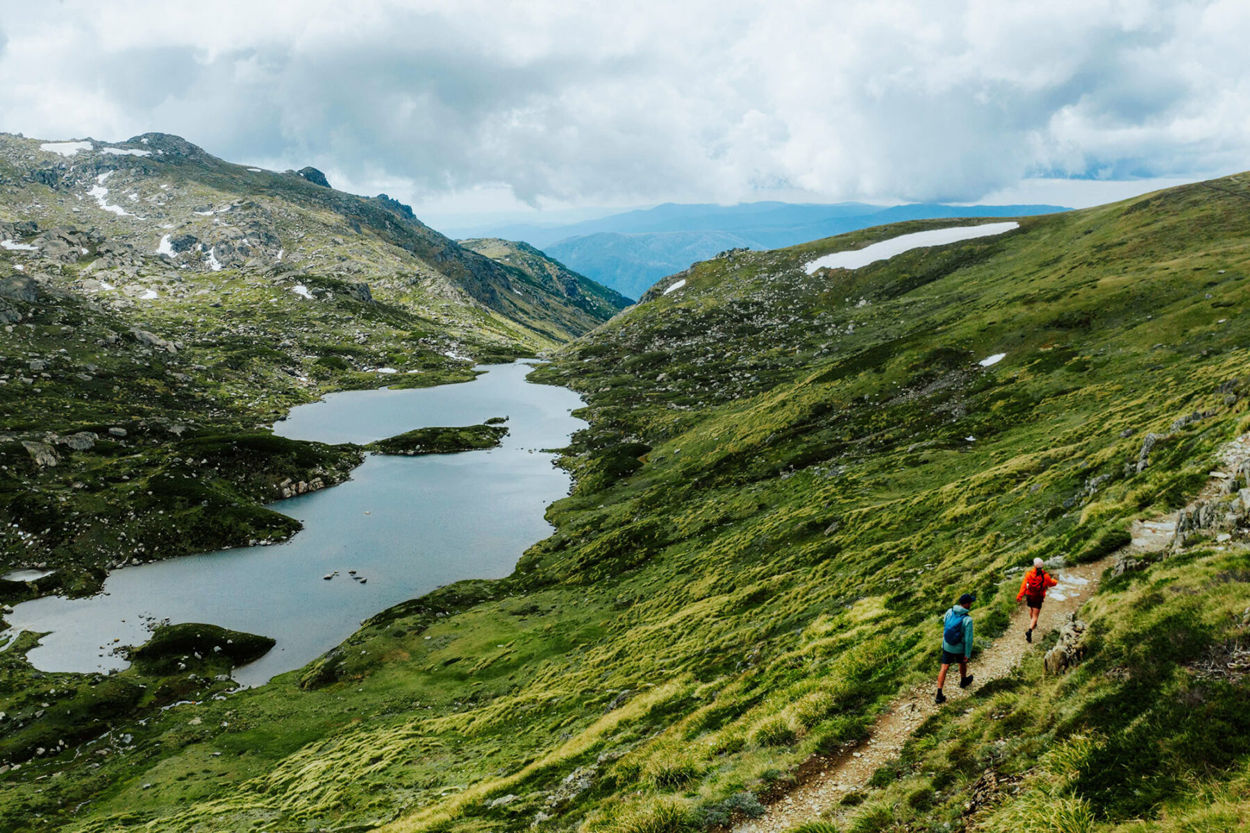
The final stage – 12 kilometres from Perisher to Bullocks Flat at Lake Crackenback – has just been completed and now keen walkers can tackle the Full Monty version of this exciting new trek. Setting out from Guthega, the walk’s northernmost point, the nine-kilometre stage 1 follows the Snowy River valley to Charlotte Pass, crossing Australia’s highest suspension bridge (1627 metres above sea level) over Spencers Creek. The walk really gets into stride on stage 2 as it makes a 22-kilometre loop out from Charlotte Pass, crossing the Snowy River and rising onto the high ridge of the Main Range, where it detours onto the summit of Mt Kosciuszko – all of Australia now briefly lies at your feet. Continuing along the ridge, the Alpine Walk passes Mt Townsend (Australia’s second-highest mountain) and Carruthers Peak before dipping into the craggy bowl of Blue Lake, one of only four glacial lakes on the Australian mainland. Lake Cootapatamba, on the other side of Mt Kosciuszko, is one of the other three.
The longest stretch of new track comes on the 12.9-kilometre stage 3, which weaves among snow gums and summer wildflowers high above Thredbo Valley as it makes its way east to Perisher. Along the way it passes through the Porcupine Rocks for fine views back on the Main Range and down into Thredbo Valley.
As every stage begins and ends in one of the ski villages, it is also possible to also hike each of them as standalone day walks, perfect for families. Walkers can stay in one of the many accommodation options in Kosciuszko National Park including NPWS’ Numbananga Lodge, Creel Lodge or Creel Bay cottages, or in the alpine villages at Jindabyne, Thredbo, Perisher, Guthega or Charlotte Pass. Shuttle services are available if required to assist with transfers to the start and finish of each track section.
The walk can be tackled as self-guided, or for those that would prefer to be guided by an expert and learn about the area on the way, guided experiences are also available.
Cycle the Great Victorian Rail Trail, VIC
Living in the shadow of a more famous sibling can be tough, but not for the Great Victorian Rail Trail. Less familiar to many than the Murray to the Mountains Rail Trail just to its north, the GVRT is the longest rail trail in Victoria, connecting a string of well-placed towns and burrowing through the longest tunnel along any rail trail in the state.
Stretching for around 122 kilometres between Tallarook and Mansfield, the Great Victorian Rail Trail is a liaison with Lake Eildon, an audience with Mt Buller, a glimpse of the sharp Cathedral Range (if you ride the side trail to Alexandra), a brush with art and arguably a more beautiful ride than Murray to Mountains. Though it can be cycled comfortably in either direction, setting out from Mansfield, near the base of Mt Buller, and riding west delivers a net 140 metres of altitude loss to Tallarook.
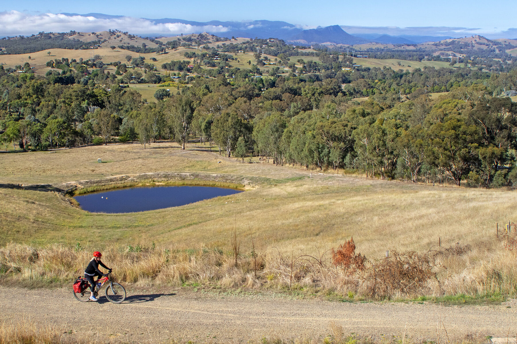
The start of the ride is cinematic as it quickly passes through Bonnie Doon, the small town turned into movie legend by the classic film The Castle. For all its big-screen stardom, its most notable feature is the unrelated 387-metre-long bridge on which the GVRT crosses the Brankeet Arm of Lake Eildon.
Tiny towns, and two of eight artworks commissioned along the trail, dot the next 40 kilometres of riding as the GVRT crosses its highest point at Merton Gap (397 metres above sea level) and descends through rural landscapes into Yarck.
The 13-kilometre side trail into Alexandra doubles back east not far beyond Yarck, though my advice is to treat this extension as an essential part of the ride – it’s the prettiest section of all, especially as it rises over Eglinton Gap to views down onto Alexandra and the peaks of the Cathedral Range. ‘Alex’ meanwhile serves as a great stopping point for a night (as well as delaying the climb back out over Eglinton Gap).
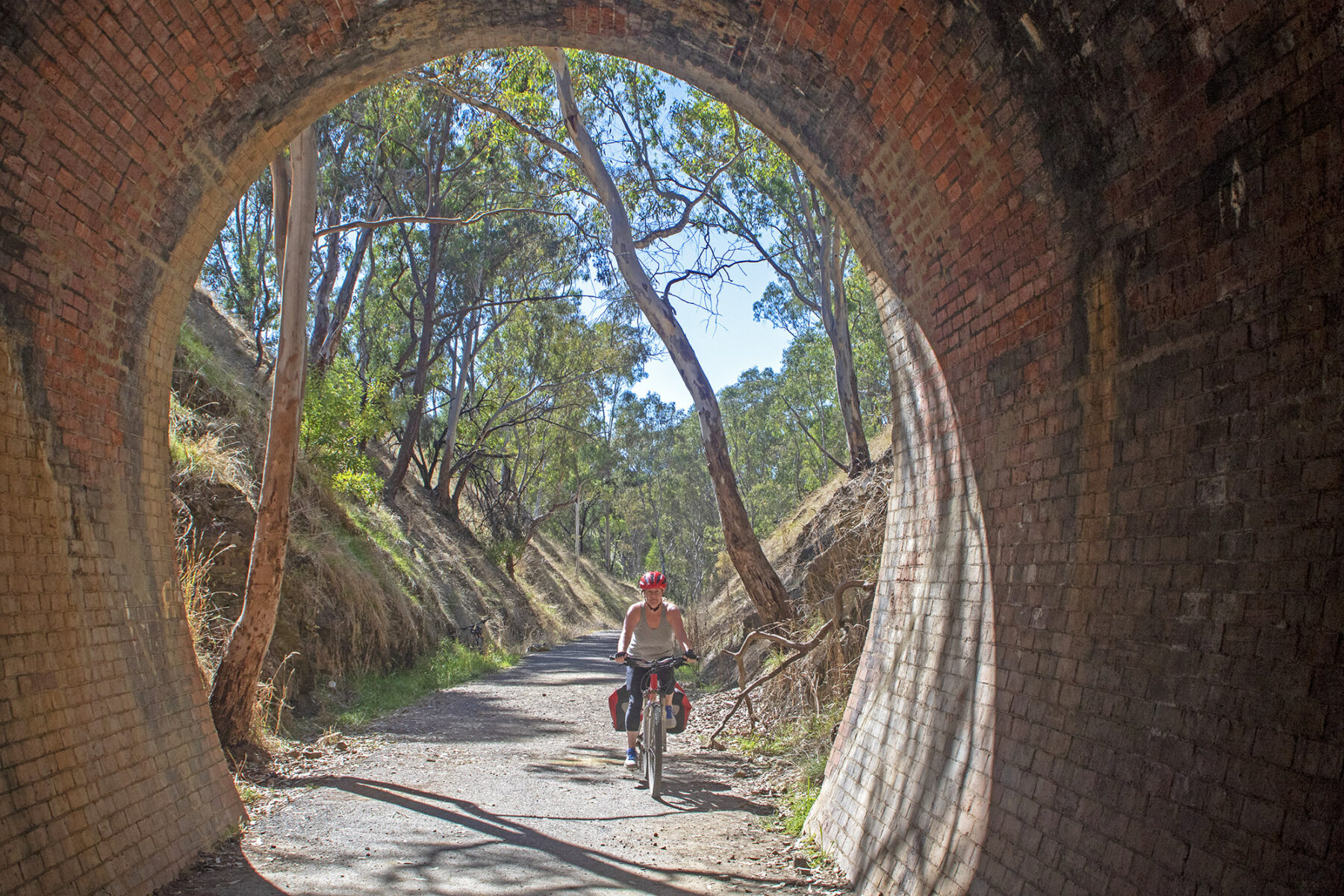
Back on the main route, Molesworth marks the start of the GVRT’s second and most rewarding climb as the ride coils uphill to the Cheviot Tunnel, a 200-metre-long railway tunnel lined with an estimated 675,000 handmade clay bricks.
It’s a welcome feeling to roll out of the tunnel and begin the descent towards Yea and, ultimately, Tallarook, but it also highlights a feature of this ride that will be a curse to some and welcomed by others – the GVRT packs more climbs into its journey than most rail trails. If you want to ease the burden, luggage transfers between stops can be arranged through Double Black Alpine.
Snorkel the Tangalooma Wrecks, QLD
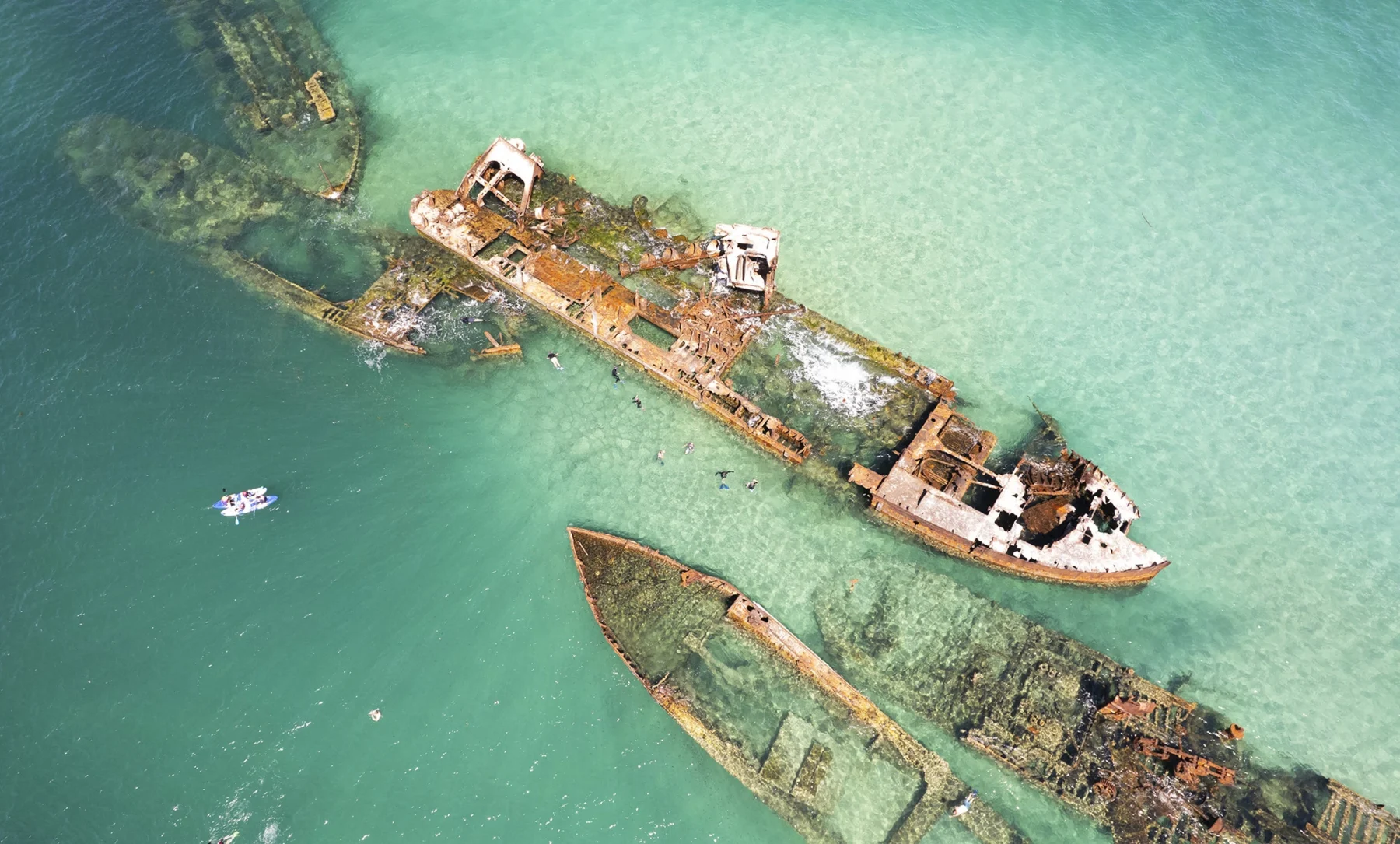
In a channel of ocean along the west coast of Moreton Island, you can see the buildings of Brisbane’s city centre across the water in one direction, and a beach lined with 4WDs close at hand in the other. But it’s when you put your face in the water that you see truly great things.
Along this beach, around 20 minutes’ walk north of the Tangalooma Island Resort, 15 ships – the so-called Tangalooma Wrecks – were scuttled in the 1960s, ’70s and ’80s, creating an artificial reef that’s now so rich in marine life it rivals much of the Great Barrier Reef as a snorkelling destination. And yet it’s just 90 minutes by ferry from Brisbane.
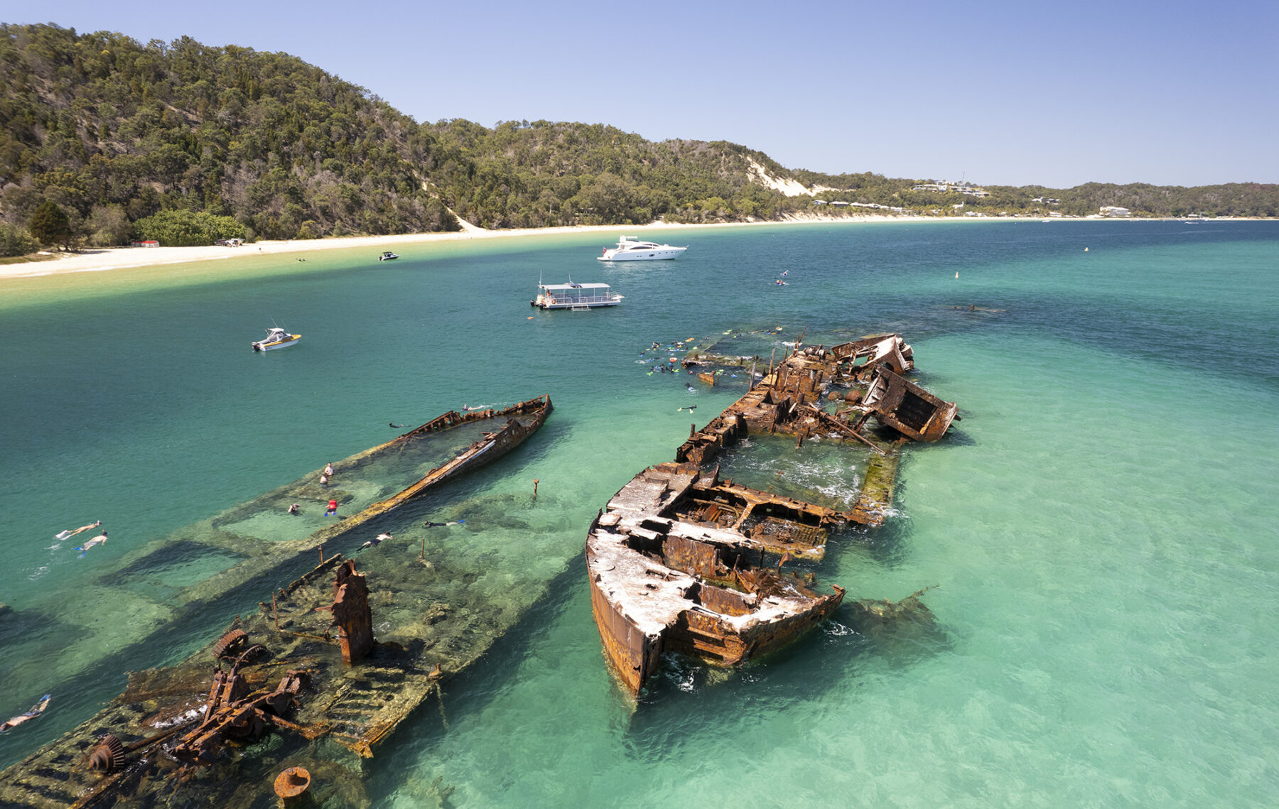
Depending on tides, the wrecks can be as near as 30 metres from the beach, making for an easy swim from the sands (Tangalooma Island Resort also runs boat-based snorkelling tours that head directly to the wrecks). The ships sit at depths of up to 12 metres, creating good diving also, but it’s the accessibility of the snorkelling – even the Micat ferry from Brisbane docks on the beach right beside the wrecks – that really sets them apart.
The wrecks are home to more than 100 tropical fish species, and no sooner have I swum out to the rusting line of hulls than a pair of lionfish float beneath me, their fins wide like the fans of high-society Victorian ladies, and a wobbegong shark glides like a torpedo across the deck of one of the ships. Lucky days bring sightings of green sea turtles.
The best snorkelling, in my experience, is among the wrecks at the southern end of the line: the Echeneis, Seal and Platypus. Coral grows in marine bouquets across their hulls, fish school in every shape, colour and size, and the decks and hulls sit close to the surface, allowing for easy exploration.
Ferry timetables make it possible to come to the island to snorkel on a day trip, or there’s accommodation at Tangalooma Island Resort and basic camping at the Wrecks campground immediately onshore from the shipwrecks. The best time to snorkel is an hour either side of high and low tide, when the current is at its most gentle.
Hike the Cape to Cape Track, WA
The 135km Cape to Cape Track, linking Cape Naturaliste to Cape Leeuwin in WA’s southwestern corner, runs alongside the pristine Leeuwin-Naturaliste National Park.
The landscape walkers travel through is incredible: wind- and ocean-blasted headlands and sea cliffs, towering karri forests and beaches where, often, you will find no-one else on them. In short, it’s the perfect mix of coast and hinterland, with enough fauna and flora to keep the most specific nature-lover more than happy.
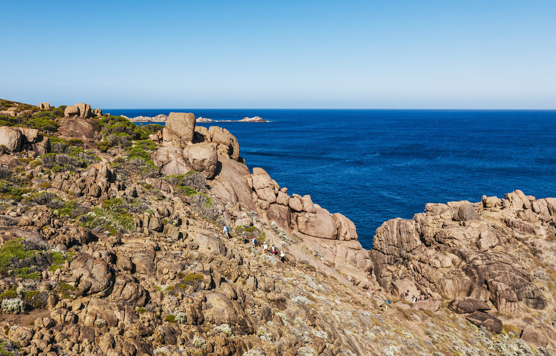
Rock pools full of marine life, distant pods of dolphin and (in whale watching season) larger marine mammals frolicking in the waters of Ngari Capes Marine Park, (if you’re there at that time) the crazy colour-fest that is WA’s wildflower season, no matter the time of year, you’ll be spending more time looking off the track than watching where you are walking.
For experienced hikers, the track can be walked comfortably in a week or, if you have less time (or not the experience of fitness level needed), you can sample a few sections of it as day walks, with several roads providing access to different parts of this coastal adventure. If it was us, though, we’d take the full week; seven days on this track, admiring all its natural wonders, will take you far, far away from any stress and worries of your everyday life.
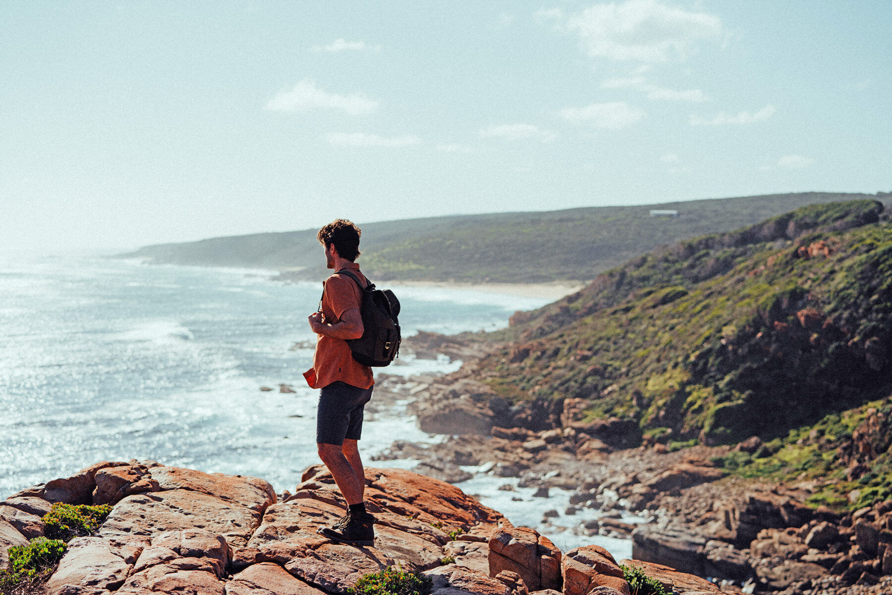
Even though the walk is not as well-known as it probably should be, it is very popular with WA residents. This is not just because it is a cracking adventure, but also because Leeuwin-Naturaliste NP cops the most visitors of any national park in WA. To this end, we’d suggest starting that week-long trek from the northern end, so you get the busy tourist hub of Margaret River and surrounds out of the way first, and then focus on just enjoying this undulating route’s abundance of nature as you follow it along one of the world’s most magical sections of coastline.
Ride the Melrose MTB trails, SA
Scratched into the slopes of Mt Remarkable, the tallest peak in the Southern Flinders Ranges, the Melrose trail network covers around 100km, split into three sections: Melrose Town Trails, Willowie Forest and Bartagunyah, and with a mix of trail grades, from easy to advanced.
The Melrose Town Trails form the heart of the network. Leaving from the very centre of town, they set off in all directions across and up the slopes of the mountain. The signature trails are arguably Weaving Camels and Dodging Bullets. The former is a 1km blue trail that rolls along the banks of Willochra Creek, set beautifully among large river red gums and functioning as an access trail to the southern end of the network. Here, the blue Big Rhua and a selection of black trails coil up the slopes to Wilburs Watch, a ridge-top building with extensive views over Melrose and the flat earth well beyond.
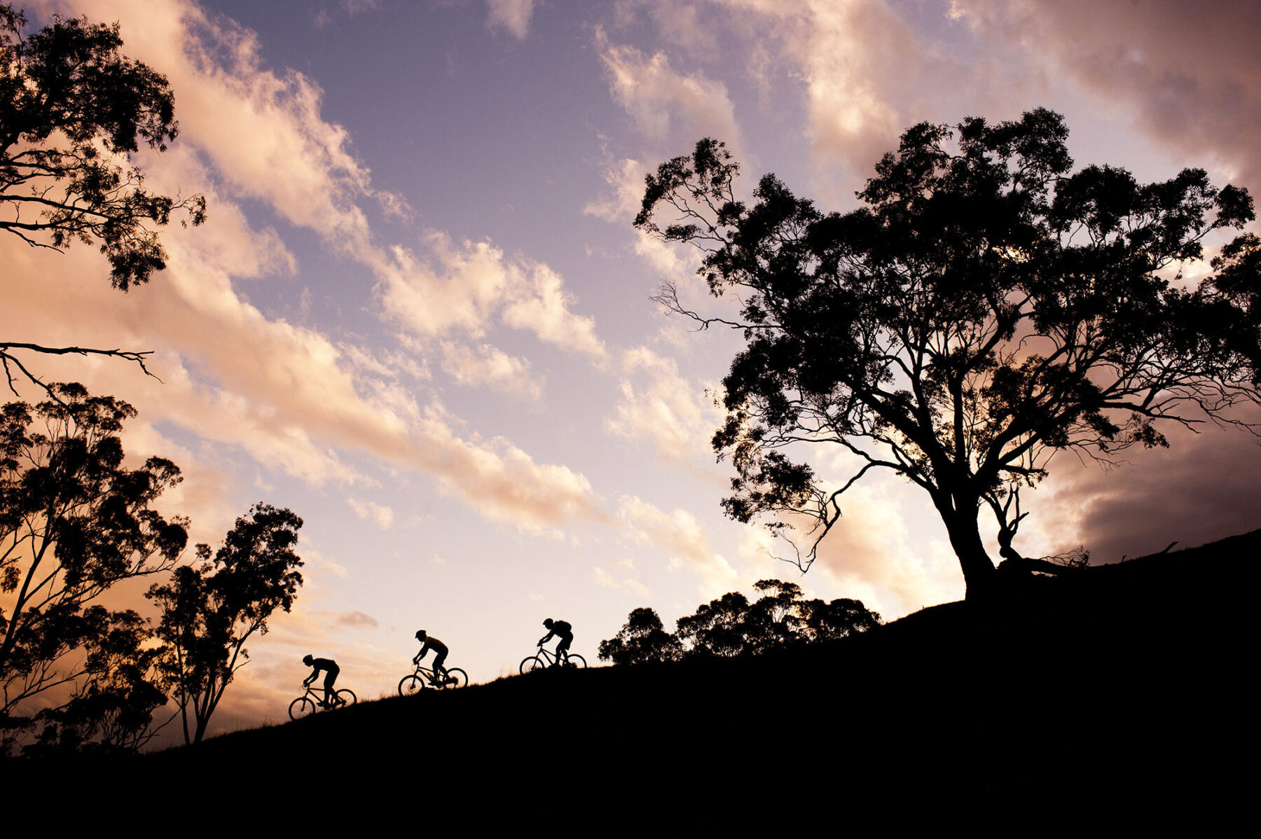
Dodging Bullets is a playful black run that dips through a concrete pipe and, near its end, cuts through the middle of a tumbledown farmhouse – how many chances will you ever get to ride through a house?
The Town Trails are, by nature, exposed, with trails hanging over steep drops. The giddying sense of exposure, more than any technical trickery, means many trails are graded higher than they might be on less precipitous terrain.
Willowie Forest, 8km north of town, has some good offerings for novice riders, especially on the flowing, green Twisted Sisters. Bartagunyah, on a private property 5km south of town, is a more unmaintained, rough-and-ready collection of trails.
Hike the Routeburn Track, NZ
Yes, the well-known Milford Track is right next door, but for those looking to jam in the most of NZ’s Southern Alps landscape – mountains, fast-flowing alpine rivers, or beautiful beech forests of multiple shades of green – then the 32km, three- to four-day, Routeburn Track, traversing two of the Shaky Isles’ most famous national parks, is the best of the NZ Department of Conservation’s (DOC) Great Walks.
The Routeburn can be walked in either direction: from Routeburn Road end, in the east (accessed via the mountain town of Wanaka), to The Divide or vice-verse. Either way, you’ll be gobsmacked by the landscape within minutes of hitting the track. At 32km, you could even, theoretically, complete the Routeburn Track in two days, but that would be a disservice to the track and yourself.
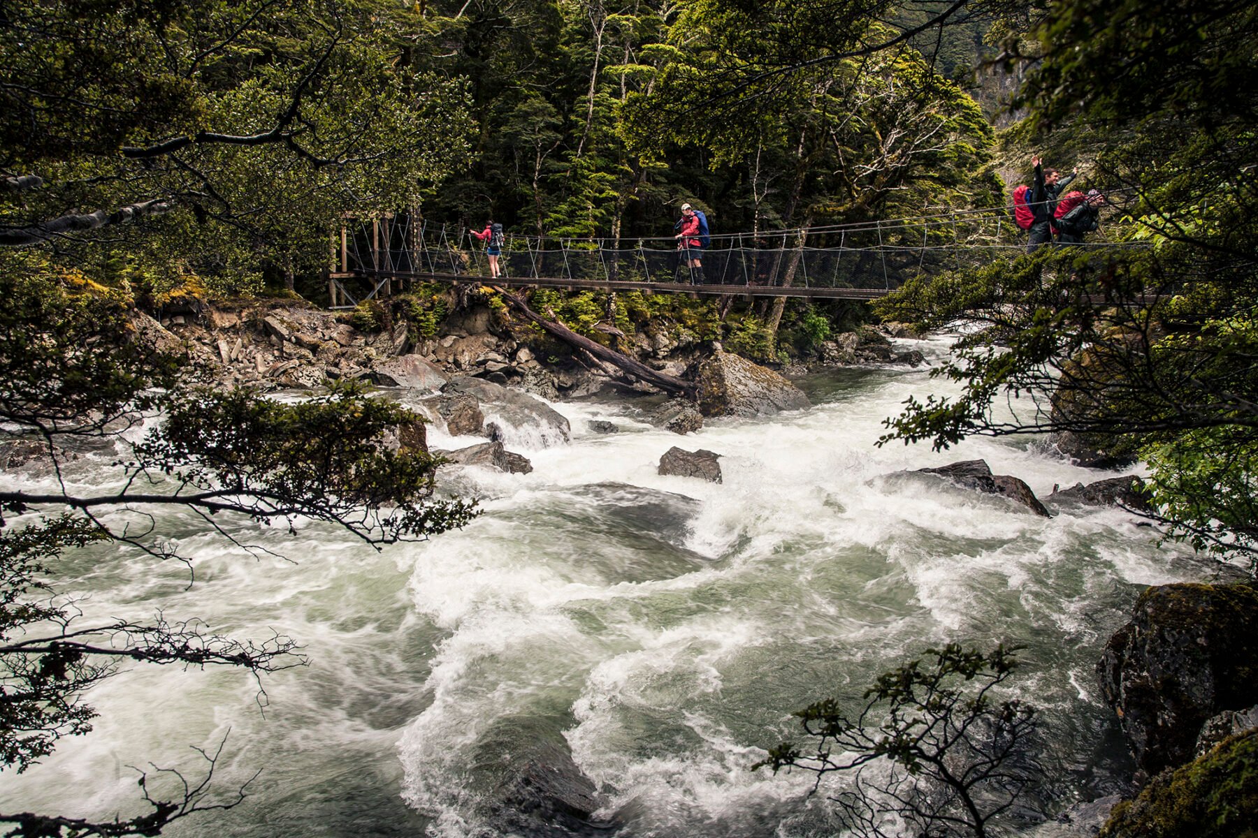
Our preference would be to start from the eastern point at Routeburn Road, inside Mt Aspiring National Park, and get the big climb up to Routeburn Falls Hut out of the way on day one. The Falls Hut is probably one of the most dramatically situated of the DOC backcountry huts, perched high overlooking the river valley (and Mt Somnus) below, with a waterfall running down one side of its location.
The second day on the Routeburn Track is spectacular: you continue climbing to Harris Saddle (passing Lake Harris along the way), before winding your way along the (near) top of the Serpentine Range, with views of the Hollyford River valley, before descending to Lake Mackenzie Hut, another beautifully located hut.
The final day involves an initial climb, passing Earland Falls on the way, before descending to Howden Hut and then climbing up again to The Divide. One side track not to miss is the one to The Divide. The turnoff is 15 minutes from Howden Hut and when you arrive at The Divide (1.5-hr return walk) you get awesome views of the Darran Mountains.

The track is well graded throughout with only a few short rocky sections, and the Great Walks huts (for independent walkers) are brilliant (gas stoves and wood heating, plus bunk rooms). As long as you’re well prepared for the region’s oft-changing weather (and remember to book your hut tickets well in advance), the Routeburn Track is perfect for those just getting started on multi-day treks, and adventurous families; children from 10 years of age upwards will have a cracking time.
If there’s one world-class track we’d recommend for introduce the family to the joys of multi-day trekking, it’s the Routeburn.
Ride the South Coast MTB trails, NSW
With the recent opening of the 70km-plus eastern section of Mogo Trails, at Mogo, just south of Batemans Bay, in the south coast’s Eurobodalla Shire, an awesome new mountain bike road trip is now a possibility. Adding Mogo’s amazing new trails to the recently expanded 85km trail network at Narooma, the 58km Gravity Eden MTB Park, in the Sapphire Coast’s popular tourist town of Eden, and throwing in the long-established 55km Bundadung MTB trails at the coastal village of Tathra (around 12km from Bega), there’s really no excuse for any mountain bikers not to tackle what looks to be one of NSW’s best adventures, in the form of a mega road trip along the South Coast. (Note that, by early 2025, Mogo Trails will have expanded to around 130km.)
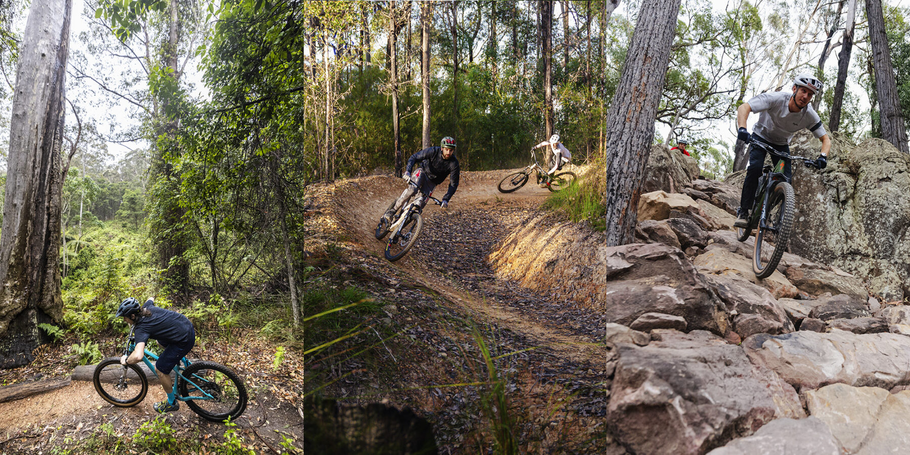
This MTB road trip is packed with a variety of riding experiences, thanks to each network’s unique trails. From Gravity Eden’s 300 metres of vertical gain that offers plenty of challenging and beginner-friendly trails, to Narooma’s wide variety of steep, gnarly, flow experiences and now Mogo’s epic combo of long and short, gnarly and steep, and flow and fast, it’d be easy to spend a week riding at each, much less all three.
Thankfully, with only 2.5 hours separating the north (Mogo) from the southern (Eden) of this road trip, driving between each of these trail networks is no difficult task over the course of a few days, with ample trail-riding rewards (and some brilliant dining and accommodation) the result.
Only four hours south of Sydney (and around two from Canberra) Mogo Trails are a great way to kick off this MTB road trip, with trails of all grades meaning any rider from the true beginner and young kids, through to the double black diamond-loving enduro and downhill fanatic, will have an absolute blast.
Venture south from Mogo and talk to any Narooma or Eden residents and you will get the same reply when asked about the difference their respective trail networks have made to visitor numbers: “We’ve never seen so many bikes!”, with both towns recording uplifts in visitation, and primarily they are of the bike-riding kind. And, they are also repeat visitors, proving each town’s MTB trail offerings are not just ‘something new’ but are built and designed very well, ensuring plenty of return visits from keen mountain bikers. Mogo’s trails have started doing exactly the same when it comes to enticing return riders.
There’s no excuse for any mountain biker not to look at the NSW south coast’s booming MTB trail networks and start planning that road trip. If it was us, at Aus Geo ADVENTURE, we’d be planning for a week – and for any time of year, too. The weather on the south coast is beautiful in summer, of course, but it’s also pleasantly mild in the cooler months – and this makes for optimum riding conditions, we reckon!
Add in the excellent eateries up and down the south coast, and the character-filled pubs and craft breweries and, really, there’s no excuse, is there?
Many more adventures ahead…
Of course, this selection of escapes, really, is just the tip of the summer adventures iceberg. From checking out the best family bike rides around Australia or what else NZ’s epic South Island offers up, through to some of Australia’s famous river journeys, there’s a literal smorgasbord of outdoor fun to experience throughout summer. Have fun!
