
Walking is one of the world’s most accessible outdoor activities. Australia is full of awesome foot-borne escapes, whether short jaunts to breathtaking viewpoints, or multi-day treks that take walkers into remote parts of the country. In this fourth part of our great Aussie walks series, we reveal five of the best in the Sunshine State.
Bartle Frere
Distance: 15km return Time: 1–2 days Difficulty: Hard
It’s a mighty challenge to walk up the highest mountain in Queensland but great fun for very fit,
experienced and self-sufficient walkers. Bartle Frere (1611m), in Wooroonooran National Park, is about 30km north-west of Innisfail in far north Queensland. From Josephine Falls (100m) it’s a relatively easy walk to Big Rock camp. From there you’ll climb – steeply rising for 1000m over 4km through the humid rainforest – dodging vines, clambering over rocks and tree roots to emerge from the canopy at one of Australia’s most remote and spectacular campsites, Eastern Summit camp. The ascent from the campsite to the summit is an exciting scramble over huge boulders. From here, and from the campsite, there are 360 degree views of the Atherton Tablelands, Innisfail and the Great Barrier Reef.
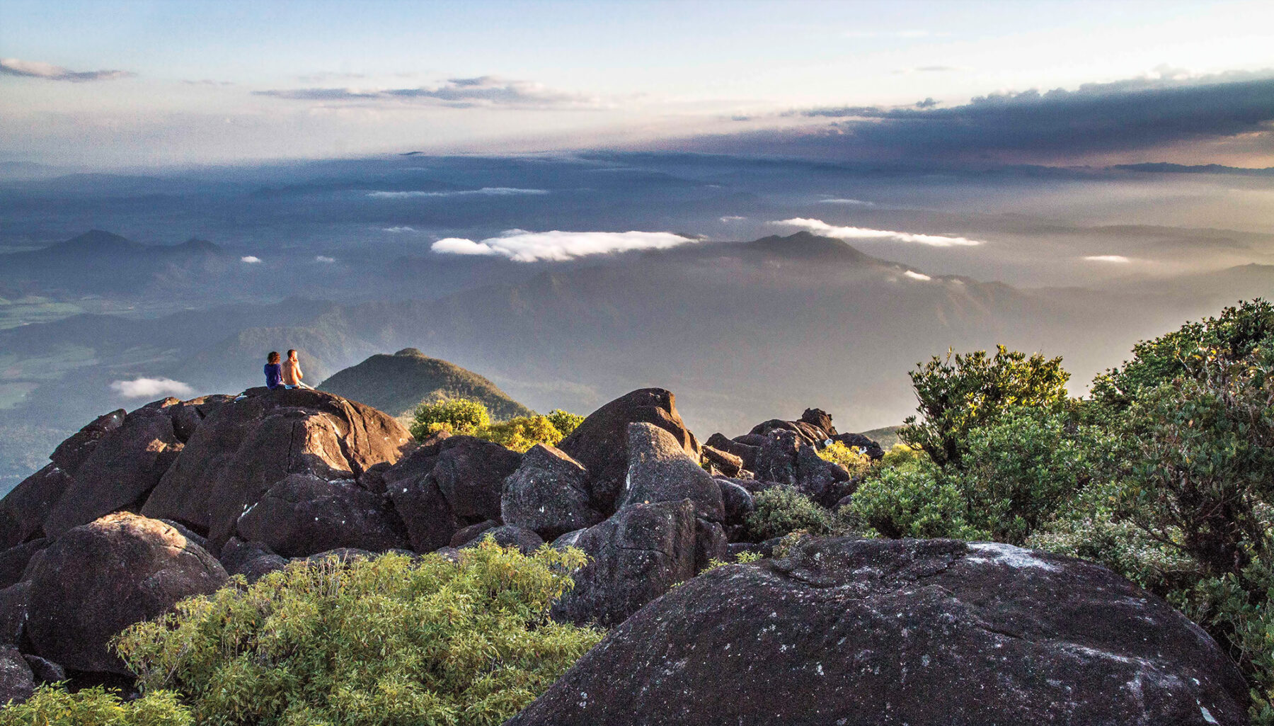
The trail may be closed during the wet season, between December and April. Even in the tropics walkers need to be prepared for all conditions because rainstorms, freezing winds and cloud may envelop the upper ridges of the mountain at any time.
Mt Cordeaux
Distance: 6.8km return Time: 2.5 hours Difficulty: Medium
To climb this mountain is to stand on the western rim of a massive shield volcano, active some 24 million years ago. Mt Cordeaux (1135m) is just one of a spectacular arc of mountains, known as the Scenic Rim, which stretches from Mt Mistake to Springbrook in south-eastern Queensland. Naturally, there are spectacular views – over the Main Range, Darling Downs, Lake Moogerah and McPherson Range. About 100km south-west of Brisbane, Mt Cordeaux is found within Main Range National Park, part of the Gondwana Rainforests of Australia World Heritage Area. It’s a relatively easy and delightful route that offers great rewards for a short distance.

Starting from the carpark at Cunninghams Gap, trucks can be heard labouring up Cunningham Highway but the sound fades away as you climb, to be replaced by bellbirds, whipbirds and lyrebirds. The track zigzags uphill through mossy rainforest to two lookouts near the summit, bristling with spiky grass trees and giant spear lilies. If you have energy to spare it’s well worth extending the walk along the ridge top to Bare Rock (2.8km one way), which provides another perspective of Mt Cordeaux and views over the fertile valleys. The walk is popular so start early if you want it all to yourself. Be careful of the sheer cliff edges and take a jumper in case it’s cold at the top.
K’gari (Fraser Island) Great Walk
Distance: 90km Time: 6–8 days Difficulty: Medium
The world’s largest sand island is a spectacular World Heritage area, with pristine lakes, rare rainforests growing on sand and exuberant wildlife including whales, dugong, freshwater turtles, the country’s purest wild dingoes and half of Australia’s bird species. For thousands of years the up-to 9000 Butchulla people who lived here called the 123km-long island K’gari. It means ‘paradise’ or ‘beautiful place’. It is certainly that and the best way to appreciate it, free from the tourist crowds, is this long-distance walk traversing the middle section of the island from Dilli Village to Happy Valley.
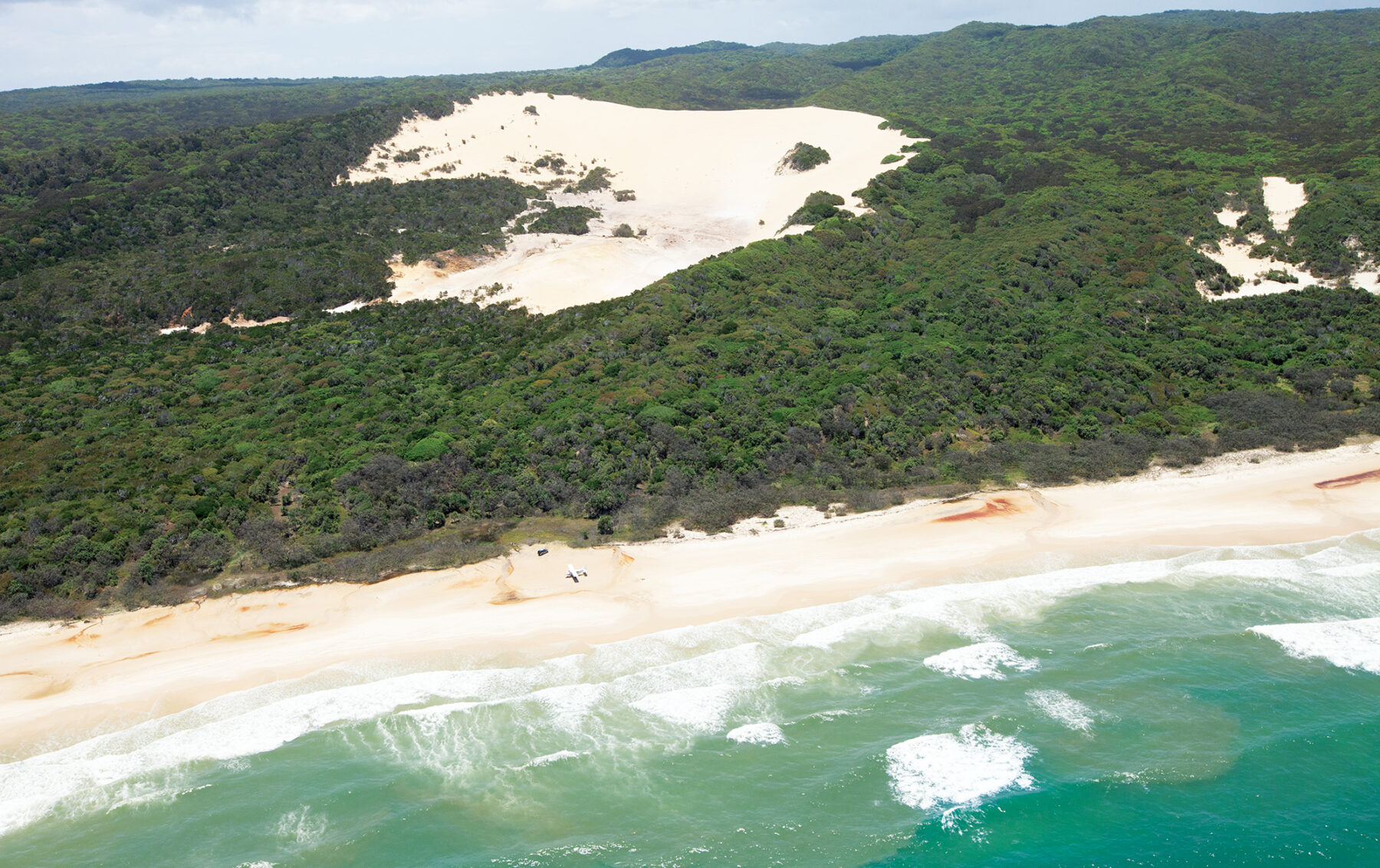
You’ll visit exquisite emerald and sapphire lakes fringed by white sand, giant rainforest trees, coastal heathland, mangrove forest and creamy dunes called sandblows. As an independent walker you’ll need to be entirely self-sufficient but there are supported and guided options, and a taxi service that can provide transfers. Walkers campsites must be booked with QPWS.
North Stradbroke
Distance: 6km return Time: 2 hours Difficulty: Easy
Just 30km south-east of Brisbane, North Stradbroke Island, or Minjerribah, is a large sand island much loved by locals for its natural beauty and relaxed pace, perfect for holidays full of walking, swimming and fishing. The Quandamooka people, the island’s traditional owners, have a strong culture and custodianship over its special places. About half the island is protected within Naree Budjong Djara National Park (meaning ‘My Mother Earth’), where you’ll find sand dunes, wetlands, endangered heathlands and lakes.
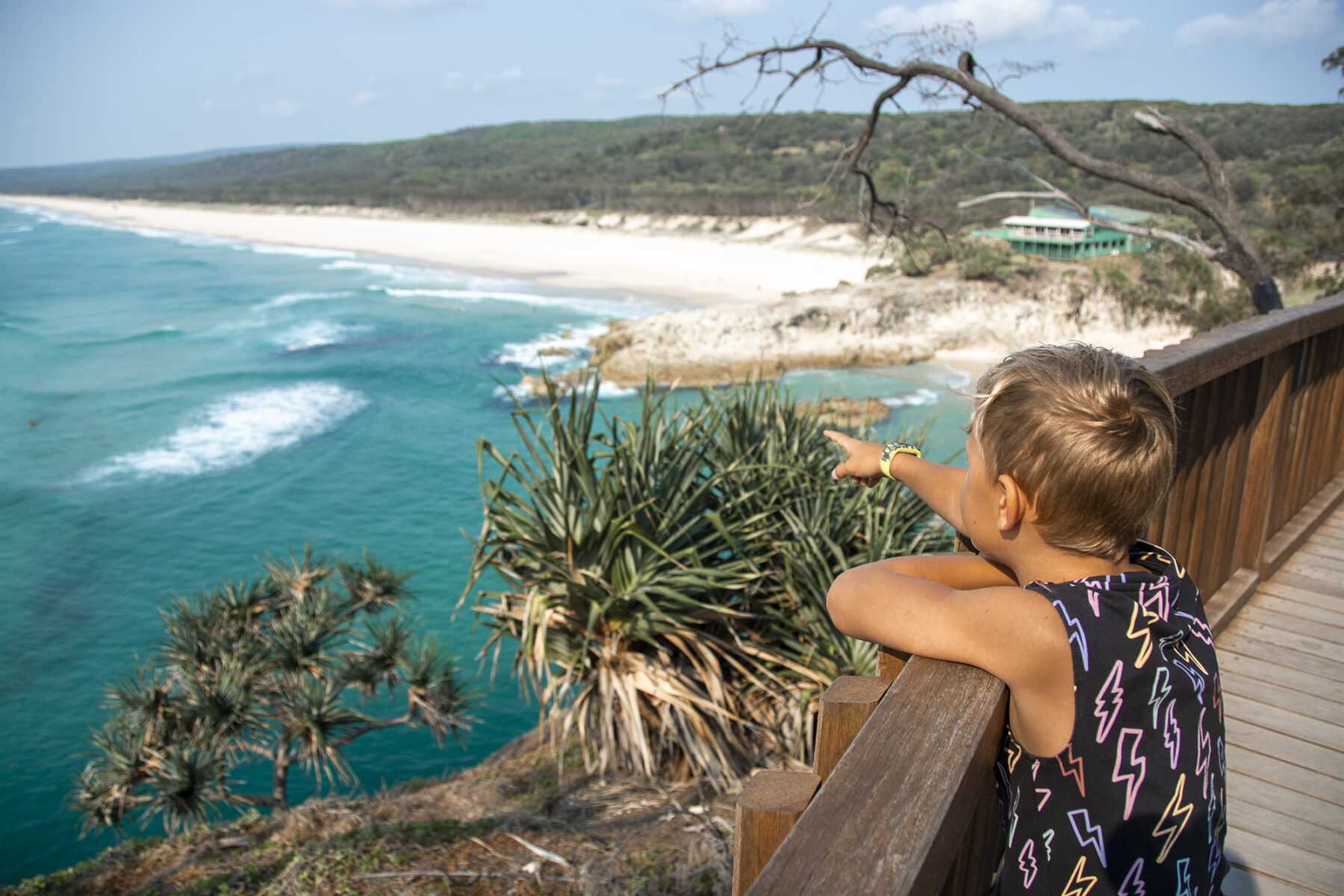
You can explore Point Lookout by walking around the beaches and headland to the spectacular Gorge Walk. This is Queensland’s most easterly point and one of the best places for viewing the humpback whale migration (Jun–Nov). In fact, the University of Queensland has a whale research facility that uses North Stradbroke Island for research on humpback whales and their songs. During this walk you might also spot dolphins, manta rays and sea turtles. Start from Cylinder Beach and simply follow the track around the coastline. At Frenchmans Bay climb the steps through banksias, she-oaks and pandanus trees to the roadside path. Head left to join up with the Gorge Walk, where boardwalks line the sides of this narrow notch in the headland and look south over 32km of white, sandy beach. The loop track will take you back to the road, and this is a shorter route back to Cylinder Beach.
Thorsborne Trail
Distance: 32km one way Time: 3–5 days Difficulty: Hard
Thorsborne Trail on Hinchinbrook Island is one of Australia’s great multi-day walks, providing walkers with a real wilderness experience. Only 40 people are permitted on the track at a time so you can enjoy the solitude of a relatively untouched landscape. There are few traces of human interference here. Apart from track markers, fixed to trees at eye height in the scrubland and rainforest sections, there is very little signage. Walkers must camp and be entirely self-sufficient.
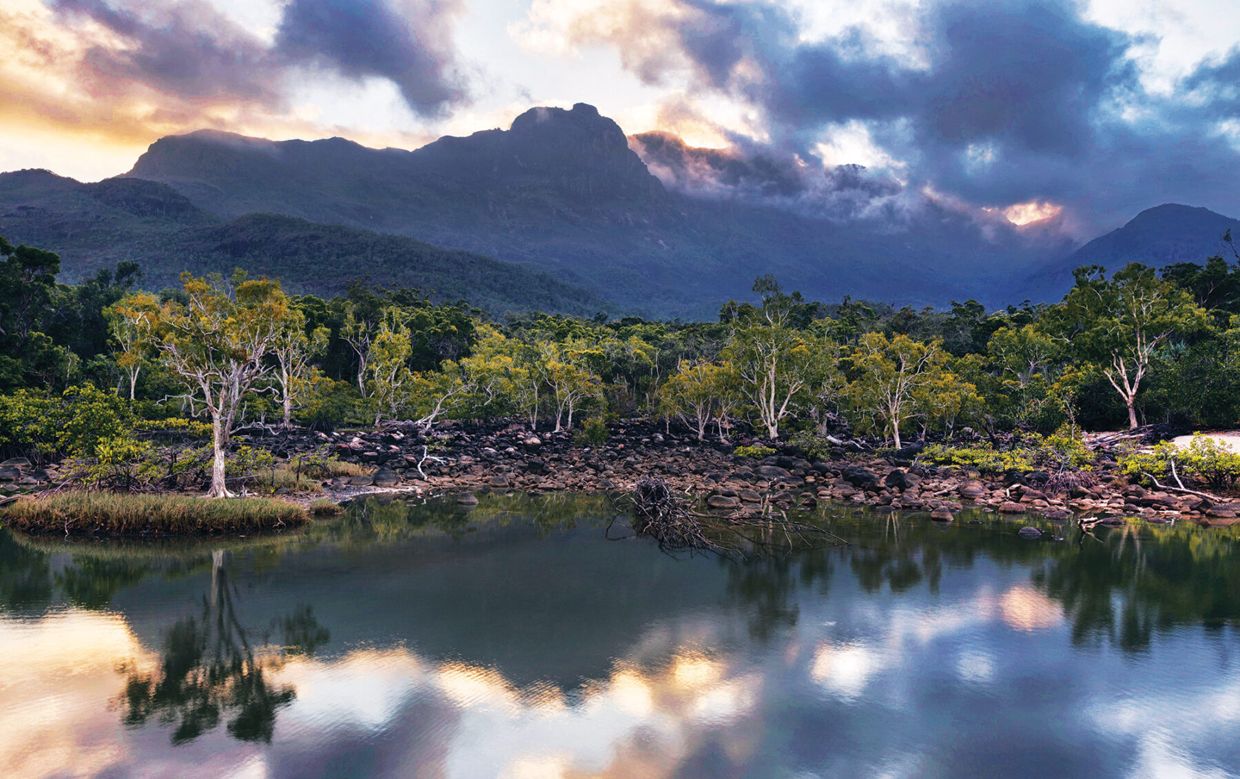
Hinchinbrook Island, 53km long and 10km wide, located about 6km off the northern Queensland coast, is part of the Great Barrier Reef World Heritage Area. Water is a defining feature of the landscape on the island – its rugged 400sq.km landmass has been shaped by the seasonal rains and tidal swells of the Wet Tropics. An intricate network of creeks and waterways threads across the island; swollen with monsoon rainwater during the humid summer months, they give birth to falls that thunder through the island’s rock country. During winter the waterways gradually drain and evaporate, leaving many creeks dry.
The Thorsborne stretches 32km along the eastern coast of the island, from Ramsay Bay in the north to George Point on the south-eastern tip, and can be walked in either direction. The trail passes through incredibly diverse landscapes, traversing mangrove swamps, sweeping beaches and rocky headlands on the Coral Sea, heath-covered mountains, melaleuca and palm wetlands, eucalypt and casuarina woodlands, and lush, tropical rainforests. Although daily distances are short, it’s a challenging walk thanks to the humidity, the need to carry your own gear and water, tidal creek crossings and the danger of saltwater crocodiles and marine stingers. Nevertheless, the island’s wild and pristine beauty is hard to resist and you’ll soon see why people come from all over the world for the Thorsborne. Camping permits must be obtained from QPWS. Plan well ahead as this is a popular walk.


