
Tasmania’s Walls of Jerusalem National Park is one of the world’s most overqualified World Heritage sites and forms part of the Tasmania Wilderness World Heritage area. This area encompasses 1.38 million hectares and includes Cradle Mountain-Lake St Clair, Franklin-Gordon, Southwest and Hartz Mountain national parks, as well as Adamsfield Conservation Area and the Central Plateau Conservation and Protected Area.
As well as its many natural highlights – glacial-carved valleys, ancient pencil pine forests, pristine alpine lakes and ancient dolerite peaks – Walls of Jerusalem NP is also a famous bushwalking destination, with the park’s 518,000 hectares offering walks ranging from day-long, to overnight, to a six-day (or longer) circuit (guided or independent), exploring the park from north to south and back again. The variety of walk lengths means Walls of Jerusalem NP has a walk suited to bushwalkers of all skill and fitness levels, with the walking season generally running from September to May. It also provides the perfect location for taking that next booted step in their walking careers, while offering a fantastic – and rewarding – challenge for the more experienced walkers.
The park’s northern access point is located roughly three hours’ drive southwest of Launceston, passing through the township of Deloraine (the final chance to grab last-minutes supplies) and then Mole Creek (home to a fine example of Tassie’s character-filled pubs), before the turnoff from Myall Creek Road to Fish River car park. Then, it’s just a matter of signing the Parks Tasmania walker registration book, and the real adventure begins.
The long way round
To fully appreciate the wonder that is “the Walls”, a six-day circuit of the national park is a must, albeit one for experienced walkers. Ideally, you will have completed other unsupported/independent multiday treks (or even guided full-pack treks), be walking in well-worn hiking boots, and be comfortable carrying all your food and water, as well as appropriate clothing and camping gear (see our comprehensive guide to hiking, here). You will also need to think in terms of time, rather than distance, owing to the terrain encountered during this circuit and its side-trips, and the amount of ascending and descending.
Even though the tracks in the park are easy to follow and the majority are signposted, you should be adept at basic navigation and carry (preferably) topographic paper maps of the park and a compass, plus an emergency beacon. Why no GPS? A handheld GPS is fantastic but these can sometimes fail or simply run out of power (if you do take one, don’t forget spare batteries) so are not a good idea as the sole navigation aid (this writer takes paper maps, compass and GPS on all treks. This all sounds daunting but for experienced walkers, this equipment will be always in their packs and with proper preparation and all the essential gear, you can just focus on why you’re really here: to experience one of Australia’s premier multiday bushwalks.
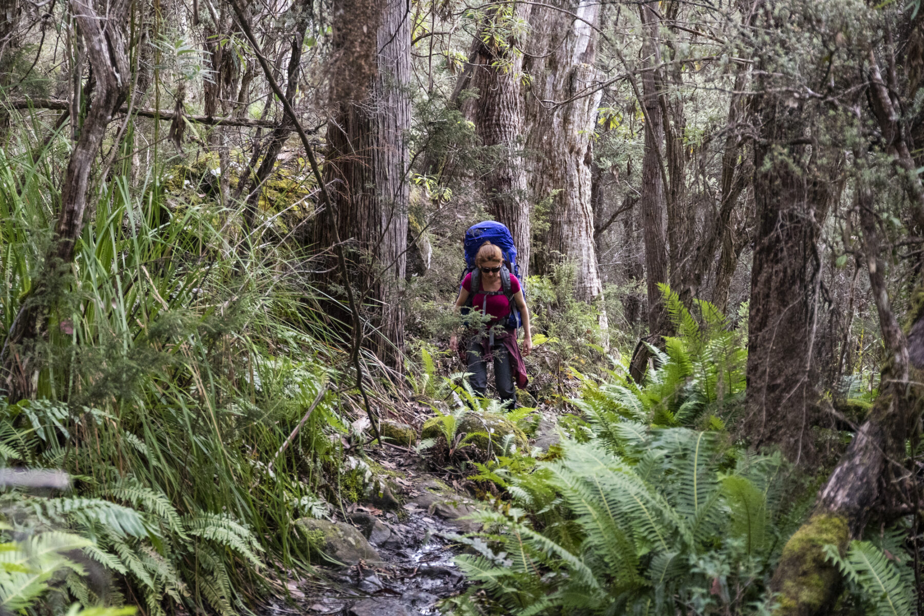
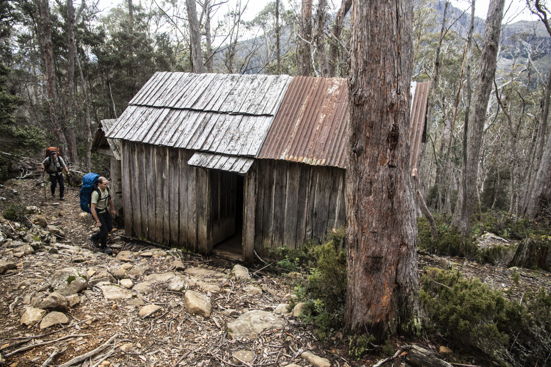
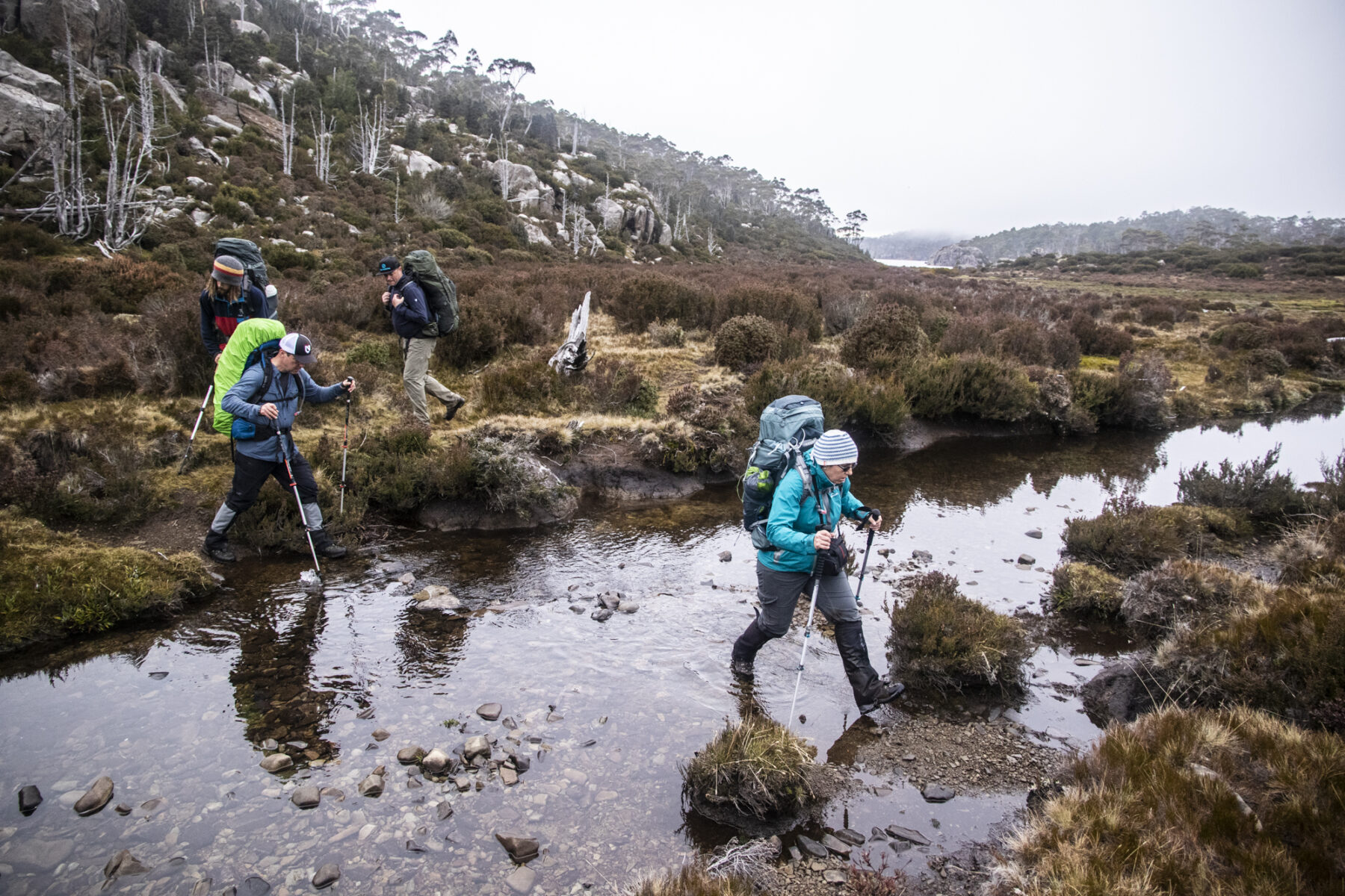
The Walls of Jerusalem circuit is far from subtle in its introduction for walkers to the majestic landscape found in the park; the initial ascent begins straight from the Fish River car park; following the rock-strewn track upwards immerses you immediately in dense forest, with towering eucalypts shadowing you and lush tree ferns bordering the track. You will ascend 500m to the park’s boundary line, which is just above what will be the first of the area’s historic huts you will encounter. Trappers Hut was, as the name suggests, used by wallaby trappers initially, and later by bushwalkers (although nowadays you are not allowed to stay in the hut unless in an emergency situation). Following the rock-strewn track upwards immerses you immediately in dense forest, with towering eucalypts shadowing you and lush tree ferns bordering the track. Even allowing for the steepness of the ascent, the first section is cracking good fun, and hints at what lies ahead over the next six days as you explore this wild land.
Above it all
Once you reach the park boundary you will come to the junction of Walls of Jerusalem Track and Junction Lake Track. This junction point is where you start and finish the circuit itself. You can opt to go south on Junction Lake Track and complete the circuit anticlockwise, but we’d recommend turning southeast onto Walls of Jerusalem Track first – you want your introduction to the park’s many natural highlights to happen on the first day – plus it’s a fitting reward for that hour-long lung-busting climb.
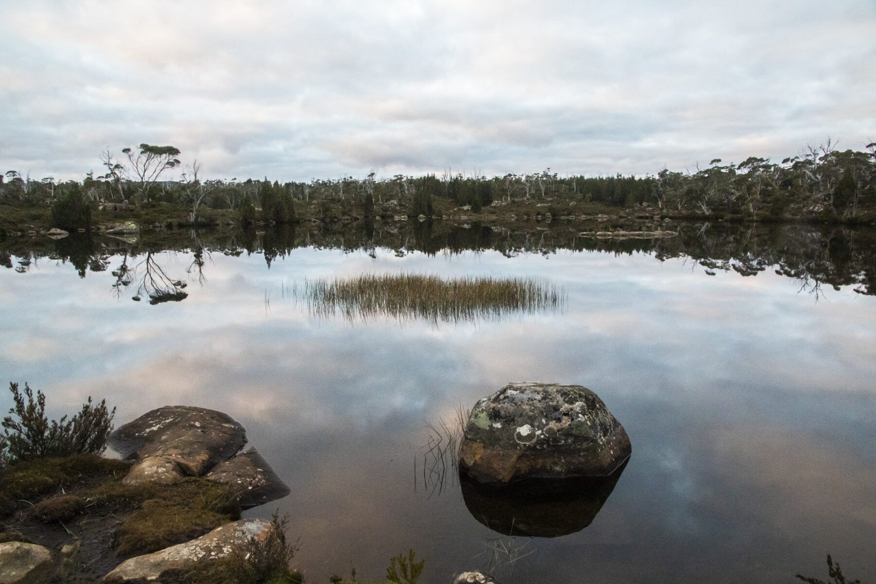
You are now at 900m and soon move out of the dense timber and onto the Central Plateau and the first of the circuit’s highlights. Solomons Jewels is a landscape of small alpine lakes surrounded by native pine trees – and the second (after the park title itself) of what will become regular encounters with the park’s rather unique naming convention. The park’s title is thanks to 19th-century surveyor James Scott. In the 1920s, Launceston solicitor Reg Hall (a regular visitor) continued this biblical theme when naming natural features, so landmarks are tagged with titles such as Zions Gate, King Davids Peak, Herods Gate, Wailing Wall, Pool (and Vale) of Bethesda, Lake Salome, and The Temple. All epic names, but then, this is an epic landscape.
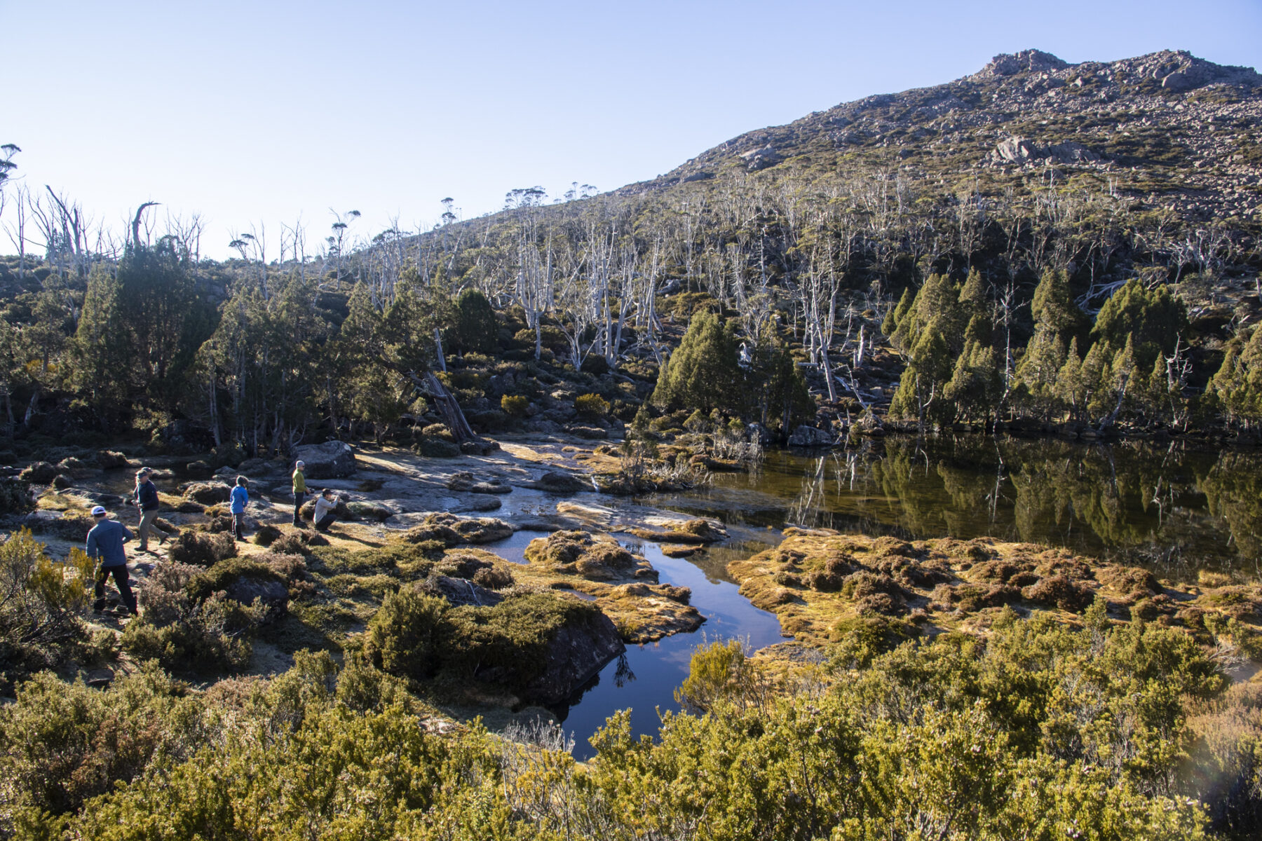
The traverse of Solomons Jewels is relatively quick and then there is a final, but short, ascent to Wild Dog Creek campsite, perched at the base of King Davids Peak (1499m and Tassie’s tenth highest). This will be your base for one night. The campsite has tent platforms raised up above the ground to protect the fragile vegetation below, and there’s a self-composting toilet about 50 metres further up. There is also water here (boil before use). It’s a roughly three- to four-hour journey from Fish River car park to Wild Dog Creek campsite and once there – and after setting up camp – you can relax and enjoy the spectacle of sunset over the lumpy peaks of Howells Bluff and Clumner Bluff. Oh, one important note: keep an eye out for the oversized possums that will try and raid your food bags here; keeping all your food stored and your tent zipped up will help discourage these opportunistic characters.
Entering the amphitheatre
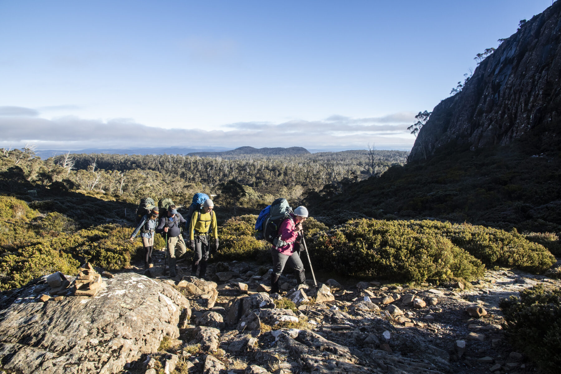
The area of the national park that encapsulates the actual Walls of Jerusalem themselves is worthy of a full day’s exploration, and is deserving of its “The Amphitheatre” moniker. You enter this natural arena via Herods Gate, a 20-minute climb from camp and then once through are immediately confronted with the immense scale of this area; the towering dolerite cliffs of the West Wall shadow walkers as they move southeast on the second day of the circuit, along slightly undulating terrain. Highlights here include Lake Salome to your east, and the pristine Pool of Bethesda. It’s an hour traverse (with a quick sidetrip to the Pool) before you ascend Damascus Gate and have the choice of two sidetrips: a scramble up Solomons Throne, at the junction of the West Wall and the Wailing Wall, and/or The Temple, to the east.


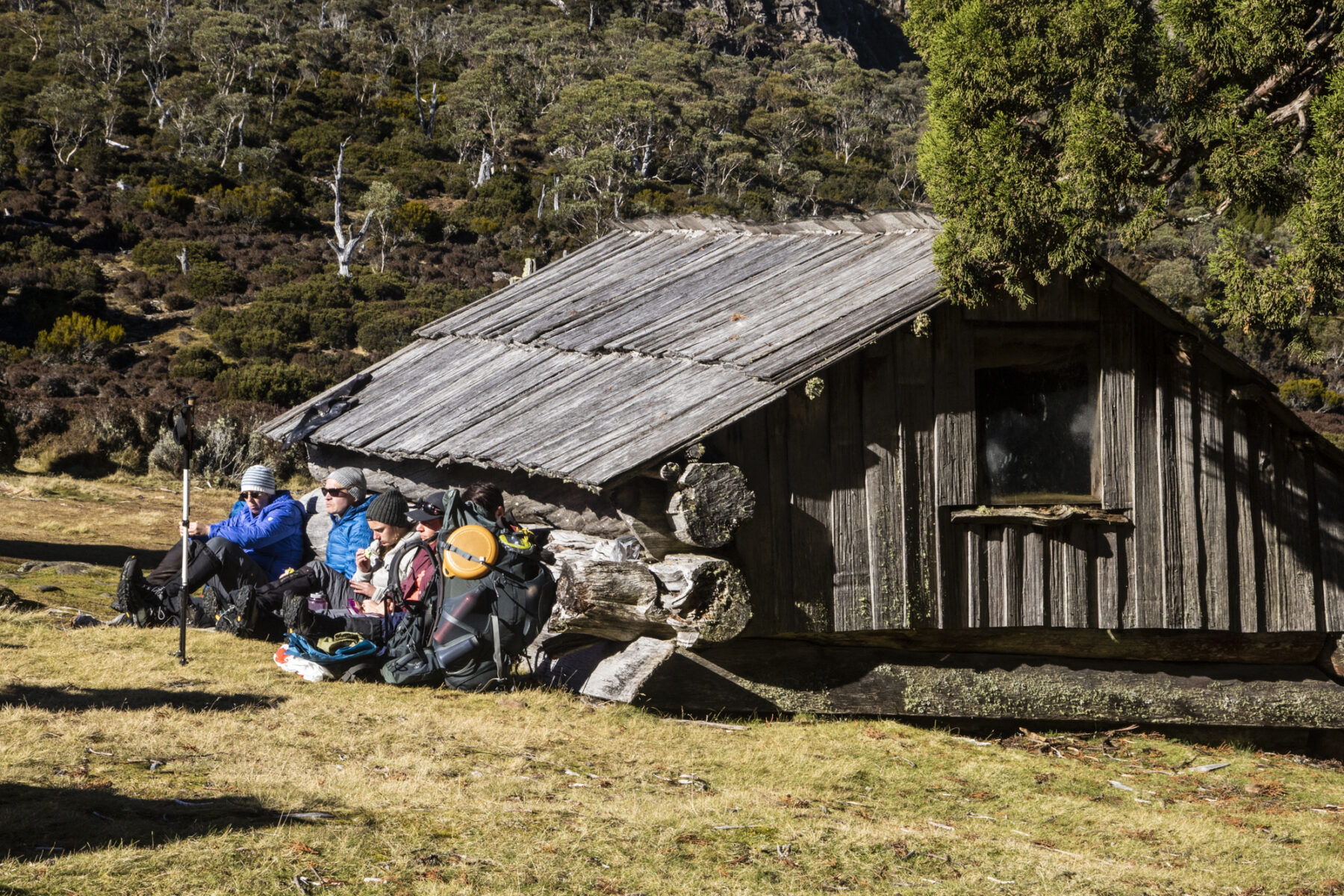
We’d opt for Solomons Throne; scrambling up a scree field, then climbing through a square-edged notch cut out of the West Wall sees you soon at the summit of Solomons Throne, with 360-degree views across the park. Take in the Great Pine Tier and Bernes Valley to the southeast, Mt Jerusalem to the east, Chinamans Plains to the south and your day four destination of Lake Adelaide to the southwest before returning to the Damascus Gate junction and continuing southeast to your next camp at Dixons Kingdom Hut. This historic hut is reached after an hour of walking along a rocky, undulating track that takes you through an emerald-green wonderland of lush grass and native pine trees before coming out into a clearing beside the hut.

As well as sublime camping, Dixons Kingdom Hut is also where the track to the 1459m summit of Mt Jerusalem is accessed. This steady ascent takes about an hour, with the track taking you over plenty of the rocks and boulders synonymous with the park, past some more pristine alpine lakes, and over some false summits before you reach the cairn that marks the true summit. The views over the park – and especially over the myriad lakes to the east – are outstanding.
The end game
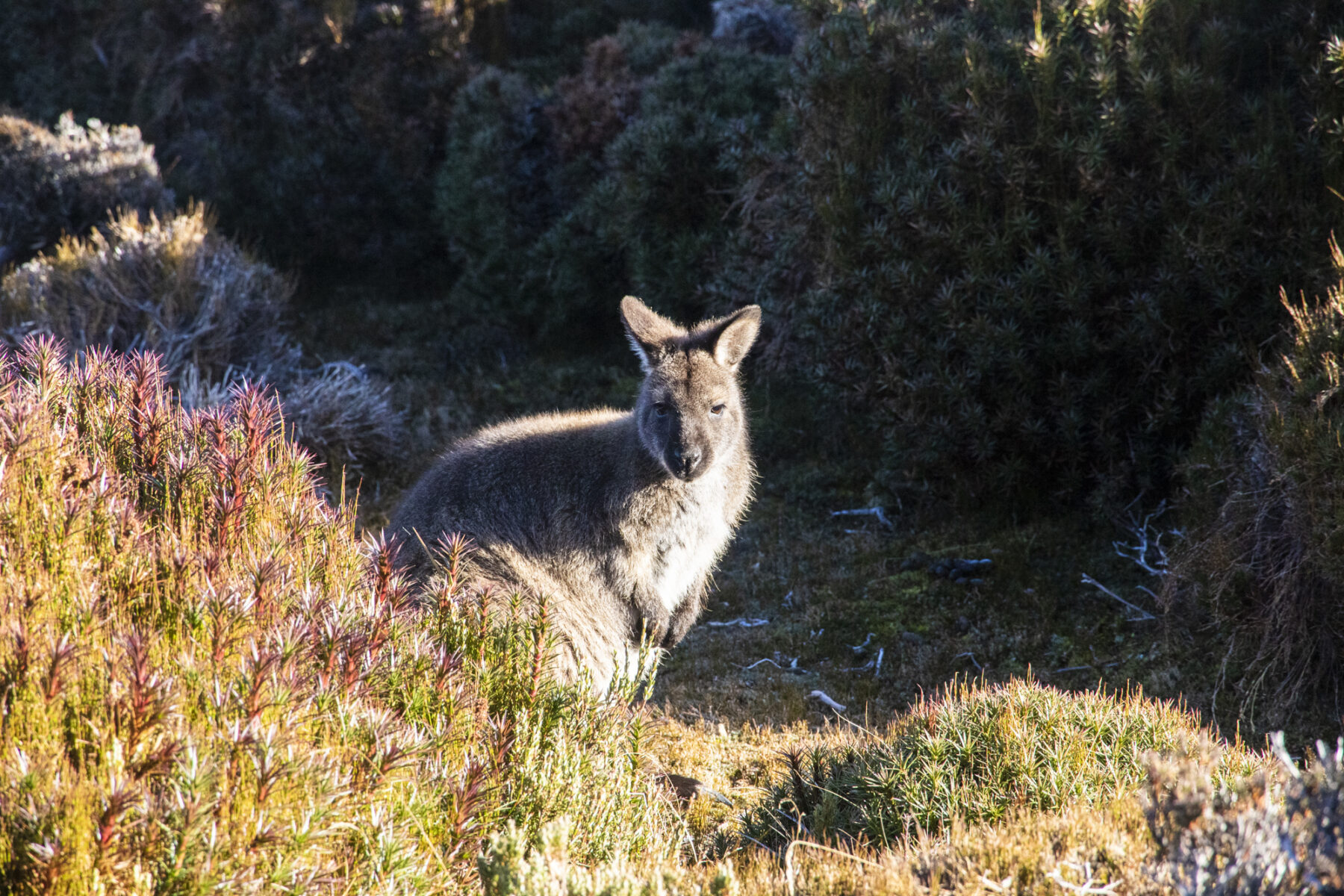
Our circuit loops south then east, then south again over the next two days; the walk southwest through Jaffa Vale from Dixons Kingdom Hut is brilliant, with the chance to spot wallabies and birdlife hiding in the button grass, before you turn east and follow the shoreline of pretty Lake Ball (passing the hut of the same name) before joining Junction Lake Track at the head of Lake Adelaide.
The options here including camping near this track junction, or turning south to follow the eastern shore of Lake Adelaide to a campsite halfway along this immense waterway. This is highly recommended as it brings you closer to the following day’s objective: camping at Lake Meston and tackling the ascent of Mt Ragoona (1350m). To reach Lake Meston from this point it is two hours walking through what is claimed to be one of the world’s best examples of a glacial valley – Adelaide Plain – to camp at the head of Lake Meston.
Here, you’ll find not only one of the circuit’s prettiest campsites, overlooking the lake, but you gain access to the track up Mt Ragoona (1350m). By this point you’ve walked many kilometres but this ascent is a must-do; from Meston Hut (midway along the lake’s western side), the climb up is slightly challenging but awesome fun, negotiating scrubby, then progressively rockier terrain on the way to the Mt Ragoona Plateau. The plateau is covered in rocks and boulders, dotted with beautiful, clear mountain lakes and leads into the final hour of walking to the summit and yep, more unforgettable views, this time with Cradle Mountain and the rugged ramparts of the Western Arthur Range clearly visible.
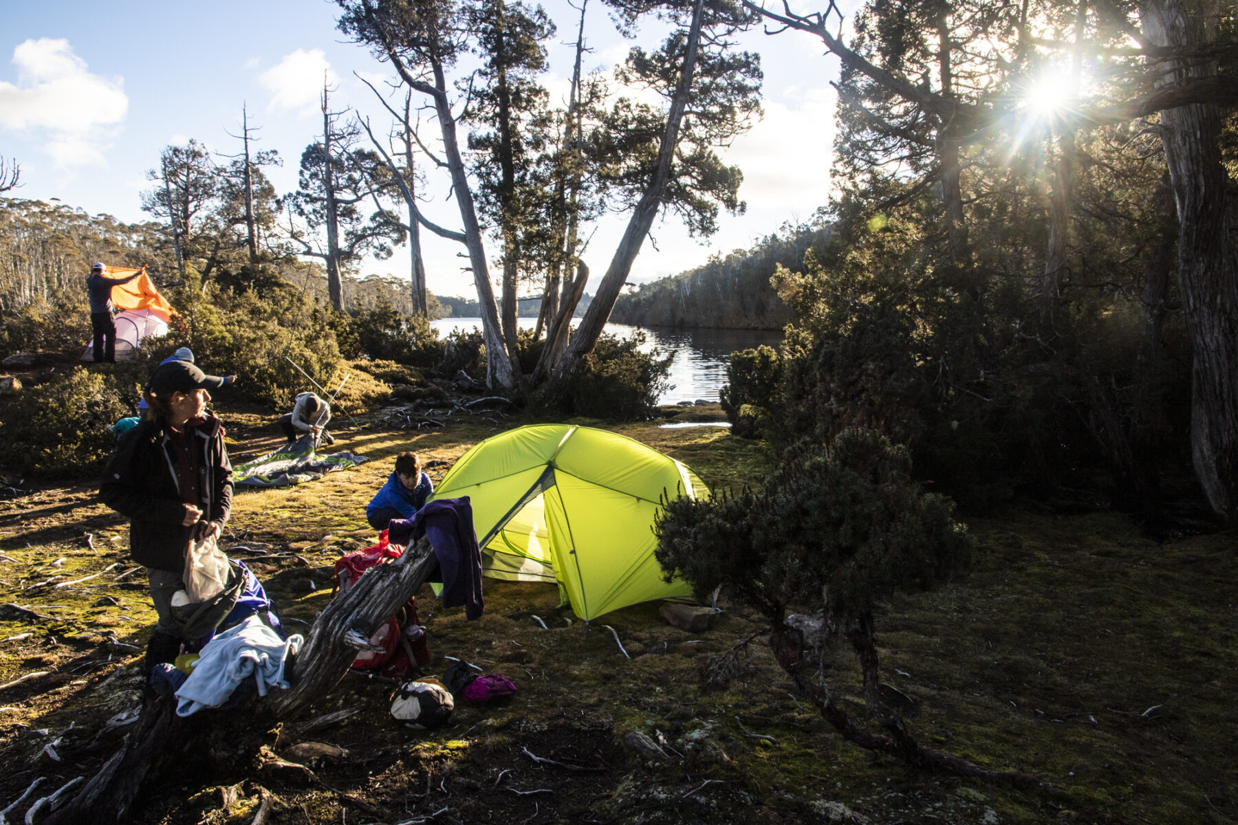
From the campsite at Lake Meston you will backtrack north on Junction Lake Track, past Lake Adelaide and then through more valleys on the way to the final (optional) night’s campsite at pretty Stretcher Lake. It will be a six-hour walk but one that is well worthwhile. The lake is reached via a mix of off-track and track walking and is, in this writer’s opinion, one of the best ways to finish this circuit. Doing a short walk around the lake itself, then sitting back at camp as the sun sets makes a brilliant sign-off, with only a return to Junction Lake Track, then on to Trappers Hut and the final descent down to Fish River car park. Leave early enough from Stretcher Lake (it’s about three hours to the car park) and you’ll time it perfectly for lunch at the Mole Creek Hotel restaurant and a celebratory beverage at its iconic Tassie Tiger bar. Not a bad way to finish six days in Walls of Jerusalem National Park.
Fact File
Getting there: Walls of Jerusalem National Park is most easily accessed via the northern entry point of Fish River car park, around three hours’ drive southwest of Launceston. There are daily flights to Launceston from most capital cities.
Best time to go: September to May.
Guided trek options: For those who would prefer a guided full-pack trek, Tasmanian Expeditions (a subsidiary of World Expeditions) offers a number of treks in the park, including a six-day circuit, as well as a winter trek and a self-guided option.


