Peru’s secret trek
Stepping off the bus after five hours of travel, my initial impression of the Inca Rivers Trek is underwhelming. The dirt road upon which our group of trekkers (a mix of Aussies, Canadians and Europeans) is deposited, outside the town of Cachora, is unremarkable, and certainly a contrast to the way in which World Expeditions touted this trek: a spectacular, remote, uncrowded, nine-day ramble across the Vilcabamba mountain range, that encompasses a traverse of two deep river valleys (the Apurimac and Urubamba) with a chance to see one of Peru’s less well-known, but equally remarkable, Incan ruins, before reaching Machu Picchu itself from “the other side”. That’s a hell of a promise to live up to…
First impressions don’t count
To get to this unremarkable dirt road, we’d spent five days acclimatising to the higher altitudes in the Andes via a series of cultural adventures in Cusco, the Chinchero Plateau, the Sacred Valley of the Incas, and the historical site of Ollantaytambo. This had been nothing short of amazing, but I’m restless now to get moving; keen to step foot on the first part of the Inca Rivers Trek and make the most of what it promised.
Unsurprisingly, the Inca Rivers Trek only takes, oh, around 30 minutes to quash my foolishly pre-emptive negative opinion. The trek’s innocuous beginning is banished from my mind once we round the first long-arcing bend. In the distance, the immensity of the snow-capped Padreyoc mountain range looms high as we trundle along the dirt road, listening to our guide, Josmar ‘Chema’ Valer, as he regales us with stories of Peru’s amazing history.
Plans are made to change
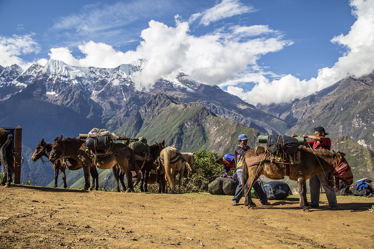
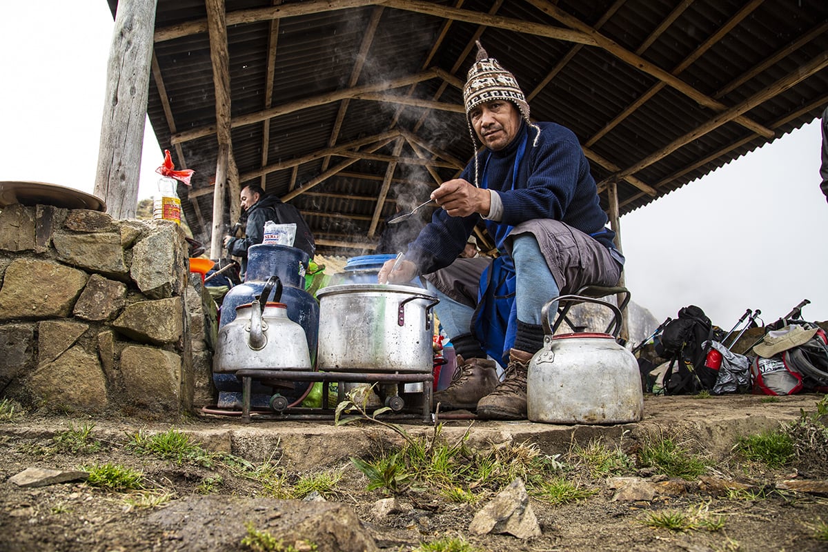
Our original itinerary saw us walk for less than an hour before setting up camp just outside the town of Cachora (where the bus had dropped us) but Chema is keen to get a head start on what promised to be an epic trek. And we’re all fresh and raring to go, so Adrian decides to push on to Chiquisca. Along the way we meet our first team of muleskinners, who are tasked with transporting all our camping gear, plus the food and – most importantly – the kitchen. Yep, this would be a trek in true expedition style, with high comfort levels and plenty of nosh to fuel us all for the upcoming steep ascents.
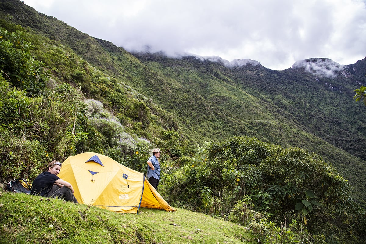
The route to Chiquisca is a brilliant introduction to Peru’s high country. AS well as the amazing mountain ranges surrounding us as we walk, we are also fortunate enough to spot a couple of condor – an adult in the distance and a juvenile quite close at near eye-level – as they float on thermal currents pushing up from the valley below. The track becomes progressively more rugged, but we aren’t in any rush, so the descent is easily negotiated. Camp is close to 600m below our start point and our only real concern is getting there before nightfall, which we do. Upon arrival we’re greeted by a buzzing campsite with our group of walkers, guides, mules and muleskinners all bustling around between tents. The full moon shining overhead finishes off an easy but spectacular first day.
What comes down must go up
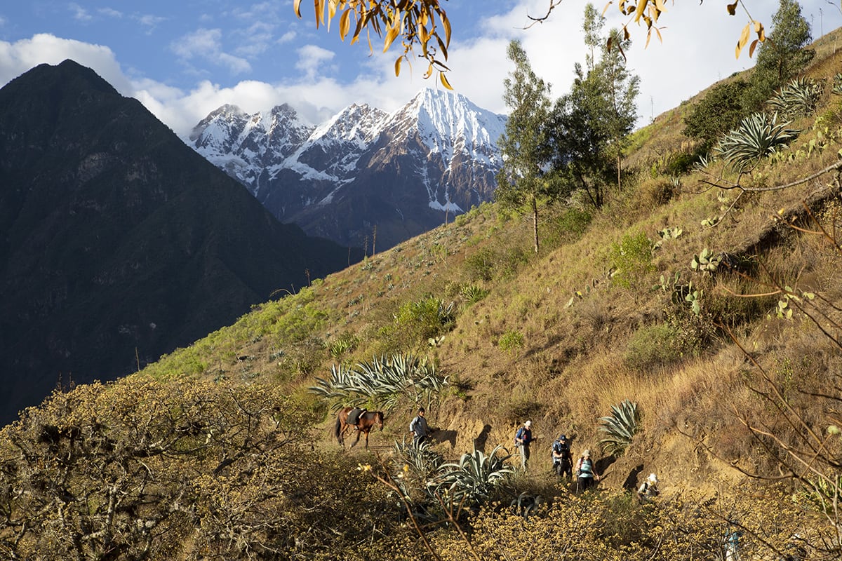
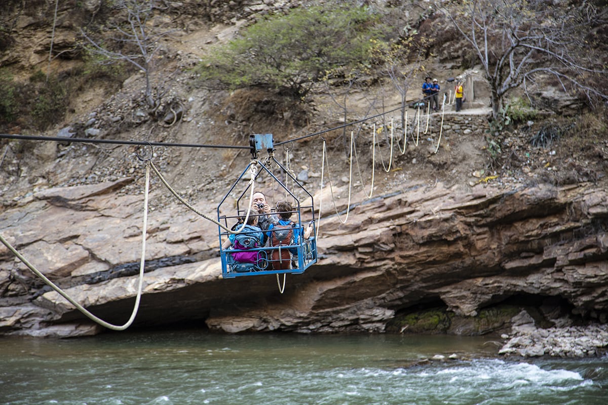
My preference on any trek, walk or hike is to go up, rather than down. Our descent the next day – to the pulley-car crossing of the beautiful Rio Apurimac – starts early and is quick. The pulley-car ride itself is also fun, only dampened slightly by the fact we’re saying goodbye to our first team of muleskinners. The next team, who would accompany us for the remainder of the trek, is waiting for us on the opposite bank. Once across the river, we make our way steadily uphill, following a series of switchbacks that offer both brilliant views back across to the ridgeline where we started, and also show how hardy the Peruvian people are. Dotted up and down the extremely steep mountainsides back across the valley is a patchwork of fields, worked by local villagers. It’s incredibly steep terrain and all the work here is mostly reliant on human power, putting any grunts or groans at the angle of our ascent into perspective.
The campsite at Santa Rosa is brilliant: our tents are neatly aligned on a couple of grassed terraces, with the always-important dining tent at one end. Not only is this tent the obvious place to feed our faces, it’s also a great place to download our experiences at the end of each day’s walking. On this second day the conversations are about the heat as well as what’s just over the hill: Choquequirao.
A more than pleasant surprise
Whenever people think of Peru, invariably Machu Picchu is mentioned. This site was first ‘rediscovered’ in 1911 by archaeologist Harim Bingham, who was actually searching for the famed “Lost City” of Vilcabamba, which was the last to be overcome by the invading Spanish. (Bingham, for many years after, maintained – incorrectly – that Machu Picchu was Vilcabamba). Since then, the ancient city has become one of the world’s most famous landmarks and tourist hotspots. Small wonder, then, that when Incan ruins are mentioned, the first words out of most people’s mouths are “Machu Picchu”.
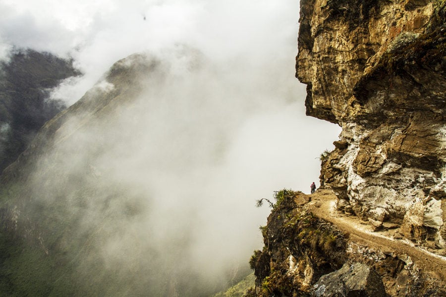
This, however, is slowly starting to change, and leading this change is the historical site of Choquequirao. This site is harder to reach than its famous counterpart but the rewards – no crowds, plenty to explore – are many. It takes us around two hours of uphill slog from our camp the next morning before reaching a small plateau – and a tiny village – that leads us on to a track that hugs the cliffs overlooking the ancient site.
From our lofty viewpoint we can see cleared terraces marching up what looks to be a sheer, jungle-smothered cliff. Above this, a just-discernible path weaves upwards again to our upcoming campsite. And, most impressively, above this campsite we get our first glimpse of Choquequirao. It is an incredible sight – even from where we are, still a couple of hours away. The cleared parts of the Inca city seem to cling to the side of a steep tree-covered cliff, with the main house, outbuildings and a number of walls all visible from our high vantage point. Being able to see the ruins – and our campsite – puts some speed into our steps and it isn’t too long before we’re at camp dragging our large bags (they’ve already arrived via the mules) into our tents. Yes, we’re doing it tough.
The trek up to the main cleared section of the city takes about an hour; the terrain here is exceptionally steep and it has you wondering how the Inca managed to lug the huge stones used in the city’s construction up here, let alone place them so precisely into position. Walking out into the main cleared area brings with it a real sense of just how magnificent the city must have been in its heyday; walking around what seems like a plaza area, with the huge main house (still mainly intact, save for the lack of a roof), walls and outbuildings below us, it’s hard to think just what else lies, still uncovered, beneath the lush, dense green canopy of the cloud forest.

The next big thing
According to Chema and Louis, only around 30 per cent of Choquequirao has actually been uncovered since archaeologists started work in the mid-1990s. They also claim that, once (or more to the point, when) the entire city is freed from its green-clad prison, it will be larger than Machu Picchu. Mentally, I tick off a date 10 years from the moment I hear this to return and see just how much more is underneath the jungle.
So far, what the archaeologists have uncovered is amazing. As well as the aforementioned buildings and walls, the city’s aqueduct system has been largely revealed above the main square. There’s also a number of walls on the western side, below the main plaza area and reached via a steep dirt track, that feature Incan rock art in the form of white stones placed in geometrical patterns – and also some “stone Llama” rock art further down the steep western valley side. It’s enough to bring out the latent Indiana Jones in all of us, but even more amazing is the fact that we have the entire city pretty much to ourselves.
It’s an incredible privilege to hear Chema and Louis recount the history of the city (it was also settled by pre-Inca civilisations; the key to identifying this is by the buildings that use mortar. Inca construction did not use mortar, instead relying on close-fitting rocks to fit snugly together). As we sit around soaking up the historical atmosphere this site resonates, it’s hard to see how the trek can get any better. But of course, it does…
The height of excitement
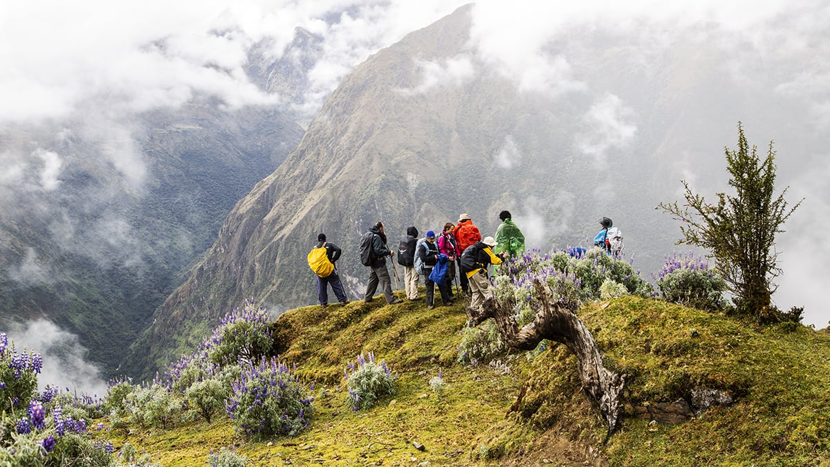
We are lucky enough – the next morning – to retrace our steps to Choquequirao and we follow one of the city’s cleared aqueducts as we ascend to a high pass on the way to our riverside campsite at Rio Blanco. Throughout this trek, we’ve been amazed by the heat at such high altitudes, but also the dense rainforest that threatens to swamp the track hewn out of it. We see a number of jungle palms and myriad other tropical plants – a result of Peru’s proximity to the equator. It’s pretty amazing stuff, but hot humid work as we trudge higher. The humidity is more than matched by the temperature once we crest the pass above Choquequirao though: my watch records 38 degrees Celsius as we descend steeply – and quickly, often sliding or glissading along the dusty track – down to the shores of the Rio Blanco. The water here is freezing, but a welcome respite from the stifling heat. It is also our first chance to give our bodies a thorough wash, and I reckon I shed about 10kg of dirt and dust during my very quick dip in the glacial-cold water. It is sweet relief, only tempered by the fact we have another big climb up to Maizal the following day.
The climb is a case of head down and one foot in front of the other – a real slog that also includes some comedic relief from a wandering camp dog that adopts our group. After lunch and a siesta at a high plateau that, again, provides fantastic views back down the valley, there’s more climbing. The humidity on this side of the valley is really noticeable but it’s more than offset by the magnificent surrounds.
Topping out twice
Over the next two days there are plenty more ascents, but we are rewarded with a great lunch at the top of San Juan Pass which, at 3900m, is our highest point to date. We then drop down 500m to the village of Yanama. The views along this section of track are something else; the vegetation changes dramatically once we crest San Juan Pass, with low alpine tussocks, small trees and plenty of rocks dominating the higher sections, replaced far lower down by more cultivated grassy slopes as we near Yanama village.
At the end of each day on the trek, I have been writing notes on the day’s walk, both in terms of what we see and in terms of the challenges we face. Words like “huge” and “big” feature prominently, and the day we cross over San Juan Pass my notepad is peppered with both these words. It has, indeed, been a huge day, but is about to be relegated as a precursor for the main event: the crossing of 4660m Abra Yanama.
Funnily enough, the “biggest” of days starts off quite innocuously. For the first few hours we follow parts of the new road to Yanama, which is a gradual ascent. Chema opts to ride a mule for the initial section, before we head off-road, back onto the track itself. The grassy hills and lack of tall vegetation are – along with our headaches and shortness of breath – the main indication that we are gaining altitude, and the group soon becomes spread out as everyone takes on the climb at their own comfortable (and sensible) pace. The pass itself is actually part of the new road but rather than being an anticlimax, it is actually pretty amazing: being able to stand up at the sign proclaiming the altitude – and cop a near-360-degree view of the Yanama Valley and, still slightly obscured, our day’s destination of Hornopampa way down below, is awesome.
The big push
Our night’s camp at Hornopampa, around 1500m below Abra Yanama, is a return to more humidity and a few mosquitoes, but is a beautiful place to lay down our heads nonetheless, with the rushing Rio Yanama lulling us to sleep.
And sleep we do, as we know that the next day will be another demanding one. We have fallen a little behind the official itinerary but Chema points out that even though the next day’s walk will be around 30km, it will be relatively easy going as we’ll be mostly following the dirt road. Of course, there will be a few off-road shortcuts with the obligatory amazing mountain scenery, waterfalls and thundering rivers as we make our way to Lucmabamba. This town will be our last night camping out in the wild, but the biggest incentive – okay, perhaps in my mind only – to get there as fast as possible is that the campsite is part of a coffee plantation. Thirty kilometres? The distance doesn’t even register; those fresh coffee beans are a clarion call…

Reality bites
Is it possible for one particular moment to stand above all others on any adventure? Following the ancient Inca road from Lucmabamba up to the ruins of Paltallacta (2655m) on that last morning, catching glimpses of Machu Picchu’s rarely seen “other side” in between clouds barrelling through the valley between us and it, I have found that moment. Perhaps it’s because, in my mind, that’s how I envisage Bingham first seeing his “Lost City” back in 1911, or perhaps I am just a dreamer. Either way, it is an amazing sight; and one that still resonates as a moment of undiluted “true adventure”, even after the following day’s exploration of Machu Picchu among the tourist throngs.

