Mountains to sea: Hollyford Track, NZ

JUST AROUND THE corner from the famed Milford Sound, the Hollyford Track is the lesser-known hidden gem of New Zealand’s Fiordland. It’s also chance to get into the area without the crowds.
Deemed the easiest of the other two classic Fiordland walks (the Milford and the Routeburn), the 56km Hollyford wends its way along the Hollyford Valley from the Darran Ranges of the Southern Alps, following the Hollyford River (Whakatipu Ka Tuka) to Lake McKerrow and then to the Tasman Sea at Martins Bay.
The start of the track is located about a two-hour bus ride from Te Anau, not far Gunns Camp, a last-chance pit stop. Along the way, you pass the turnoffs for the Milford and Routeburn walks, all the while enjoying the famous Fiordland alpine scenery.
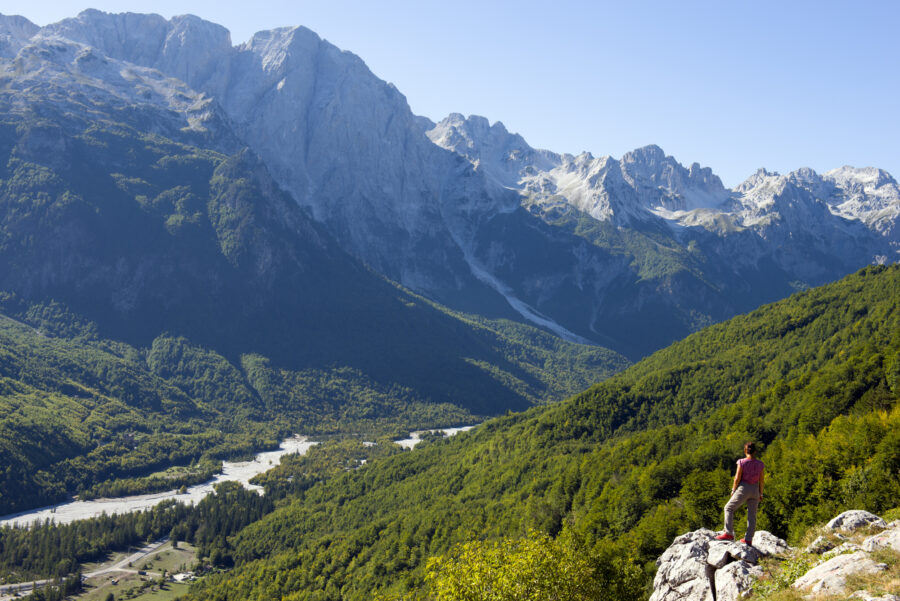
The Hollyford Valley is a classic U-shaped glacial remnant, carved around 20,000 years ago. Though the track follows a path through the mountains, it keeps close to sea level, never venturing above an altitude of 170m. I’m grateful for this when Mother Nature decides to deliver one of the earliest snow dumps in recent memory. The April snowstorm blanketed the region in the white stuff down to 400m, which made for some stunning mountain scenes. The snow never reached the track, but the cold front delivered some chilly walking conditions. The puffy jacket didn’t spend much time in the pack.
Local legend Davey Gunn pioneered guiding the valley in the 1930s. The hike begins from the camp named after him.
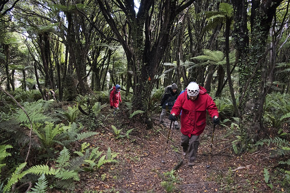
The track immediately heads into dense forest, the world’s only five-canopy-layer temperate forest in the world. The mostly singletrack weaves its way through a carpet of mosses, overlaid by ferns, which give way to the next layers of smaller trees. Majestic silver beech trees top out the canopy, gracefully providing shelter from the weather above. It’s like walking straight into a scene of Lord of the Rings, where Gandalf may appear at any moment.
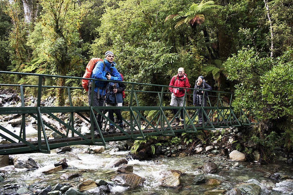
Swampier sections of the track are traversed on boardwalks, making the trekking quite easy. The many creeks that flow into the Hollyford River from their mountain sources are crossed by swing bridges, which can occasionally be a hazard if flooding occurs – always a possibility with Fiordland’s volatile weather. The many creeks are also great natural taps and you’ll never be short of a drink; the water is pristine too, and regularly tested, so you don’t even need to filter it.
The first public hut is reached at about the 10km mark, at Hidden Falls, and well worth a look and a pic or two. You can stay at Hidden Falls, but if you have the legs, push on to the second hut at Lake Alabaster, another 10km away. It’ll be a longer day, but waking up to a sunrise on the lake is worth it. This section takes you through podocarp forest and then tall beech forest. Across to the southern side of the valley are views of Fiordland’s two highest peaks, Mt Madeline (2537m) and Mt Tutoko (2746m), named after one of the last Maori chiefs in the area. The nearby Sara Hills and May Hills are a nod to the European names of his daughters. You hit the confluence of the Hollyford and Pyke rivers heading up a little further to the hut at Lake Alabaster.
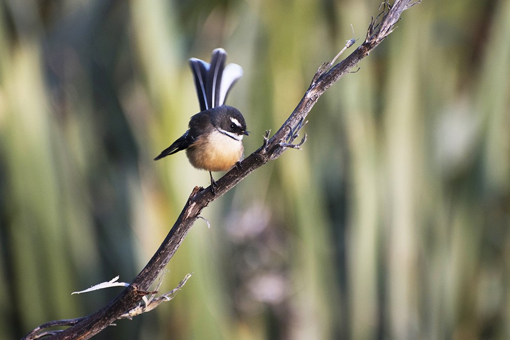
Fantails are one of the many small bird species seen on the track.
From Lake Alabaster, you head back out to the trail and cross the Pyke River on an impressive swing bridge – the longest in Fiordland, at 80m. The track follows the Pyke River for a while, heading into the quiet of the lush podocarp forest. When the track emerges from the dense, lowland vegetation, it opens out to the Hollyford River, where it’s now more powerful than before. The next stop point is at McKerrow Island where there’s a hut for a nice break.
If you’re not in a hurry, you can stay here the night and rest up for the Demon Trail, an historic cattle trail so named for its rugged, rocky, wet and undulating track. Take care at creek crossings and try to stick to the wire bridges. It’s slow going on this track, which crosses the Southern Alps fault line, but to keep you motivated, you have occasional views out to the spectacular snow-capped peak on the other side of the lake.
There are two huts on the Demon Trail about one-third and two-thirds along the way, but most people like to hunker down and knock off this section in one go and stay at the Hokurri Hut.
The next day’s walk is a breeze compared to the Demon Trail and finishes at your destination of Martins Bay. Stop in at the historic Jamestown settlement not far along, where there’s a plaque and a couple of rusty artifacts from a time long gone. A small number of families settled there in the hope of pioneering a town, but the harsh existence and isolation (made difficult by the sand bars at Martins Bay which hindered supply delivery) doomed the plan, and it’s easy to see why when you’re in the midst of the rugged beauty of this still isolated forest. All but a few people remained in the area and the settlement was eventually abandoned.
The valley is home to some of the biggest and oldest ferns in the world. Some tree species have lineage dating back to Gondwana.
Along this section of the trail, the forest is more open, but still filled with ferns. More than 200 of the world’s 10,000 species of plants are here and 40 per cent of them are endemic to New Zealand. Some of the largest trees are several hundred (up to 1000) years old. You’ll also notice a lot more birdsong. Little fantails flit around, curiously following as you make your way along the track; and you can also catch a glimpse of the endemic tui and maybe even a kakapo in a rimu tree, if you’re really lucky.
As you near the coast the infamous sandflies become more of a problem. In the colder months, you’ll mostly be covered anyway, but you’re still advised to slap on insect repellent on uncovered skin. These little blighters leave quite nasty bites that become itchy and sore, with red welts lasting longer than a week.
You’ll first bypass the Martins Bay Lodge, private accommodation, and head towards the coast for another 90 minutes to an hour. The trail heads through the Jerusalem Creek Destruction, where a huge flood wiped out a section of the forest, and then into the goblin forest, where the trees are covered in epiphytes that give them a gnarled appearance.
Once you reach the hut, drop your packs and head on a quick trip up to Long Reef to see the resident New Zealand fur seals. From July to November, you’ll also see Fiordland crested penguins.
From Martins Bay you have several options. Because the Hollyford is a one-way track, you have the choice of backtracking to your vehicle at the start or the luxurious option of hitching a ride to Milford Sound by seaplane or helicopter, where you can get a shuttle to your car. The best option is to call ahead to the Hollyford Track Guided Walks a week or so before your planned hike, as they have regular chopper trips ferrying supplies in and would rather not have an empty flight back out.
The helicopter is the more reliable (and braggy) option and gives you a chance to survey the area from the sky, including the coastline of Martins Bay, and the stunning Milford Sound – a fitting end to a magnificent hike!
The essentials
Where: Fiordland, South Island, New Zealand.
Accommodation: Six public huts run by the DOC, with a mattress, running water and toilets provided. You don’t need to book, but you do need hut tickets.
Best time to go: October-April. Sandflies are at their worst at the peak of summer.
Highlights: A mix of Southern Alps mountains and river scenery as well as beach and dense forest.
Watch for: The nasty sandflies, mostly near the beach end. Cover up and bring repellent.
How to get there: Take a two-hour bus ride from Te Anau to the end of the Lower Hollyford Road, not far from Gunns Camp.
Difficulty: Moderate. No alpine sections, but heavy rain can cause local flooding and cut off bridges.
Tip: Check ahead with Hollyford Track guided walks to grab a spare spot on their helicopter transports.
Contact: www.hollyfordtrack.com