Chasing waterfalls
I DON’T KNOW IF Australia has what you would call a ‘waterfall appreciation society’, but if there was such a thing, Tropical North Queensland would be its spiritual home. Thanks to the high rainfall (up to 8m per year), powerful rivers and steep escarpment country of this region, there are waterfalls aplenty here. These falls are fed by a plethora of streams that run off the surrounding high peaks and are often situated in picture-perfect locations, with fantastic camping grounds, swimming holes and day-use areas nearby.
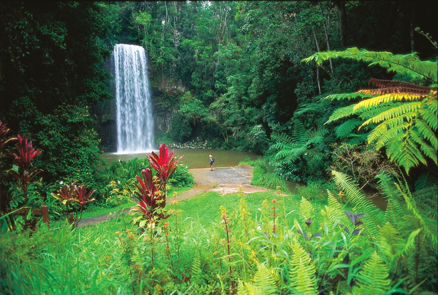
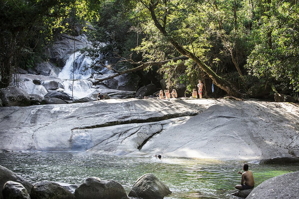
1. Millaa Millaa Falls
Claimed to be the most photographed in Australia, Millaa Millaa Falls’ spectacle is only matched by the ease of which it is accessed from its namesake township of Millaa Millaa, in the southern part of the Atherton Tableland. The waterfall (left) is just off the Palmerston Highway, and then via Theresa Creek Road (about five minutes from town, hence its popularity with day visitors). It is also the start of a waterfall loop drive.
This includes five other waterfalls – Pepina, Souita, Mungalli, Ellinjaa and Zillie – and offers a memorable day of touring. Best described as a cascade-style waterfall, Millaa Millaa Falls drops 18m to a pool below that is perfect for swimming. It will be busy when you visit, which makes it even more amazing that you may – if you’re lucky and patient – spot the reclusive platypus here. This is most likely in the early morning or afternoon (you may also see them at Pepina Falls about the same time of day).
Similar to most of the waterfalls in this region, Millaa Millaa is the result of the erosion of volcanic basalt that, in this case, has created easily discernible vertical pillar-like formations that contribute to its photogenic appearance.
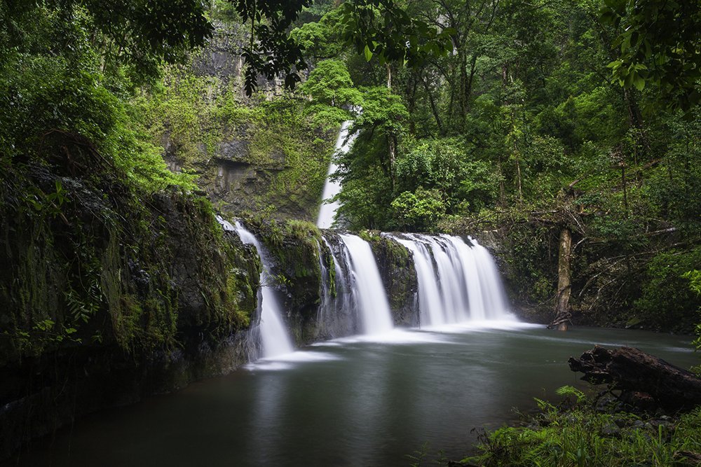
2. Josephine Falls
Credit: TEQ
Located at the base of Mt Bartle Frere (Queensland’s highest mountain, at 1622m) in Wooroonooran National Park, Josephine Falls sees more than 250 days of rain each year. The result is a multi-tiered waterfall that offers spectacular photographic opportunities, as well as some brilliant swimming. It is also easy to access, being only an hour’s drive south from Cairns, and, from the car park itself, is about a five-minute (600m) walk through dense rainforest to the Bottom Pool (above). This pool is the most popular for swimming – it is wide and relatively shallow.
There are three separate pools that make up the falls, with Bottom Pool and Middle Creek accessible and open for swimming. Top Pool and the smaller pool above are considered off-limits as the cliffs and rocks here are steep and slippery. There are two viewing platforms (at Bottom Pool and Middle Creek) that provide excellent photographic viewpoints. Also worth checking out is the vegetation near the falls. The high-altitude origins of Josephine Creek mean that the water is still quite cool when it gets to the falls. This combines with cold alpine air that runs down the valley to provide the ideal climate for high-altitude vegetation – such as the potato fern and Atherton palm – to thrive in this lower-altitude area.
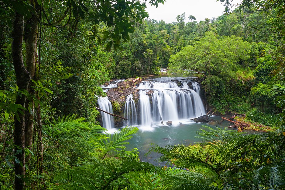
3. Nandroya Falls
Credit: Shane Pedersen / Getty
Nandroya Falls is the third waterfall of a cluster in the Palmerston area of Wooroonooran National Park that includes nearby Wallicher and Tchupala (you can do a half-day hike past all three, starting at Henrietta Creek camping ground). Nandroya (left) is different again in appearance from its southern neighbours, with the waters of Douglas Creek flowing over a straight 50m drop from a tree-shrouded basalt parapet.
This waterfall is best seen after heavy rain, but, even when not at full flow, is still worth a visit; the large swimming hole below the falls is brilliant in itself. You can reach the waterfall easily by crossing the footbridge over Henrietta Creek and then, when you reach the first track junction, taking the left path for about 1.6km up the Douglas Creek valley. If you go this way, you will also pass Silver Creek Falls.
The other route to the falls is via a 3.5km track that is the right-hand option at the track junction. This takes you deeper into the rainforest before looping back to the waterfalls. You can complete the loop by following the shorter track back to the campsite.
4. Wallicher and Tchupala falls
Credit: Alamy Stock Photo
Okay, we’re cheating a bit here by describing two waterfalls at once, but Wallicher and Tchupala falls can both be accessed via the same walking track, just off the Palmerston Highway, about 2km east of the Henrietta Creek camping ground, in Wooroonooran National Park’s Palmerston section. The track splits at about 200m in, with Wallicher Falls to the left fork, and Tchupala accessed via the right-hand track.
For two falls in close proximity, they couldn’t be more different; Wallicher is a wide fall that, due to this width, seems to run more slowly as its flow is split into two distinct streams. You’ll find about 800m of walking along a well-graded track where you are fully immersed in dense rainforest. There is also a lookout at the end, and you can continue walking, crossing Henrietta Creek just up from the top of the falls, to find Henrietta Creek camping ground (another 3km away).
For those who backtrack to the junction, Tchupala Falls (left) is a leisurely 400m walk away. Tchupala Falls is best described as a segmented waterfall, with three distinct falls that drop the fast flowing water of Henrietta Creek over what Queensland’s Department of National Parks describes as a basalt barricade (basically a jumble of huge boulders.
This article was originally published in the AG Tropical North Queensland Special Edition.
READ MORE:
- Bird watching in Tropical North Queensland
- Top 5 kayaking spots in north Queensland
- Rainforest to reef: Tropical North Queensland