Australia’s best 4WD tracks

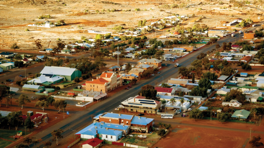
AUSTRALIA IS SOMETHING of a road-tripper’s dream. All you have to do is gather some friends, stock a car and set out. In addition to the wide, open paved roads, Australia has some of the best off-road driving in the world.
There are hundreds of outback 4WD routes that lead you through remote deserts, rugged mountain ranges and swaths of grassland – but not without an obstacle or two. Here is a list of 10 iconic Aussie off-road adventures that will leave your tyres caked in mud and maybe even some bragging rights to tuck in your back pocket.
Top 10 4WD tracks in Australia
1. Canning Stock Route
Location: Wiluna to Halls Creek (WA)
Distance: 1800km
Suggested min. travel time: 16 days
Best time to travel: May-August
Renowned as one of the world’s most remote off-road tracks, the Canning Stock Route offers challenge and reward. Once an old stock route, the track follows a series of wells once used to water livestock, which now provide trekkers with a water source. Don’t expect to encounter towns or emergency support centres along the way as the isolated route crosses through several deserts (the Gibson Desert, Little Sandy Desert and Great Sandy Desert) and Aboriginal traditional lands.
While solitude may be your priority, as general services are not available, it’s not advisable to travel the Canning Stock Route alone. Travelling in a convoy of 2-4 vehicles is best, as the campsites and points of interest along this route are fairly small and are therefore easy to crowd. It’s also essential to keep an eye on the weather several weeks before you start your trip as the northern reaches of the route can become impassable during the Wet, particularly in the area surrounding the salt lakes.
2. Cape York Track / Old Telegraph Track
Location: Cooktown to Seisia (QLD)
Distance: 848km
Suggested min. travel time: 24 days
Best time to travel: May-October
The Cape York Track, also known as the Old Telegraph Track, guides you through Australia’s tropical northern reaches. Once the region’s only line of communication, this track features numerous river crossings, such as the Jardine River and Gunshot Creek, some of which involve near-vertical exits. It’s therefore essential to have all-terrain tyres and check for sturdy recovery points before undertaking these crossings. There are a variety of swimming holes to enjoy, including those at Fruit Bat Falls, Eliot Falls and Twin Falls. Several scenic stop-off points along the way include Old Laura Station, Lakefield National Park, Weipa, Thursday Island and Chili Beach. While the river crossings may make progress on the Cape York Track a bit slow at times, embrace the opportunity to get intimately acquainted with Australia’s ‘Tip.’
3. Gibb River Road
Location: Kununurra to Derby (WA)
Distance: 930km
Suggestedmin. travel time: 3 days
Best time to travel: May-September
The Gibb River Road traces through the Kimberley region, rewarding you with secluded swimming holes, fresh water gorges, quintessential outback landscapes and sprawling cattle stations. Be sure to allow time to enjoy points of interest such as the falls at Mitchell Plateau and the coastal Aboriginal settlement of Kalumburu. While this route is certainly remote, its popularity can make it a bit crowded during the peak season. To avoid excessive company, you could travel in April to October, but be sure to call ahead to check road conditions as they can be closed during the wet season which persists from December through March.
4. Binns Track
Location: Mt Dare (NT/SA border) to Timber Creek (NT)
Distance: 2191km
Suggestedmin. travel time: 10 days
Best time to travel: April-August
Binns Track, named after Bill Binns, a NT park ranger who served for 32 years, is known for its diverse terrain as it courses though mountains, deserts and vast plains – challenging the hardiest tyres with sandy slopes, soft riverbeds, jagged rock, bogs, bitumen and bulldust. This track takes you through the Simpson Desert to Alice Springs, on to the East MacDonnell Ranges and the fossicking haven of Gemtree. Soak up the historical offerings of Tennant Creek before heading into the cattle stations of Barra Country. Keep weather conditions in mind before you travel, as access through Gregory National Park is often limited from December through May.
5. Victorian High Country and Billy Goats Bluff
Location: Mansfield to Harrietville (VIC)
Distance: 306 km
Suggestedmin. travel time: 3 days
Best time to travel: December-April
The Victorian High Country is a unique departure from outback driving. While challenging, the region’s soaring peaks feature panoramic views as you wind across mountainous ridgelines. There are a number of abandoned mining towns to explore along the way, an aspect of off-roading which offers a fresh perspective on the conveniences of modern travel.
“It gives you an appreciation for how easy life is today. When you go through the Victorian High Country and pass old gold towns which were bustling in the 1920s, but are abandoned now, it’s incredible just to think how they got their mining equipment up there in the first place,” says James Eling, an off-road enthusiast with the 4X4 Earth Australia association. Be aware that many sections of this region’s 4WD tracks are extremely steep. Billy Goats Bluff, is known as a particularly hairy track which leads vehicles 250 metres above sea level to 1480m over only 6km, over changing surface conditions.
6. Birdsville Track
Location: Marree (SA) to Birdsville (QLD)
Distance: 534km
Suggestedmin. travel time: 2 days
Best time to travel: April-October
Established as a cattle route, one version of the Birdsville Track – the Inside Track – follows the original stock path. Instead, you may choose to take the nearby Outside Track which was created by travellers as a safer route that avoids the Diamantina floodplain. While the track surface is primarily gibber-covered sand, which is not especially difficult to traverse, sudden braking can be hazardous as the gibbers (large pebbles) can be slippery and offer poor traction. You also should keep aware of cattle grids which can pop-up without warning, as well as wandering livestock, emus and kangaroos, which may dart into your path. While few and far between, the roadhouses dotting this lonely landscape are perfect pull-off points for a coffee and a chat with local station owners.
7. Gunbarrel Highway
Location: Wiluna (WA) to Yulara (NT)
Distance: 1420km
Suggestedmin. travel time: 4 days
Best time to travel: April-September
The Gunbarrel Highway has a reputation for being one of Australia’s most rugged off-road tracks, perfect for the experienced off-roader who’s prepared to face wash-aways and deep corrugations. The track is notoriously unforgiving – even its numerous bore holes, while tempting to a thirsty traveller, are not good to drink. However, there are a number of bush camps along the way. Places to explore during your journey include the Yelma Stockyard ruins, summit views from Mount William Lambert, the geologic curiosity of the Gnamma Rockholes and the Gile Weather Station. Before setting out, be sure to obtain permits from both the Ngaanyatjarra and Central Land Councils.
8. Hay River
Location: Birdsville (QLD) to Gemtree (NT)
Distance: 928km
Suggestedmin. travel time: 9 days
Best time to travel: May-September
The Hay River track follows the course of an extinct river and is highly remote. It was only recently opened to the public in 2000, after a series of negotiations with the area’s Aboriginal custodian, Lindsay Bookie. Today, the track can only be accessed by permit in order to preserve the environment of this most isolated region. This journey offers stunning contrasts in landscape as it passes by the Big Red and Spinifex dunes, on to the Georgina Gidgee and Gypcrete Interdunes, levelling out to the bed of the Hay River and Lake Caroline (which actually holds water from time to time). As there are no towns along this track, be sure to take advantage of the many amenities of Birdsville. If you’re travelling in early September, you might even try to be in town for the annual horse racing carnival.
9. Simpson Desert French Line
Location: Dalhousie Springs (SA) to Birdsville (QLD)
Distance: 439km
Suggestedmin. travel time: 3 days
Best time to travel: May-September
While this is the quickest way to traverse the Simpson Desert, frequent dune crossings and narrow tracks make this a challenging run. The French Line is only wide enough for a single vehicle, so it’s essential to be wary of oncoming traffic. By flying a dune flag, carrying a radio, beeping a warning signal on dune crests and keeping aware of your surroundings, head-on collisions are easily avoided. While the trees in this region won’t offer much in the way of shade, dried mulga wood makes for excellent fire fodder. There are also plenty of sites to set-up camp in the flat swaths between dunes. Be sure to stop-off for a steamy dip in the Dalhousie hot springs.
10. Stockton Beach
Location: Williamtown to Anna Bay (NSW)
Distance: 53km
Suggestedmin. travel time: 1 day
Best time to travel: All year
If you’re keen to off-road seaside, Stockton Beach is a haven for sand enthusiasts. While many of the dunes are steep, so much so that they can only be summited by snaking up more gradual slopes nearby, these obstacles only increase the track’s popularity. If you’re looking for a break from the dunes, watch for low tide and explore the wreck of the MV Sygna, which washed ashore in 1974 or check out the Tank Traps, which were installed as a means of defence during WWII.
Just keep in mind the growing prevalence of ‘sand driving schools’ which often hold classes on the Stockton dunes. While some may see these convoys as a nuisance, there are sure to be ‘helpers’ in the event that you get caught in a soft spot.