Summer is here, and with it comes longer days that are perfect for outdoor fun in Oz and across the Tasman in NZ. To that end, we’ve picked seven amazing adventures, from hiking in Fiordland and canyoning in Tassie, to paddling in Victoria and cycling in WA, there’s a memorable outdoor adventure here for everyone.
Canyoning at Cradle Mountain, TAS
It’s only right that Cradle Mountain steals the scene at the northern end of Tasmania’s most famous mountain national park – it’s Cradle Mountain, after all! – but if you look down rather than up, you’ll find one of the state’s most exciting summer adventures.
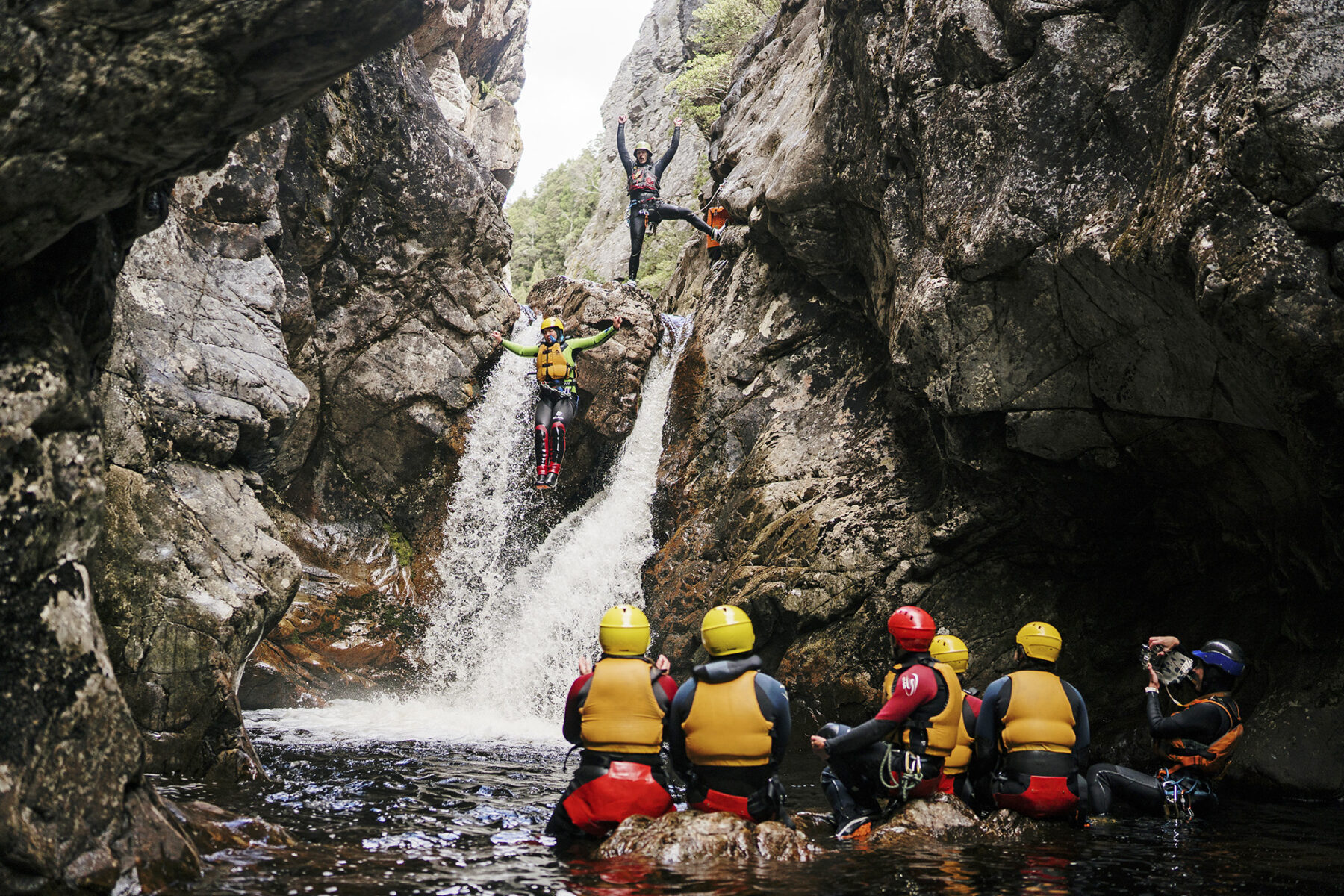
In the cracks below the emblematic mountain, a river flows through a narrow canyon, diving over ledges and boulders and into chutes carved into the rocky floor over millennia. The water is ice-cold, but that’s the least of the challenge when you’re canyoning through Dove Canyon.
The canyon is entered via a 12m abseil, dunking you into the water like a cold teabag, and from there it’s a canyoning puzzle to make your way to the other end of the canyon, 750m downstream. Doing so employs the full set of canyoning skills – wades, swims, abseils, high leaps into deep pools, traverses and slides through chutes. It’s a game of Twister in nature.
There are six main features to navigate along this journey through the underworld, from waterfalls to the ominous Laundry Chute. To clear the waterfalls you must leap, plunging off ledges as high as 6m and splashing down into pools blackened by tannins.
The Laundry Chute is the signature feature, requiring you to wriggle into a water-eroded sluice barely wider than your hips and then washing through it fast and furiously to a pool far below. At times of high water, there’s barely a moment to grab breath, but amid the challenges, there’s also great beauty, as canyon cliffs tower high and water sculpts the rock into myriad shapes.
For families, or those wanting a simpler look at canyoning, there’s a gentler Lost World trip available further upstream – it’s suitable for kids aged eight and over.
See Cradle Mountain Canyons for bookings and more info.
Canoe the Glenelg River, VIC
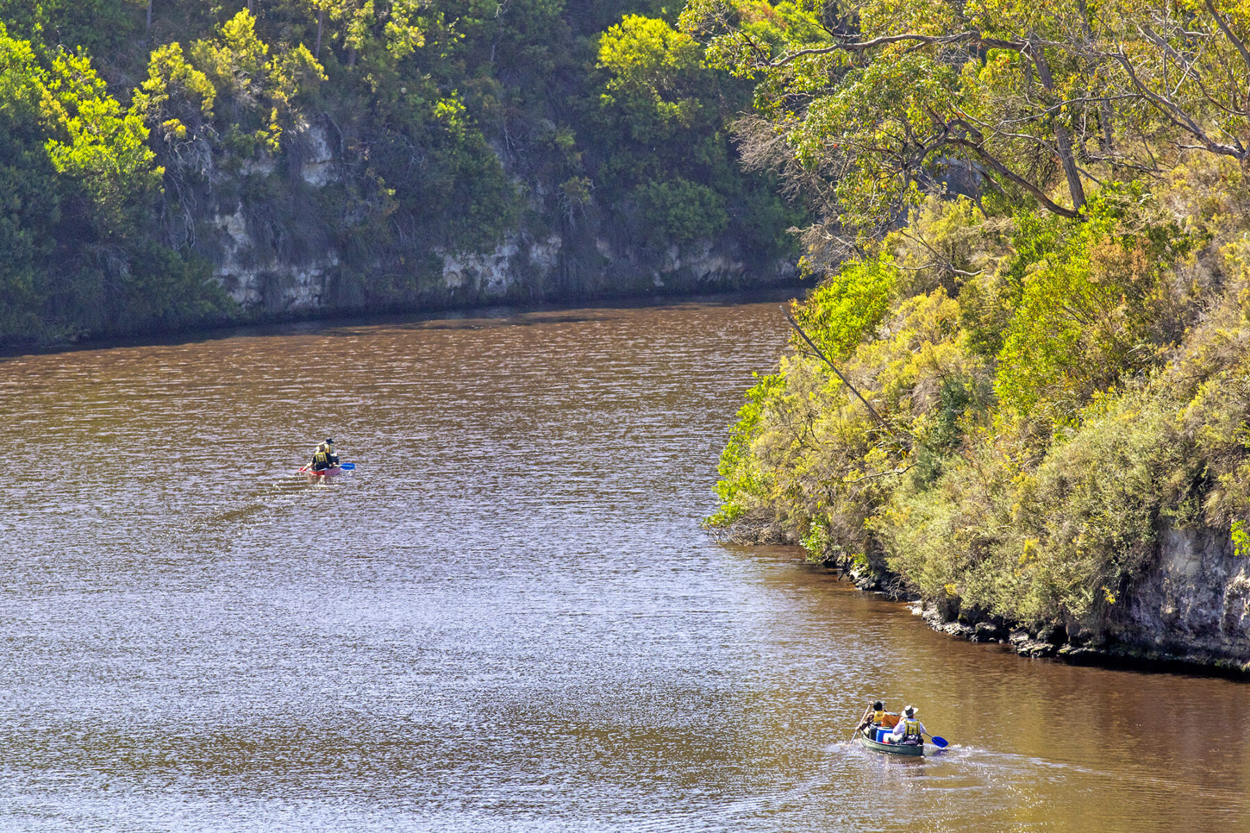
Raging rivers – hello Tully, hello Franklin – might catch all the whitewater attention, but in Victoria’s far west, a gentler waterway calls to canoes or kayaks. Wriggling through a limestone gorge, the Glenelg River is paddle-perfect if you’re chasing mild over wild on your paddling adventure.
The river is navigable from around Dartmoor, which is where the Glenelg River Canoe Trail begins its journey, stretching for 73km to Nelson, near the river mouth. Early sections are noted for snags, and it’s common for paddlers to set out instead from Pines Landing, 17km downstream from Dartmoor and just inside the edge of Lower Glenelg National Park. It’s a beautiful beginning, and when I paddled out from Pines Landing late one afternoon, beginning a three-day canoe trip to Nelson, the surface of the river was as taut and smooth as satin in the calm approach of evening. Nothing stirred but for the occasional appearance of a platypus.
Cliffs rise from bends as the slow-moving river sets a languorous paddling pace, though the biggest cliffs – those of the 15km-long Glenelg River Gorge – are still away downstream, providing a tunnel-like path to the coast. The approach to the coast is in stuttering steps; the canoe trail is lined with seven camps – for the exclusive use of canoeists and kayakers – which are dotted between another 10 riverside camps accessible to motorists. The camps are basic and no more than 13.7km apart, but the water views are priceless.
The long-distance Great South West Walk runs unseen beside the river for much of the journey, providing chances to pull up and stroll the banks, while a short wander from Moleside Landing leads to tiny Moleside Falls. But it’s the gorge that’s the star feature of what’s typically a three- or four-day glide down the river.
Within its tall walls the world is reduced to river and bush, its white cliffs rising to 50m overhead. These cliffs are at times smooth – almost polished to a shine – and other times worn and eroded into lumpy figures. For up to two days they are the fences that encase the river and the journey, guiding both towards the Southern Ocean. Scored into the cliffs near the gorge’s southern end is the Princess Margaret Rose Cave, filled with speleological features, but currently closed to visitors as long-running safety upgrades continue. Work is slated to be completed late in 2025, so check ahead on possible reopening dates.
By now, the only signs of humanity are the campgrounds. Otherwise, it’s just you, the cliffs, the river and the splashing soundtrack of your paddles. If the sea breeze is up and the tides are working against you, progress slows as you meander past Dry Creek and Donovans, where shacks and boathouses begin to line the bank and, briefly, the river swings into South Australia, making this a dual-state paddling trip.
Soon, Nelson and the highway bridge appear ahead, drawing you forward, though never quite to the fierce river mouth. Instead, the trail ends by the bridge, the gorge now flattened into a plain but long etched into memory.
Canoe and kayak rental is available from Paestan Canoe Hire near the northern end of the trail, and Nelson Canoe Hire at its finish. Both companies offer drop-offs to points along the river.
Ride the Burnaaga-Goanna Trail, NSW
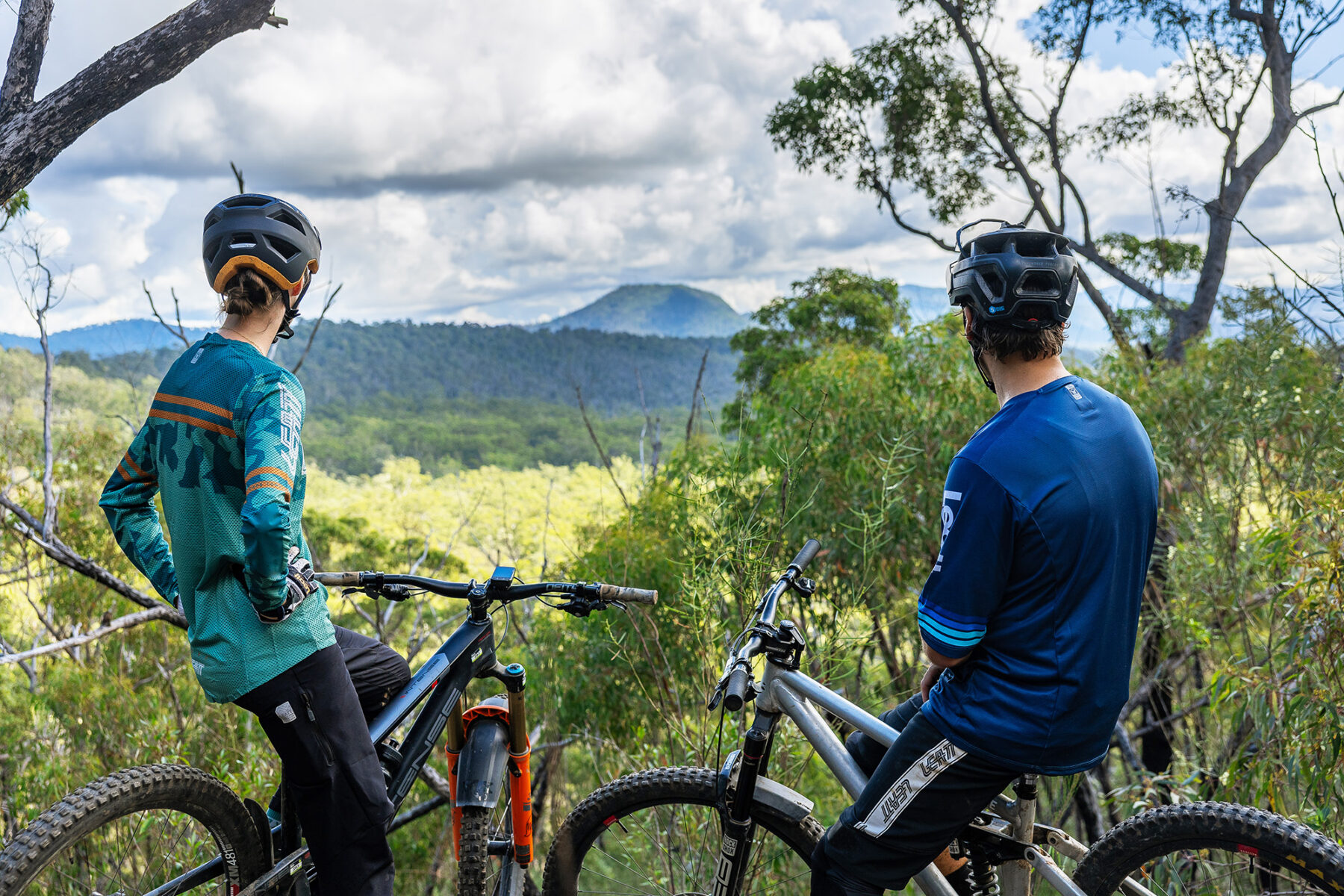
The only thing growing faster than the trees along the lush NSW South Coast in recent years has been its mountain bike trail networks. Gravity Eden launched in 2023, and the Narooma Mountain Bike Park followed in its wheel tracks a year later. This year it was the opening of the Mogo Trails, the newest feather in the South Coast’s helmet.
Mogo has more than 70 purpose-built trails, totalling around 125km. The bulk of the network is on the eastern side of the Princes Highway, but to find its prime wilderness ride, cast your eyes west.
Setting out from the summit of Mt Wandera, with vast views across the plains and far beyond, Burnaaga–Goanna is 28km of pure singletrack that ends in Mogo township itself – a true mountain-to-mocha ride. With 962 vertical metres of descent, the blue (intermediate) trail flows down the hill faster than a waterfall and has already been likened to rides such as Derby’s Atlas – no small praise.
Trail builders have used the natural landscape brilliantly to create a fast and flowing ride. High up, it scrapes past rock walls and dips through rainforest, with 6km of pure descent to get things started. Before you know it, you’re peering back at Mt Wandera, which looks satisfyingly distant.
Lower down, Burnaaga–Goanna is defined by granite as the country opens up and the trail rolls over boulders the size of buildings. Technically, this MTB adventure is very much in the wheelhouse of intermediate riders, though it’s not a trail beginners will want to attempt – there’s rock aplenty. Nor is it a ride to be rushed. Fill an extra water bottle, pack some food and make a day of it.
The trailhead is 4WD access only, and using Mogo’s Southbound Escapes shuttle service is recommended.
Kayak Queen Charlotte Sound, NZ
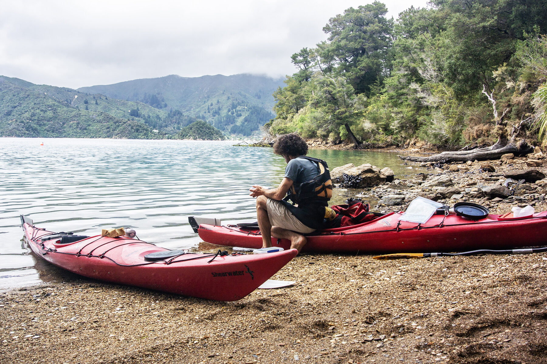
New Zealand might look finger-sized on a map, but it’s wrapped in 15,000km of coastline, more than 10 per cent of which is found along the frayed edges of the Marlborough Sounds.
At the heart of this sublime and sunny region – Marlborough gets more sunshine hours than any other place in the country – is Queen Charlotte Sound, edged on one side by the Queen Charlotte Track, keeping hikers and cyclists happy, but with water at its heart. Most people see these waters from the railings of the Interislander ferry to Wellington, but kayakers get the best of it.
Paddling options here are plentiful, from combination tours that mix kayaking with hiking and mountain biking on the Queen Charlotte Track, to single-day or multi-day kayak rentals that offer total freedom, paddling between the 50-plus Department of Conservation campsites dotted along the sound’s shores (or perhaps a night or two in the waterside lodges and resorts).
With three or four days, a recommended paddle adventure is between Picton and Meretoto/Ship Cove (where James Cook anchored five times, spending more than 100 days ashore, during his 18th-century southern sojourns). Local water taxis can transport kayaks, taking out the need to backtrack, so you can paddle out to Meretoto/Ship Cove and taxi back (or vice versa).
At the Picton end of the sound, the waters are busy with other boats and the Cook Strait ferries, but once you pass the opening to the Tory Channel, where ferries divert, the sound can become gloriously peaceful as you nose your kayak into coves and around headlands.
For all the beauty of the landscape, wildlife is the star of this sound’s show. Sea birds fly ahead like marine escorts, and fur seals bask atop waterside rocks. In the time I was here, seals sometimes tailed our kayaks, sneaking along in our wake. Another time, bottlenose dolphins surrounded us, leaping over the noses of the kayaks and diving beneath us like missiles. On land, there’s the chance to visit Motuara Island, a bird reserve that’s home to rare species such as the yellow-crowned parakeet and the saddleback.
See Marlborough Sounds Adventure Co for guided sea kayak trips, or kayak hire.
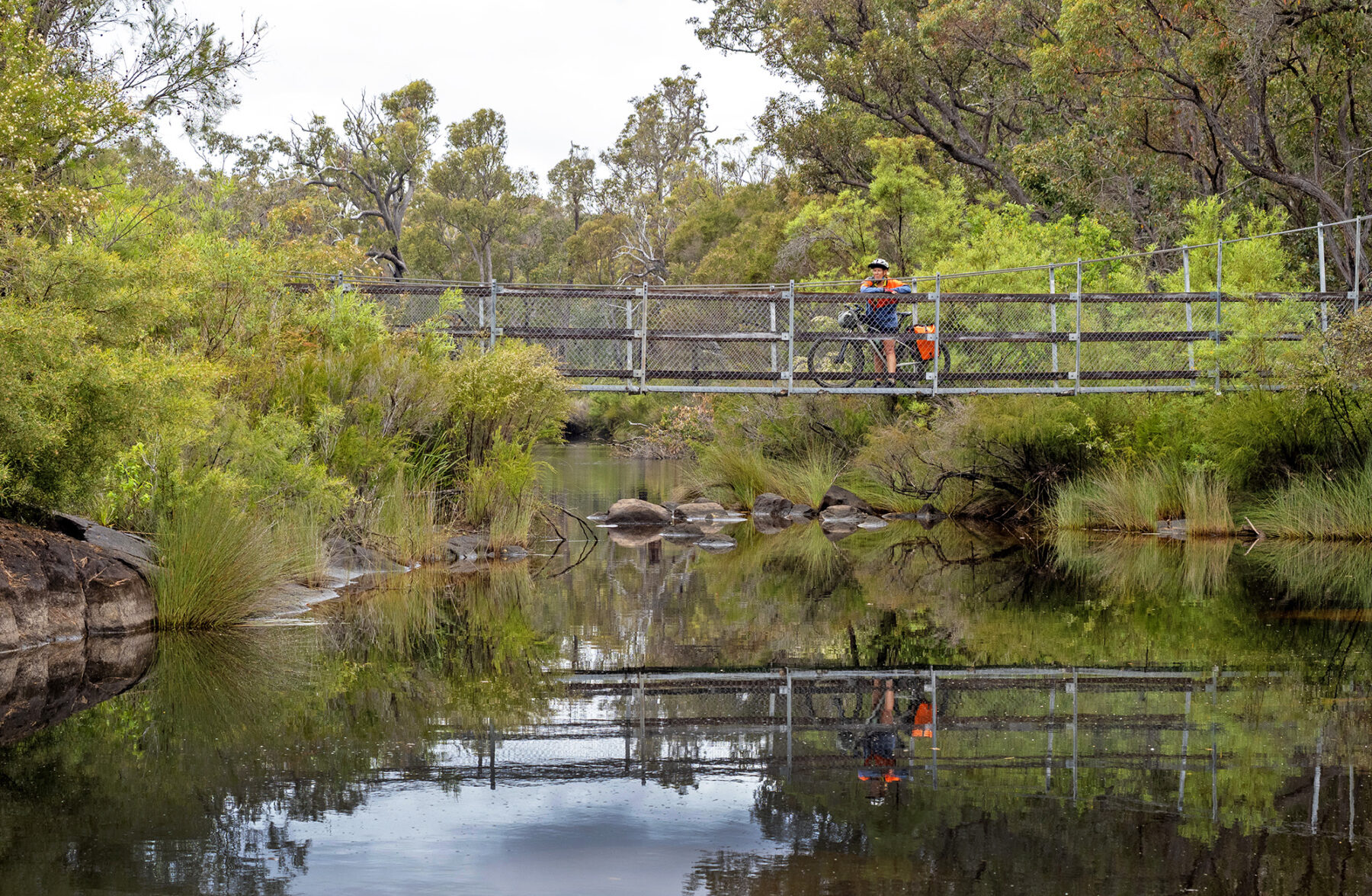
Cycle the Munda Biddi Trail, WA
Why look afar to long-distance cycling trails such as the EuroVelo routes or North America’s Great Divide Mountain Bike Route when one of the world’s great off-road cycling epics begins on Perth’s very doorstep?
Connecting Mundaring in Perth’s hills to faraway Albany, the 1072km Munda Biddi Trail is a journey through one of Australia’s most beautiful forest regions as you pedal beneath (and at one point, through) towering karri and tingle trees – with a splash of coastline to freshen things up at its southern end.
Liberally sprinkled with sand patches and natural pits of slowing pea gravel, it’s a ride suited to mountain bikes (and very doable on gravel bikes, if you’re prepared for a little extra pushing through the sand and pea gravel) that feels eternally remote and yet passes through a string of towns – Jarrahdale, Dwellingup, Collie, Boyanup, Donnybrook, Nannup, Manjimup, Quinninup, Pemberton, Northcliffe, Walpole and Denmark. Scattered in between are a dozen purpose-built Munda Biddi shelters, strategically positioned to break the trail into manageable cycling days. Each shelter has sleeping platforms, water tanks, bike racks, tent sites and tables with benches, and they come to acquire a homely familiarity as you proceed along the trail. There’s many a night where you might even get a hut to yourself.
For a lot of riders, the trail’s toughest and least enjoyable moments come early as the Munda Biddi grinds through slowing pea gravel and along the steep tops of the Darling Range. Compensation comes in a cameo appearance of smooth singletrack in Lane Poole Reserve (along with a cooling swim in the pools around the bridge crossing) just beyond Dwellingup, and an evening of keyhole views to the Indian Ocean (the one and only sighting of the world’s third-largest ocean) from beautifully positioned Dandalup Hut.
The name ‘Munda Biddi’ is a Noongar phrase that translates as ‘path through the forest’, and the most noteworthy stretch of forest – and the start of the most beautiful stretch of this cycling adventure – begins around Donnelly River, 500km from Mundaring. Suddenly, karri trees (the tallest tree species in Western Australia, and one of the world’s tallest hardwoods) tower over the trail, their trunks as straight as barcodes and as white as Whitsunday sand. From here to around Denmark – another 450km ahead – it’s some of the finest forest cycling in the world, especially as the trail climbs past the Valley of the Giants, the only place on earth where the wide-girthed tingle trees grow (a species so large that visitors to the valley used to be able to park a car inside one of the trees). In a crowning moment, the trail at one point cuts through the burnt-out middle of one of these forest goliaths.
Across its journey, the Munda Biddi connects a variety of trails and roads – flowing singletrack, forestry roads, mining roads, the occasional sealed stretch, sandy stretches and a shared coastal pathway atop the cliffs as it approaches Denmark. And while the trail never ascends beyond 400m above sea level, it packs plenty of climbing punch, with ascents totalling around 12,000m across its course.
The Munda Biddi’s pleasures are not all on the bike, though there are plenty of them. Swims beckon as the trail crosses streams and rounds lakes and pools (and even a swimming dam). There’s a canopy to wander through on the Valley of the Giants Tree Top Walk, brewpubs (for carb-loading, of course), wineries, beaches in Walpole and the poster-worthy Greens Pool, plentiful wildlife to view, and a couple of rail-trail sections on which the Munda Biddi pauses for breath between the hills.
Walk the Kepler Track, NZ
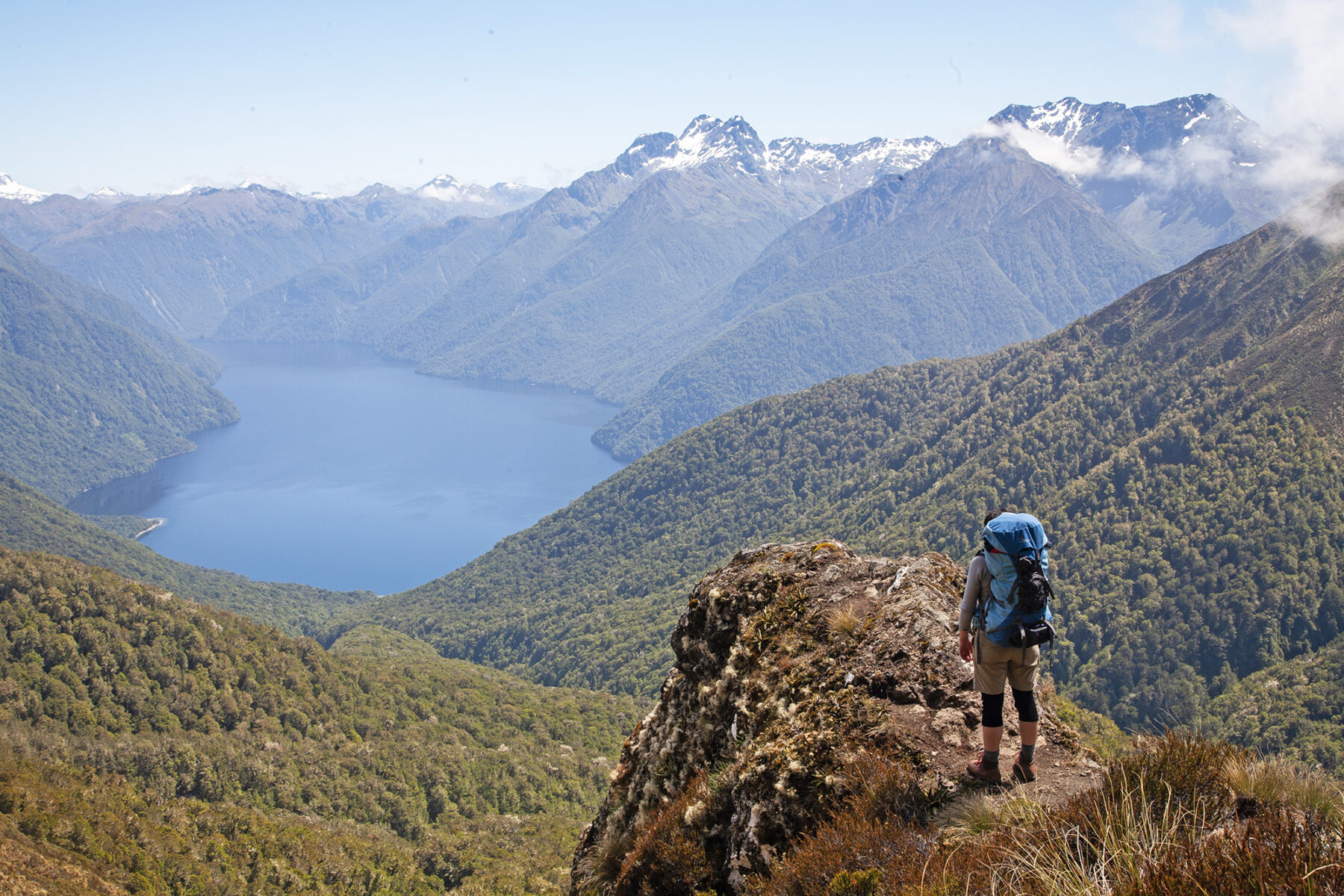
Take one popular adventure town, in the form of Te Anau, add in a sublime multi-day loop track right nearby (within walking distance of town) and you have one of NZ’s trekking success stories: the Kepler Track.
Originally designed to take the load off the other two Great Walks nearby – the Milford and Routeburn tracks – the Kepler has become more than just quiet achiever in terms of a fulfilling trekking experience. This 60km/three-day circuit offers the quintessential Fiordland Great Walks experience of majestic landscape, brilliant Department of Conservation huts, a well banked track, and the chance to spend a full day walking above the tree line, surrounded by NZ’s Southern Alps.
The Kepler can be walked in either direction, starting at Lake Te Anau Control Gates or, if you wish to walk clockwise (our preferred route), from Rainbow Reach (a short shuttle bus ride from town). The Kepler is best walked in three days, to fully soak up this unique trekking experience.
If you start at Rainbow Reach, the first few hours are flat before you reach the beachside Moturau Hut. Walk a further four hours and you will reach Iris Burn Hut. Here, if you’re lucky, you may hear the elusive kiwi calling during the night.
The “middle” day – from Iris Burn to Luxmore Hut – is the most amazing part of this adventure. After a steep climb of around 800m you reach the Hanging Valley Emergency Shelter, and you’re at an altitude of 1390m, with the magic vista of Lake Te Anau and the snow-capped Southern Alps around you. You then spend the rest of the day traversing the ridgeline until Luxmore Hut (take the sidetrack to Mt Luxmore if it is fine). Luxmore is like all NZ Great Walks Huts – the atmosphere is jovial and the views to Lake Te Anau below are brilliant, the perfect way to lead into the final day’s descent back to Te Anau.
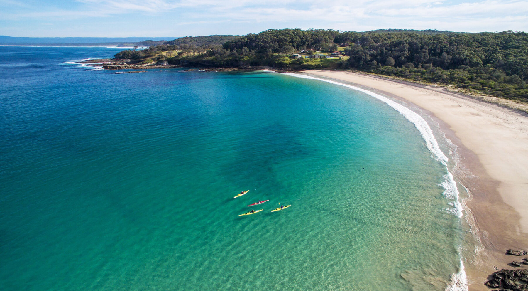
Sea kayak and SUP Jervis Bay, NSW
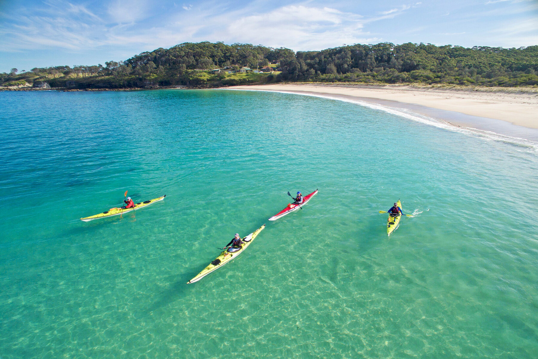
The marine wonderland that is known as Jervis Bay is only a three-hour drive south of Sydney and offers some of the best paddling on the eastern seaboard, whether your watercraft of choice is a sea kayak, or a SUP (Stand Up Paddleboard), with opportunity for independent and guided experiences for all skill levels.
For sea kayakers, one of the most popular guided adventures is the out-and-back journey (with beautiful sunrise start) from Iluka Beach to Bowen Island. This small ‘bump’ sits just off the edge of the Bherwerre Peninsula, the bay’s tree-crowded, beach-lined southern heads – a stark contrast to the steep sea cliffs of Point Perpendicular on the bay’s northern heads. During your paddle you may see turtles, seals and the bay’s resident dolphin pod who love hanging around kayakers, plus Bowen Island’s resident penguins. The return leg is equally enjoyable as you tuck close to the southern shore; passing the natural rock formation of Hole In The Wall is a highlight, as is finding a beach to stop at for a snack or a swim, before returning to your put-in location at Iluka Beach.
For the SUP fans, anywhere on the bay is great, while tranquil Currambene Creek, near Huskisson, is brilliant, with guided tours here of around 1.5 hours (and 3km) providing a leisurely experience in this secluded waterway. Keep an eye out for large stingrays and flathead from your SUP as you cruise along the creek.
See Jervis Bay Kayaks and Paddlesports for a full range of guided trips.