
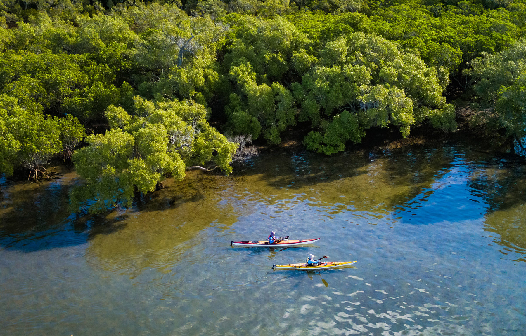
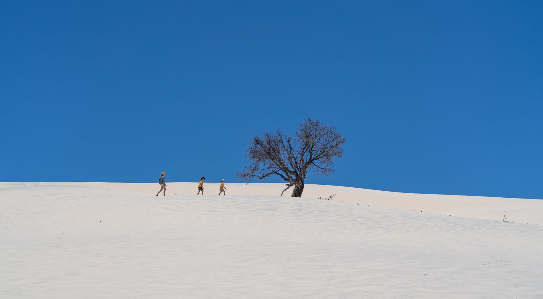
Moreton Island
Want one of Queensland’s best outdoor escapes as close as possible to Brisbane? Well, at 40km from the centre of the Sunshine State capital, Moreton Island fits that bill. Moreton Island’s 18,000 hectares contain plenty for a weekend escape, whether you’re a swimmer (the island’s lakes make great swimming spots; confine your surf/beach swimming to the patrolled area at Main Beach), diver, angler (the island is one of Australia’s best fishing escapes), camper, bushwalker or a combo of all of these.
The island is reached via a ferry that runs daily from Brisbane (the Port of Brisbane, to be exact) to the island’s central western coastline (The Wrecks). As expected, the island’s beach-driving conditions are governed heavily by both the tides and the weather; big storms can wash away large sections of beach, so check online at the Queensland Department of Environment and Science’s Parks page for the latest track/beach conditions, and also to book your vehicle access and camping permits. Our tip for a worry-free beach-driving experience is to make sure your planned beach driving happens around two hours either side of low tide only.
The island has five campgrounds, all of which have toilets, showers and bore water (treat or boil before consumption or use with cooking). There are a further five camping ‘zones’. Campfires are not permitted on the beaches (you can have fires in designated fire pits at campgrounds, but will need to bring your own wood), so it is a good idea to bring your camp stove (see here for our expert guide to camp cooking). For anglers, parts of Moreton Island’s coastline are encompassed inside Moreton Bay Marine National Park, so fishing is not allowed in those areas.
In terms of an overnight or weekend drive/camping adventure, we’d head north once the ferry has deposited you and your vehicle at The Wrecks. You have the option here (if the tide dictates) to take the high tide tracks at Cowan Cowan and Cravens Creek and then return to the beach for the rest of the trip north to Bulwer and the pretty Comboyuro Point campground.
The Bulwer North Point Road (sand) takes you across the island’s northern section, passing some beach access tracks along the way (as well as the must-visit Five Hills Lookout, a viewpoint atop a huge sand dune that provides a vista that takes in Heath Island) before you reach two potential overnight stays: Yellow Patch and, just a bit farther along, North Point campgrounds and the island’s famous historic Cape Moreton Lighthouse.
For those towing camper trailers, the best option is to take the Bulwer Blue Lagoon Road to the Blue Lagoon campground and to access the east coast. Time your visit for whale-watching season (June to late October) and you’ll spot those big boppers from here – a definite bonus in one of Australia’s great outdoor escapes. The next day’s drive down the eastern coastline of Moreton is awesome; there are more camping opportunities once you’re south of Spitfire Creek, but we’d continue on to beautiful Blue Lagoon, with its nice campground and fantastic swimming. This lake is the island’s biggest (and often most popular). Also worth a pause as you continue south along this eastern coastline is the Rous Battery site. This World War II defence site is now in ruins, but it offers a great chance to get the young’uns out of the vehicle for a bit of exploration.
For more family entertainment, the Little Sandhills and, a couple of kilometres south of these, the Big Sandhills, offer both great views from their lofty heights (80m-plus) and the chance to try an activity synonymous with outdoor escape on Moreton: sand tobogganing. The island’s southernmost point includes Mirapool Lagoon (a top spot for birdwatchers) and then, on the southwestern side, Kooringal, the landing point for the ferry to North Stradbroke Island. It is here you need to backtrack – the beach north of Kooringal is more challenging (often impassable) so you can backtrack and take the eastern beach-side drive again up to the Middle Track turn-off. This takes you back overland to The Wrecks and the ferry back to Brissy at the end of a special island weekend, done right!
Border Ranges National Park
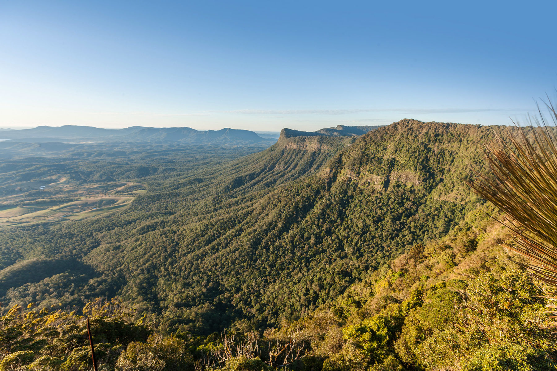
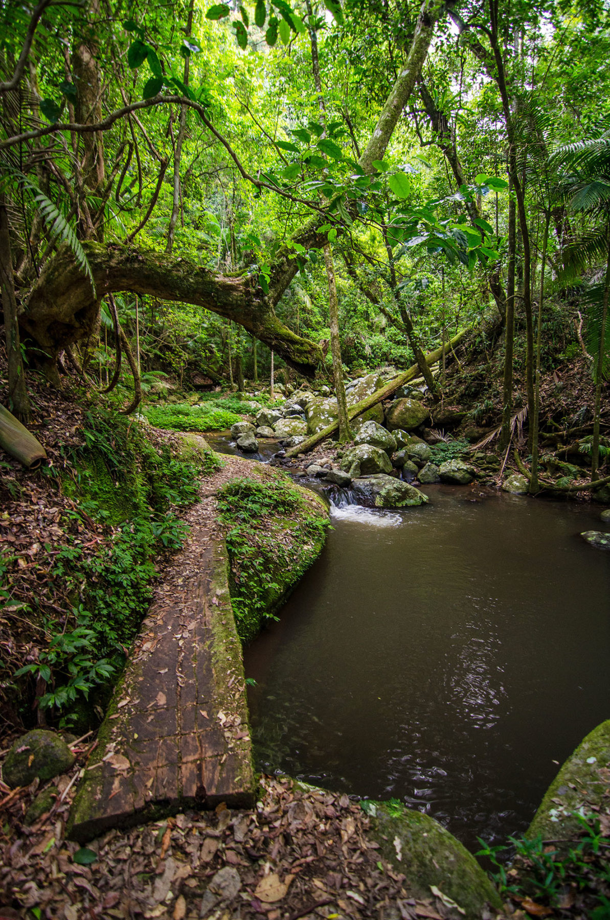
We’ve snuck south across the border (excuse the pun) to the northern limits of NSW for the second of our Brisbane outdoor escapes. This decision is with good reason: the 31,680-hectare Border Ranges National Park resides here. Located just 2.5 hours from Brisbane, this park is World Heritage-listed for its range of rare and endangered wildlife and flora, has one road (Lions Road) that takes visitors through landscapes ranging from Australia’s largest area of protected sub-tropical rainforest to truly mountainous alpine terrain, and offers brilliant camping.
Accessed from the north via the hamlet of Tamrookum (south of Beaudesert), Lions Road initially crosses the narrow ‘join’ of the park’s west and east sections. It is worth checking out the short track branching off the right-hand side just inside this narrow section, as it leads 200m down to a picnic area that offers views over the Border Loop railway line. This was an engineering marvel in itself; crews of workers shovelled, dug and exploded their way through the mountains, building a tunnel to join the NSW and Queensland ends of the rail line together more than 80 years ago.
Once back on Lions Road, you continue south parallel to the western border of the park’s eastern section, before turning left onto Wiangaree Forest Road and entering the park proper, where you pay your vehicle/visitor registration fees (visit the NSW National Parks website for fees and info).
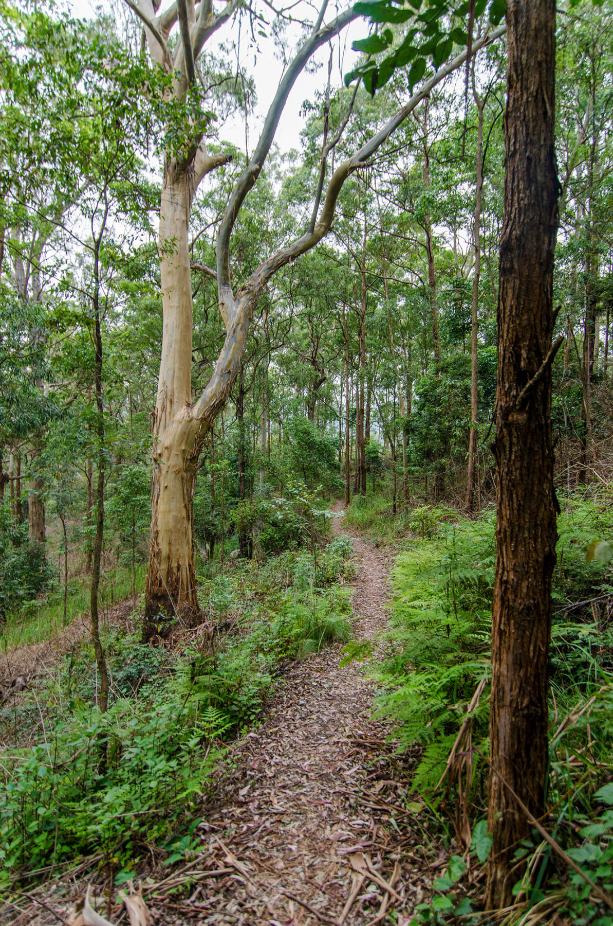
The popular Sheepstation Creek campground is just north of the entrance and provides access to a number of short bushwalks including the must-do Palm Forest Walk, a 2km loop along a long-disused bullock track to Brushbox Falls and then onto a large grove of the walk’s namesake bangalow palms. This campground’s sites are well away from each other and screened by natural vegetation, making it a great ‘base camp’ for exploration of this park. One last and much shorter walk worth your effort is the Red Cedar Loop, a 750-metre stroll to see one of the few – and massive – red cedar trees that escaped the timber industry. It is impressive.
The main track through the park – Tweed Range Scenic Drive – joins Sheepstation Creek campground to Forest Tops before following the ever-higher escarpment as it winds eastward toward the aptly named Lookout Point. This is the first of a number of escarpment-based lookouts – others include The Pinnacle (reached via a short walk) and, further south, Blackbutt Lookout. If you can, try and spend an early morning sunrise at The Pinnacle. This will give you what NSW NPWS rates as “the best views of the crater escarpment, Wollumbin-Mount Warning and the coast”.
Between the diverse landscapes and plethora of wildlife (quolls, koalas, boobooks, Albert’s lyrebirds, tawny frogmouths, numerous reptiles and more), rugged Border Ranges NP makes one of Brisbane’s close escapes a true Lost World, and it is only a few hours’ drive from the city.


