Scientists use old maps to analyse how the northern Great Barrier Reef has shaped over time

OUR SMALL INFLATABLE boat pulls up to the pristine white sands of uninhabited Pipon Island, off the coast of far north Queensland, Dr Jeff Kelleway is first to jump out. Wearing gumboots and a floppy hat, and with a compass hanging around his neck, he is hardly the picture of a typical weekend visitor to the Great Barrier Reef (GBR).
Following Jeff, a research fellow in the School of Earth, Atmospheric and Life Sciences at the University of
Wollongong (UOW), is Associate Professor Dr Sarah Hamylton, a marine geographer at UOW, and PhD students Zachary Nagel-Tynan and Oxana Repina.
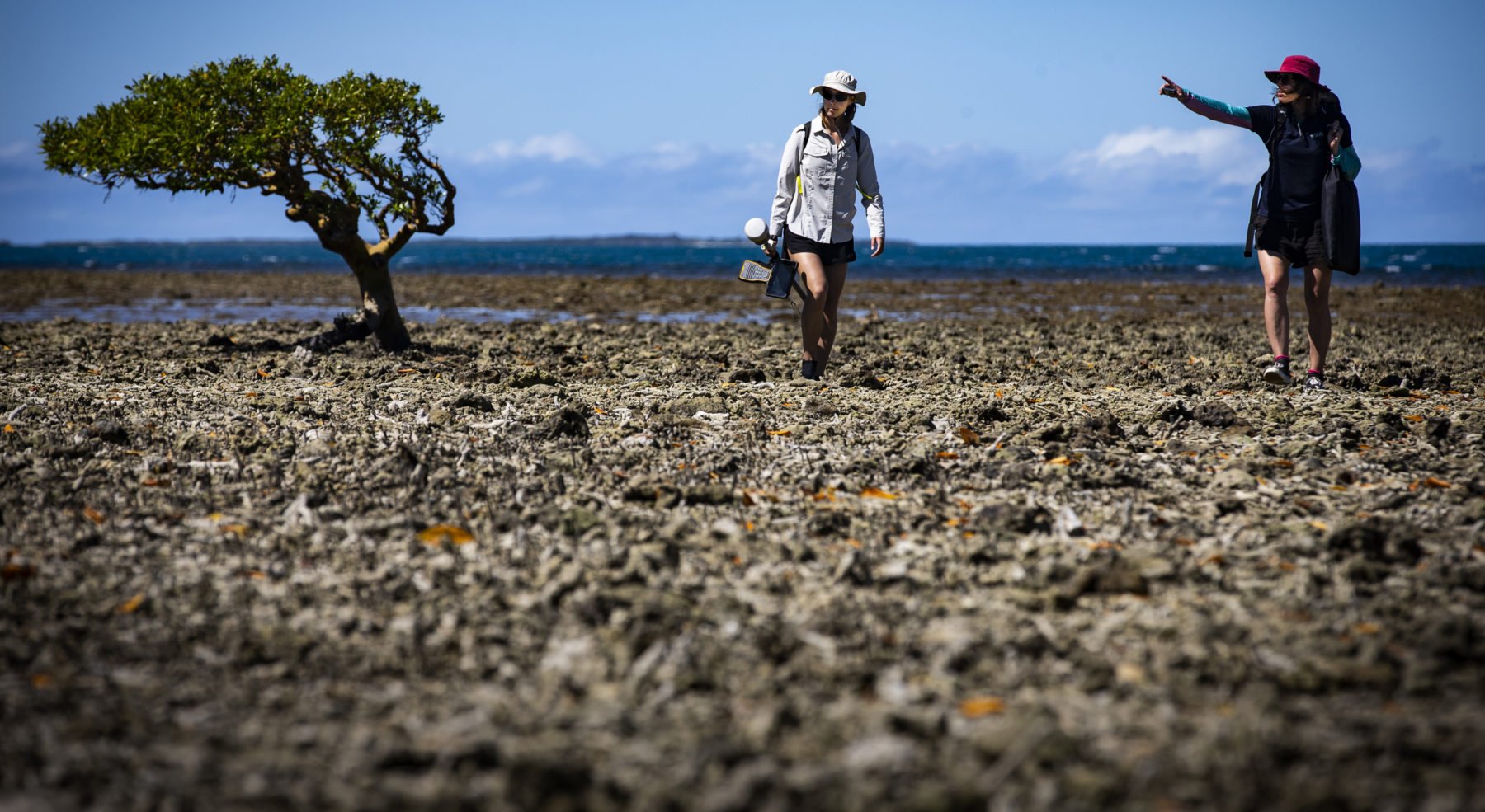
They are here to map and investigate the Howick Group National Park (Cape York Peninsula Aboriginal Land), a remote collection of 19 continental islands and sand cays located in the Coral Sea off the coast of Cape Melville, in the northern section of the GBR. With an array of plastic suitcases, tape measures and digging tools strewn across the sand around them, the researchers pore over a series of digital images as they plan their day’s activities.
“Isn’t this totally amazing?” Sarah asks as she looks out over the empty, mangrove-lined beach. “There is a real sense of remoteness out on these unspoilt islands.”
Sarah is leading this research project, which will see the team collect thousands of aerial images of the islands using an unmanned aerial vehicle, or drone.
They will compare their drone images with hand-drawn maps created in 1928 and photographs taken in 1974. The team will also conduct mangrove forest surveys on 10 different islands in the Howick Group. The data will be used to monitor mangrove expansion and other changes to reef environments. It’s critical information for tracking the effects of climate change.
Great Barrier Reef Low Isles Expedition
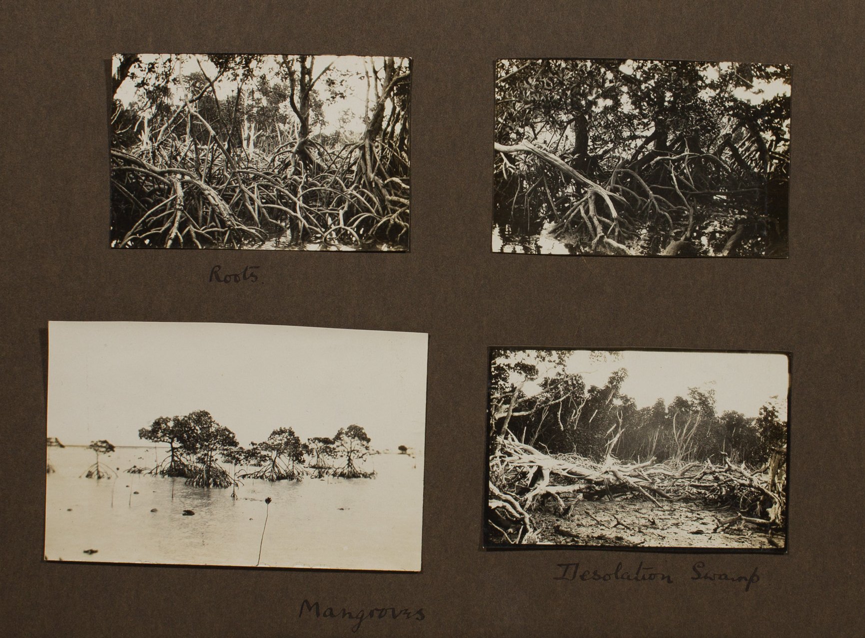
“This research was started back in 1928 with an expedition known as the Great Barrier Reef Low Isles Expedition,” Sarah explains. In July that year, a group of British and Australian scientists embarked on an epic expedition to investigate the largest coral reef system in the world. They ended up spending some 13 months exploring the GBR, documenting ocean conditions, investigating the growth rate of corals, and collecting data to learn more about the biological and geological complexities of the more than 2300km-long, almost 350,000sq.km assemblage of coral reefs.
In the northern section of the reef, the 1928 researchers observed ocean waves and tidal currents carrying loose coral sediments derived from the underlying reef platform and depositing them, where they formed cays and islands. “Sometimes these types of cays or islands remain unconsolidated and move around with the seasons,” Sarah says. “But over time the larger cays built up to be above sea level, and became covered in vegetation, which stabilised them into more permanent features.”
Sarah has a keen interest in geomorphology, which examines how landscapes are shaped over time. “Two members of the Great Barrier Reef Low Isles Expedition were particularly interested in how old the reef islands around here are and how they were formed,” she says. Their focus on this particular section of the reef provided Sarah with several invaluable sets of maps to use as reference points for studying changes to the islands of the Howick Group.
“In 1928 the expedition team hand-drew all their maps of the northern Howick Islands,” she says. The maps were produced using a plane table as a drawing board. Paper was clamped to the board using heavy screws fitted with large wings.
Then, along with sighting instruments, a wooden ruler, an ivory scale rule and a trough compass, the 1928 team recorded distances and transferred their measurements onto the paper. The whole kit would then be bundled up into two large stiff canvas bags and transported to the next location.
Forty-five years later, in 1973–74, another group of researchers conducted the Royal Society/Universities of Queensland Expedition, which retraced the footsteps of some of the original researchers from the 1928 expedition. They concentrated on remapping the Howick Group, as well as other islands further north, in more detail. As they remapped the islands they also collected more data on islands with mangrove forest vegetation.
“When I looked over the maps from 1928, then some aerial photos from 1974, and then compared these maps and images with recent satellite imagery from the internet, I could plainly see that the islands had increased in size – especially since 1974,” Sarah says. So, with funding from the Australian Academy of Science, the UOW team set off to test the theory that some of the islands in the Howick Group are indeed getting bigger, and to assess whether mangrove forests are thriving in current climatic conditions.
Mangrove magic
Although scientists have long known that mangrove ecosystems play a huge role in nurturing fish populations and buffering shores from storms and ocean surges, it’s only in recent times that scientists have realised how consequential these forests are when it comes to climate change.
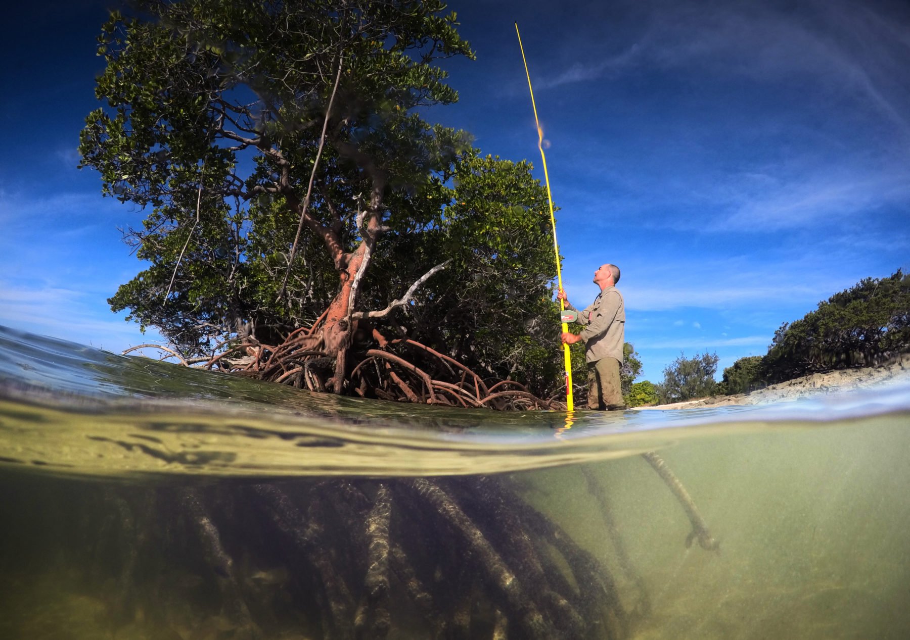
According to Jeff, these vital trees truly are magical. “Mangrove forests on these islands are so important,” he says. “The dense underground root system helps bind soils and build elevation, while the above-ground root system provides shelter for marine life, slows down water flow, and encourages sediment deposits that reduce erosion.”
Mangroves are also great at removing and storing carbon from the atmosphere, a detail that really excites Jeff. As he climbs over a tangle of roots deep inside a mangrove forest on Pipon Island, he waves his hand towards an abundance of Rhizophora trees, which rise from the salty water on their tangled clusters of stilted roots.
“The Rhizophora, with their outlandishly tall roots and dense mud beneath them, are important tools in a climate emergency,” says Jeff. “In this forest, we will measure heights and trunk sizes of mangrove trees and figure out how much carbon this ecosystem can hold.”
Mangrove trees capture carbon dioxide from the atmosphere and store it in their leaves, roots and branches. When old leaves, branches and dead trees fall to the sea floor, they take the stored carbon with them to be buried in the soil. The term ‘blue carbon’ refers to the carbon stored under water in coastal and marine ecosystems.
It’s only now that scientists are beginning to understand how truly extraordinary mangrove forests are in their ability to store blue carbon. According to Jeff, when it comes to storing carbon, they are virtually unmatched by any other ecosystem on Earth.
Growing islands
As their day on Pipon Island ends, the team gathers around a small table aboard their research vessel MV Kalinda. Sarah examines a series of drone images taken that day. Using the latest 3D photo-stitching software, she compares the images with the hand-drawn maps from 1928 and the photographs from 1974.
“You can see that these islands are actually growing,” she says, excitedly. The simple explanation for this growth is the build-up of coral sediment – the islands are predominantly made up of broken corals deposited by waves. Mangrove forests then expand over and stabilise the new sediment. “Some mangrove forests are marching forward by some 5–6m per year,” Sarah says.
The team is keen to discover why, when these islands are growing, that islands further north in the Torres Strait are shrinking. There, rising sea levels, coastal erosion, unpredictable winds and destructive king tides are increasingly washing away roads, buildings and even cemeteries.
“At this stage of data analysis, it’s still too early to have a clear indication as to why,” Jeff says. “It could be the deforestation of mangrove forests, or it could have to do with the health of the reef around the islands.”
On the 27-hour boat trip back to Cairns, the team sits around the small dinner table and discusses their adventures and discoveries. There is laughter and sadness as they tell stories about the reef itself and reveal anecdotes about their trip, including their constant fear of encountering crocodiles, and mishaps such as how the drone blew off course and was almost lost due to strong winds.
Despite the challenges fieldwork in remote places such as the Howick Group presents, the researchers all agree that discovering more about how these islands have changed over time is worthwhile for understanding the implications of climate change on reef ecosystems.
“The fate of the GBR depends on how quickly we address human-made pressures such as climate change and try to reduce greenhouse gas emissions,” Oxana says. “This place is among the most diverse and iconic ecosystems on Earth. Sure, the media headlines have portrayed the reef as dying or dead, but that’s an oversimplification, it’s a bit more complicated than that. Let’s not write the reef off just yet.”


