
The Jatbula Trail
If the Larapinta Trail is the perfect NT Red Centre experience, then the 62km Jatbula Trail more than qualifies as its Top End equivalent; the walk is moderate in level but takes you through some of the most vibrant and engaging terrain in this country. It can be walked independently (you need to book well ahead for park camping/passes) or you can jump on board a guided adventure (World Expeditions offers a six-day trek). The Jatbula is located in Nitmiluk National Park and heads north (it is a one-way walk) from Nitmiluk (Katherine Gorge) itself. If you have the time, it’s worth spending a few days exploring this gorge system – it is amazing.
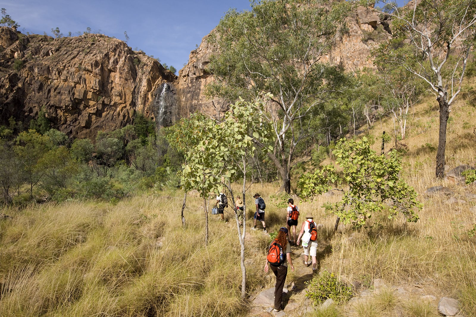
The route takes walkers on a tropical adventure along the western edges of the Arnhem Land Escarpment, through savannah grasslands, rocky quartzite cliffs, creek-crossings, and exploring monsoon forests, with each day ending at the perfect campsite: beside a waterfall. This is the land of the Jawoyn, and you’ll get the chance to spot brilliant rock art in a number of caves and rocky overhangs and outcrops as you trek an average of 10km each day (the longest stretch is 16km on Day 3, from 17 Mile Falls to Sandy Camp Pool) between campsites.
The first few days see walkers traverse the brilliant “stone country” before entering some pockets of ubiquitous monsoonal rainforest. After a few days you’ll follow a gentler track beside the pretty Edith River to Sandy Camp Pool, where you’ll camp for the night, and then through paperbark forests and past more waterholes on to Sweetwater Pool.
The hike is brilliant and can be done at a leisurely pace. Having said that, it’s well worth starting early each morning so you can take full advantage of the campsites’ locations right next to waterholes; nothing beats a cooling swim after a day’s walk. The trekking season is July to September in the tropical north, so as well as warm days and cool-ish nights, you should see plenty of stars in the clear Top End skies.
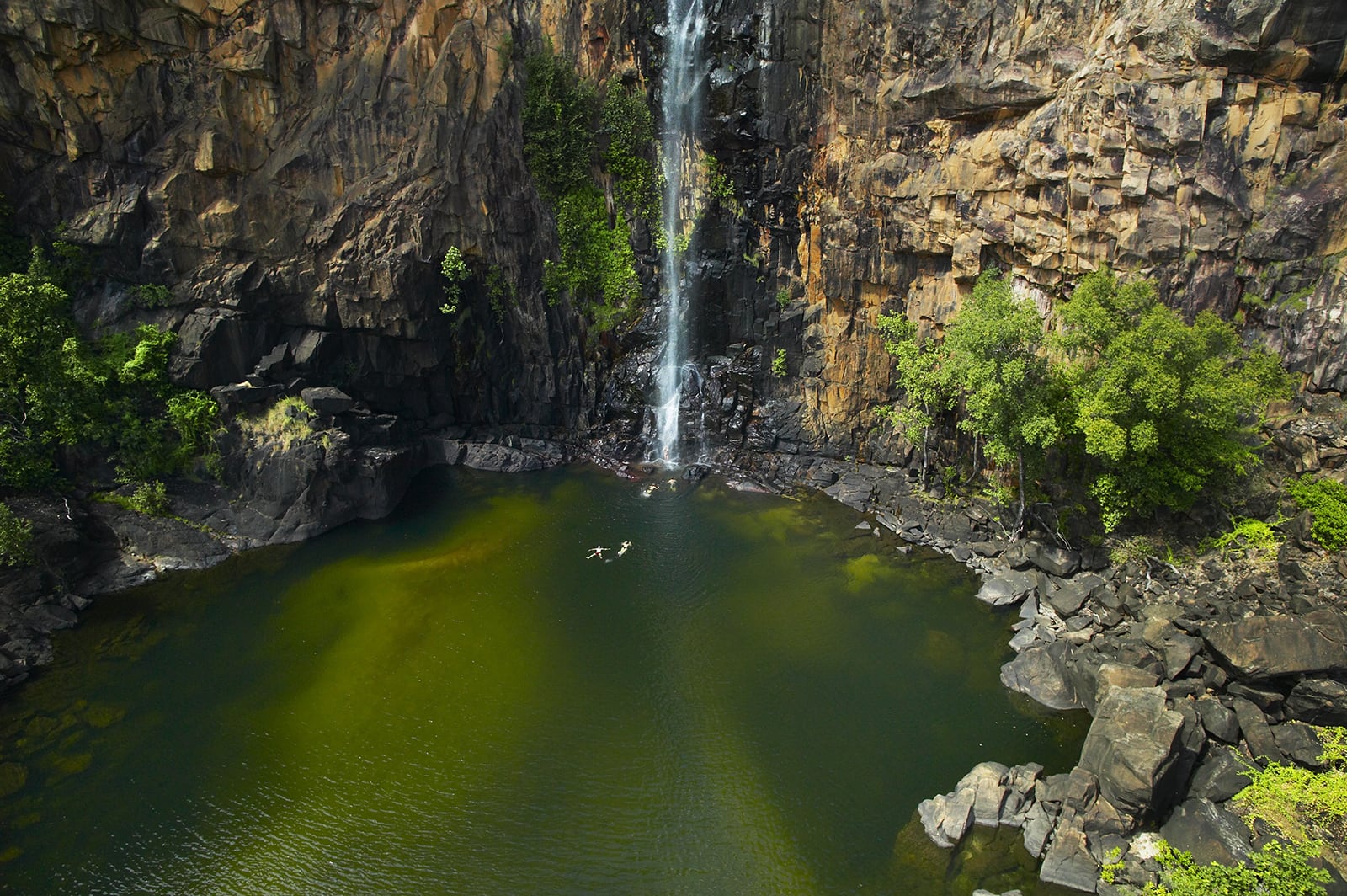
In addition to the overall walking experience, the fantastic campsites and the rich indigenous history, the Jatbula’s start- and endpoints are ideal if you’d like to spend more time here doing day walks through Nitmiluk National Park or canoeing up the gorge or down Katherine River. Or, you can simply keep that waterfall spirit alive and spend a few days lolling about at Leliyn (Edith Falls), the endpoint of your tropical trekking adventure. The campground here is awesome – as is the swimming!
Kakadu National Park – North
Ignore the grumblings of “Kakadu, Kaka-don’t”; this globally famous 20,000-square-kilometre national park can fill half a year’s worth of adventures. The park is best visited in the Dry Season (May to October) when river levels are low and most parts of the park are accessible. Plus, it is cooler and less humid. You’ll need plenty of time to do this huge world wonder some kind of justice, with the lesser-known areas of the park just as worth exploring as the more popular. In fact, there’s so much to do here that we’ve split our Kakadu guide into two parts: north and south.
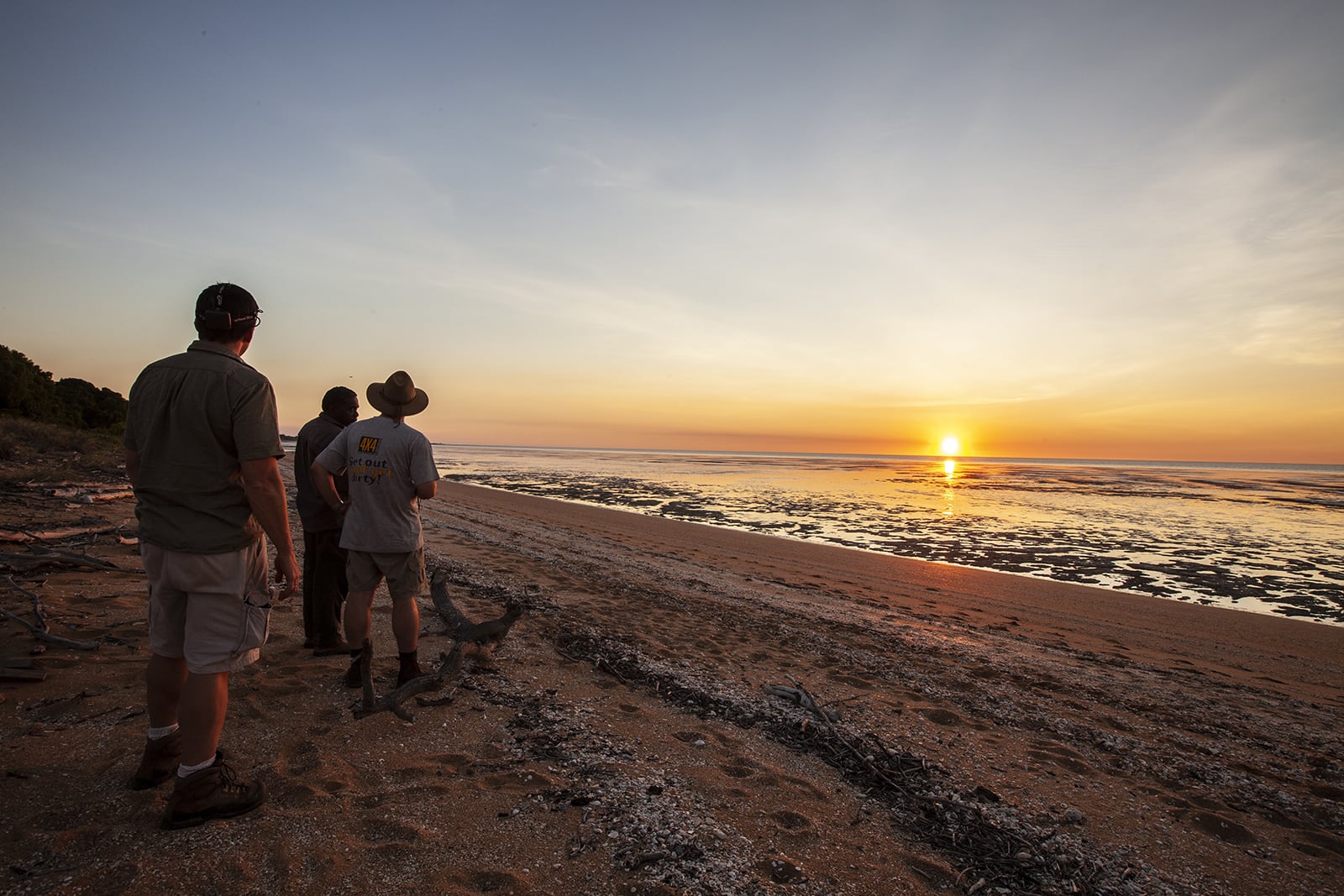
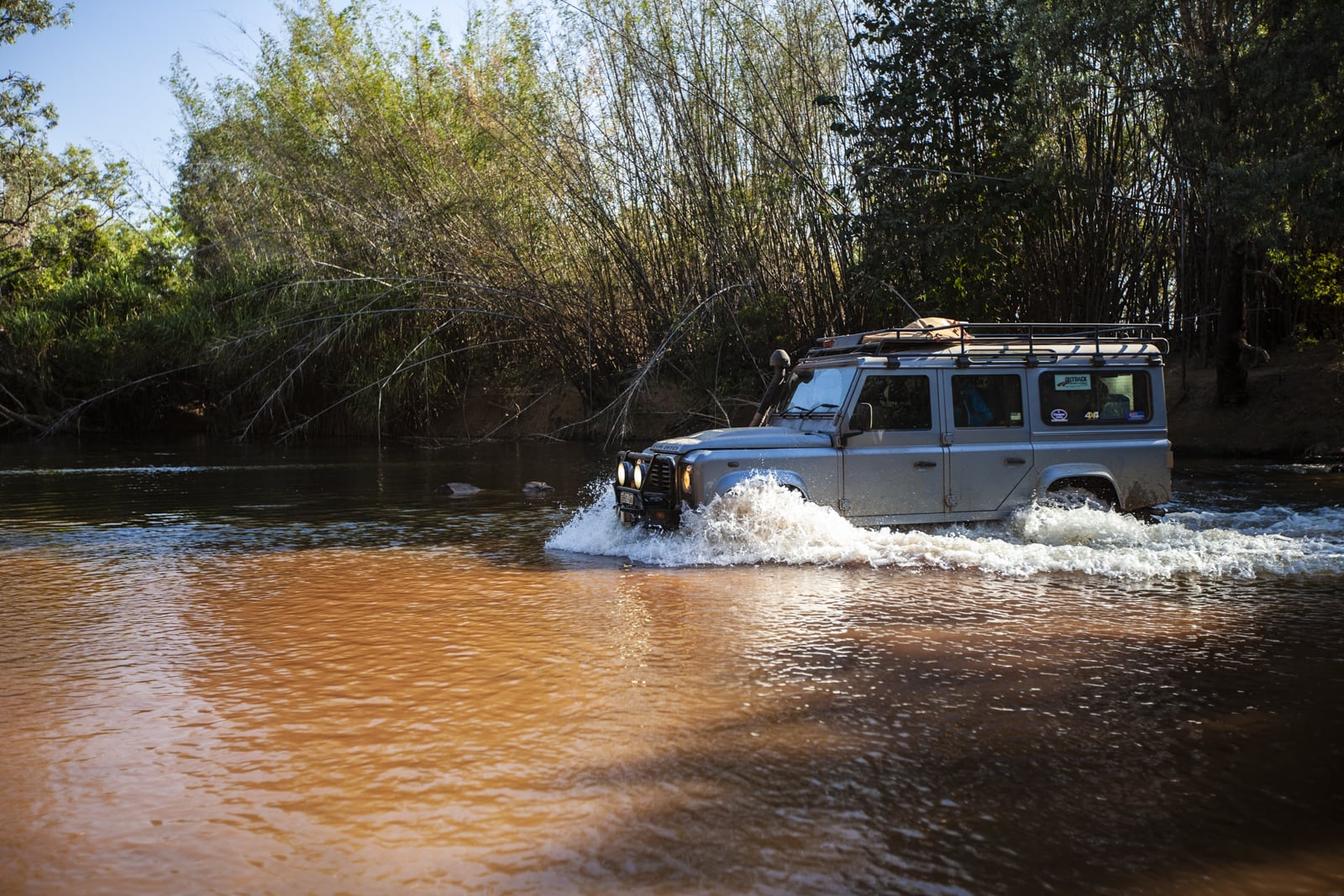
Kick off your northern Kakadu adventure with a leisurely 1.5-hour run south from Darwin via the Arnhem Highway before you reach the park entrance. The temptation here is to punch through to the park’s main tourist hub of Jabiru, but to do so means you’ll miss one of Kakadu’s less visited highlights: the Waldak Irrmbal (West Alligator Head) track heads north to Pococks Beach, located on the park’s northern coastline, abutting Van Diemen Gulf. This drive is 4WD-only (if you don’t own a 4WD you can hire one in Darwin – it’ll be well worth it as it will open up far more of the national park for exploration) and is a cracker. If you have a spare day it’s worth camping somewhere along this route; Two Mile Hole and Four Mile Hole are great fishing and camping spots, with Two Mile Hole (12km in from the turn-off) allowing some access to the Wildman River, plus a billabong just before the river. Be aware, though, that this is saltwater crocodile country; this writer has seen a sizeable salty sunning itself in the long grass beside the billabong at Two Mile, only spotted when its head moved as we walked toward the billabong’s banks.

Returning to the main Waldak Irrmbal track and continuing north for a further 50km is challenging in parts but a great experience; the near-flat Manassi Floodplain that dominates this part of the park is occasionally interrupted by stands of savannah forest, which increase in density (and are joined by huge palms closer to the coastline) as you near Waldak Irrmbal and Pococks Beach itself. The facilities at Waldak Irrmbal are relatively basic but both Jungle Camp and Pococks Beach campsite offer a far more remote camping experience than you’ll find at one of Kakadu’s more easily accessed (and thus popular) campsites. You can explore Pococks Beach (be croc-aware; saltwater crocs often bask on the beach here) by foot, and it’s also worth exploring east of the campsites as well; the rocky outcrops and mangroves near the mouth of the West Alligator River are full of things to check out. Also keep an eye out for the native orange-footed scrub fowl – or easier – its nest; this ground dwelling bird builds what is more appropriately dubbed a huge mound (they can be up to 4.5m tall and 9m in diameter). Just be prepared for some noise during the night if your camp is too close to said nest…
After returning along the same track you can rejoin the Arnhem Highway. Rather than heading all the way to Jabiru, though, look for a signposted 4X4-only track that leads south. This is a great ‘shortcut’ that, again, takes you away from the heaving dry season crowds on the bitumen roads and passes by some beautiful waterholes – Bucket, Alligator and Red Lily billabongs – before you ford the southern ‘tail’ of the Alligator River and join Old Jim Jim Road, another 4X4-only route.
Eventually, and a bit sadly, you will have to rejoin the bitumen at the Kakadu Highway, the park’s other main thoroughfare. We’d highly recommend camping at Yellow Water (located slightly north just after you rejoin the Kakadu Highway) and partaking in the next morning’s sunrise cruise on this huge waterhole; birdlife, saltwater crocs and turtles can all be spotted here. After this amazing wildlife experience, continue north along the Kakadu Highway for a Top End experience of a different kind: Nourlangie contains some brilliant rock art and some short walks that take you to all the main sites. Next stop is Jabiru for the excellent cultural centre before (hopefully) timing your drive right and reaching Ubirr – another globally lauded rock-art site – where, after perusing the eons-old artwork, you walk to a vantage point that looks over the park’s northern floodplains for sunset. It’s brilliant.

Kakadu National Park – South
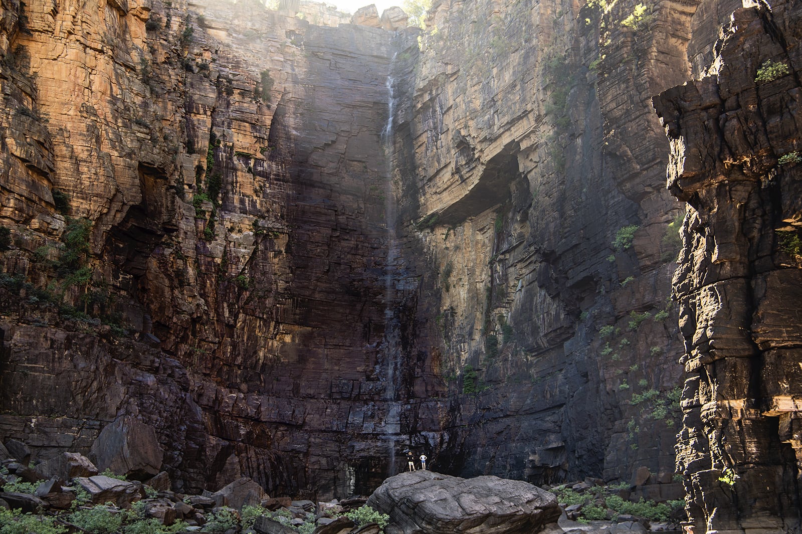
A lovely southern adventure in this famous national park begins with a bitumen run down the Stuart Highway from Darwin to Pine Creek, and then turning left and following the Kakadu Highway into the park itself. Just inside the southern border is Goymarr Tourist Park, with a great campground and all facilities. Tracking north from here you soon reach the turn-off to one of Kakadu’s most famous waterfalls – Gunlom. Following this dirt road will bring you to the falls (made famous in the original ‘Crocodile Dundee’). It’s easy to while away a day here swimming in the lower pool. But, for the best Gunlom experience, be sure to tackle the short but quite steep walking track that takes you up to the top of the falls and the rockpools that feed it from above. These are perfect swimming holes, with the final pool before the drop offering spectacular views over the park’s west and south. You can camp at Gunlom, but for a truly remote Top End camping experience in this busy park, we’d suggest driving further south-east to Jarrangbarnmi Campground (Koolpin Gorge). This campsite requires a permit (be sure to book well ahead) but it’s worth it; it is simply sublime. The campsites are nestled beside Koolpin Creek and short walks take you to remote plunge pools and waterfalls.
Leaving this heaven-on-earth behind the next day, backtrack to the Kakadu Highway and continue north to the turn-off to the 4X4-only track to Maguk (Barramundi Gorge). This is yet another beautiful location; a one-kilometre level walk from camp sees you reach one of Kakadu NP’s most beautiful plunge pools, with the waterfall at its eastern end (easily reached by swimming). There’s a separate walking track that takes you directly to the top of the waterfall itself for a dip in the plunge pools above the falls. From Maguk, it’s a short return to the highway and then a further drive north to the Graveside Gorge turn-off. This (very) remote campsite needs to be booked ahead and the drive in will take around three hours along the 44km of rocky, tricky terrain. It’s worth it of course if you wish to see another spectacular part of the park. Further north from here – and, again, back on the Kakadu Highway for access – is Jim Jim Falls, one of Kakadu’s most famous destinations.
The drive in here is 4X4-only and is slow-going until you reach Garamarr campground. This campground is sizeable (it can handle 200 people) and has excellent facilities. From here, the access track to Jim Jim Falls (and its beautiful plunge pool) continues (check with Parks and Wildlife as to whether the track is open, first), and you can also turn right to tackle the extra 10km to pretty Twin Falls too (there’s a water crossing here – a snorkel is advised for your vehicle) Twin Falls Gorge is accessed via a boat shuttle but as with everything in this park, it’s worth the time and effort. For both Jim Jim and Twin Falls you can also ascend to the plateau above them, but both are steep and challenging walks (four hours for Twin Falls; six hours for Jim Jim). The many walks in this area take you to some fantastic locations and it makes a fitting final night in Kakadu National Park.
Equally fitting is the last day’s journey out of the park. Rather than taking the bitumen Kakadu and Arnhem highways, we’d recommend backtracking south slightly from Jim Jim Falls and taking the 4X4-only Old Jim Jim Road that tracks west through some fantastic floodplains and waterways. A great morning tea/lunch spot is Giyamungkurr (Black Jungle Springs) camping area. From here it’s a straightforward run northwest to the Arnhem Highway and, after a few days in what seems like a totally removed, wild and untamed land, a return to ‘civilisation’.

The Larapinta Trail
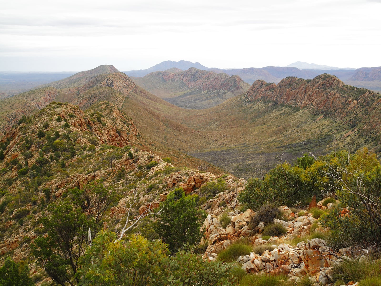
The mighty Larapinta – all 223km of it – takes walkers through a microcosm of the Northern Territory’s Red Centre landscape of rich-red rocky terrain, deep gorges with cool waterholes beneath, and ethereal ghost gums.
The Larapinta is nothing if not a versatile walk; there are a number of ways you can “do” the trek, including the most challenging – walking it point-to-point 223km independently over 10-14 days (with one or two food drops along the way), or joining a guided group (still carrying all your food and gear). For those with less time, you can sample different section of the track on a seven-day sojourn, via adventure travel company World Expeditions. Or, if you’re less experienced (or, again, have minimal time) World Ex also runs a three-day luxury Larapinta ‘experience’. This takes you out on separate day walks on some of the track’s best sections before returning you to your comfortable camp accommodation (and a campfire meal, chef-cooked) at the end of each day. In terms of seasons, we’d recommend the cooler months of April to October.

Perhaps surprisingly, in lieu of its lofty reputation, the Larapinta Trail is far from crowded. This, of course, has a lot to do with its sheer size; not many people have that two weeks spare in which to complete the full 223km. A popular alternative is for walkers to tackle shorter sections (three to four days, for example) over a few years to complete the track.
You can walk the Larapinta in either direction: east to west, starting from Alice Springs’ historic Telegraph Station and finishing with a sunrise on top of Mt Sonder (and a pre-booked bus back to town); or west to east, starting at Mt Sonder, and making your way back into town. Every day on the track brings new and memorable highlights, whether swimming beautiful Ormiston Gorge, or taking in the view across the rugged ridges of the West MacDonnell Ranges from Standley Chasm lookout.
Independent walkers will need to be fit – your pack will be full of food, tent, gear, clothing, etc. – and food drops will need to be organised through local operators in Alice Springs before departure. The designated campsites all have water tanks and are, roughly, a day’s walk apart. The longest section is the 31km stretch from Hugh Gorge to Ellery Creek; it’s a long-ish but not unbearable day.
There are numerous access points along the walk, with the track moving through popular tourist spots (usually the many gorges in the West Macs) along the way. If you opt for a guided Larapinta adventure, the logistics are taken care of. World Expeditions is the most experienced guided operator on the Larapinta Trail, with the most options (as mentioned earlier). Whichever way you choose to walk this iconic route, you will not be disappointed – but you will be amazed; it truly is a world-class walk, and one that perfectly showcases what makes the Australian outback so appealing for adventurers.
Fact File
See NT Parks and Wildlife for all information, such as track closures, campsite bookings, etc., for Finke Gorge NP, Nitmiluk NP and West MacDonnell Ranges NP.
See Parks Australia for all information on Kakadu NP.
World Expeditions runs guided Larapinta Trail and Jatbula Trail experiences.
See Tourism NT for all things Northern Territory.


